
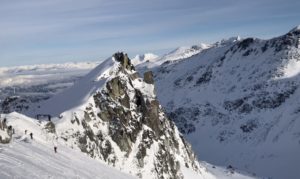
Powell River is an outdoors playground! It is best known for the renowned Sunshine Coast hut to hut hiking trail. But, what if you just want something quick. No problem.
Here’s a detailed guide of my 5 favourite easy hikes that you need to try in Powell River BC.
Remember the Backcountry Basics
- Know how to avoid negative wildlife encounters & (CARRY BEAR SPRAY)
- Practice Leave No Trace to keep the wilderness pristine
Table of Contents
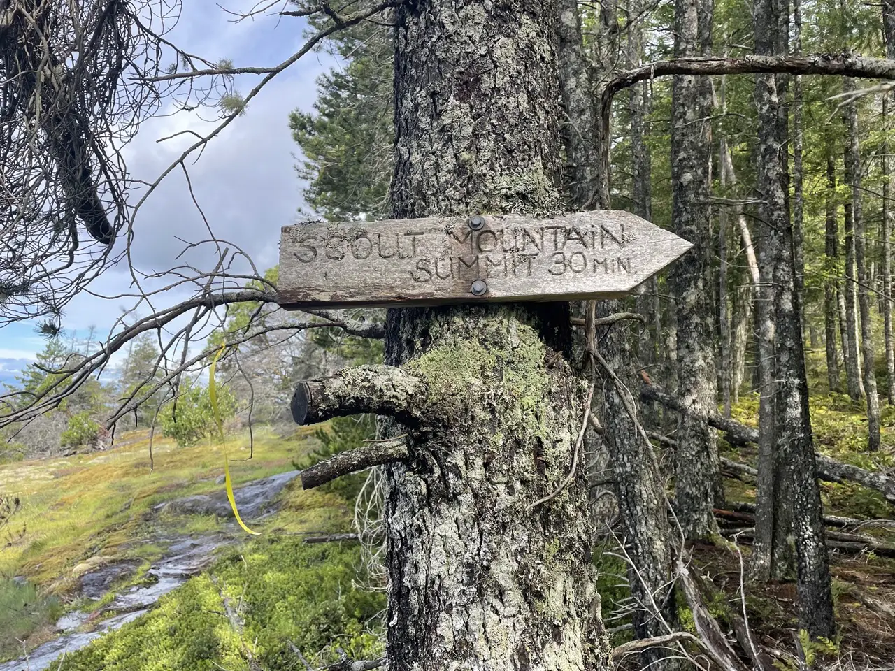
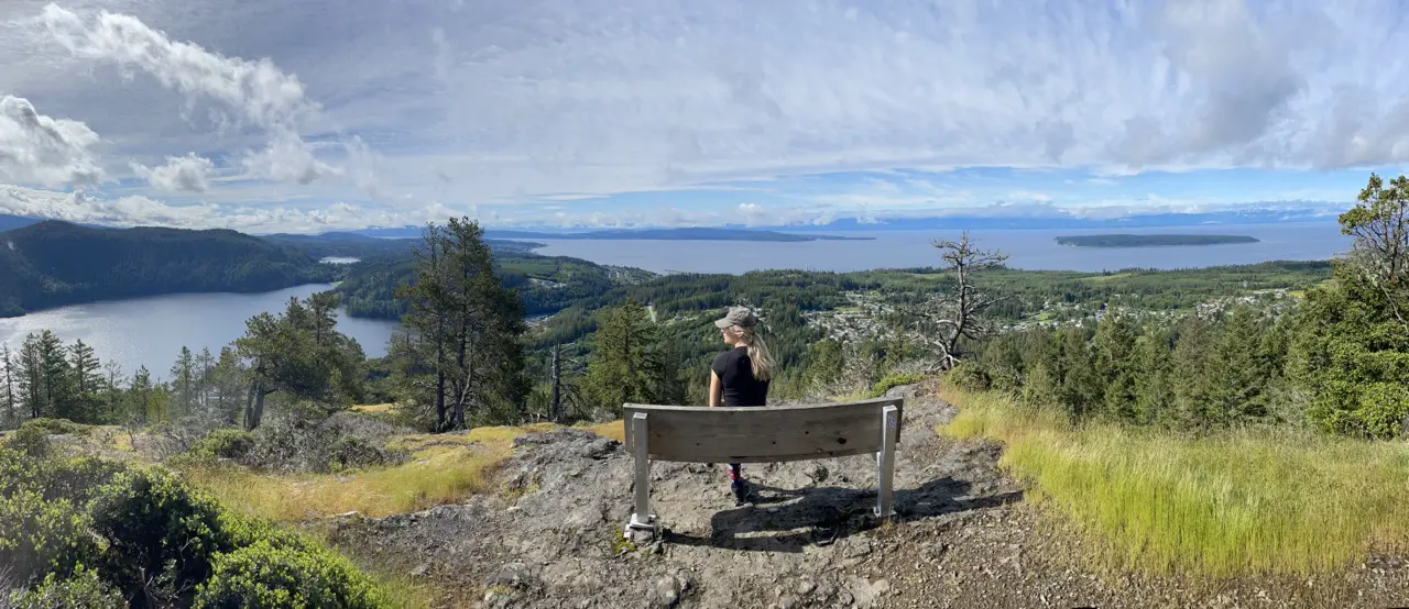
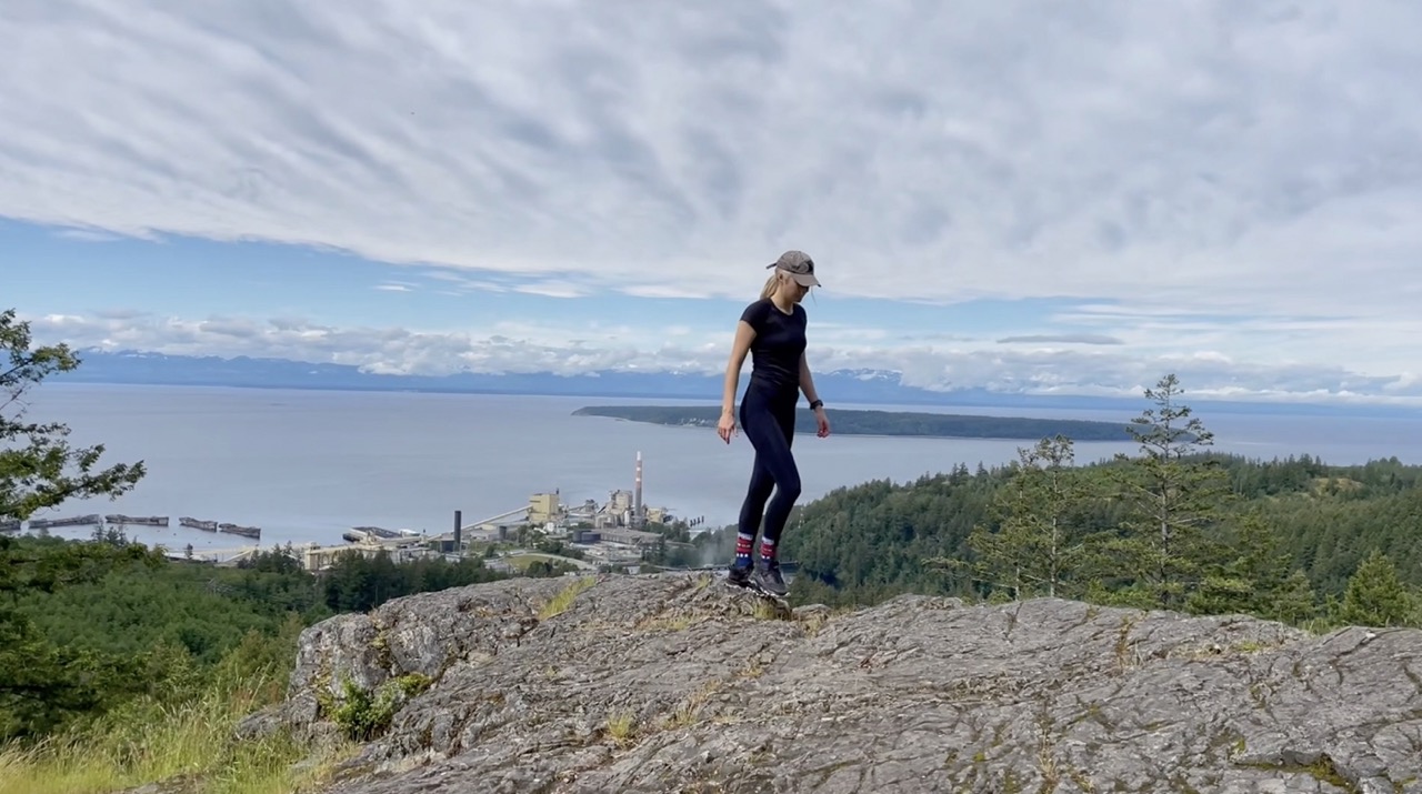
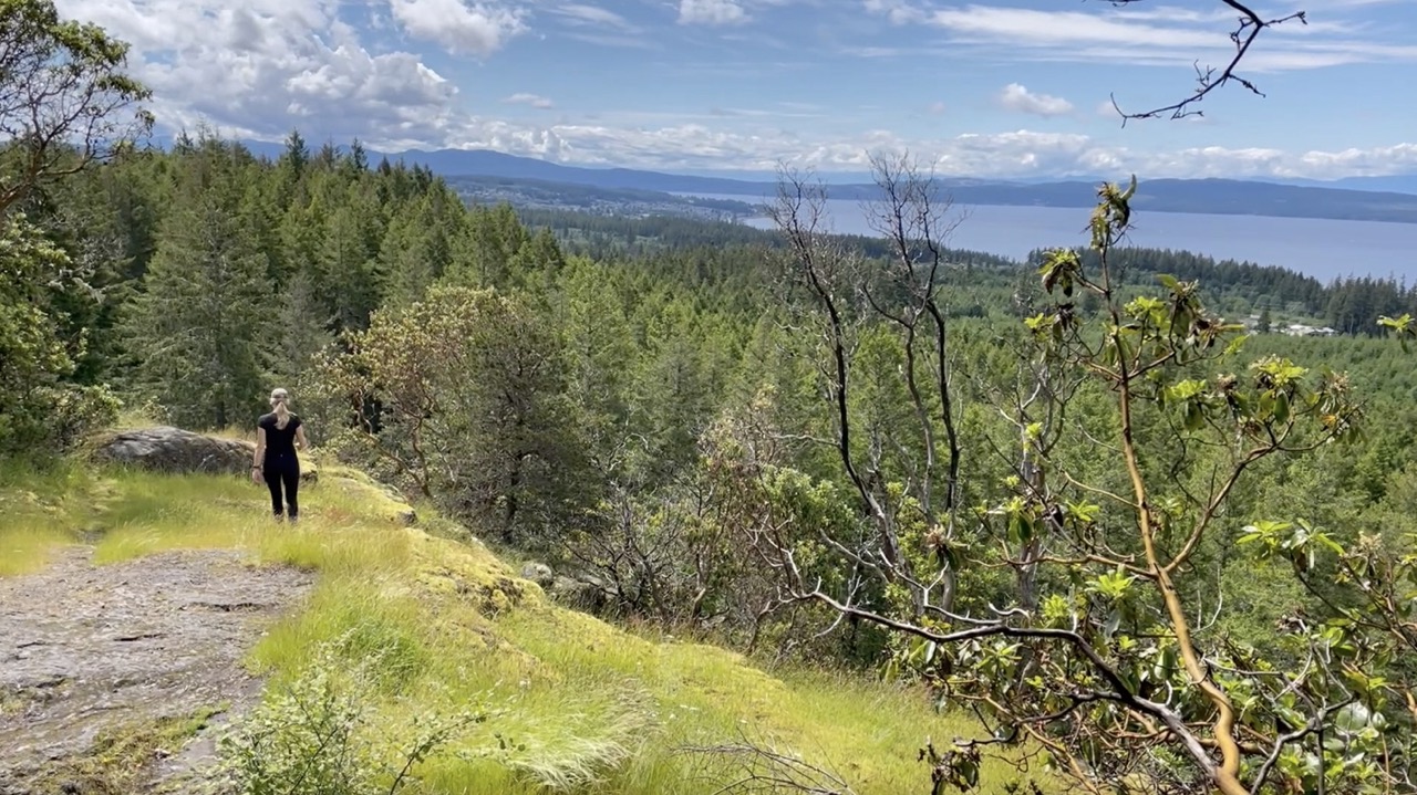
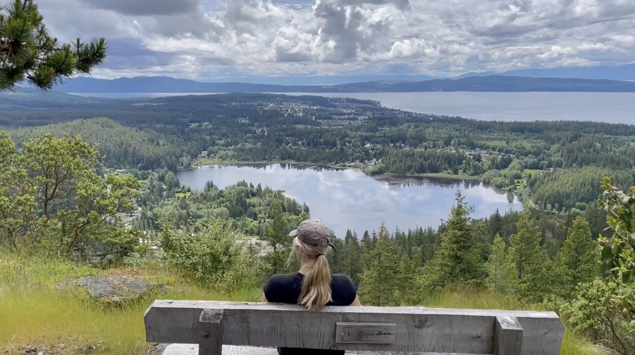
Scout Mountain
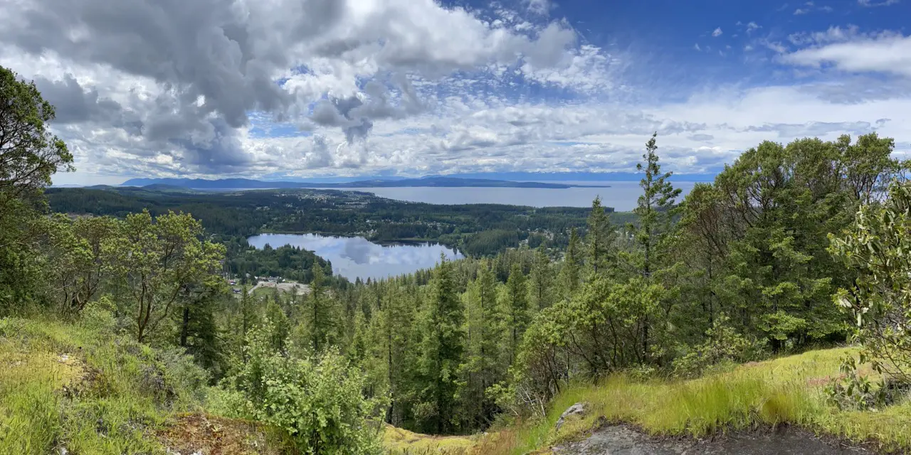
An awesome little taste of the Sunshine Coast trail with expansive views of the ocean, Powell River and Powell Lake.
Breakdown
| Distance (Round Trip) | 4.7km |
| Elevation Gain | 263m |
| Time (Round Trip) | 2-4 hours |
| Dogs | Yes |
| Season | Year Round |
| Difficulty | Moderate |
Directions
The trailhead to scout mountain is located a 13 minute 8.4k drive from Willingdon Beach in Powell River. Follow the Sunshine Coast Hwy BC-101 North toward Lund. After 6.5km take a right onto Sutherland avenue. At the end of Sutherland Avenue turn right into the gravel/dirt parking area.
The Route
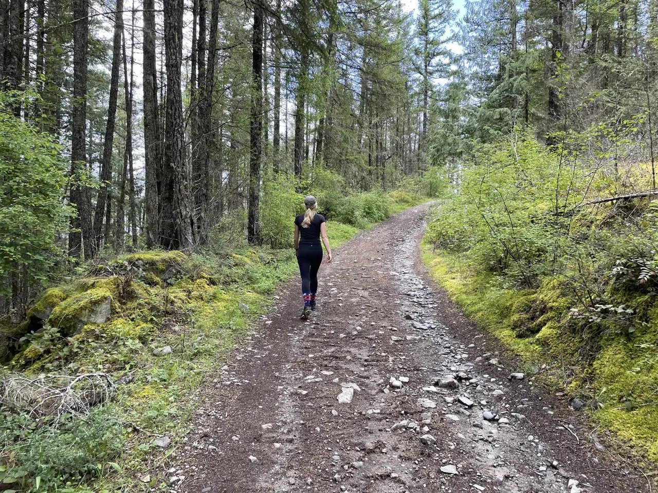
The trail begins on the wide dirt path at the end of the parking lot. After 100m you will reach a junction with the Sunshine Coast Trail (SCT). Stay right at this junction and follow signs towards Shinglemill and Scout mountain summit.
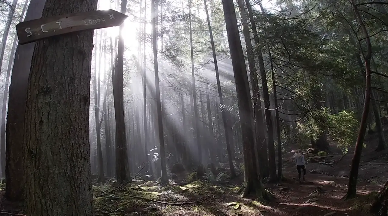
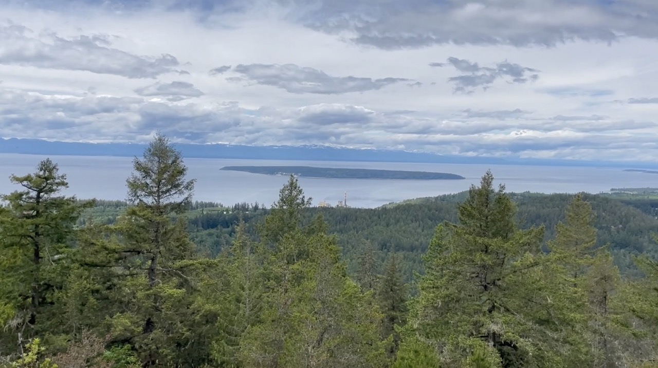
The elevation climbs steadily along the forest dirt and rock trail. Continue to follow the orange SCT markers. If there has been recent rainfall expect the rocks and roots to be slippery. At about the 1.3km mark the trees will become more sparse and you will begin to get a glimpses of the ocean and Texada Island and Harwood Island.
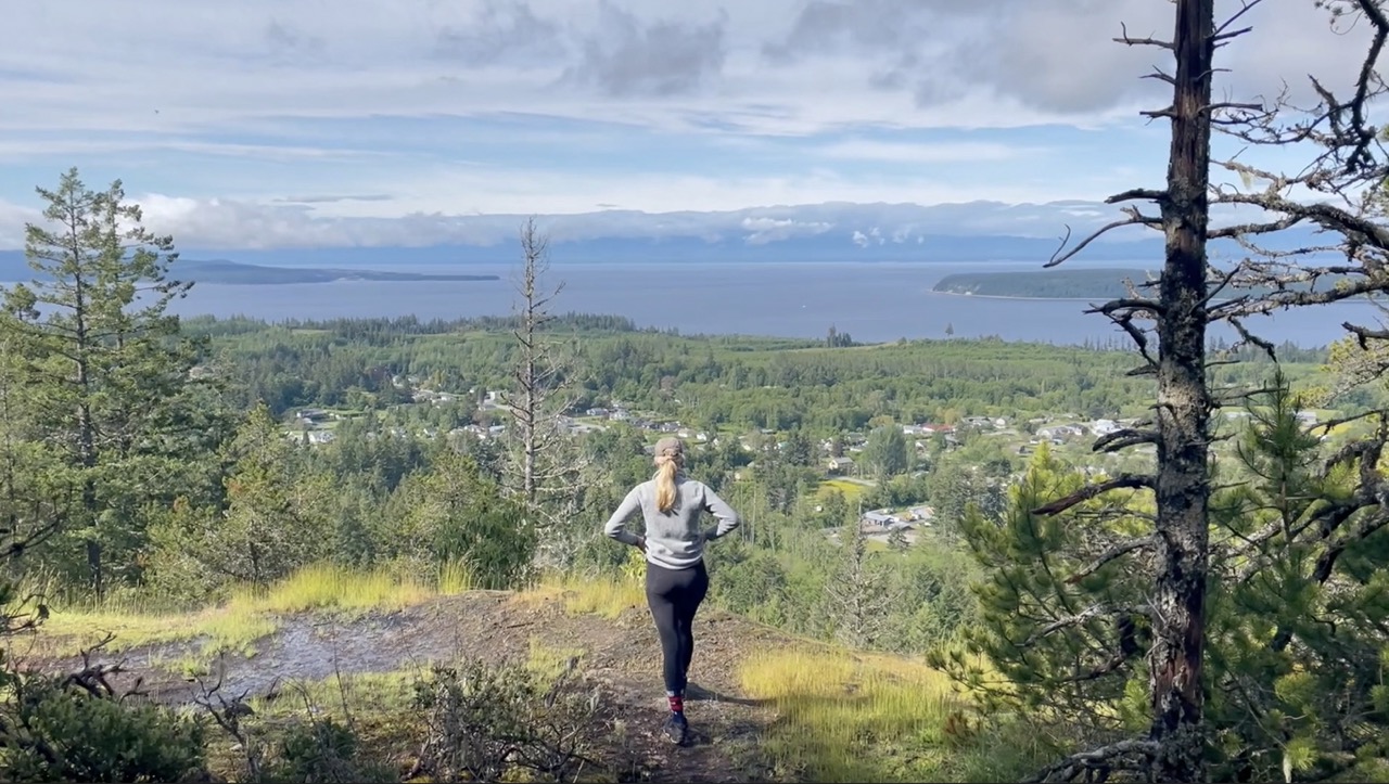
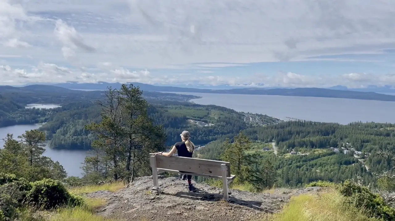
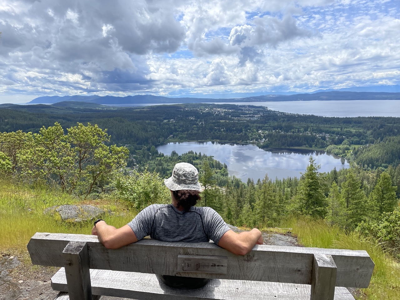
At the 1.6km mark you will reach a junction that veers off to the left and up to the summit of scout mountain. At this point you will leave the SCT and stop following the markers. The trail is very well walked and easy to follow. The higher you climb the better the views get! There is a gorgeous picnic bench at the summit where you can sit down and enjoy the amazing views of Powell River, The Ocean and Powell lake.
On the descent, continue down left along the trail until you converge once again with the SCT. Follow the SCT to the right and follow the orange markers all the way down until you reach your parked vehicle.
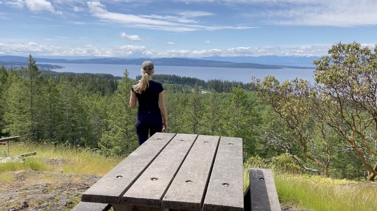
Valentine Mountain
An ultra-short trail that rewards walkers with awesome birds-eye view of Powell River and the surrounding lakes. It’s a great spot to enjoy a morning coffee!
Breakdown:
| Distance (Round Trip) | 1.54km |
| Elevation Gain | 80m |
| Time (Round Trip) | 1 hour |
| Dogs | Yes |
| Season | Year Round |
| Difficulty | Easy |
Directions:
The trailhead is located in the Valentine Mountain Park parking area. It is 5 minute 4.7k drive from the Willingdon Beach Park. Follow Sunshine Coast Hwy BC-101 North and take a right on Hawthorne St continueing right onto Timberlane Avenue. Take a right onto cranberry street then a left onto Crown Avenue. Follow Crown Avenue to the top until you reach the parking area.
The Route:
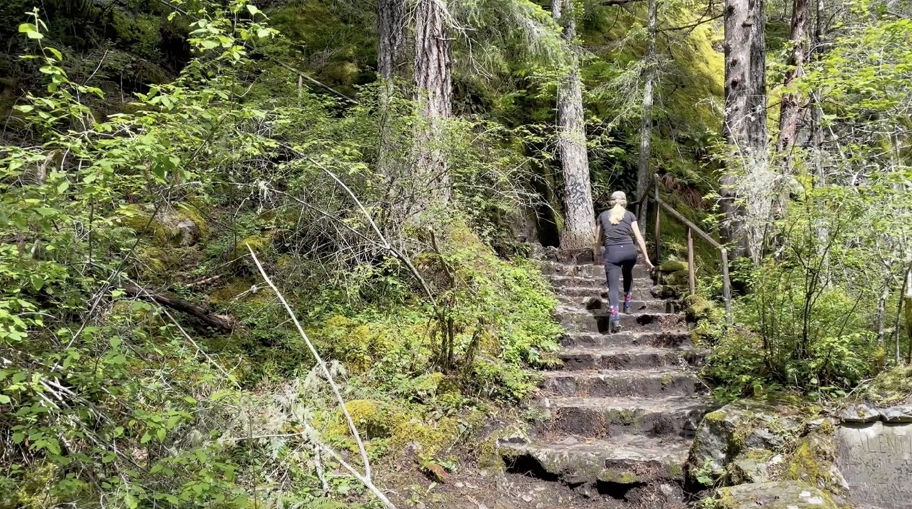
The trail begins just past the yellow gate in the parking lot. After a 100m walk on the trail you will see a set of stairs to the left. Follow the stairs up to the top. The best view is at the picnic bench looking over the ocean and pulp mill.
There are a couple other short unmarked trails you can follow in a loop fashion at the top. These will enable you to enjoy some different vantage points of Haywire Bay and the Ocean.
Gallagher Hill Loop
A moderately challenging hike through the forest leading to two awesome viewpoint benches overlooking Cranberry Lake, Powell River and the ocean.
Breakdown:
| Distance (Loop) | 5.7km |
| Elevation Gain | 225m |
| Time (Round Trip) | 2-4 hours |
| Dogs | Yes |
| Season | Year Round |
| Difficulty | Moderate |
Directions
The trailhead is located approximately 300m up the Inland Lake Forest Service Road. Follow Haslam Street until it becomes gravel and continue up for approx. 300 meters. You will see pulloffs to the right and the trailhead is marked by a small wooden walking bridge and a white marker in the trees.
The Route
There is a vast trail network in this area and I would recommend following along with your GPS on your cell phone or AllTrails to make sure you don’t get mixed up. It climbs about 200 meters through a gorgeous green mossy forest.
At about the 1.7km mark you will reach a junction, take the trail to the left. Continue straight passing by two trails heading to your left. At the next junction take another left and then a right after 200 meters.
The trail will connect with a gravel road. Follow the gravel road up to the top around the cellular tower and explore the beautiful viewpoints.
There are two fabulous benches at the top where you can stop to enjoy a picnic! My personal favourite view is the bench that looks over the ocean and Cranberry lake.
I would recommend turning this hike into a loop on the way down. Make your way back to the junction before the logging road and follow the trail to the right. This descent follows the ridge of Gallagher hill and is much more scenic, bright and less forested than the ascent.
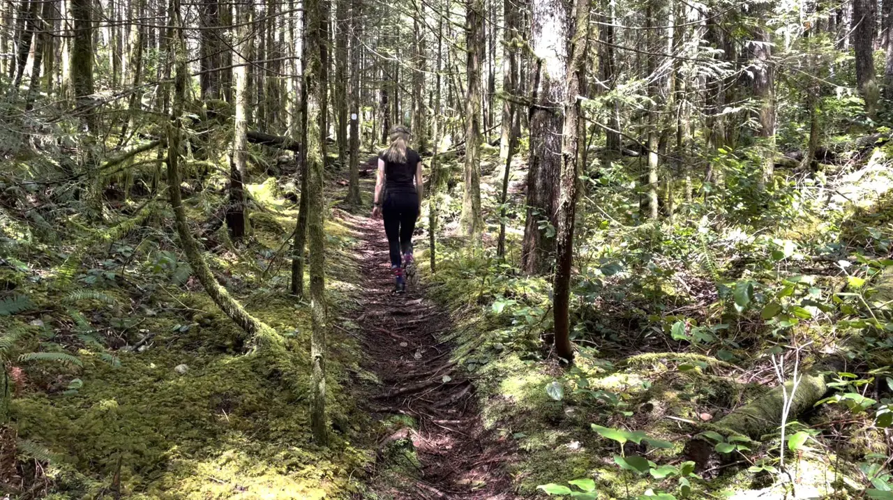
Blackwater Creek Trail (Kelly Falls & David Lam Falls)
A wonderful forest trail along a creek leading to two beautiful waterfalls and an amazing canyon.
Breakdown
| Distance (Loop) | 4.2km |
| Elevation Gain | 174m |
| Time (Round Trip) | 2-3 hours |
| Dogs | Yes |
| Season | Year Round |
| Difficulty | Easy |
Directions
Drive South of Downtown Powell River along BC Hwy 101 and take a left on Duck Lake Road this is a well graded gravel road (across from Garnet Rock RV Park & Campground). Follow Duck Lake Road until you reach Burma Road. Follow Burma road right until you reach the junction with Alaska Pine road. Park just beyond the junction and the trailhead will be to your left along Burma road.
The Route
On the left side of Burma road you will see a trail leading into the forest with a large yellow cement block with the trail names written in black.
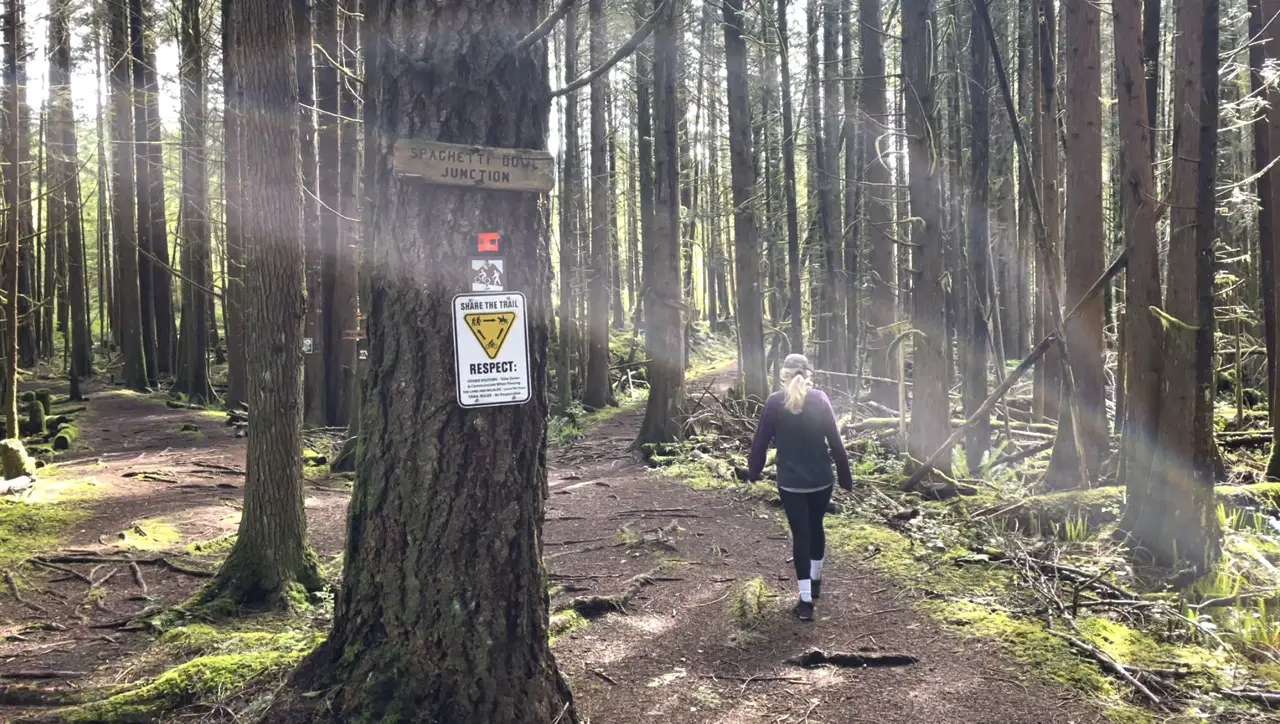
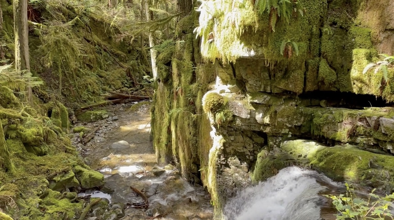
Stay right at the Spagetti Bowl Junction along the blackwater creek trail. The Blackwater creek trail will criss-cross with the Aloha trail (a mountain biking trail) but either one will get you to your destinations. Continue enjoying the solitude as you walk through the lovely forest past green moss and ferns listening to the water rushing down blackwater creek.
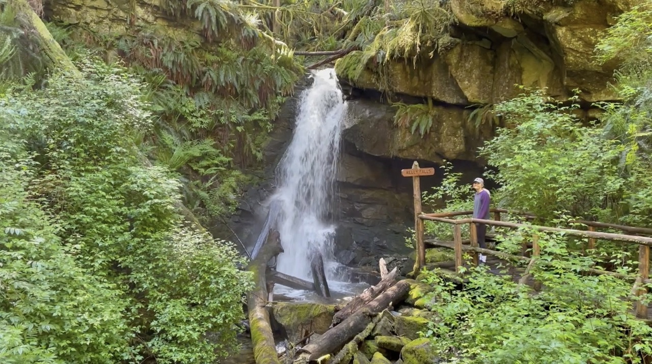
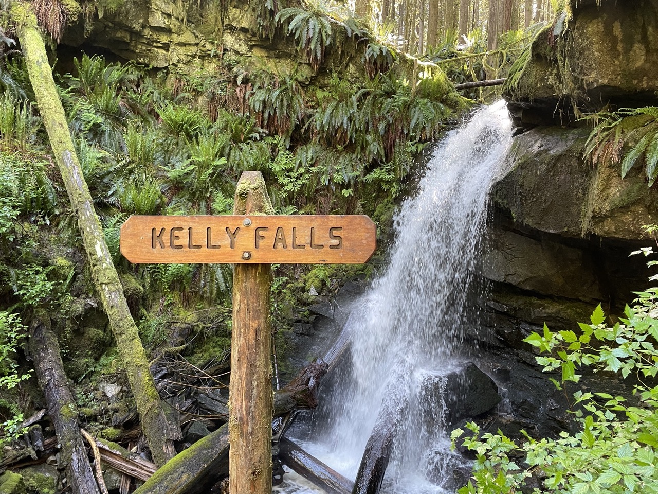
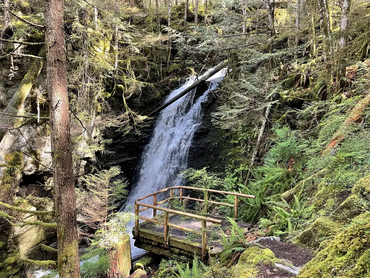
You will hear the waterfall before you see it. Kelly falls is beautiful and if you’re there in Spring when the snow is melting or after big rainfall a surprising amount of water will be barrelling down the falls. There is a great viewing platform, an outhouse and areas for a picnic.
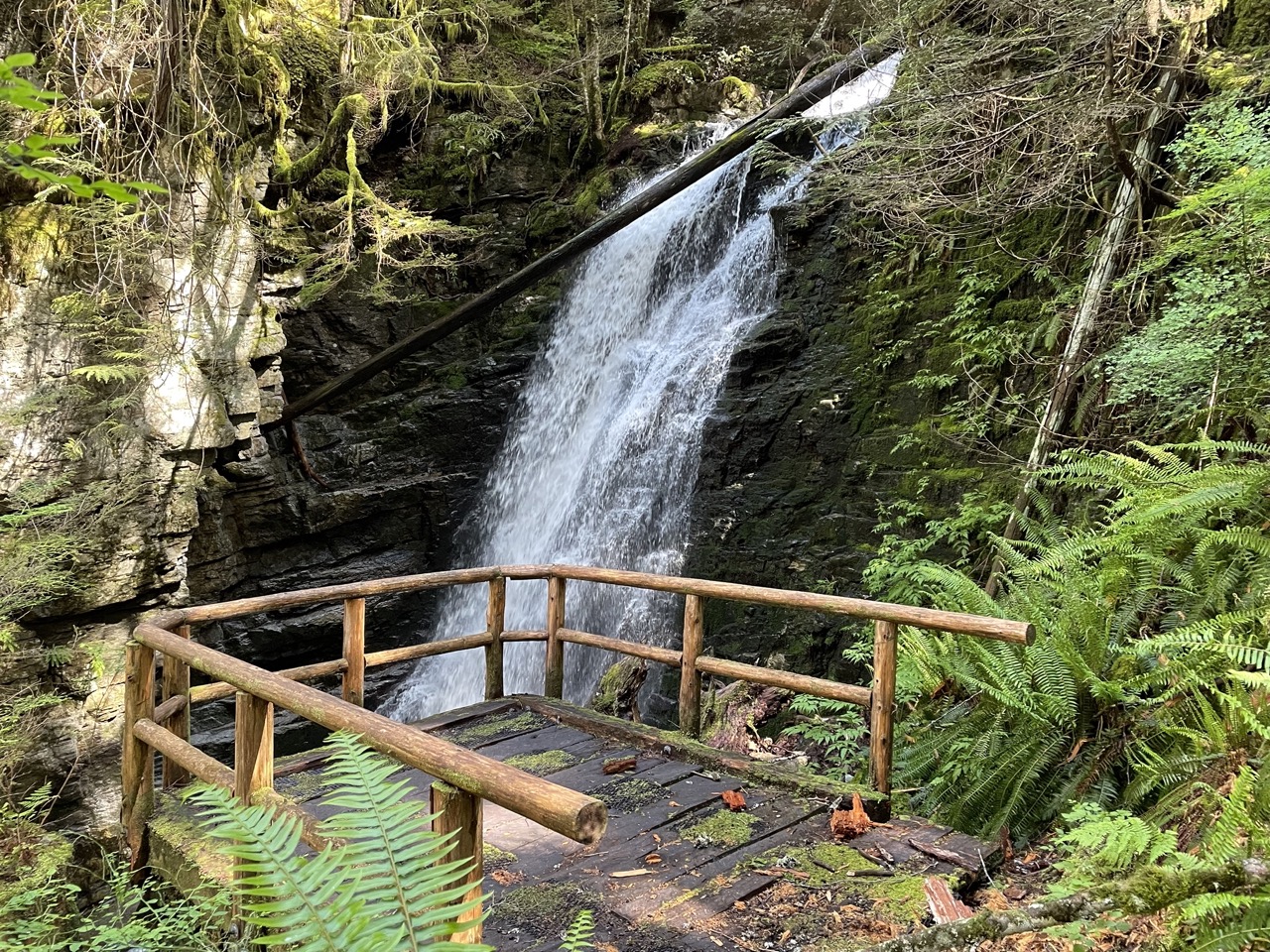
Continue following along the trail until you reach David Lam Falls. David Lam is a larger waterfall and looks like a natural staircase that the water bounces off. I found it to be more beautiful than Kelly Falls. Be careful on the viewing platform because it gets extremely slippery! Once you’ve had enough of staring at falling water continue to follow the trail along the beautiful forested canyon.
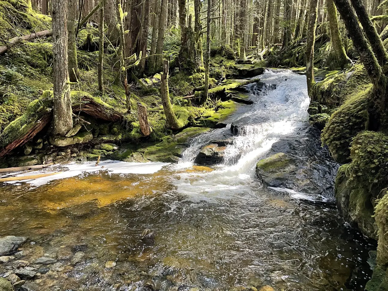
Take a left at the junction and continue along the Blackwater Creek Trail. You will have the pleasure of passing by another small waterfall and watching the water snake it’s way down the rocky canyon. Follow the trail back to the Spagetti Bowl Junction and to your parked vehicle.
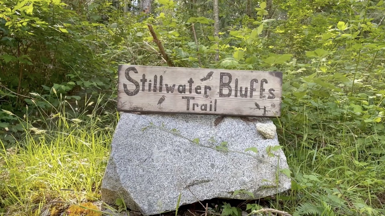
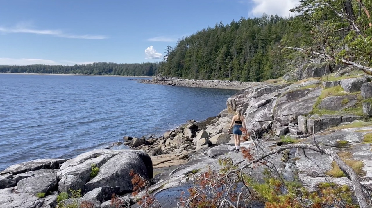
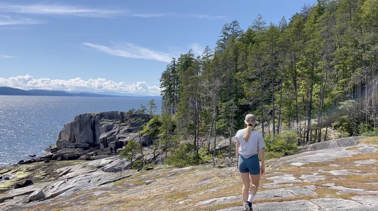
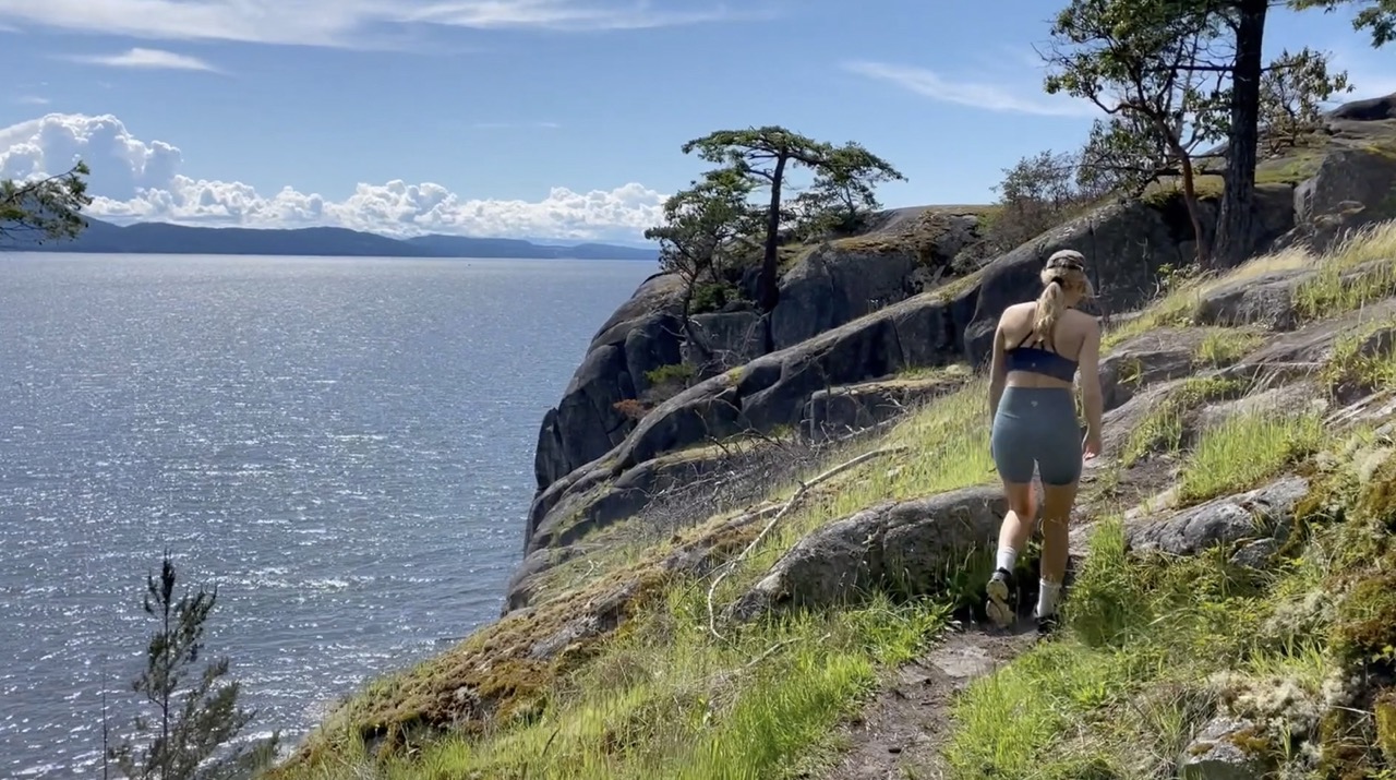
Stillwater Bluffs
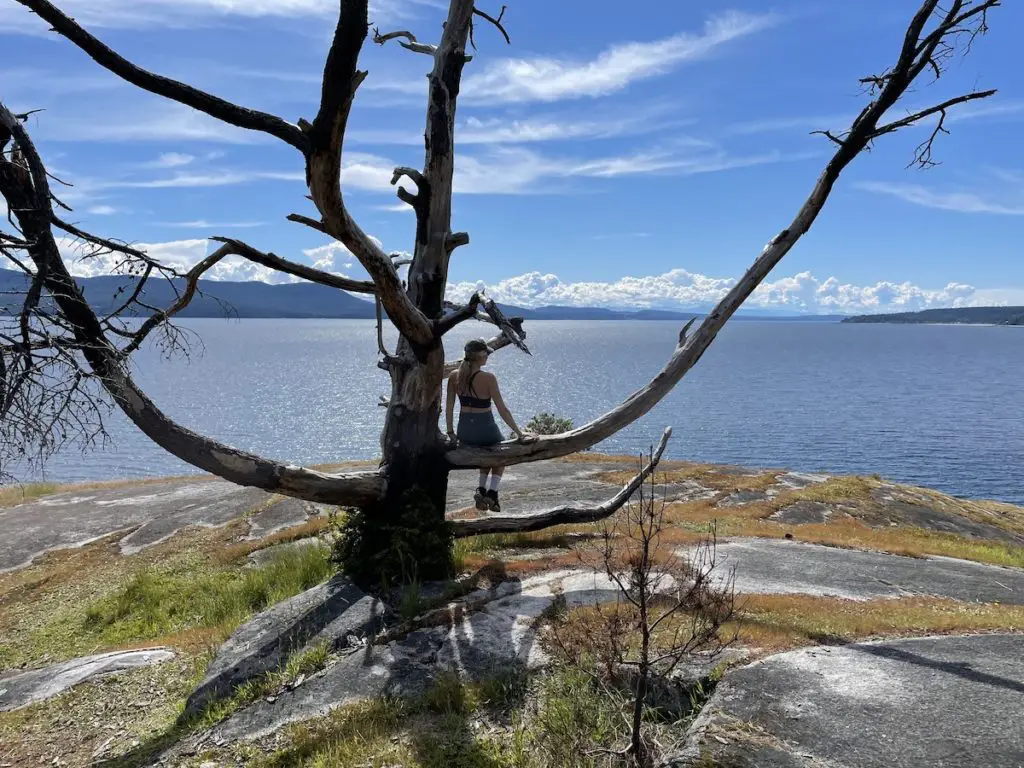
The trail follows along the gorgeous roc cliff shoreline between Frolander and Stillwater Bay. It’s popular among walkers, swimmers and cliff climbers. This trail is a fabulous spot to have a walking adventure, enjoy a picnic, go for a swim or watch the sun set over Powell River.
Breakdown
| Distance (Loop) | 3.1km |
| Elevation Gain | 92m |
| Time (Round Trip) | 1 hour |
| Dogs | Yes |
| Season | Year Round |
| Difficulty | Easy |
Directions
The Stillwater Bluffs Trail is located a 20km from downtown Powell River. Follow Hwy 101 South and turn right on Loubert Road. Continue on Loubert road as it turns into Scotch Point Road. Turn right onto Hollingsworth Road
The Route
Walk to the end of Hollingsworth road until you see the rock with the Stillwater Bluffs Trail Sign. Other than the signage at the start of the trail there isn’t much signage along the trail. Follow along the obvious walked trails and make your way along the bluffs. Sometimes more than one path will lead you to your destination.
Hopefully this post inspired you to explore Powell River.
See you on the Trail :).
Happy Hiking!


2 Responses
Love your videos. Would like you to point out names of islands/peaks and compass directions when looking East/West/etc. Could you leave maps on a touch longer to see where you are at the time.
Hint
Watch a clip of “Itchy Boots” for some great blogging ideas.
Thanks Mike! Thanks for the tips. I totally can keep maps on longer! I’ll check out Itchy Boots. Cheers!!