The Skyline Trail is the King of all Jasper National Park hikes! It’s the highest, most popular and commonly referred to as the most scenic trail in the park. Alpine hiking enthusiasts will salivate as they work their way across the 25km of trail that weaves on the ridges above the treeline. The trail exhibits unbelievable views from start to finish. Your eyes will continuously be stimulated by enormous wildflower meadows, rocky ridges and picturesque peaks unique to Jasper National Park. The Skyline trail is usually hiked in 2-3 days South to North, from the Maligne Lake trailhead to the Signal trailhead. The ideal time to attempt this trail is July-Sep but depending on snow conditions late-June and early-Oct may be possible. There is a shuttle service that caters to summer hikers who only have one vehicle. Due to its popularity, booking well in advance is recommend. As per usual, be ready for anything! The trail is well known for its unpredictable weather and snow is not uncommon in the summer months.
Table of Contents
The Breakdown
| Distance (Round Trip) | 44.1km |
| Elevation Gain | 1410m |
| Time (Round Trip) | 2-3 days |
| Dogs | Prohibited |
| Camping | Yes (Reservation Required) |
| Season | July-Sep |
| Difficulty | Moderate |
| Remoteness | Moderately Trafficked |
| Maximum Elevation | 2510m |
Remember the Backcountry Basics
- Carry your Survival Kit & Essentials
- Let someone know where you’re going with a Trip Plan
- Know how to avoid negative wildlife encounters
- Practice Leave No Trace to keep the wilderness pristine
- Carry a Satellite Communicator like SPOT X
Driving Directions
Maligne Trailhead (South)
From Jasper follow Highway 16 East towards Edmonton. 2km after Jasper, turn right across the bridge onto Maligne Lake Road. Drive 46 km south on the Maligne Road to Maligne Lake. Continue past the chalet, over the bridge and park in the lot near the boat launch. The trailhead is on the right-hand side of the road, just before you reach the parking lot.
Signal Trailhead (North)
From Jasper follow Highway 16 East towards Edmonton. 2km km after Jasper, turn right across the bridge onto Maligne Lake Road. Drive 8 km south on the Maligne Lake Road. The parking area is on the right.
Suggested Itineraries
The Skyline Trail is enjoyable in in both directions, however, I would recommend hiking the trail from Maligne Lake to Signal Trailhead. The Maligne Lake trailhead sits at 1670m, which is 650m higher than the Signal trailhead. The recommended direction allows for hikers to reduce workload by tackling less elevation gain over the course of the trail.
The typical time needed to hike the Skyline Trail is 2-3 days depending on your hiking style/preference. For hikers who want to play around on nearby peaks, you can tack on an additional day or two.
2 Day Itinerary
Day 1: Maligne Lake to Curator Campground (20km)
Day 2: Curator Campground to Signal Trailhead (24km)
3 Day Itinerary
Day 1: Maligne Lake to Snowbowl Campground (12km)
Day 2: Snowbowl to Tekarra Campground (18km)
Day 3: Tekarra Campground to Signal Trailhead (14km)
The Shuttle
There is a hikers shuttle that offers transportation to multi-day backpackers along the skyline trail. It’s $35 per hiker for the one way trip to Maligne Lake. Typically, hikers will leave a vehicle at the Signal Trailhead and ride the shuttle to Maligne Lake. Hikers can also take the shuttle from Jasper or the alternative trailheads listed below.
From Jasper to Maligne Lake:
9:00 a.m. Depart Jasper Town Office
9:15 a.m. North Skyline/Signal Mountain Trailhead
9:30 a.m. Watchtower Trailhead
10:00 a.m. Arrive at South Skyline Trailhead, Maligne Lake
From Maligne Lake to Jasper:
10:00 a.m. Depart South Skyline Trailhead, Maligne Lake
10:15 a.m. Maligne Lake Ticket Office
10:45 a.m. North Skyline/Signal Mountain Trailhead
11:00 a.m. Arrive at Jasper Town Office
Our Experience
Day 1: Maligne Lake to Curator Campground
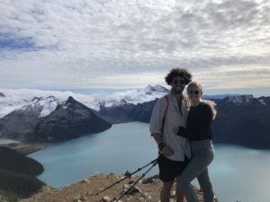
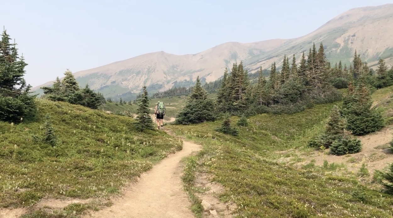
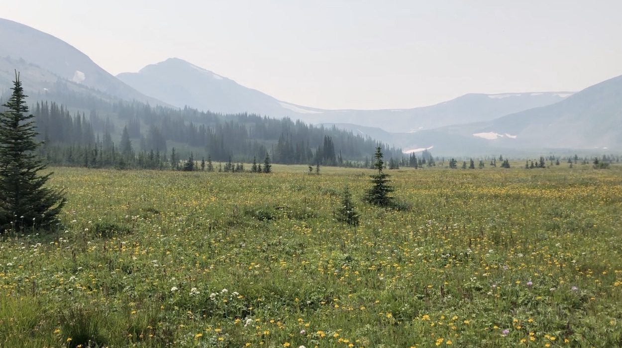
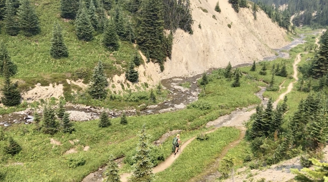
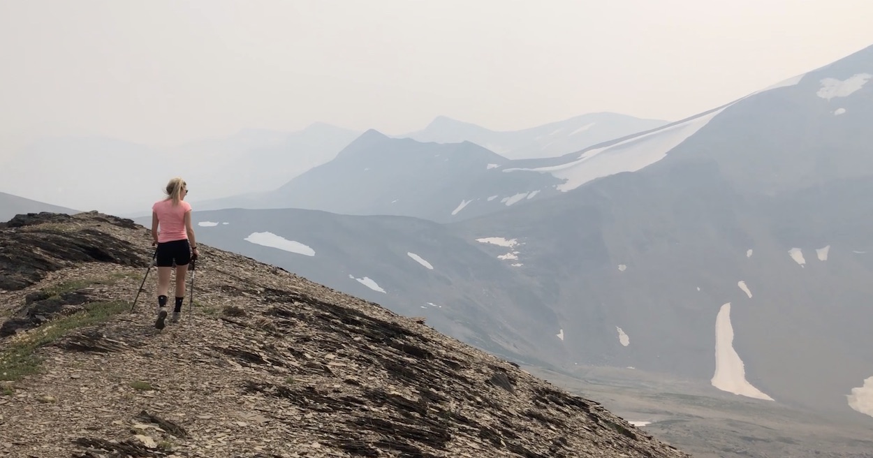
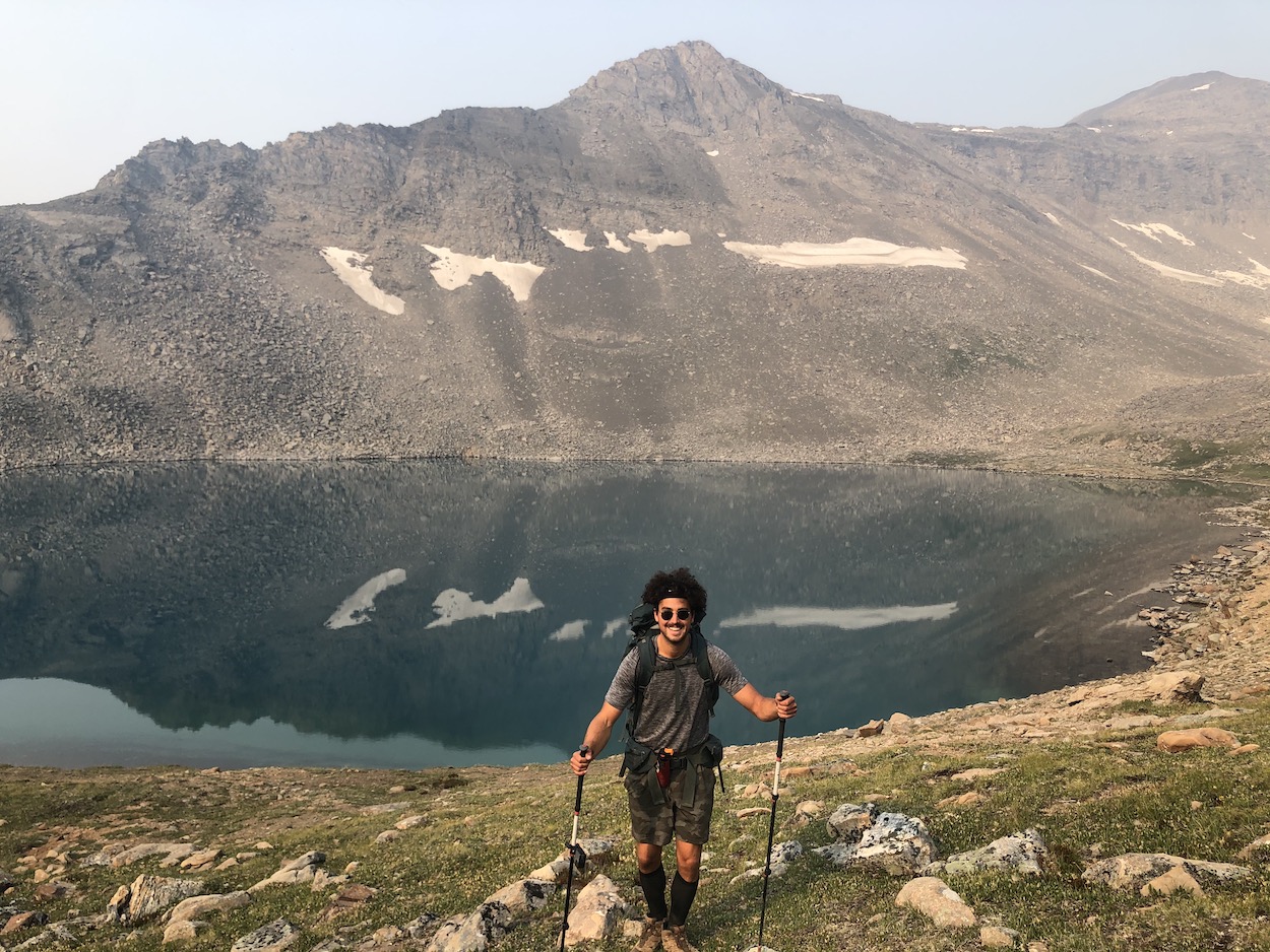
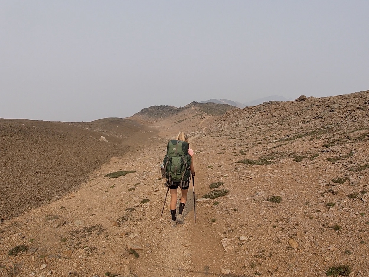
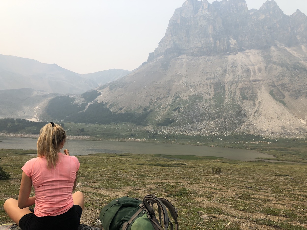
The theme of the first day was alpine Meadows! We arrived at the Signal trailhead at around 9pm the night prior and slept over in the back of the truck. We slept until about 8:30am to get ready for the shuttle pickup at 9:15am. By the time we had gotten out of bed the trailhead parking was full and hikers were parking on the edges of Maligne road. The shuttle takes about 45 minutes and once we arrived, we hit the ground running. Laura and I were hiking a pretty fast pace and hit the little Shovel Campsite at the 8km mark in under 2 hours. The forest fire smoke was quite dense and we were unable to see any views until 1km after the Little Shovel Campsite when we reached the meadows. At approximately the 9km mark, the hike really starts to become scenic. The trees disperse and meadows, mountains, creeks, and rolling hills surround you. At the 2 ½ hour mark we stopped and ate lunch on the top of the little shovel pass soaking in the miles of wildflowers around us. These are some of the most expansive wildflower meadows I have ever seen, and to this day, I cannot get over how amazing it was to walk through them.
At the 12.2km mark the meadow connects with a sparse forest and inside hides the Snowbowl campsite. This marked our halfway point for the day arriving at Snowbowl in approx. 3 hours. Our energy levels were super high as the trail and elevation gain was quite easy.
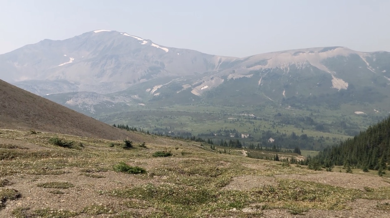
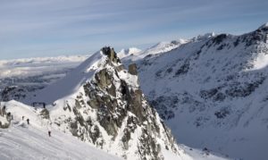
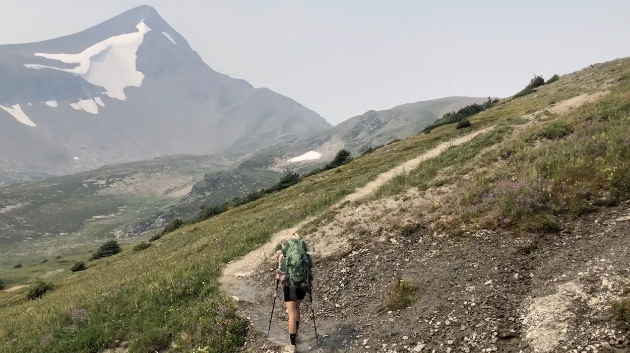
We continued onwards towards the Big Shovel Pass. The trail continues to increase in beauty and the entire big Shovel Pass switchbacks up an unbelievable meadow covered mountainside. Following the big shovel pass you really begin to understand why the hike is named the ‘Skyline Trail. Huge peaks with snow patches stood tall around us as we continued along the winding rocky ridgeline trail into the smokey mountain abyss.
At the 18km mark we decided to drop our bags and hike up the switchbacks towards the watchtower campsite. We walked left up the ridge and scrambled up to the unnamed summit beside the trail. This short detour was very worthwhile and we earned stunning views of the valley on the other side.
Once we hopped down from the detour we continued along the rocky trail until the 20km mark where we turned left towards the Curator campsite. The 1km trail down to the campsite drops about 200+ meters over 1km. It was almost more challenging than the entire 20km that came before.
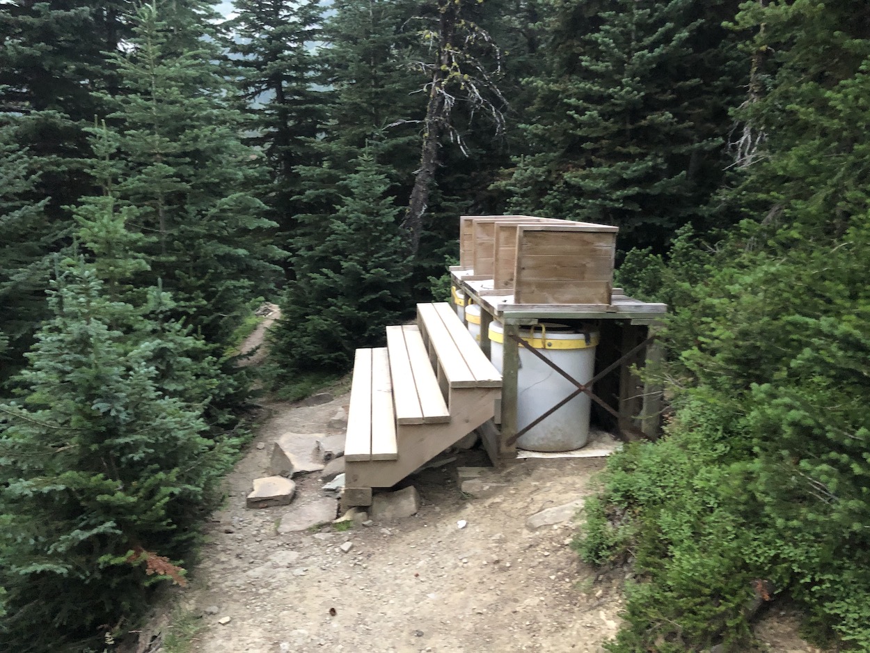
When we arrived at the campsite there were two campers already set up. The tenting areas aren’t super private and a few of the campsites hard soil had turned into rounded hills which would be uncomfortable to sleep on. Thankfully, our site was nice and flat. The eating area is fabulous and the water access is super easy. My favourite part about the Curator campsite were the outhouses. They were ‘open concept’ pit toilets that you could use alongside your neighbour LOL.
We brought along a bag of wine and did some adventuring to find a secluded spot to enjoy a drink. We walked down past the outhouses and checked out the Shovel Pass Lodge and the horse pens. We looped around the lodge and found a perfect spot on the rocks beside the river with an intimate meadow view. A glass of red wine and watching the red smokey sun set over the meadow was the perfect end to an awesome day.
Day 2: Curator Campsite to Signal Trailhead
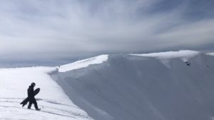
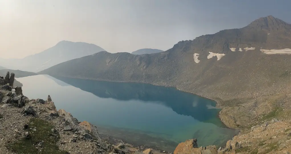
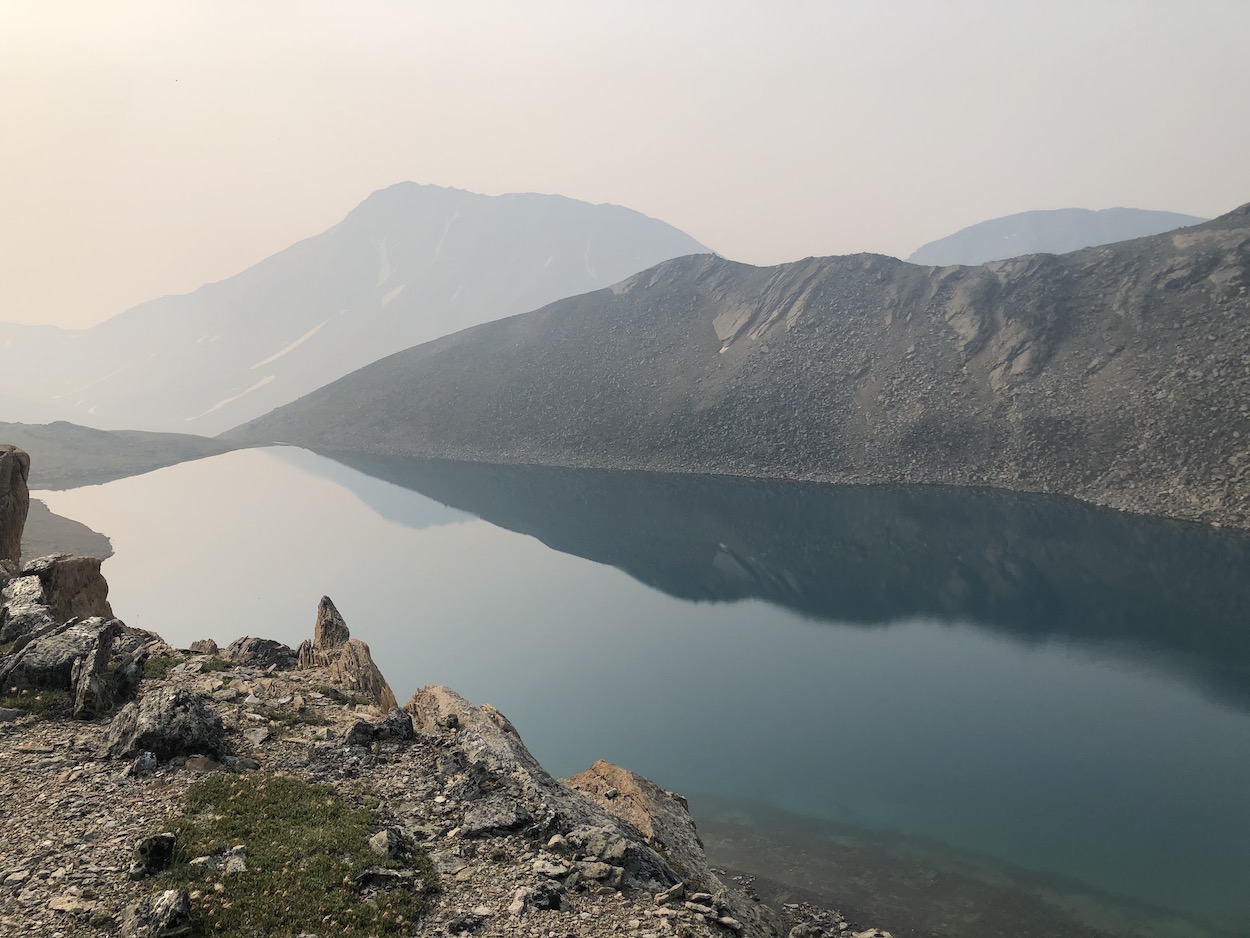
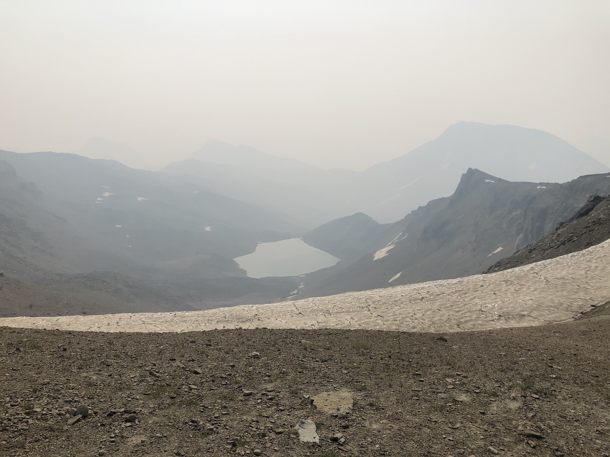
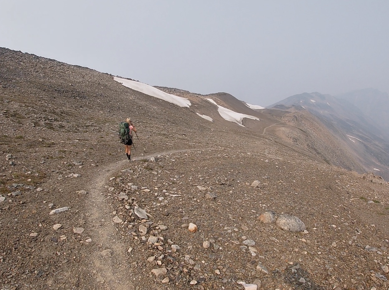
We got a late start to the morning and upon exiting the tent noticed that the forest fire smoke had become even more dense. The morning was all about elevation gain and we climbed from the campsite to Curator Lake. Curator Lake is brilliant. Even with all of the smoke its turquoise blue was still radiant. North of Curator the trail continues to the highest point on the trail, ‘The Notch’. The Notch is a steep alpine pass, and is an area that can become unpassable in poor weather conditions. I love climbing uphill so the Notch was a highlight for me.
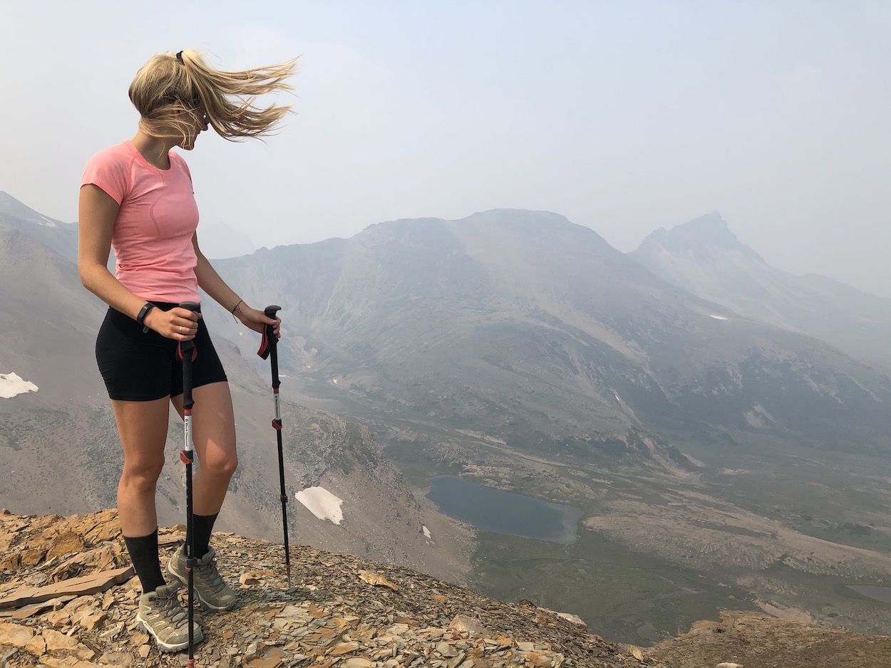
When we arrived at the top of the Notch we were rewarded with views to the North and the South. We decided to drop our bags and scramble up the summit to our left to gain an even better view. At the top of the scramble the views are unbelievable, however, due to the forest fire smoke we couldn’t see the whole horizon.
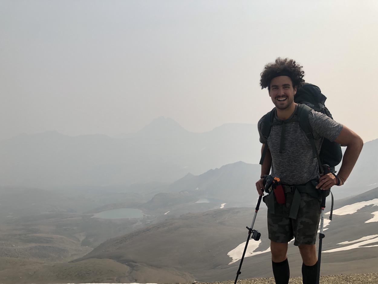
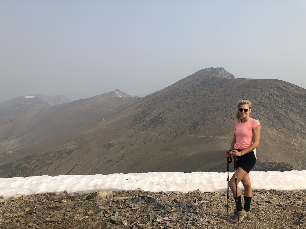
The Notch onwards was my favourite part of the trail as it follows ridgelines and meanders high in the mountains for around 10km. I felt like I was walking on the surface of Mars for about half of the day.
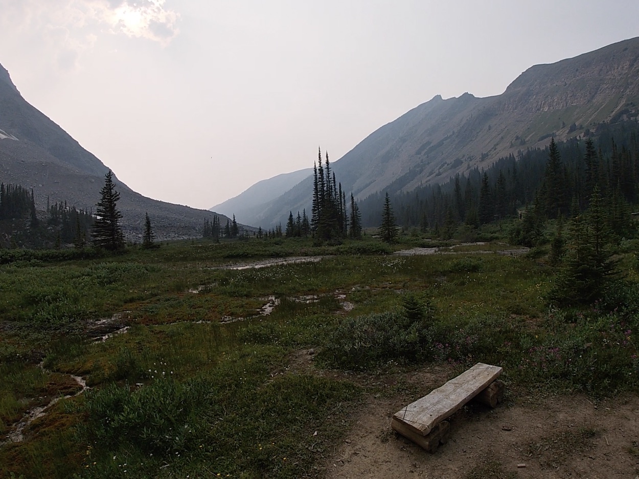
At the 26km mark you begin to lose some elevation heading down switchbacks into the valley. The trail continues through the valley meadow relatively flat until you reach Tekarra Lake.
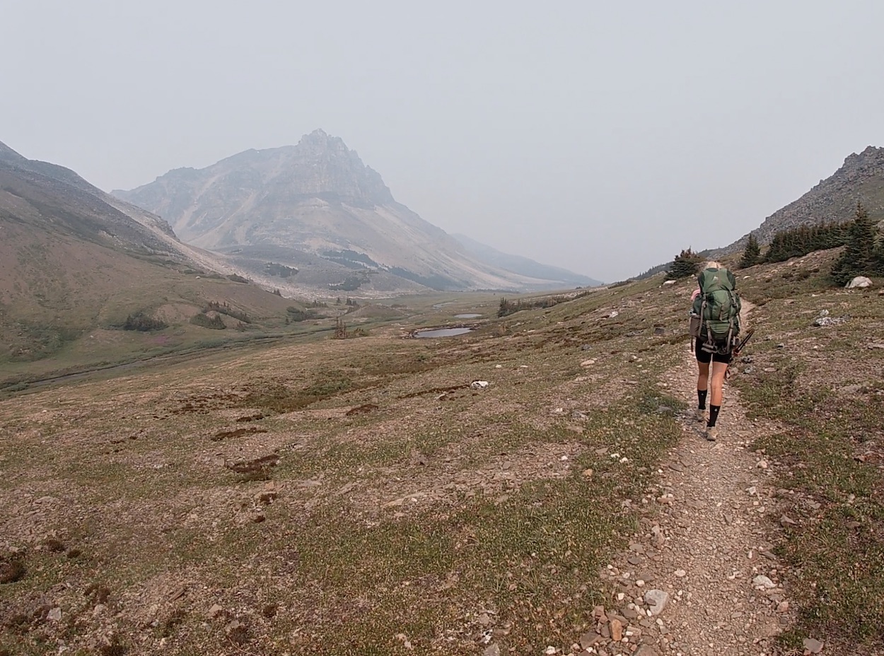
Tekarra Lake is very unique and looks like a marshy wetland type lake with a gigantic 2694m summit looming behind it. After Tekarra Lake, you slowly walk your way out of the Alpine and into the treeline.
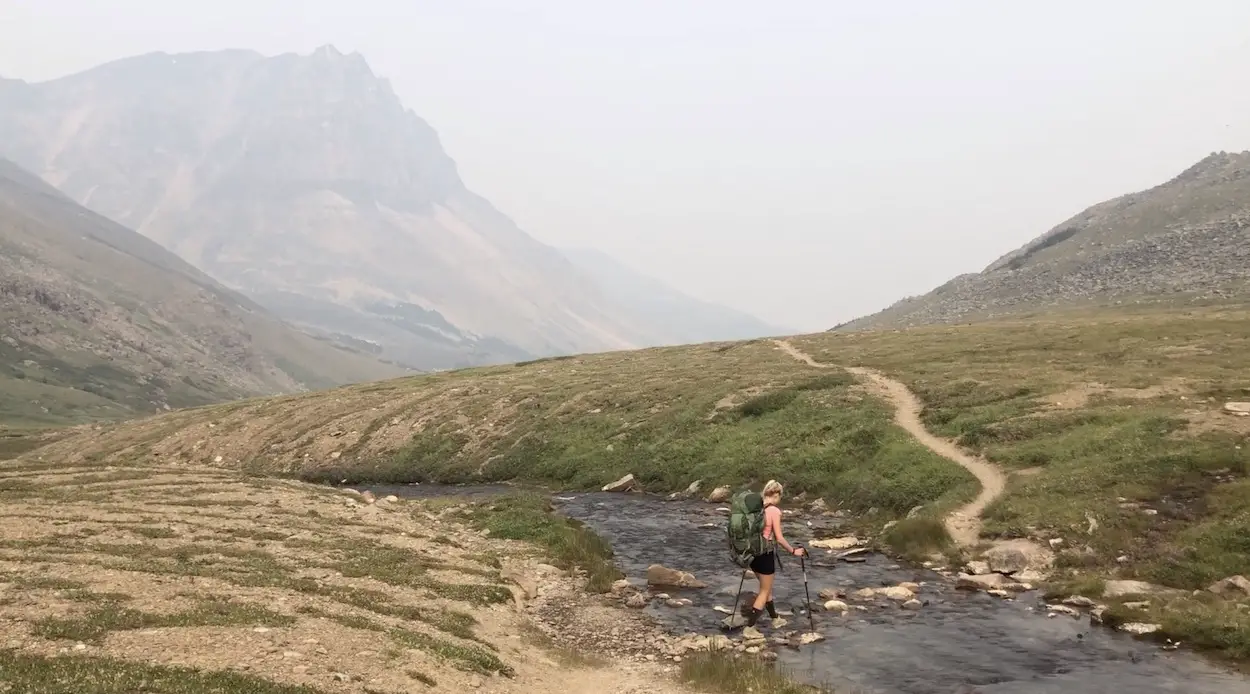
The trail continues to be gorgeous and weaves a path through meadows for the following 6km. We filled water at a creek about 1km before arriving at the Signal Campground. The Signal Campground at 35.6km marks the end of the beautiful alpine scenery and the beginning of a mundane 8.5km forest service road all the way back to the trailhead. The mix of smoke, extremely hot summer weather and sore feet made the last 8km of the day quite painful for Laura and I. We arrived back at the truck and immediately ripped our boots off. Our total time was 6 hours and 45 minutes. We packed our gear and drove straight to Edith lake for an ice cold swim.
Campsites & Reservations
Eveyln Creek (4.9km)
A quiet forested campsite with 4 tent pads, outhouse, creek, food cache and picnic tables. This campsite is ideal for hikers coming from the Bald Hills trail or looking to hike Bald hills the following day. Unless you had a really late start/end I would not recommend shacking up at Evelyn creek.
Little Shovel (8.3km)
An 8 tent pad campsite in the forest. It has an outhouse, picnic tables and food cache. The only available water source is a creek 70m downhill. It’s less busy than the Snowbowl campsite but it’s still pretty close to the Maligne trailhead so I wouldn’t recommend staying here if you have another option. We arrived at Little Shovel in under 2 hours with bad forest fire smoke so we weren’t able to see the views of Bald Hills and Maligne Lake from the site.
Snowbowl (12.2km)
The ideal first spot to camp for hikers planning for 3 days. The Snowbowl campsite is located in a beautiful partially forested meadow. There are 8 sites, outhouse, food cache and picnic tables. There are plenty of creeks to fill water and endless meadows to walk around and explore.
Curator Campsite (20.3km)
Located approximately at the half way point making it the ideal campsite for 2 day hikers. The campsite is located 1.2km from Curator lake and is around 1km downhill from the trail adding 2km and some extra elevation gain and loss to the overall hike. There are 8 campsites, 3 open concept pit toilets, food caches, picnic benches, a stream beside the sites and a great river a near walk away for even fresher water.
Tekarra (30.9km)
The campsite is located just about a kilometer North of the Tekarra lake. There are 8 tent pads, picnic tables, food caches, outhouses and a fast moving creek for filling water and beautiful white noise while you sleep.
Signal (35.6km)
At the end of the Signal fire road lies the campsite. It offers great views over Jasper and is a quieter camping option with only 4 sites. There is not a significant nearby water source.
What you need to know about Jasper National park Camping Reservations
- Click HERE to use the Parks Canada Reservation Service to book Campsites
- There is a nightly rate is $10.02/person.
- A non-refundable reservation fee applies to all bookings: $11.50 online reservations; $13.50 telephone reservations.
- The maximum group size is 10 people, 5 tents.
- No party can stay at one site more than 3 consecutive days.
Wildlife
The Skyline Trail is home to a wide range of mountain mammals well known for inhabiting Japser National Park. These include, woodland caribou, timber wolf, black bear, grizzly bear, coyote, moose, white-tailed deer, bighorn sheep, marten, pika, mountain goat, lynx, marmot, mule deer, porcupine, beaver, elk, wolverine, and cougar. Some of the more notable birds that lurk in the trails forests are great grey owls, golden eagles, great horned owls and bald eagles.
Due to the threat of Woodland Caribou becoming extinct, dogs (which stress animals) have been banned from all Caribou Habitat in Jasper National Park.
Escape Route – Inclement Weather
Due to its high elevation, the Skyline Trail is known for having very unpredictable weather. In certain poor weather circumstances, the ‘Notch’ (a pass just beyond Curator Lake) may be impassable. Fortunately you can exit via the Wabasso Trail, a rough 15km trail with a steep decent of 1100m which starts and Curator campground and ends on the Icefields Parkway 14km from Jasper. The Wabasso Trail is primarily used by horses carrying up food and supplies to the Shovel Pass Lodge. There is cell service at the Wabasso trailhead. If your phone is dead, the Icefields Parkway is typically busy and you should be able to wave down a friendly driver to borrow their phone. Parks Canada does not recommend using the Watchtower trail as an escape route.
My Thoughts
Positives
The Skyline trail has everything that an Alpine hiker could ask for. Meadows, mountains, lakes, wildlife, it has it all! The alpine terrain is unbelievable from start to finish. The highlight of this hike was the hiking itself. It’s the perfect distance, elevation and duration that keeps you enjoying every step along the way. I will 100% hike this trail again when forest fires are not so bad.
Negatives
The forest fire smoke was a bit disappointing but we still managed to have an amazing experience. The campsites themselves are not super scenic or private, just a good place to rest your head. Campsites can be challenging to book so you may not be able to do the exact hiking route that you hoped for.
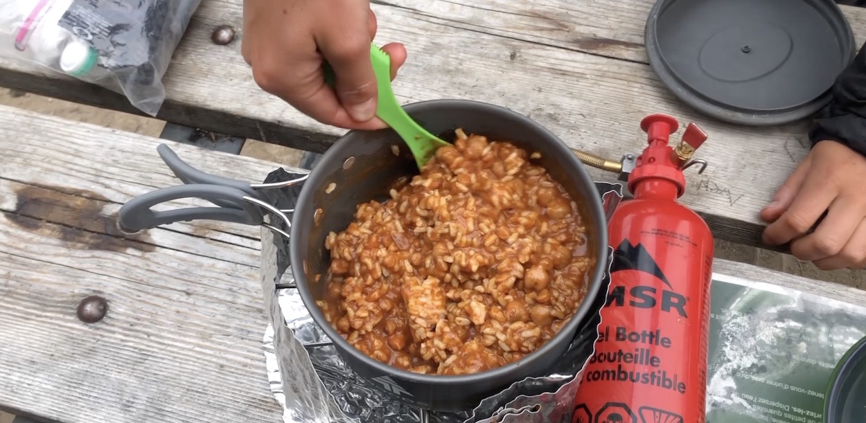
Food We Packed for 1 Night
Breakfast: Instant Coffee
Lunch: Protein Bar, Nuts, Jerky,
Snacks: Nuts, Jerky, Mixed Candy
Dinner: Premade Curry mixed with Uncle Bens 2 Minute Rice
Desert: Tea & Brookside Chocolates
What to Pack for the Skyline Trail
Worried about what to pack for the Skyline Trail. Check out our post HERE to read about what we pack for every single overnight hike.
Additional Things to Remember
- Tent pegs (campsites are on hard soil)
- Extra Warm clothes
- Binoculars for wildlife viewing
VIDEO LINKS