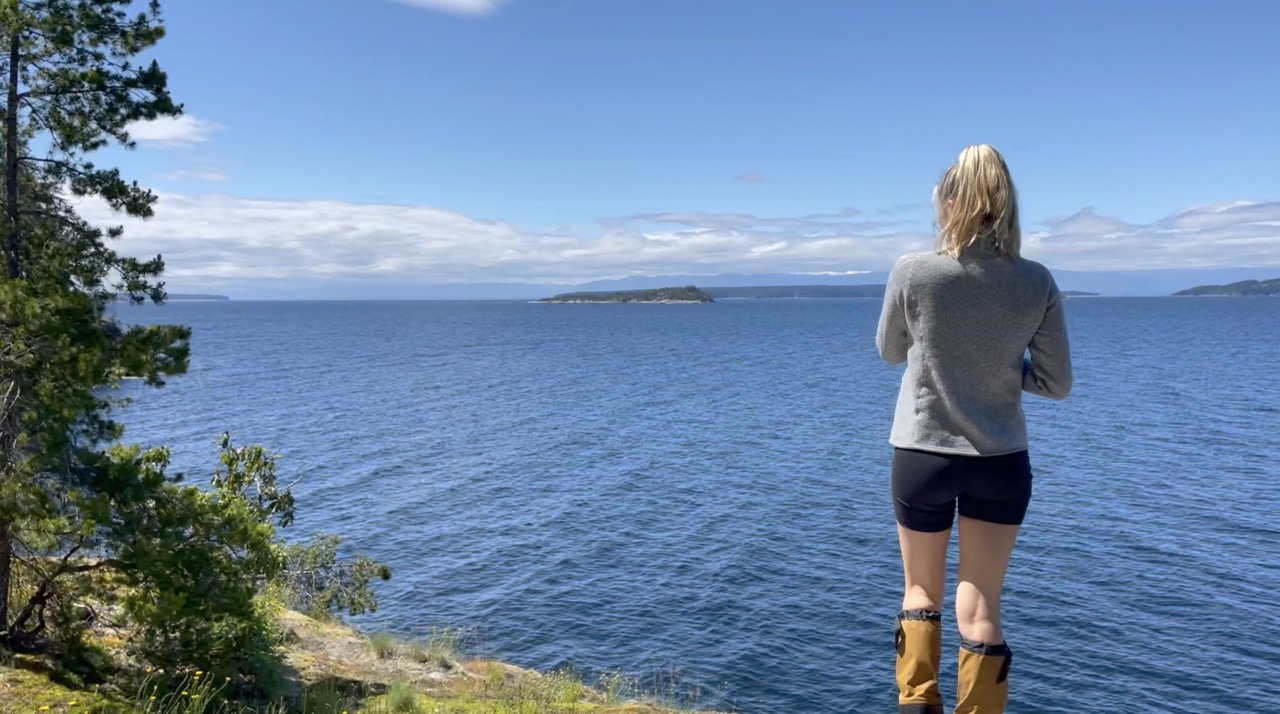
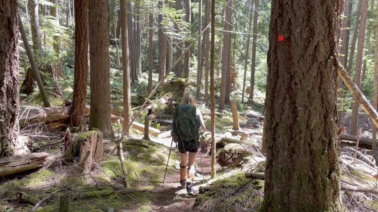
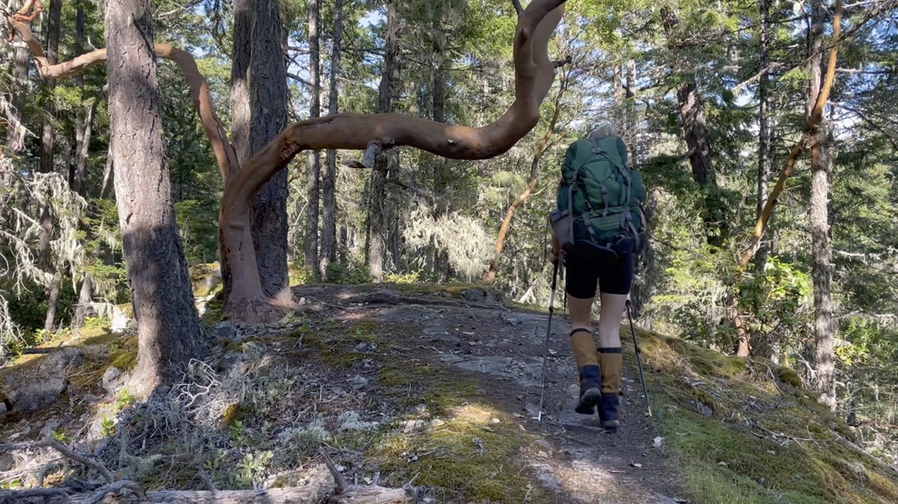
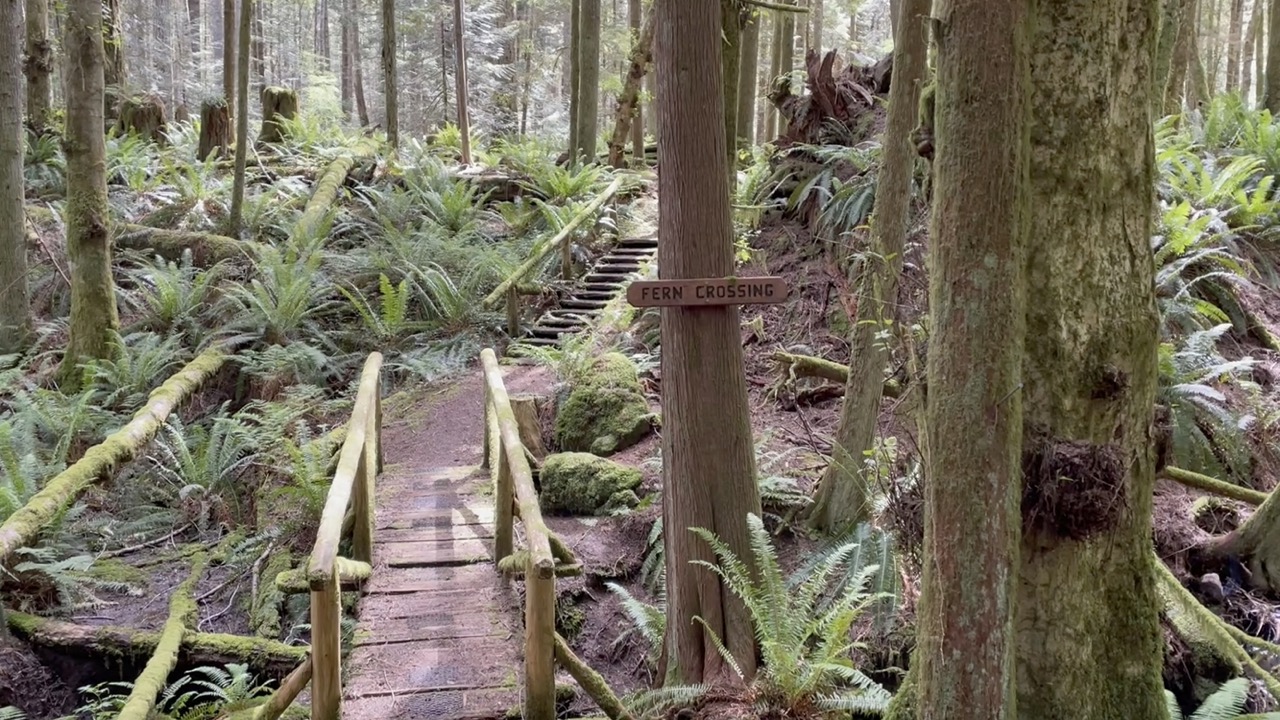
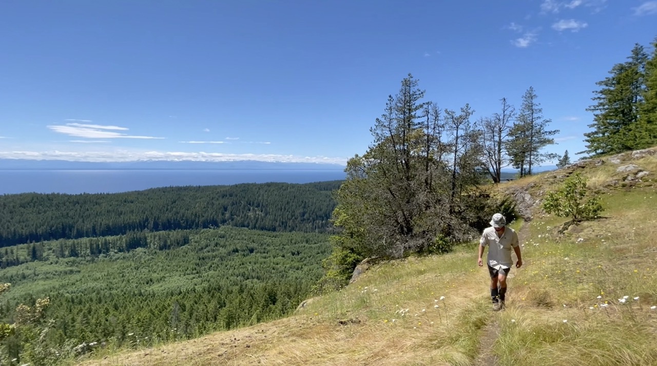
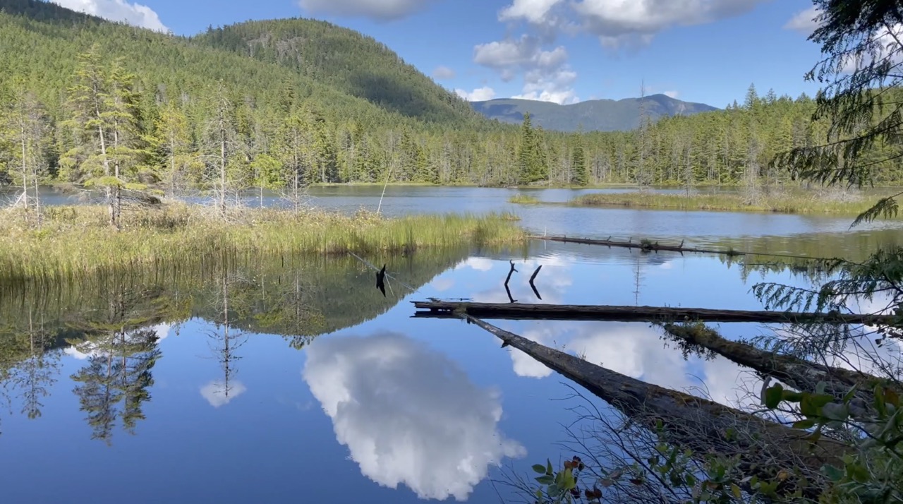
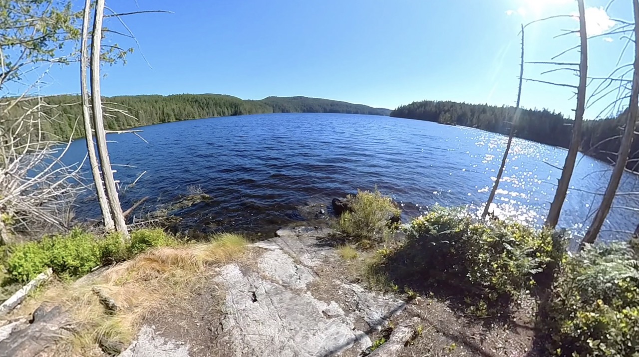
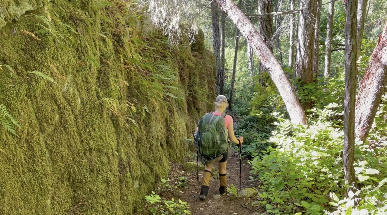
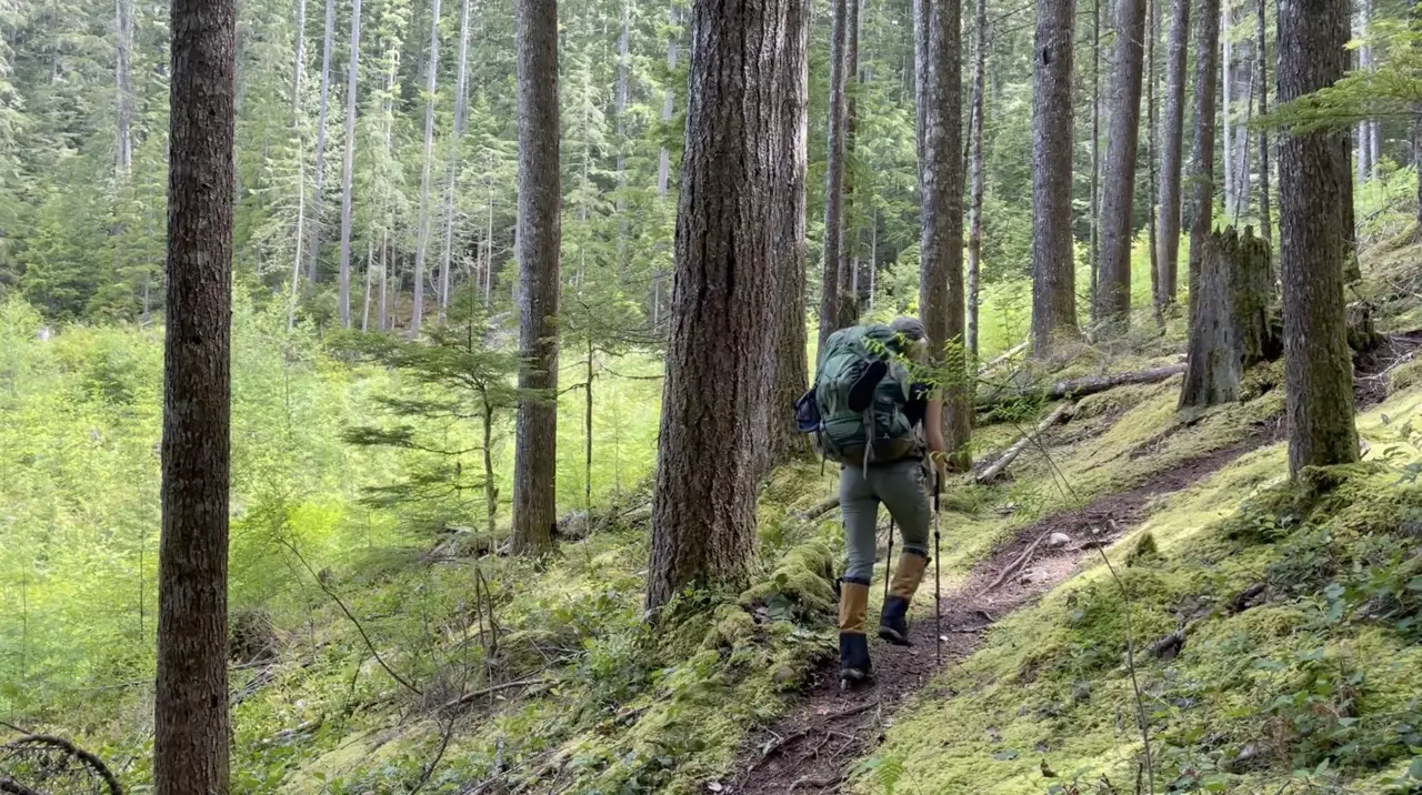
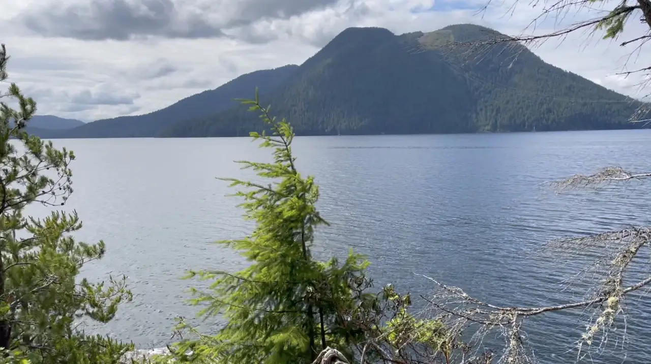
The Sunshine Coast Hut-to-Hut Hiking Trail (SCT) is a 180-kilometer backcountry hiking trail located in Powell River, British Columbia. It’s Canada’s longest Hut-to-Hut hiking trail and it’s completely free! It spans North-South from Sarah Point in Desolation Sound meandering back to the ferry Terminal in Saltery Bay. The terrain on the SCT is absolutely breathtaking and showcases gorgeous coastal and mountainous terrain and landscapes unique to British Columbia’s Sunshine Coast. Expect to be hiking through deep and dense majestic old growth forests one minute, climbing to a mountain summit with a panoramic view the next, only to once again find yourself along the shoreline of the ocean traversing rocky bluffs.
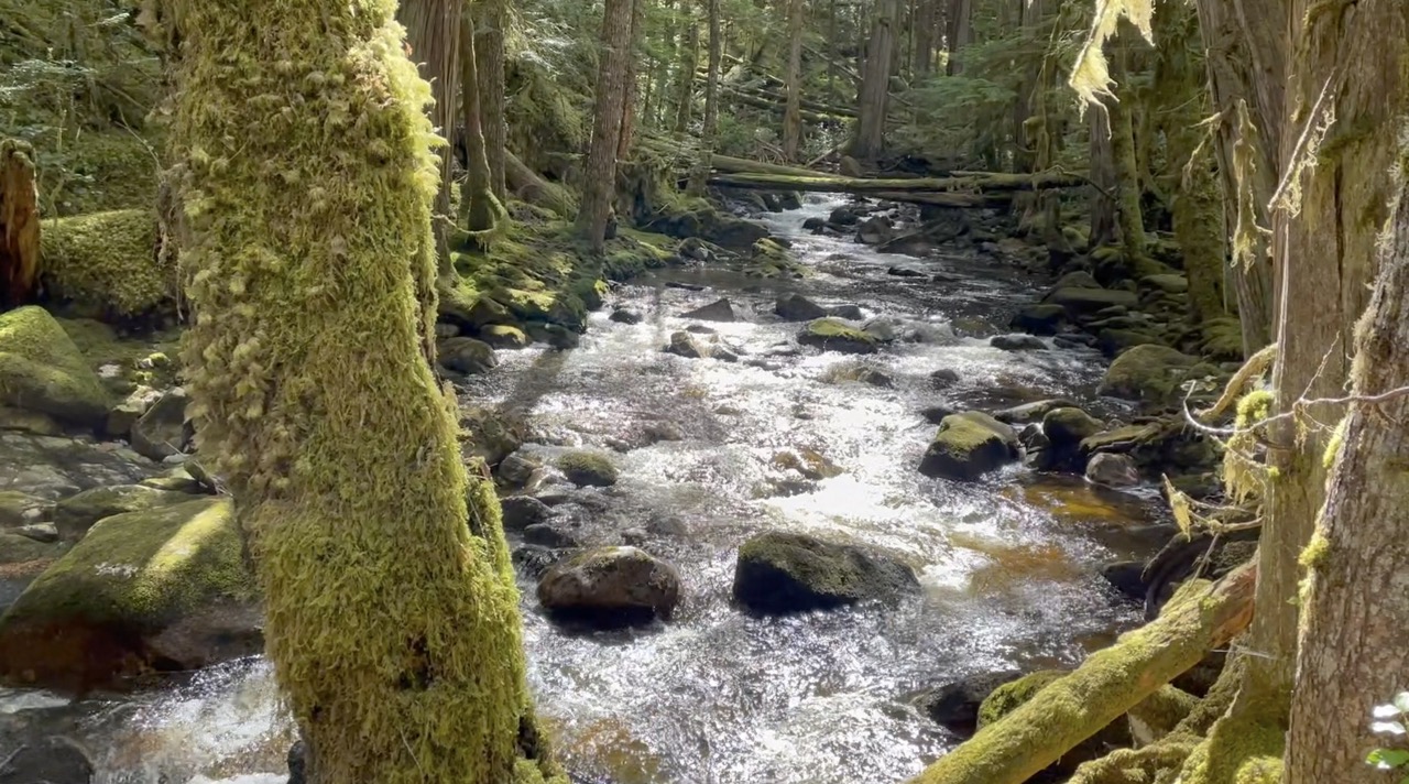
Don’t be fooled by the ‘Coast’ in the trail name. You actually don’t spend too much time along the coastline. Fortunately, this isn’t a muddy coastal hike like the West Coast Trail, North Coast Trail or Juan De Fuca Trail. Most of your time walking will be spent in the forest along creeks, scaling hills/mountains and wandering around lakes, which is still pretty awesome.
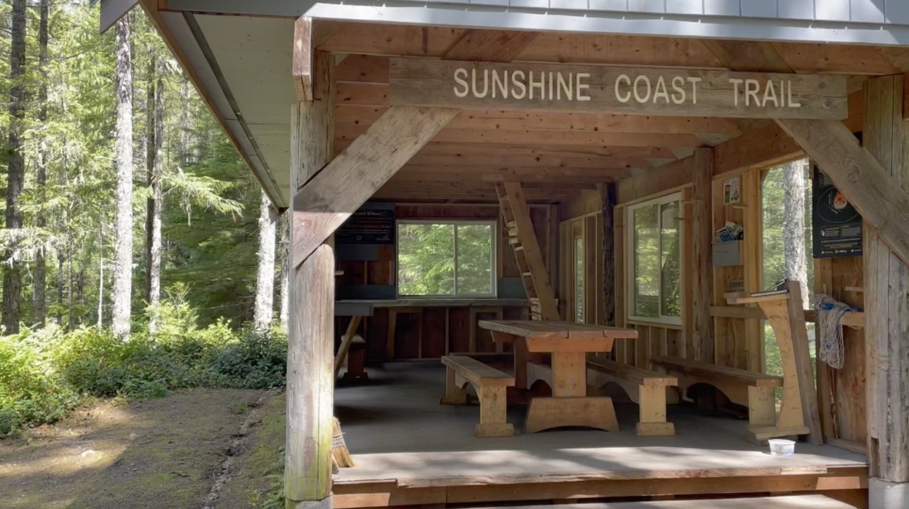
The SCT is an amazing year round hiking trail (snowshoes are required in the winter) and is a great way to kick off your hiking season before the high alpine opens. The trail was shaped in 1992 and boasts 15 fabulously crafted and enclosed wood huts where you can rest your head and stay dry for the night. You can choose your own adventure on the SCT and opt to hike it in one shot as a thru-hike or break it down into different sections of trail over time. Most hikers can accomplish the entire trail in 8-12 sleeps depending on their hiking style.
In this post I will break down the SCT into its three main sections and provide you with all the details you need to have the best possible experience on the Sunshine Coast Trail.
Table of Contents
How To Plan For The Sunshine Coast Trail
Where Is The Sunshine Coast Trail?
The Sunshine Coast trail is located in Powell River about 5-6 hours from Vancouver. This includes two ferries and a drive. The city is situated on the northern part of the Sunshine Coast in Southwestern British Columbia along the Malaspina Straight which is part of the larger Georgia Strait. The SCT is typically walked North to South from Sarah Point in Desolation Sound all the way back to the ferry terminal at Saltery Bay but can be hiked either direction.
Trail Registration or Reservations
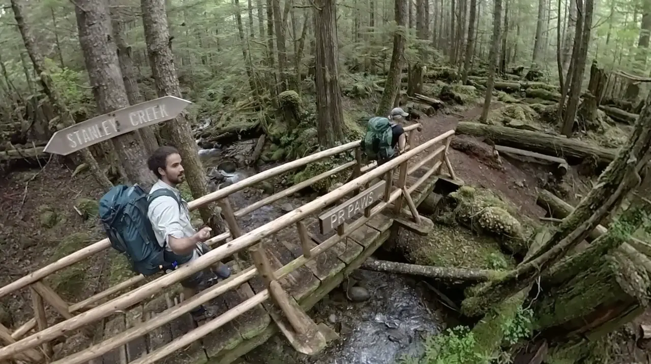
The awesome thing about hiking the SCT is that it doesn’t require backcountry permits, reservations or registrations. All you need is your backpack, boots, a smile and you’re ready to hike. The trail is wonderfully maintained and I’m very thankful for the amazing volunteers from PAWS (Powell River Wilderness Society) who constructed and keep the trail and huts maintained year round! If you want to say thanks for the great work these volunteers do you can get involved yourself or donate on the Sunshine Coast Trail Website.
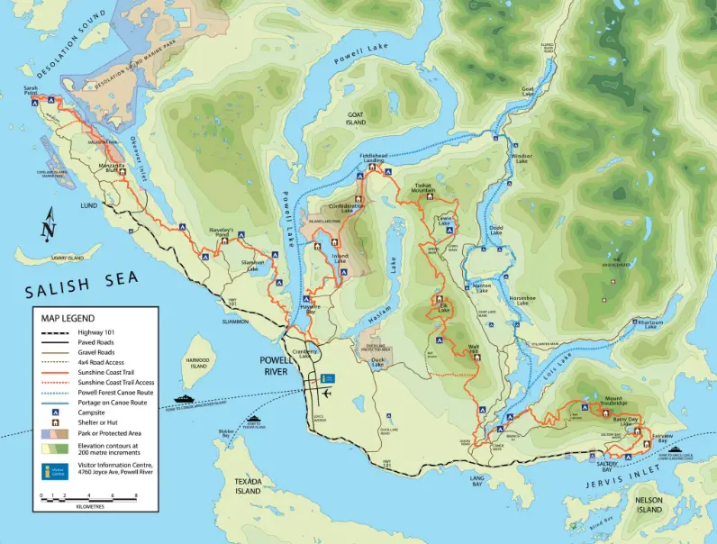
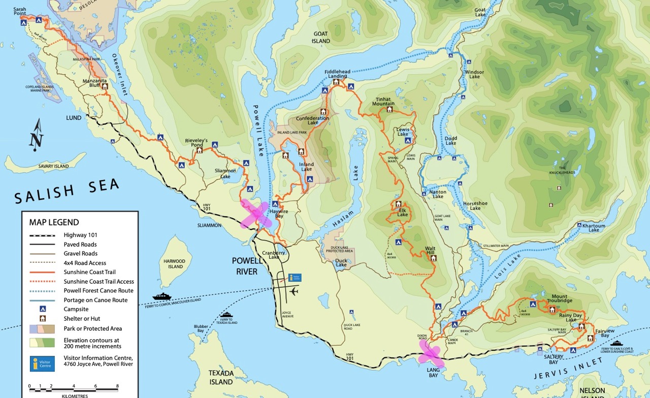
Sunshine Coast Trail Map
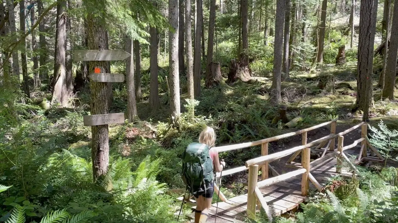
The SCT is fabulously marked, but like any backcountry hike you will want to carry a map. You can obtain a sunshine coast trail map for free from the visitor centre or download the map to your phone via the Sunshine Coast Trail Website.
The visitor centre also sells a Powell River recreation map for about $10 which is the most detailed version of the SCT map and is a great way to become familiar with the entire Powell River backcountry recreation areas. If you want to secure one of these maps ahead of time I’m sure you can call the tourism centre and organize them to mail it to you!
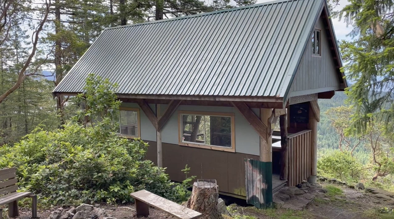
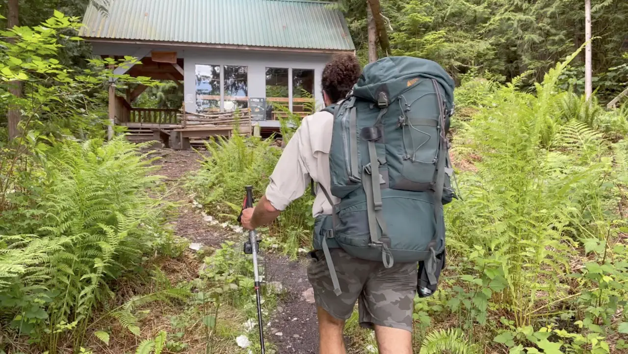
The Huts
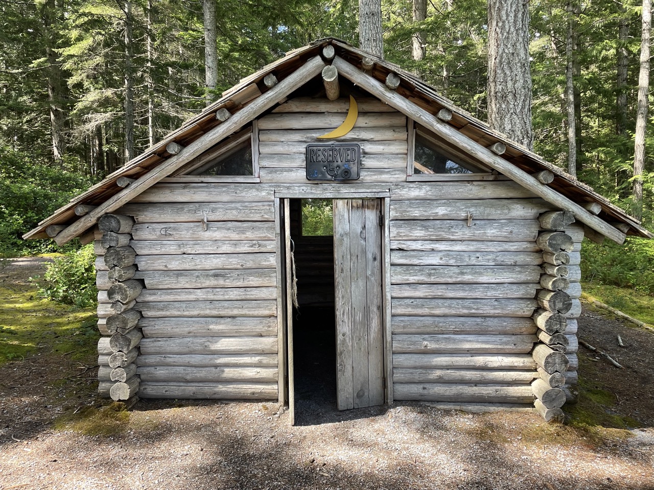
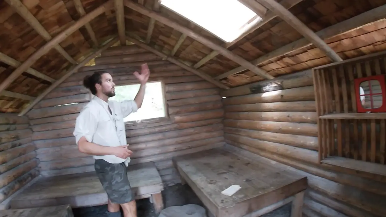
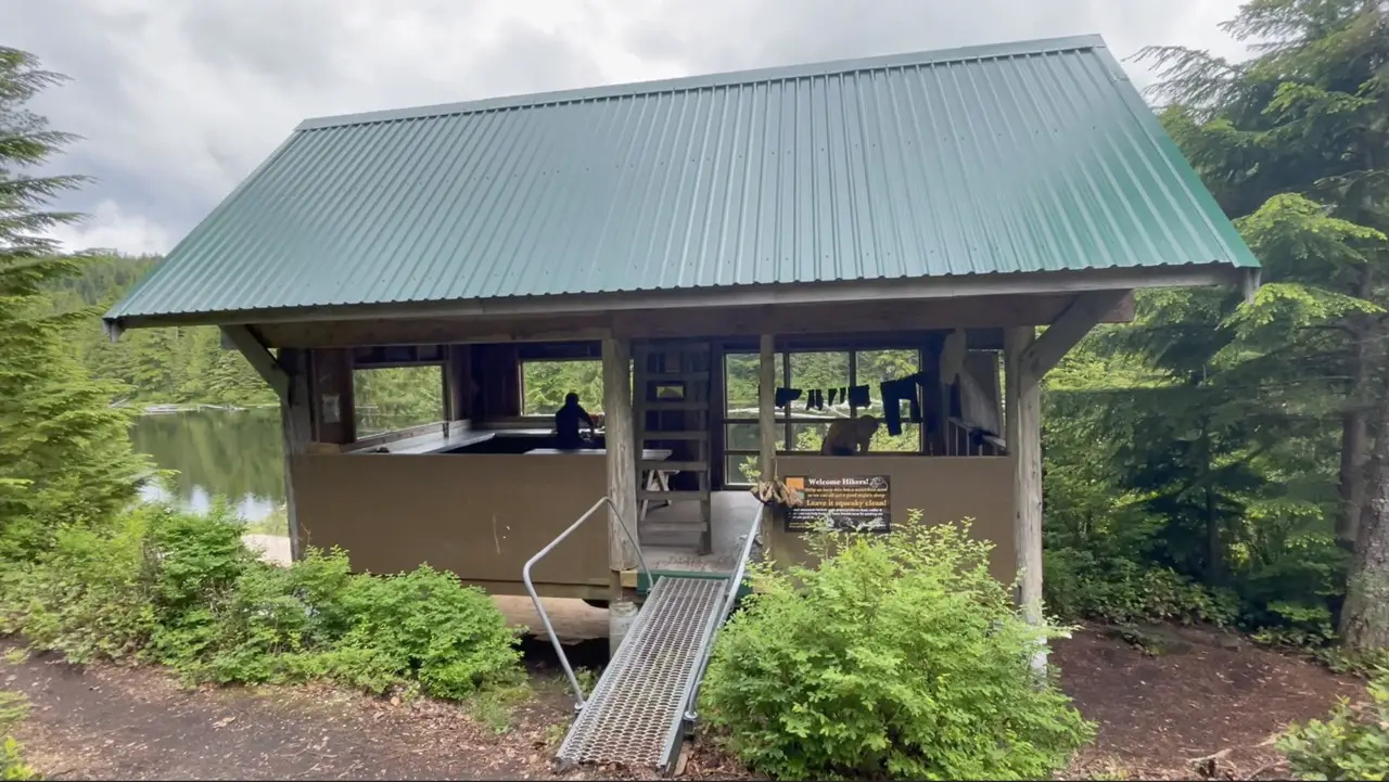
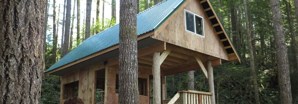
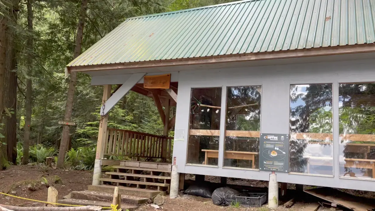
Believe it or not the SCT was not originally designed to be a hut-to-hut trail. The Huts were designed after the trail was cut. As it gathered widespread attention and gained in popularity more and more huts were constructed. The huts are all beautifully designed works of art located in some of the most picturesque locations in Powell River. The craftsmanship is phenomenal and lots of local wood and driftwood was used in construction. Each hut has an outhouse, a few fire rings, and a place you can fill water! The Tin Hat Hut, Walt Hill Hut, Confederation Lake Hut and Mt Troubridge Hut are also completely winterized with wood pellet heaters so you can stay warm and comfortable on winter snowshoeing excursions.
The huts are free and completely open to everyone in the public. So, this means that you will almost always be sharing the hut with other hikers. It’s an awesome way to meet hiking friends and they are great for staying dry if the weather gets nasty. Make sure to keep them cleaner than you found them because no one is coming to clean up after you!
Carrying a Tent on the SCT
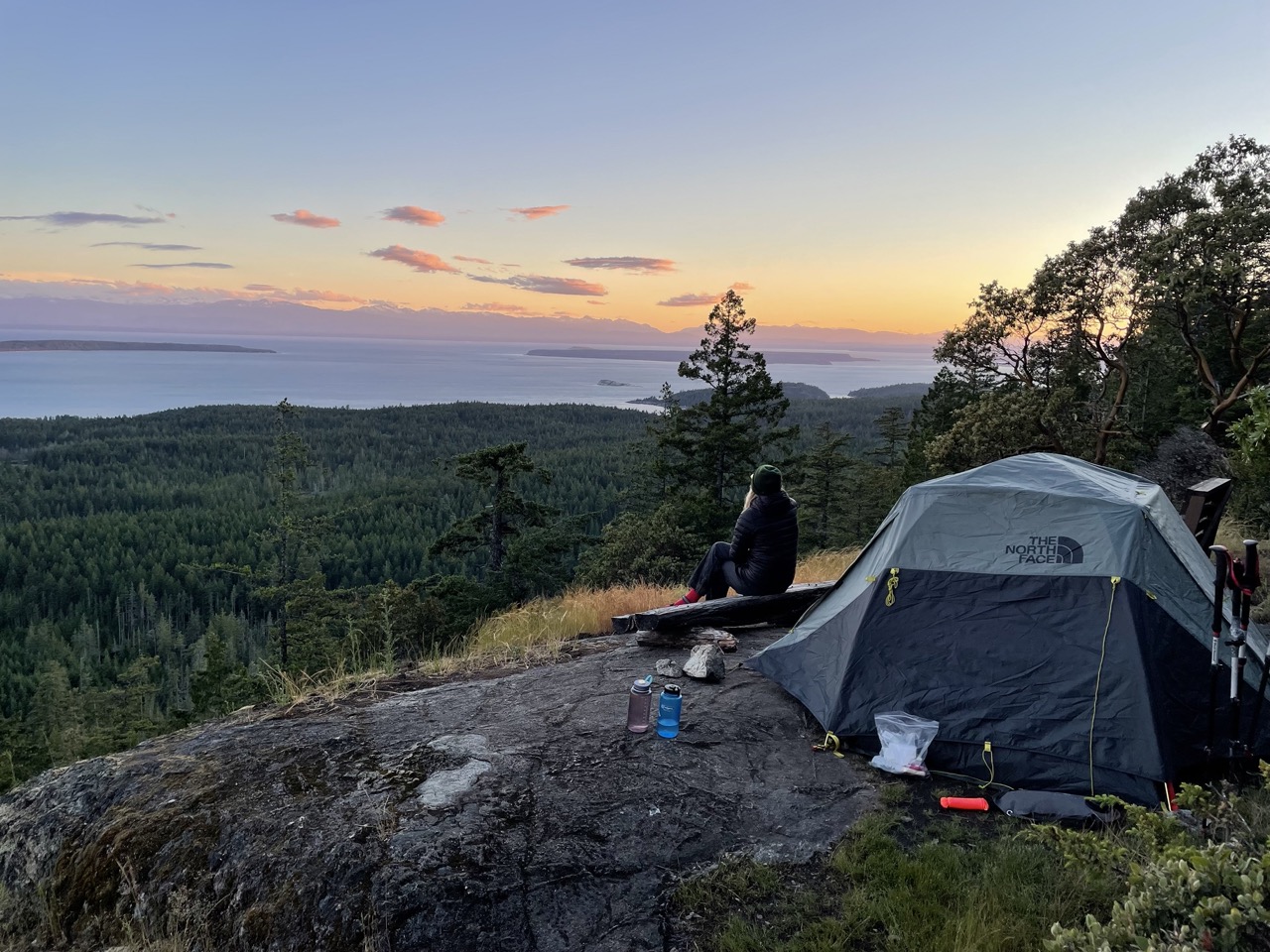
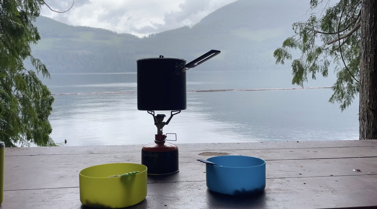
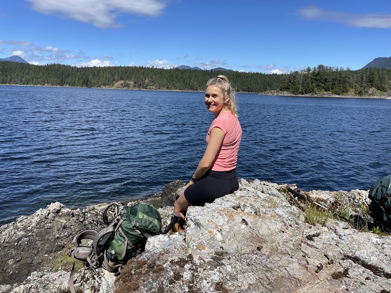
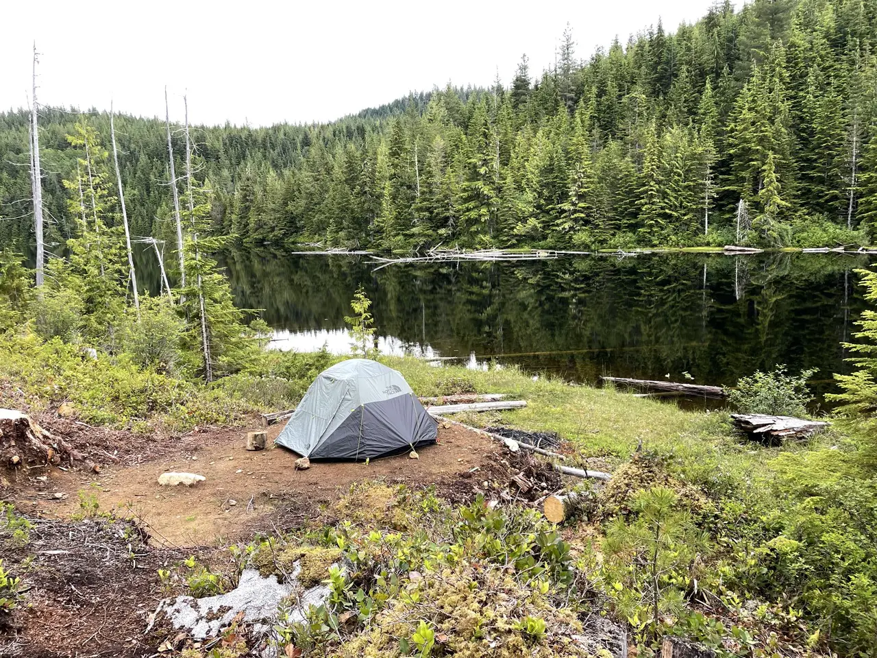
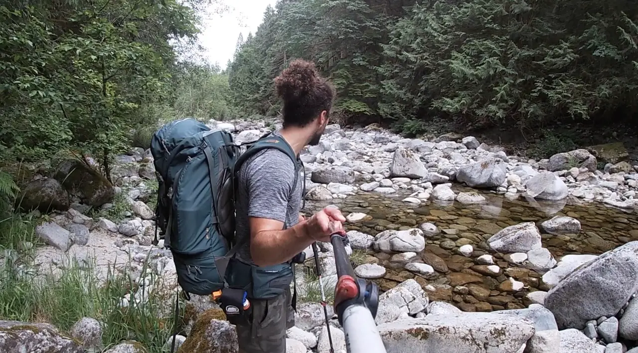
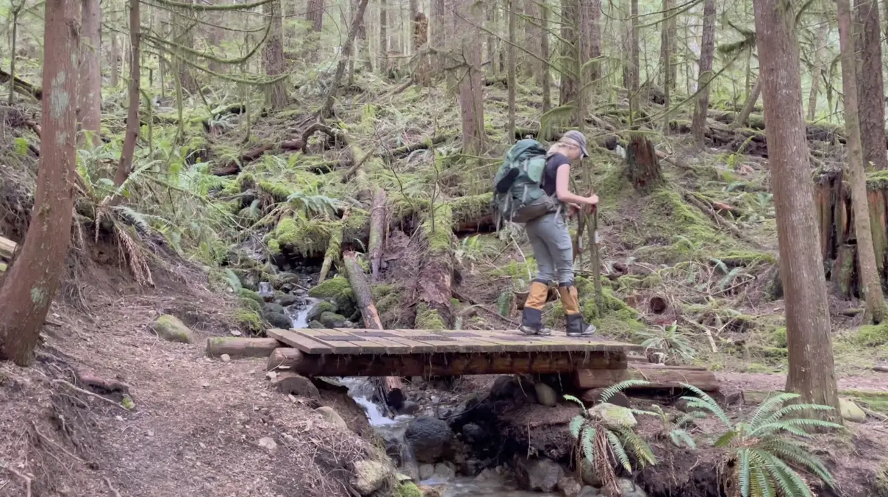
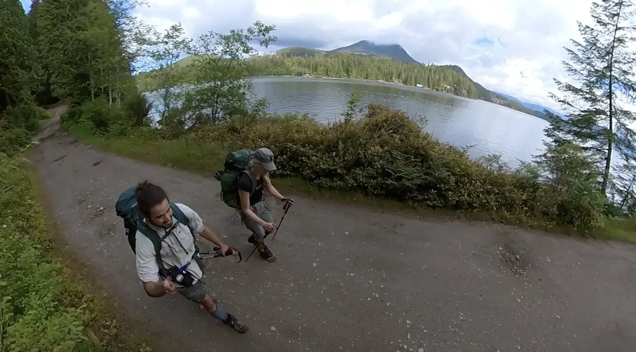
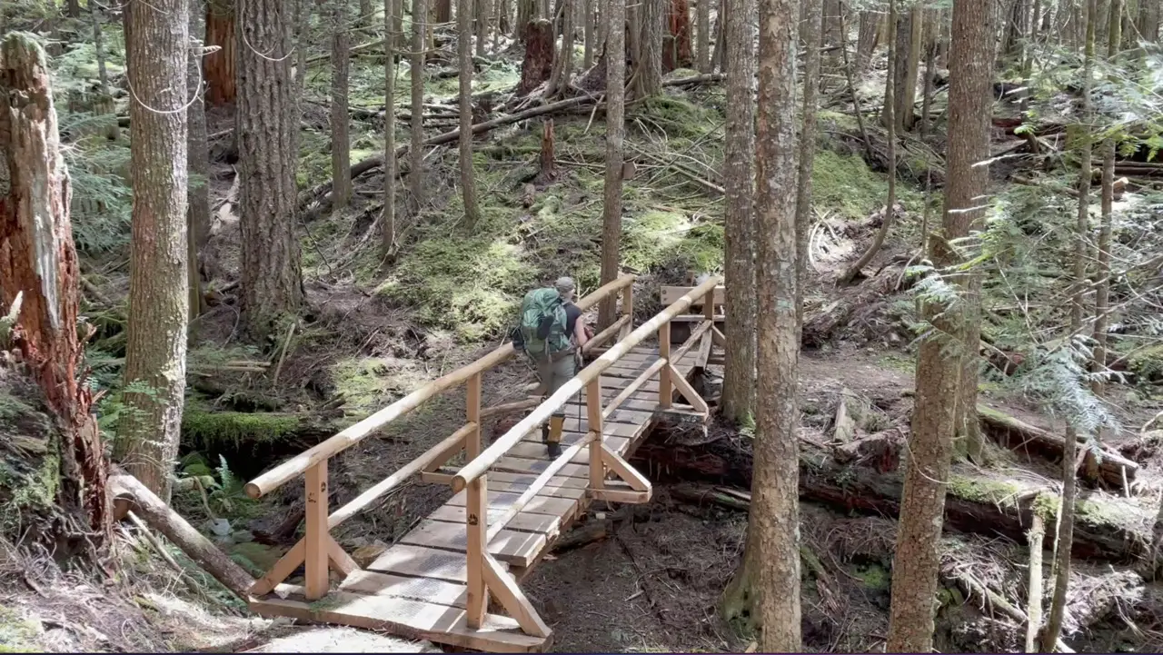
Many hikers opt to carry a tent on the SCT. It is absolutely not mandatory but I would recommend it. The distance from one hut to another will not always line up with the amount of mileage that you want to conquer on any given day. Having a tent allows you to pack it in and go to sleep anywhere along the trail if your legs get tired. Some of the huts, campsites and other areas on the trail are perfect for tenting and have more privacy and unforgettable views than the huts themselves. Also, if you don’t feel like sharing a hut with others, or you’re a light sleeper than carry your tent. When Laura and I hiked the SCT we carried our tent and slept in it most of the nights because we simply wanted more peace and quiet and like to wake up early on trails and didn’t want to wake up and bother others.
Transportation To The Trailhead?
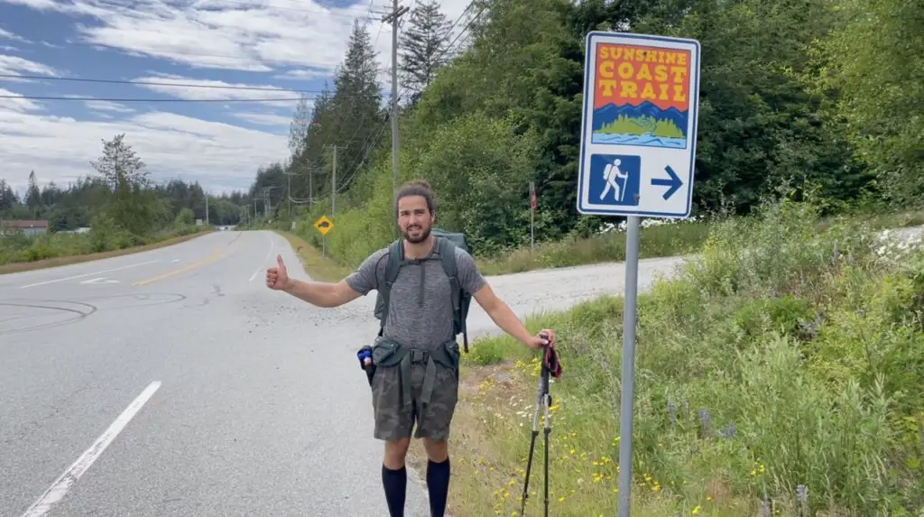
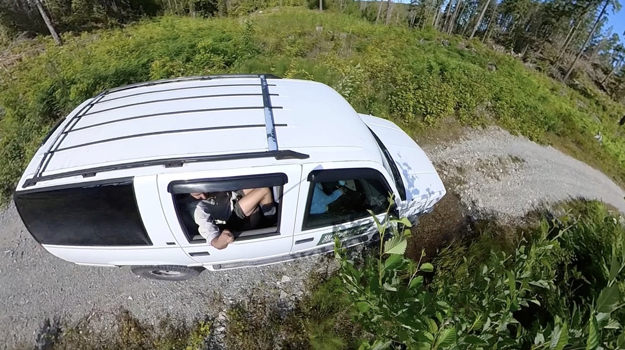
Hiking the SCT requires a little bit of coordination. Sarah Point can only be accessed by watercraft or a well-equipped 4×4 vehicle. If you do not have two 4×4 vehicles one to drop at Sarah Point and the other at the end of your chosen journey, you will have to organize alternate means of transportation. The easiest and most effective way to get dropped off at Sarah point is by the Sunshine Coast Shuttle Service or one of the two water taxi options. Both options work awesome and become significantly cheaper if you can organize sharing the ride with other hikers. A great way to do this is to check out or post on the Sunshine Coast Trail Facebook page.
The Sunshine Coast Shuttle:
https://sunshinecoastshuttle.ca/
We used the Sunshine Coast Shuttle service and they were absolutely awesome. They are super flexible with pickup and drop off points. The cost varies depending on the number of passengers, distance driven and gas prices. If you shoot them an email they will help to connect you and your party with other hikers to make things cheaper. The shuttle drops you off right at the Sarah Point Hut!
Lund Water Taxi:
https://www.lundwatertaxi.com/schedule
The Lund water taxi is cheaper than the zodiac but the times are constrained by tides. Give them a call to organize and they can try to group you with other hikers.
Zodiac Water Taxi:
http://www.terracentricadventures.com/transport/sarah-point-water-taxi/
Terracentric Adventures offers a water taxi service to Sarah Point. This is the most expensive option but does not require the tides to be bang on because the Zodiac can pull up right to shore at kilometer 0.
Public Transit: The BC transit services in Powell River are limited. The 12 bus runs from Saltery Bay to the City of Powell River and the 2 or 14 can take you to Lund. However, since buses are limited and only run a few days a week I would not recommend relying on them especially if you are constrained for time.
Food Planning, Drops and Re-supply
If you are hiking the trail as a thru-hike I would absolutely recommend planning food drops or re-supply’s. Keeping the weight of your pack down will keep your energy high along the trail and let’s be honest, nothing is better than a re-fresh of food and goodies while you’re hiking. There are two main ways hikers re-stock on food on the trail. The first is to store little boxes of food at local businesses and the second is to organize a food drop off with the sunshine coast shuttle service or Mitchells Canoe and Kayak Rental.
Without venturing too far off the trail there are two primary points that hikers can store food on the trail. The first is the Shinglemill Pub. They store food for hikers completely free and the Pub is directly along the trail. Most hikers will pick up their food here and usually enjoy a burger and one too many beers before continuing on their merry way.
Many hikers will only require one food re-supply at the Shinglemill and will carry the next 5-6 nights of food in their packs. If you want to keep things lighter, or your situation calls for it you can always leave another re-supply of food at the Lang Bay Store. The Lang Bay Store also sells hot food and loads of delicious snacks and alcohol. The Lang Bay Store is located about 8km out and back from the SCT down Dixon Road. It’s a great option if you need to restock but you will be sacrificing some time and kilometers to get down there.
If you want to opt for a food drop off from Sunshine Coast Shuttle or another company just give them a call and plan for a time and area anywhere the trail connects to a logging road that you would like them to drop-off your food.
Parking & Access Points
There are loads of free parking and paid parking options along the trail. If you are starting in Saltery Bay just park for free on Rainy Day Lake road along the side near the trailhead sign.
If you would prefer for your vehicle to be monitored you can pay $5 per night to leave your vehicle at the Shinglemill Pub or at Dave’s Parking in Lund or the Water Taxi Parking which is around $7 per night. You’ll just have to find your way back to your vehicle via shuttle, cab, hitch-hike or transit after you finish the trail.
You can also opt to park anywhere along the trail you please. There is a large network of logging roads and a quick look at a map will show you where the trail connects and there are usually spots to park at many of these convergence points. On the trail map these locations are marked with blue “P” signs. Powell river logging is very much active so be sure to use a radio and follow all best practices when driving on any active roads.
Overall the parking situation in Powell River is very relaxed except for Lund! Don’t park in Lund unless you’ve paid for parking because you will get towed!
Trip Itinerary Options
Thru-Hiking the Sunshine Coast Trail (180km/9-12 nights)
One of the most epic ways you can experience the Sunshine Coast Trail is to hike all 180+ kilometers in one shot! The number of days you spend on the trail and the huts/areas you sleep at will depend upon your hiking style and speed.
The A-Typical sunshine coast thru-hiking itinerary should involve about 9 sleeps and 10 days of hiking. Most hikers begin from Sarah Point the northernmost point on the trail heading south towards Saltery Bay. Some hikers choose to start at Saltery Bay and finish in Sarah Point. This is also a fun option and allows you to spend a night at Sarah point which is stunning. You just have to make sure your pickup is pre-coordinated because you won’t have cell service to contact anyone when you arrive.
Best Multi Day Itineraries on the SCT
Here is how I would recommend breaking up the trail and a quick summary of each.
Sarah Point to Powell River (50km, 2-3 nights)
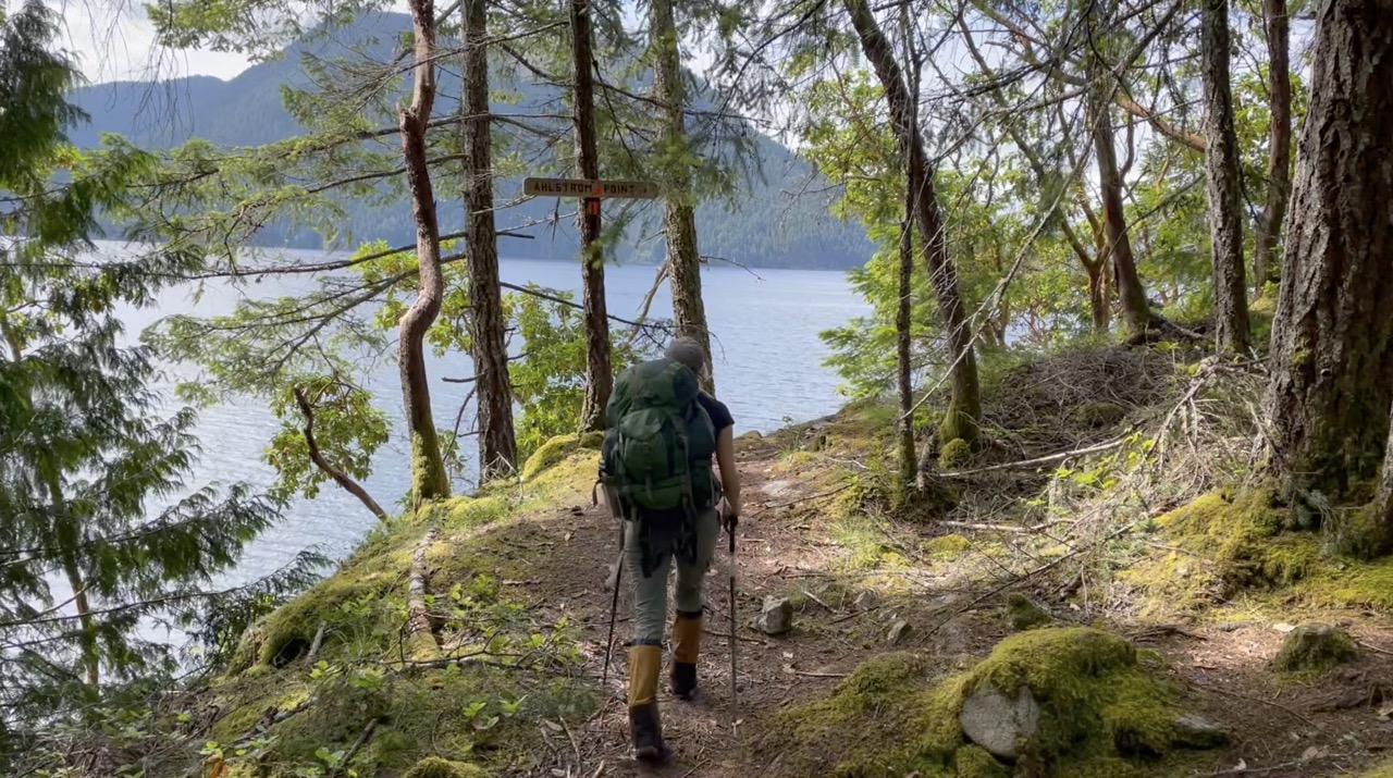
This is the most unique section of the trail and if you only have a few days, this would be my recommendation. You will be able to get a little taste of everything from the gorgeous coastal views, dense old growth forests and beautiful ocean viewpoints from rocky bluffs. The only catch, you’ll have to organize a shuttle or water taxi to Sarah Point.
Watch our Sarah Point to Powell River SCT Hiking Video
Powell River to Lois Lake (87km/3-5 nights)
This is the least coastal of the three hiking options, but don’t let that deter you, it’s wonderful. This is a flagship itinerary on the SCT and will give you a taste of what makes the Powell River backcountry so unique. This section is all about lakes, mountains, forest and more lakes. The Tin Hat Hut is the highlight of this portion of trail offering the most exceptional 360 view on the entire trail. You’ll also never feel overheated because you’ll have endless opportunities to plunge into amazing little lakes along the way.
Watch our Powell River to Lois Lake SCT Hiking Video
Lois Lake to Saltery Bay (45km/1-3 nights)
This is the least exciting of the three trail sections. The hike between Mt Troubridge and Lois Lake can feel fairly dull until you arrive at the Troubridge Hut. However, the Troubridge, Rainy Day Lake & Fairview Bay huts are all fabulous and fun spots to spend a night. I wouldn’t recommend spending more than 2 nights on this section of the trail.
Lois Lake to Saltery Bay SCT Hiking Video
Detailed Kilometer by Kilometer Description of the Sunshine Coast Trail & Huts
Sarah Point to Powell River (2-3 nights/50km)
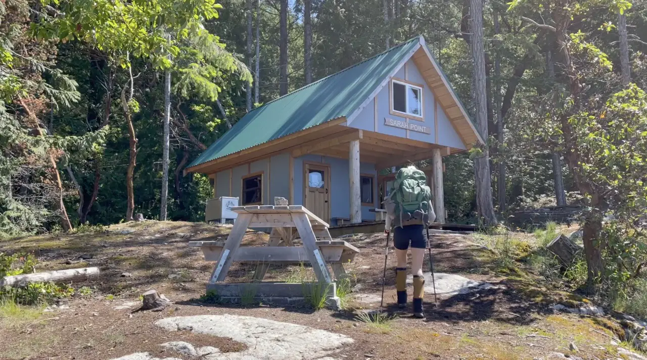
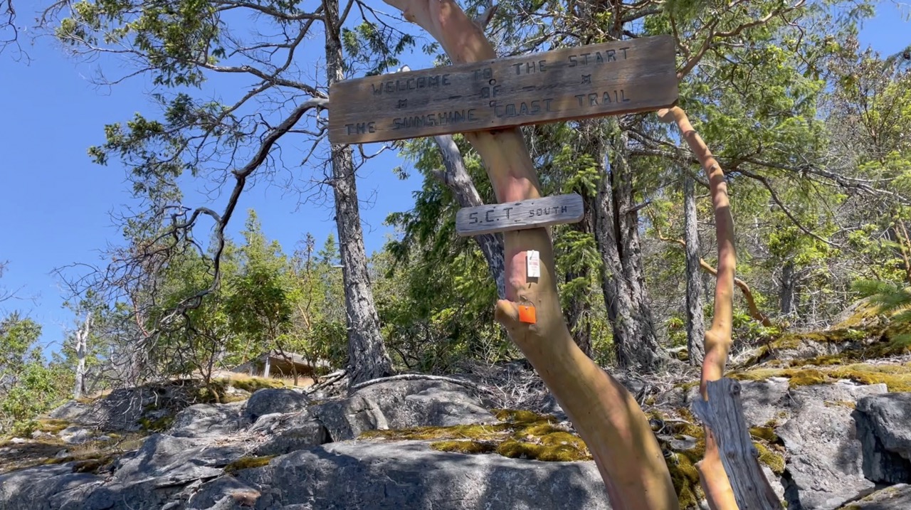
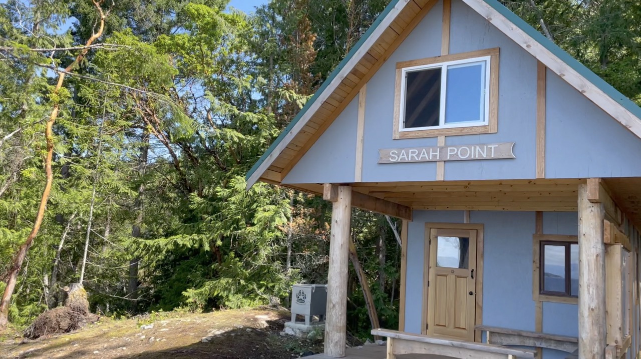
Sarah Point Hut (KM 0)
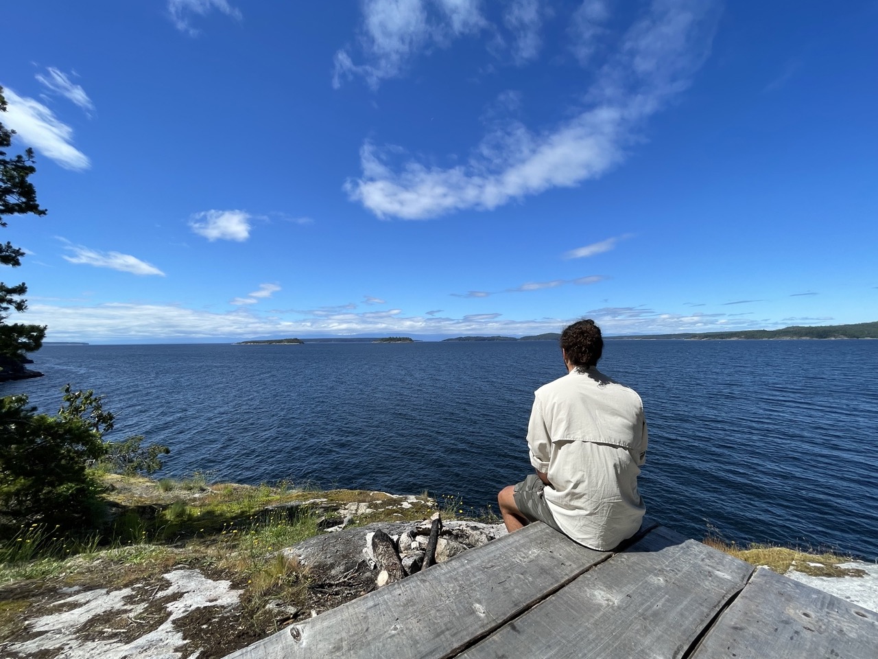
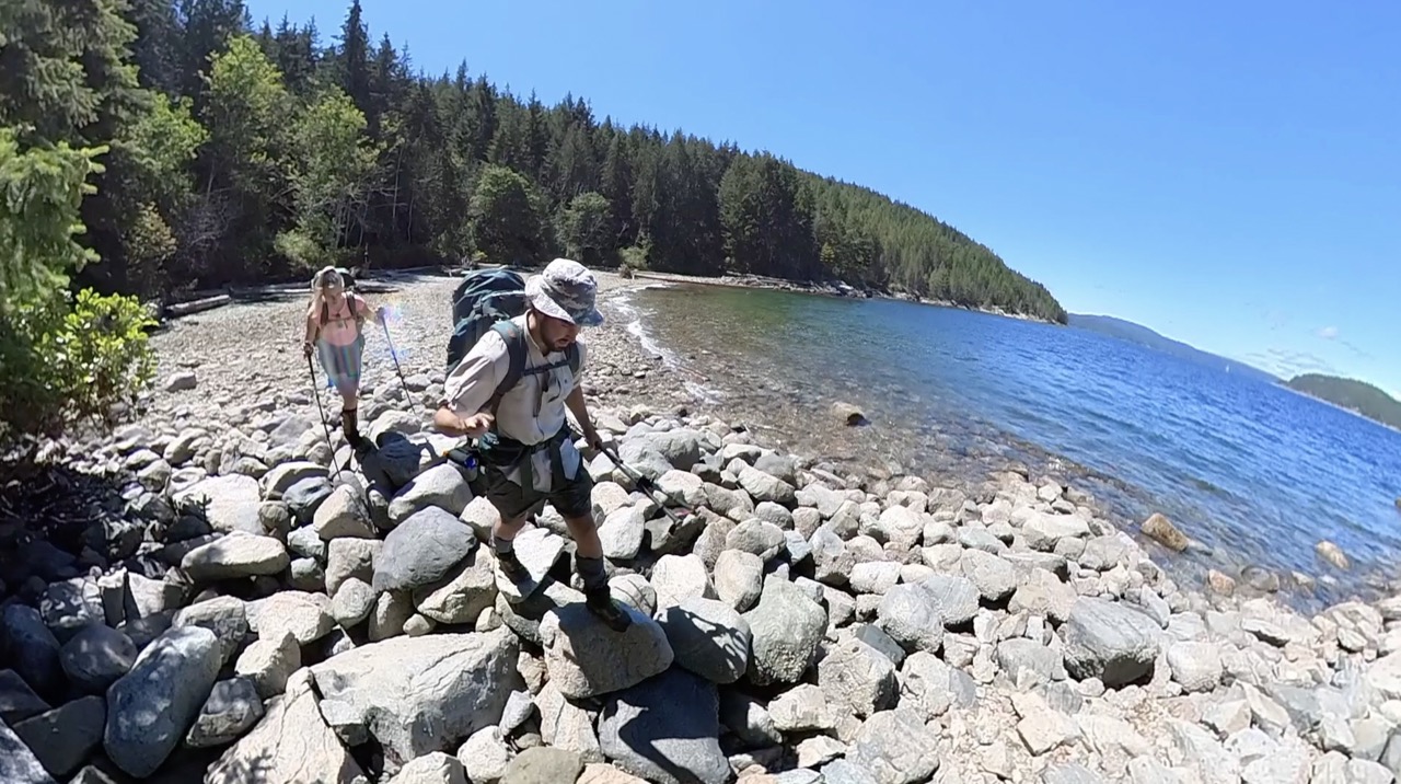
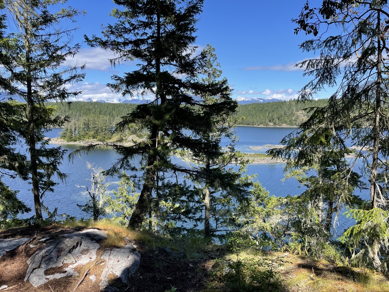
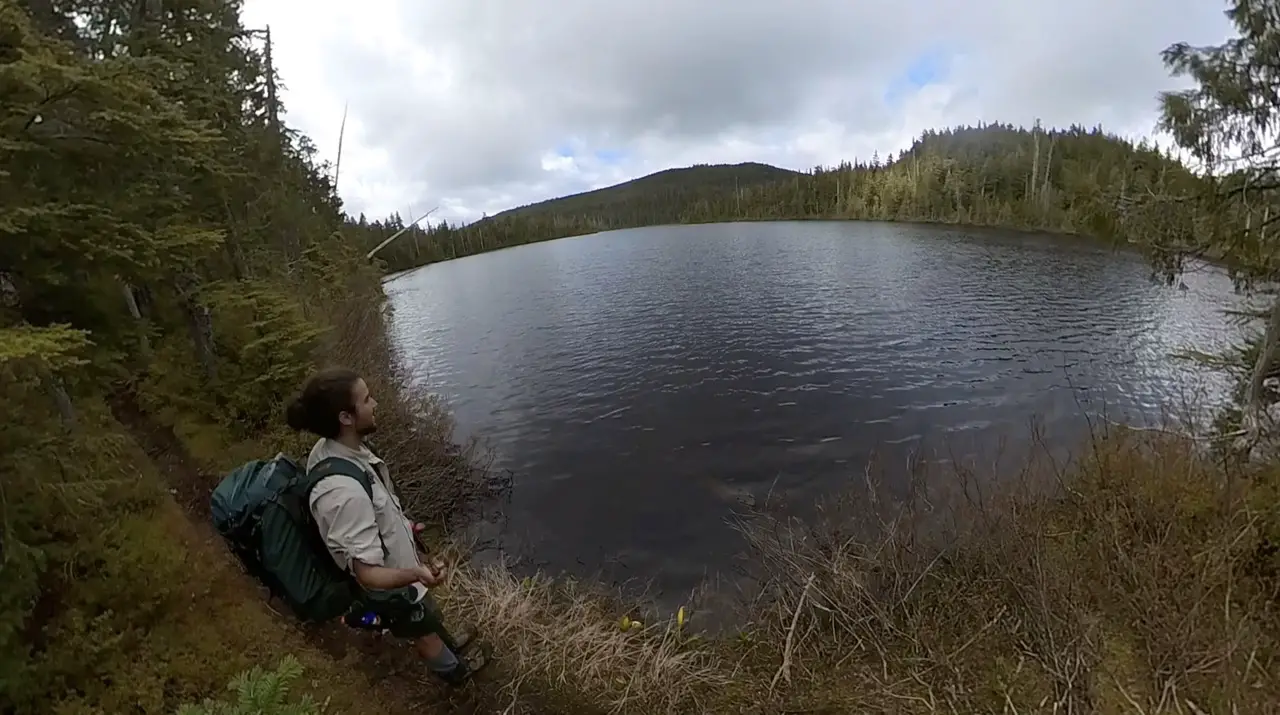
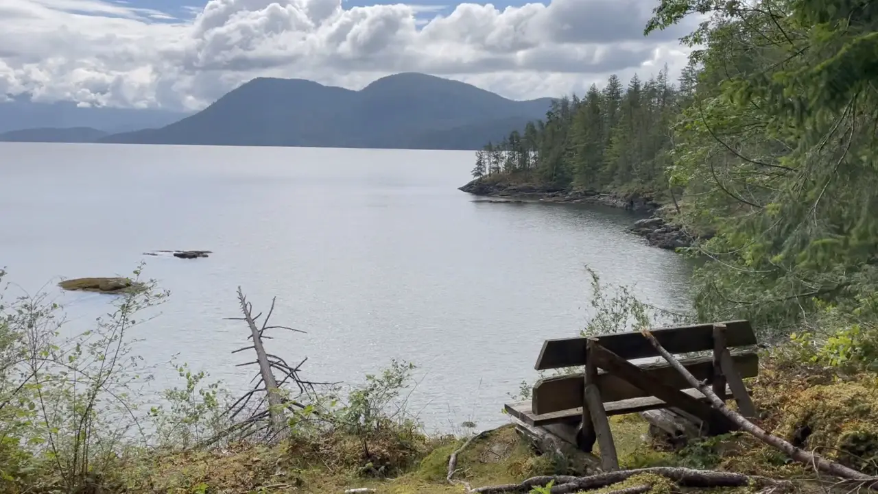
Sarah Point marks kilometer zero of the Sunshine Coast Trail and is the gateway to Desolation Sound Marine Park sandwiched between the Salish Sea (Strait of Georgia) and Malaspina Inlet. Sarah Point without a doubt, is one of the highlights of the entire trail. Talk about starting off strong!
The Sarah Point Hut is built upon rock bluffs towering over the endless expanse of ocean views below. If you’ve packed a tent you’ll be happy because Sarah Point boasts some of the most incredible tent pads on the entire trail.
Some hikers take an evening shuttle or water taxi out to Sarah Point and spend their first night sleeping under the stars and listening to the crashing waves and others actually plan to walk the trail in reverse (South to North) so they can spend their final night at Sarah Point.
If you’re a hiker like me and are eager to set sail once your feet hit the soil, then plan for a lunch or snack at Sarah Point so you can at least spend an hour or so staring out into the ocean.
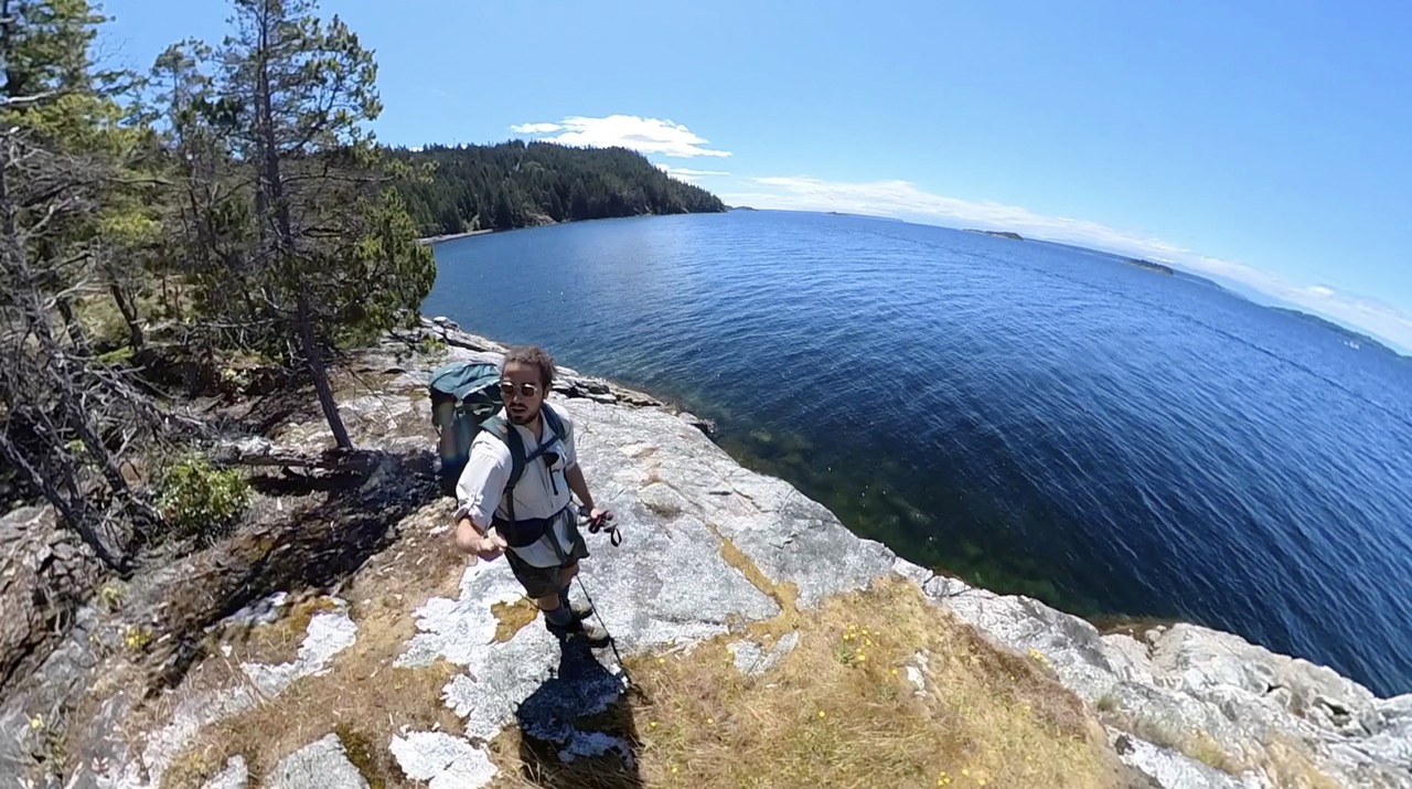
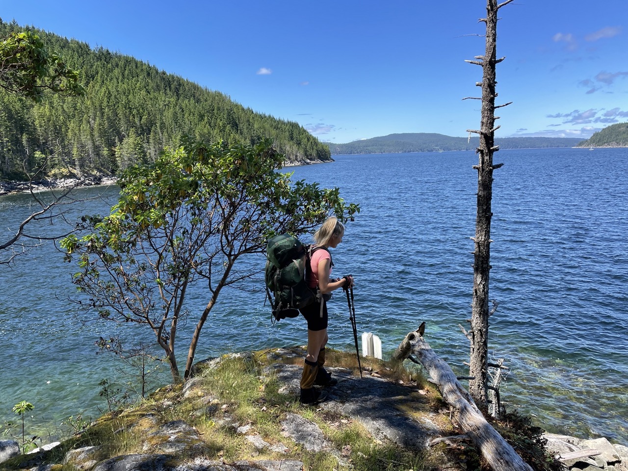
Feather Cove (KM 3)
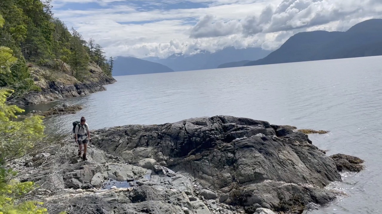
The first 3km of the trail is marvelous. You will enjoy meandering along the ocean bluffs peering out to sea through cracks in the trees.
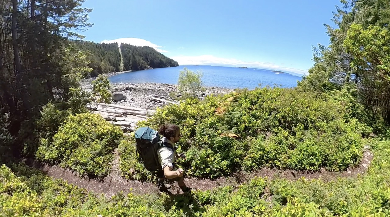
At the 3km mark you will arrive at Feather Cove. Feather Cove is a stunning rocky bay beach that boasts equally beautiful camping opportunities to Sarah Point. There are tent pads looking over the ocean and bear caches to store your food.Feather Cove is seldom used by SCT hikers and tends to be visited by kayakers adventuring in Desolation Sound. If you want an amazingly private and isolated beach camping experience than spending a night a feather cove is for you. Since feather cove is part of the Malaspina Provincial park it is regulated by BC Parks and a $5 camping permit is technically required if you plan to stay the night there.
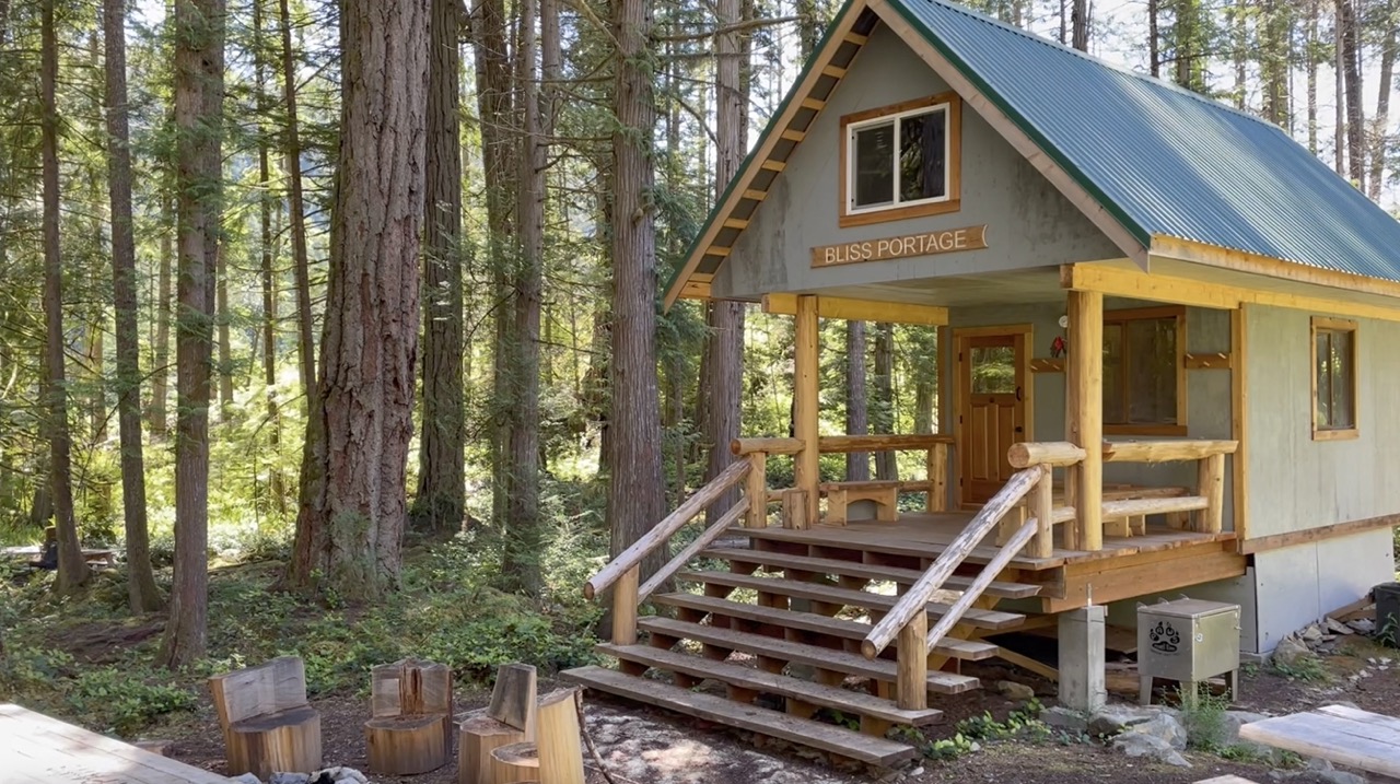
Bliss Portage Hut (KM 8)
The next 5 kilometers of trail tours you through a dense magical old growth forest. You’ll weave in and around massive trunks and stumps enjoying every step on the soft soil. You’ll pass by your first lake of the trail, Hinder Lake.
When you reach the 8km mark you will arrive at the Bliss Portage Hut. The Bliss Portage hut is located in a lovely open area in the forest. There is an awesome firepit and loads of tent pads. However, you will not ever have to use a tent pad at the Bliss Portage campsite because 8km is too quick to call it a day for most hikers and it is very seldom busy.
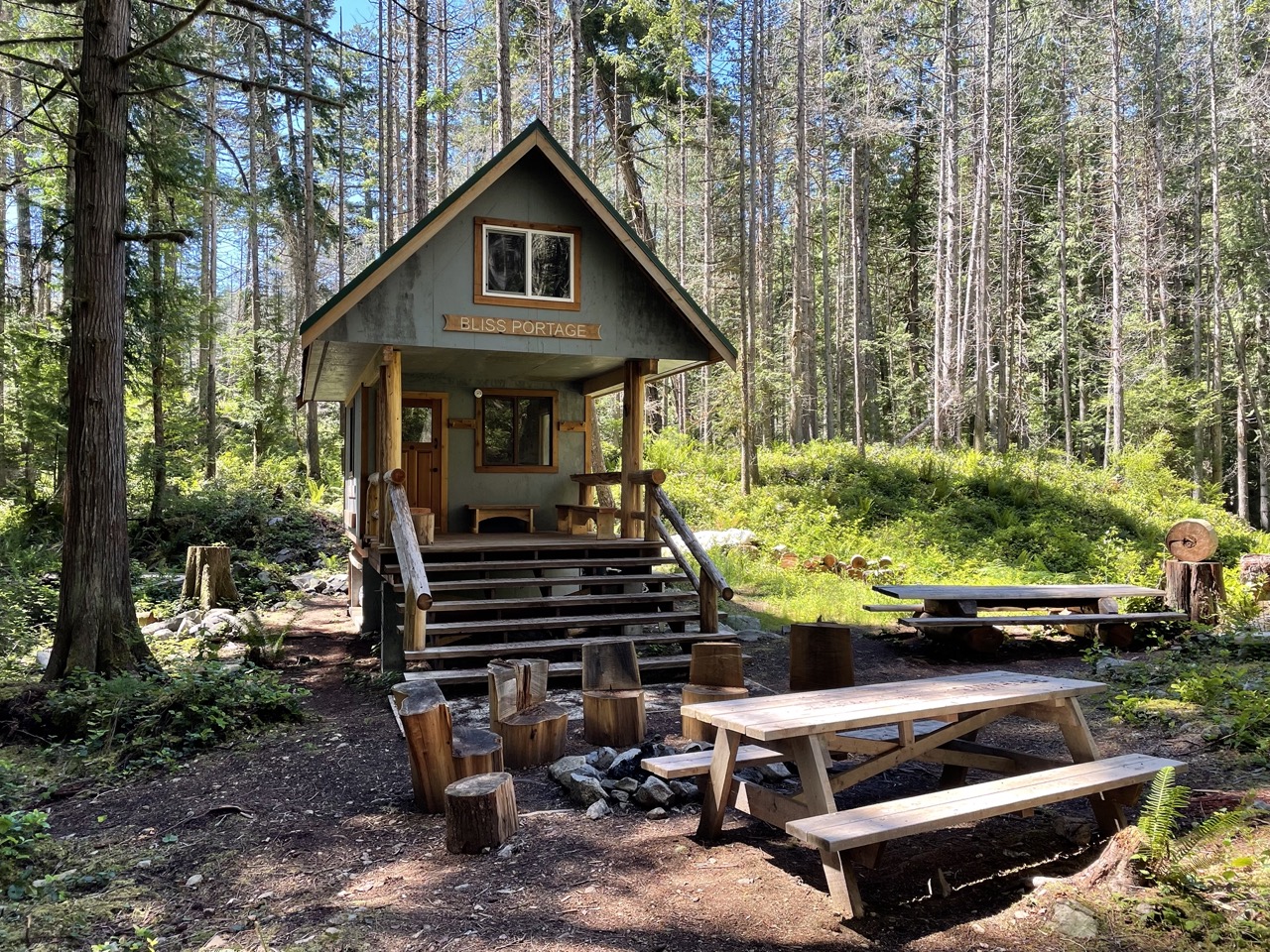
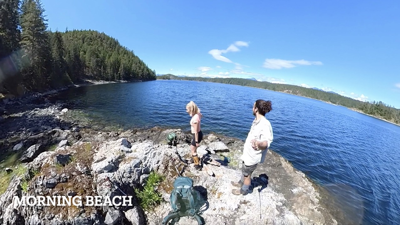
If you do plan to stay at Bliss Portage or if you continue hiking make sure to check out Morning Beach. It’s not a beach, but a nice outcrop of rocks that allows you to sit back and enjoy the sunshine or go for a dip in the ocean. It is located just a short walk South past the Bliss Portage hut and offers views into the Malispina Inlet and the beginning of Okeover Inlet.
Wednesday Lake (KM 13)
The trail continues 5 more kilometers through the gorgeous forest until you begin to see some water through the trees. You have arrived at Wednesday Lake. If the sun is shining this is the place to cool off and enjoy a swim! The rocks just beneath the bench at the lake are perfect for jumping off and the water is super refreshing!
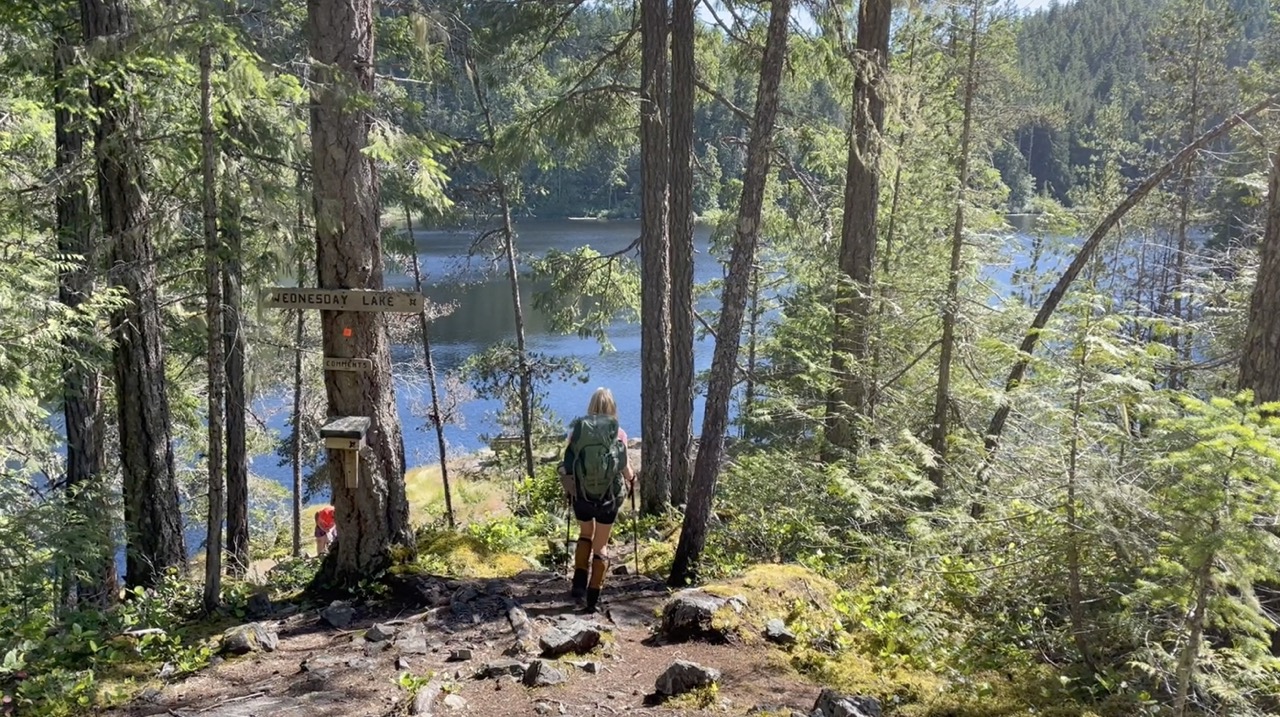
There are two great spots to pitch a tent at Wednesday Lake and this is an awesome option if you don’t feel like continuing uphill to the more popular Manzanita Bluffs Hut and Camping Area. The stream just past Wednesday Lake is the LAST SPOT TO FILL WATER before the Manzanita Bluffs, so make sure to top up your bottles for the evening!
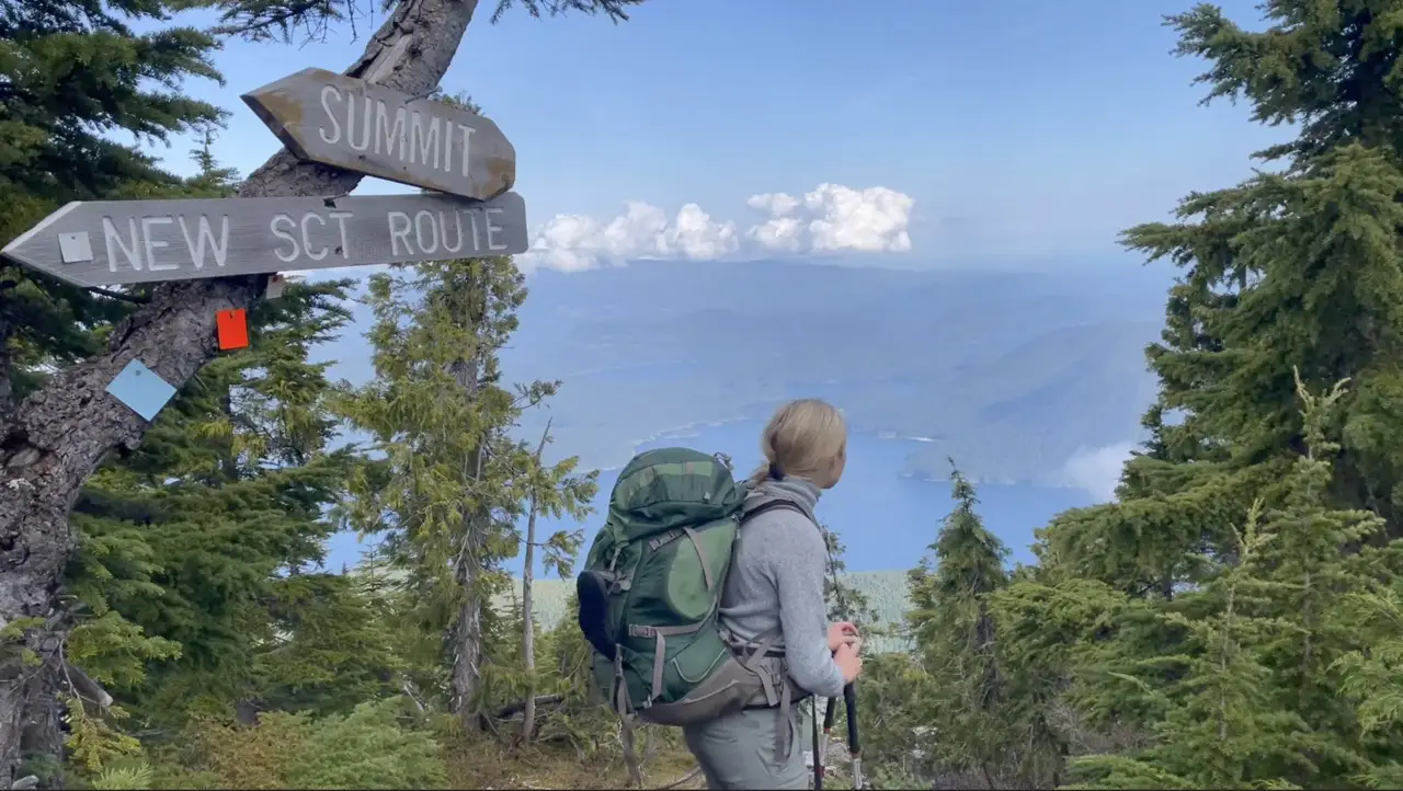
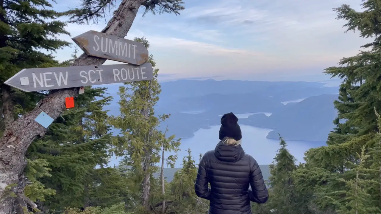
Manzanita Hut (KM 16)
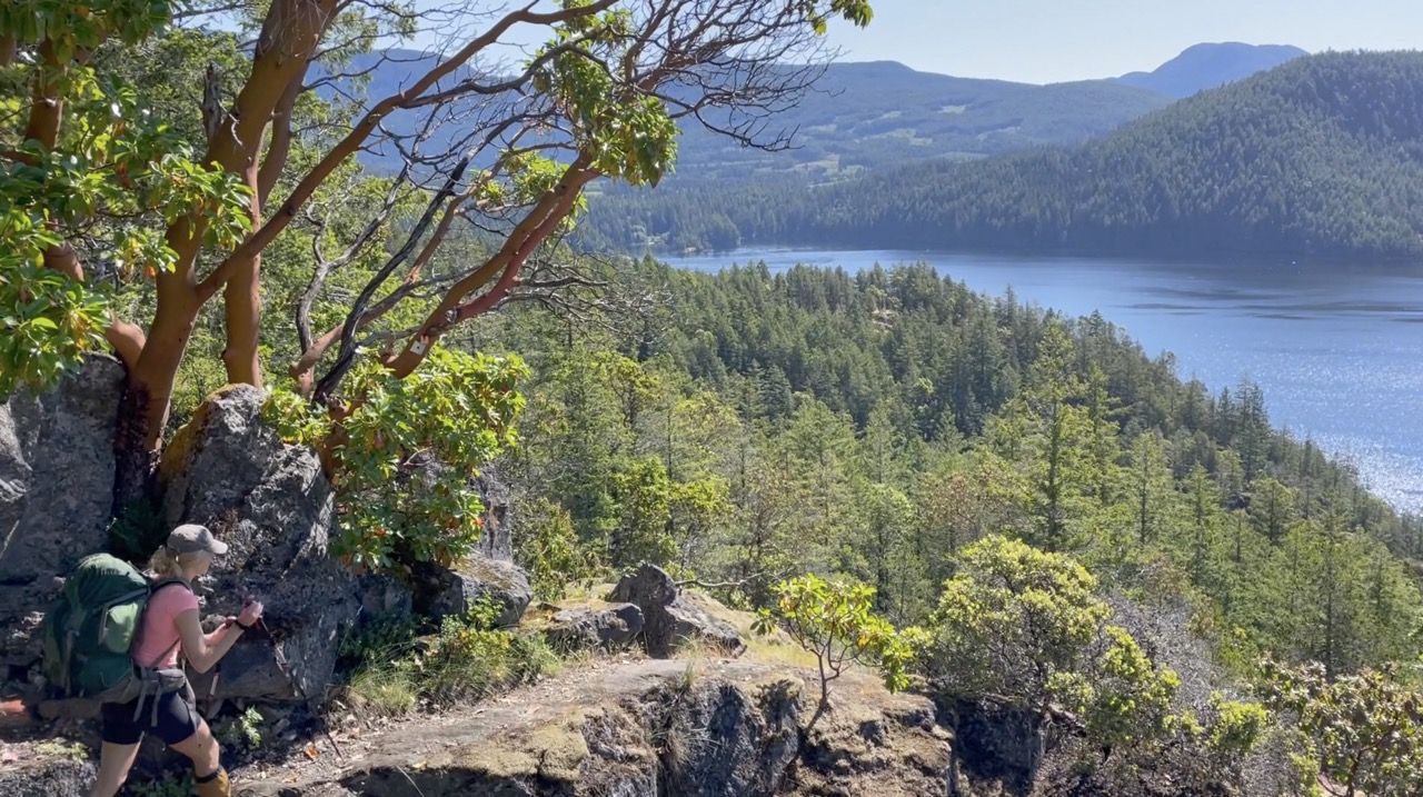
The hike up to the Manzanita Bluffs is your first taste of elevation gain on the trail. You will gain about 250 meters in elevation over the course of 3 kilometers and will know you’re getting closer to the bluffs as the trail beneath your feet becomes rockier, the foliage becomes sparse and you begin to see the mesmerizing red bark of the Manzanita trees. Manzanita trees are unique to Western North America and can live in places with poor soil and little water, hence, why they can survive on the bluffs on the SCT.
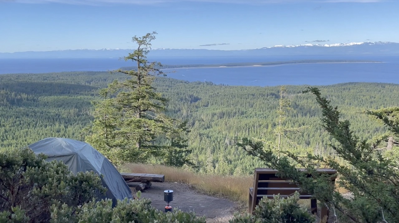
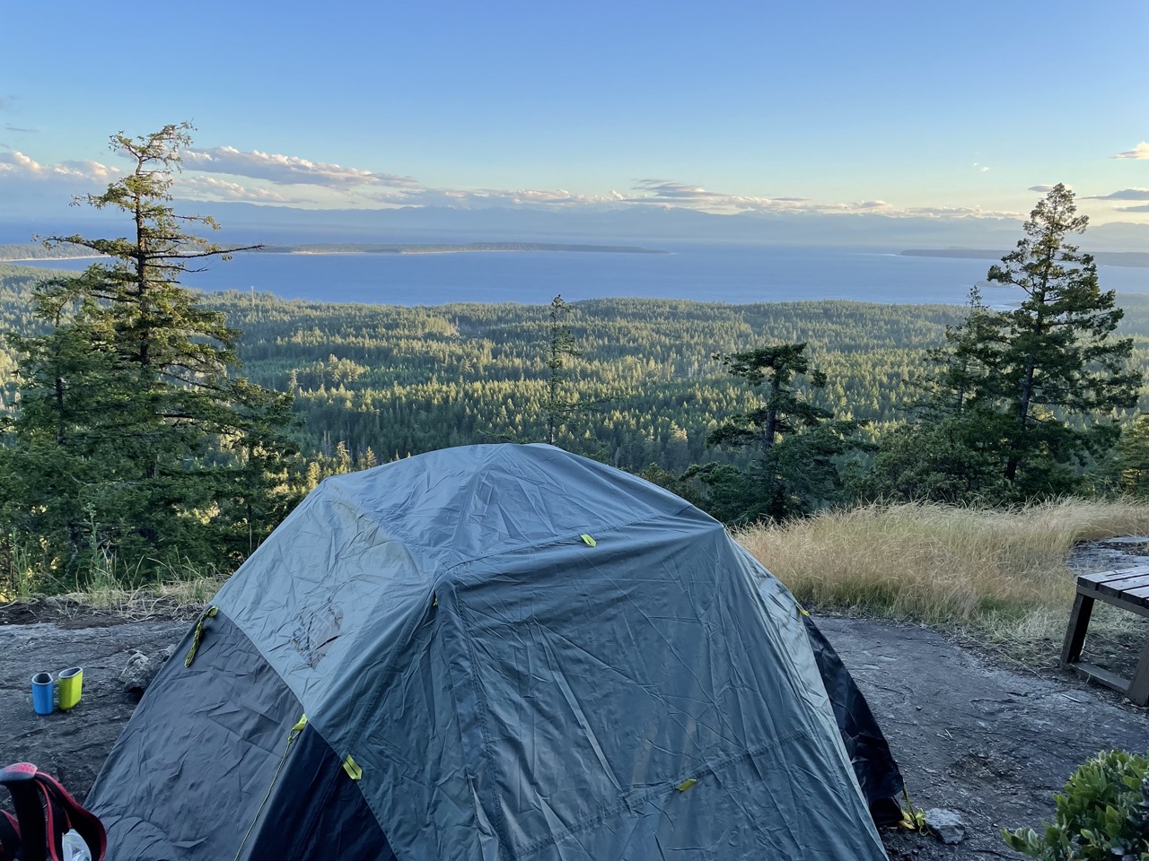
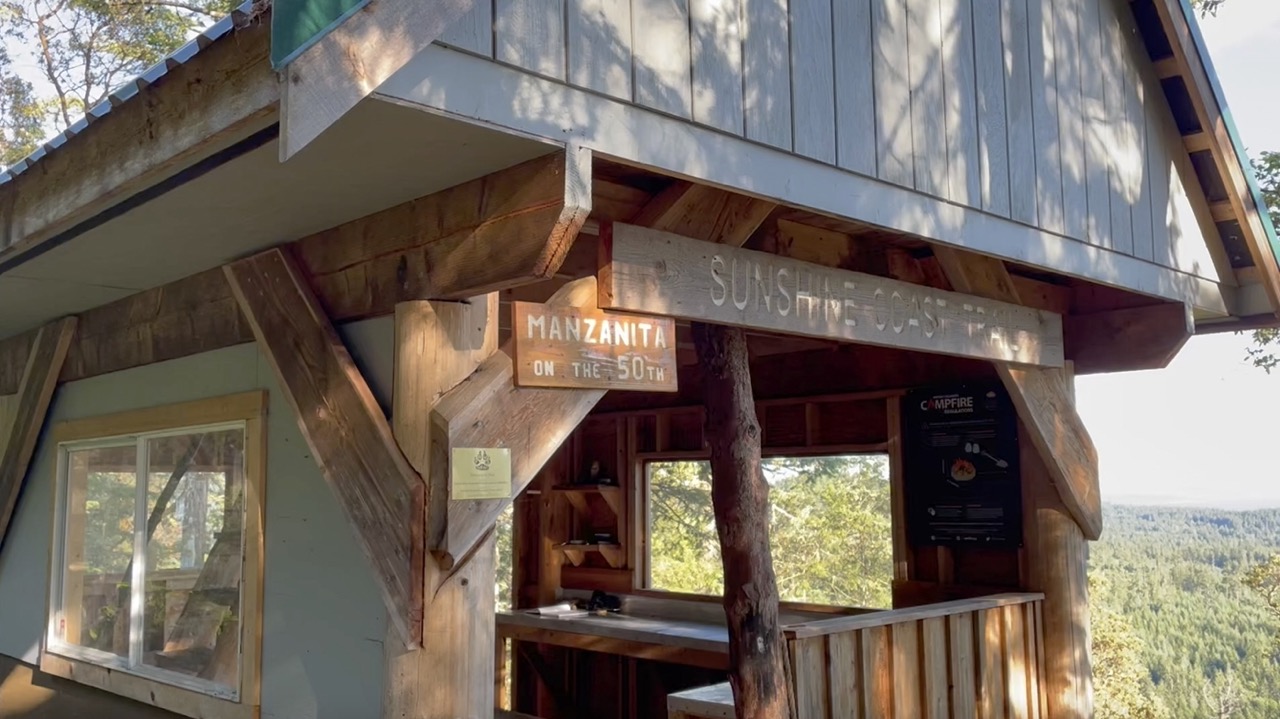
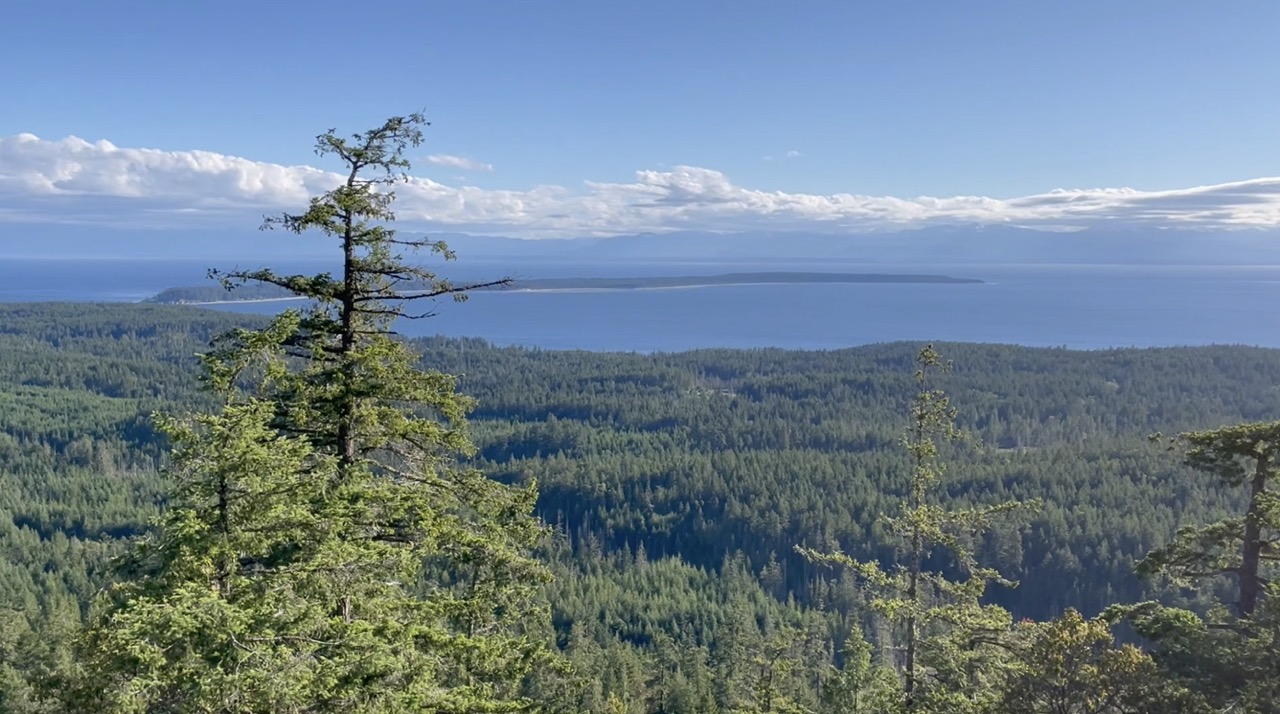
When you arrive at the Manzanita Hut you will be blown away by the panoramic views of the the Salish Sea and Savary Island. The hut, tenting and picnic areas all boast a beautiful open view surrounded by manzanitas, arbutus and old growth douglas fir trees. Camping on the westernmost part of the bluff right on the edge off the rocks will give you the best possible view. The sunsets on the Manzanita Bluffs are beautiful so make sure you don’t go to bed too early on a clear night! The Manzanita Hut is one of the most popular on the entire trail. Thanks to its many access points it is often visited by single-night or day hikers, so be prepared to have some company while you are up there!
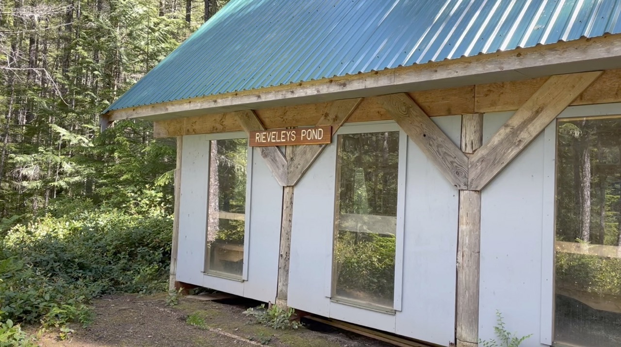
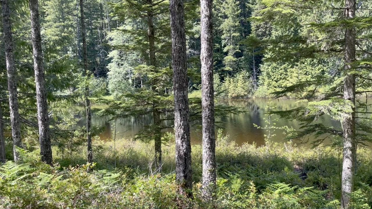
Rieveleys Pond Hut (KM 33)
On route to the Rievely Pond make sure to take the detour route to the right along the bluffs. It only tacks on a few extra steps and provides an amazing view of the Malasapina straight and Shearwater passage. I saw a few fire rings so if you want a tranquil night with an ocean view you could pitch a tent here if you had enough water.
Many parties choose to spend the night at Rieveley Pond who come from the Manzanita Hut. The pond is super tranquil and is tucked into a wetland habitat in the forest. If you like falling asleep to the sound of frogs, this is the place to be!
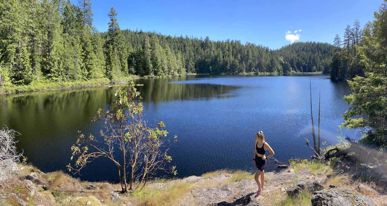
Sliammon Lake (KM 40)
The trail passes right through Sliammon Lake. It is an amazing spot for a refreshing swim and there is a huge wooded area to camp. If you want a lake view there are 1 or 2 ideal spots to pitch a tent on the shores edge. If you’ve got a bit more energy I would recommend to keep pushing a few more kilometres to little Sliammon lake!
Little Sliammon Lake (KM 42.5)
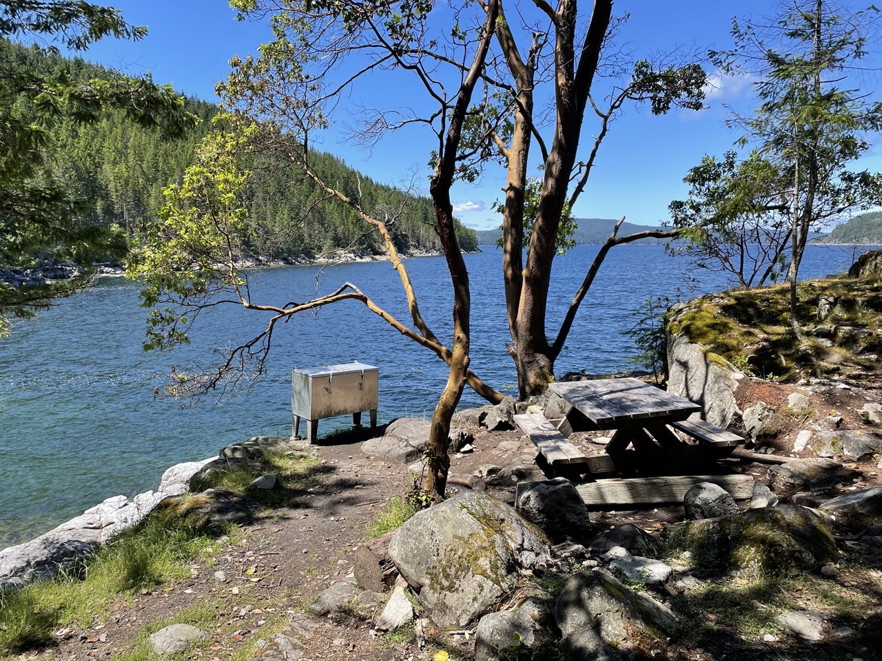
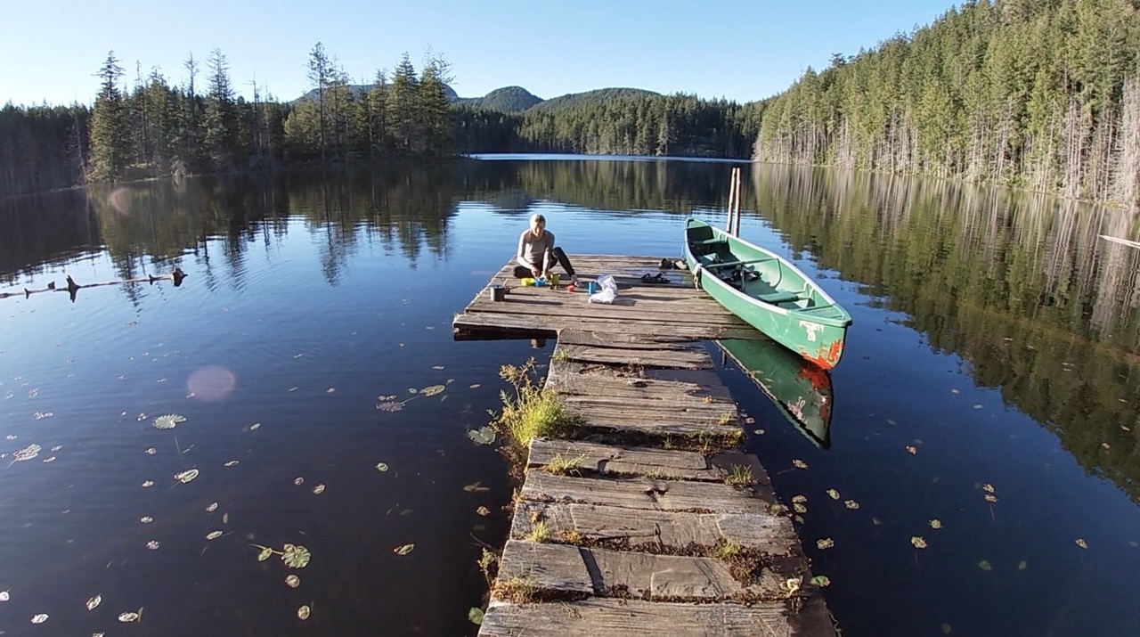
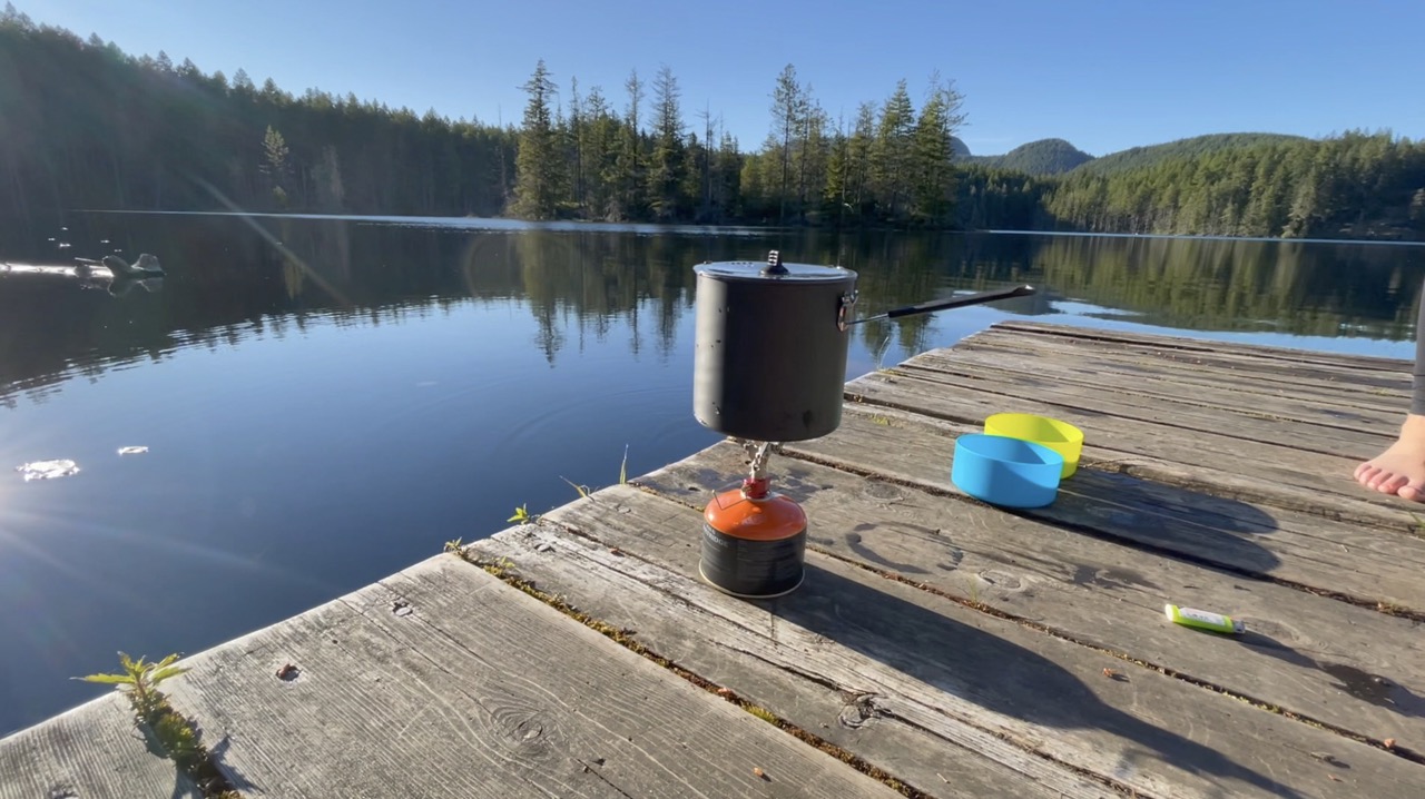
Little Sliammon was one of my favourite campsites on the trail. There are lots of awesome forested spots to pitch a tent, a small open concept shelter and a picnic table. But, the highlight is the amazing little lake, dock and the Canoe! The dock is wonderful and you can sit out on the end of it to soak up the sun and cook dinner. Since little Sliammon is a long trek from the Manzanita Hut it is often overlooked so if you journey all the way there, you’ll probably have the place all to yourself as we did!
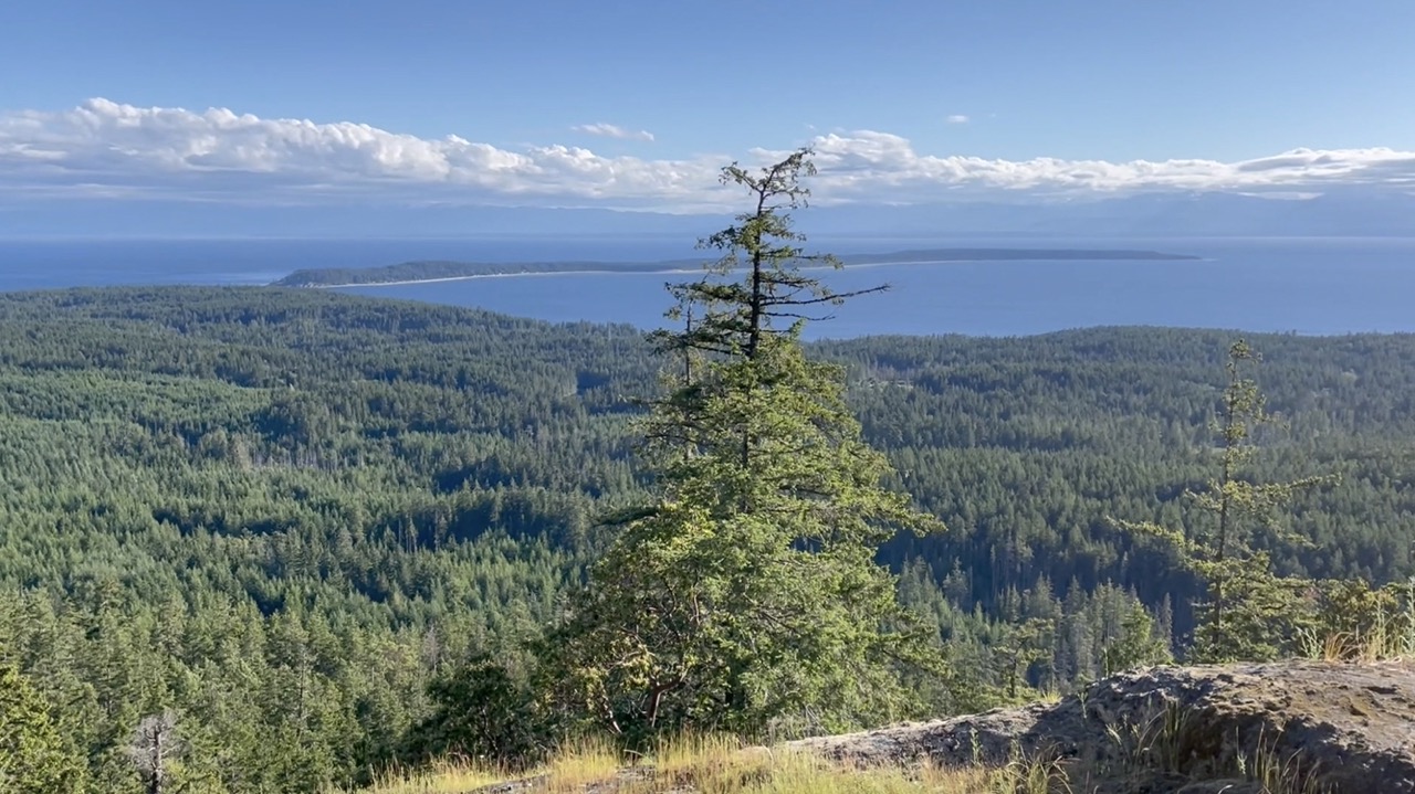
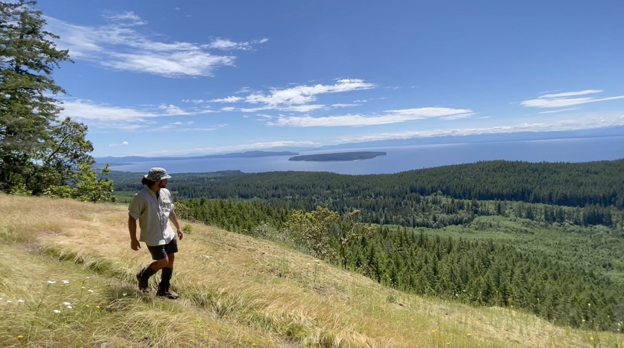
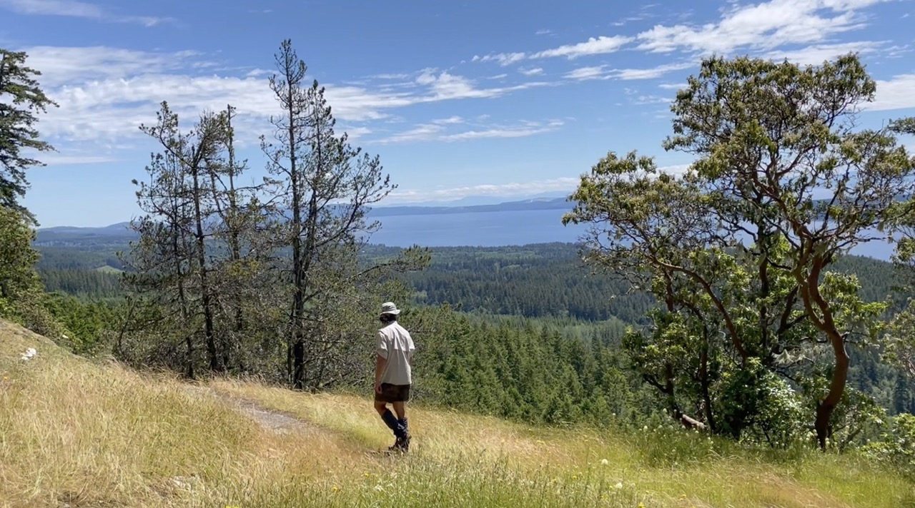
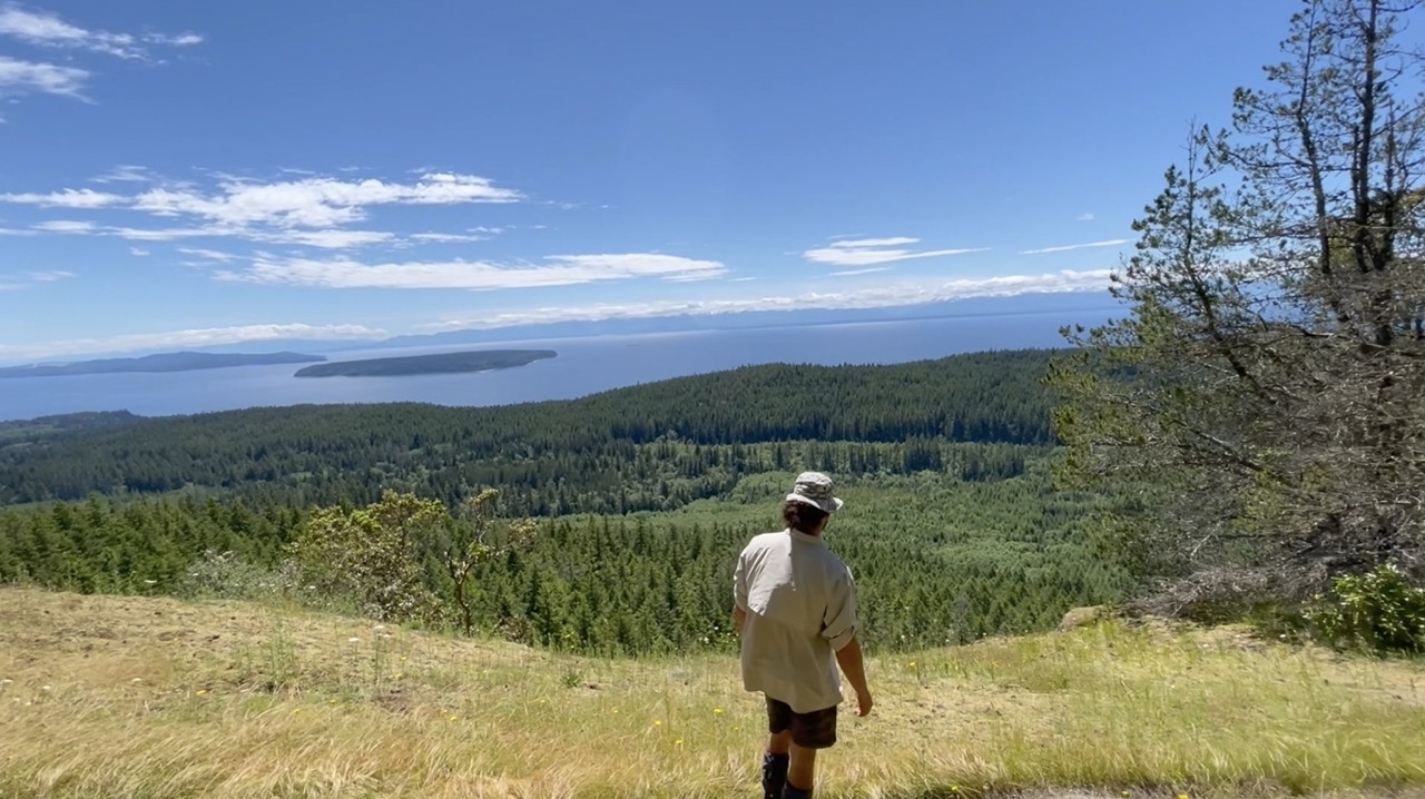
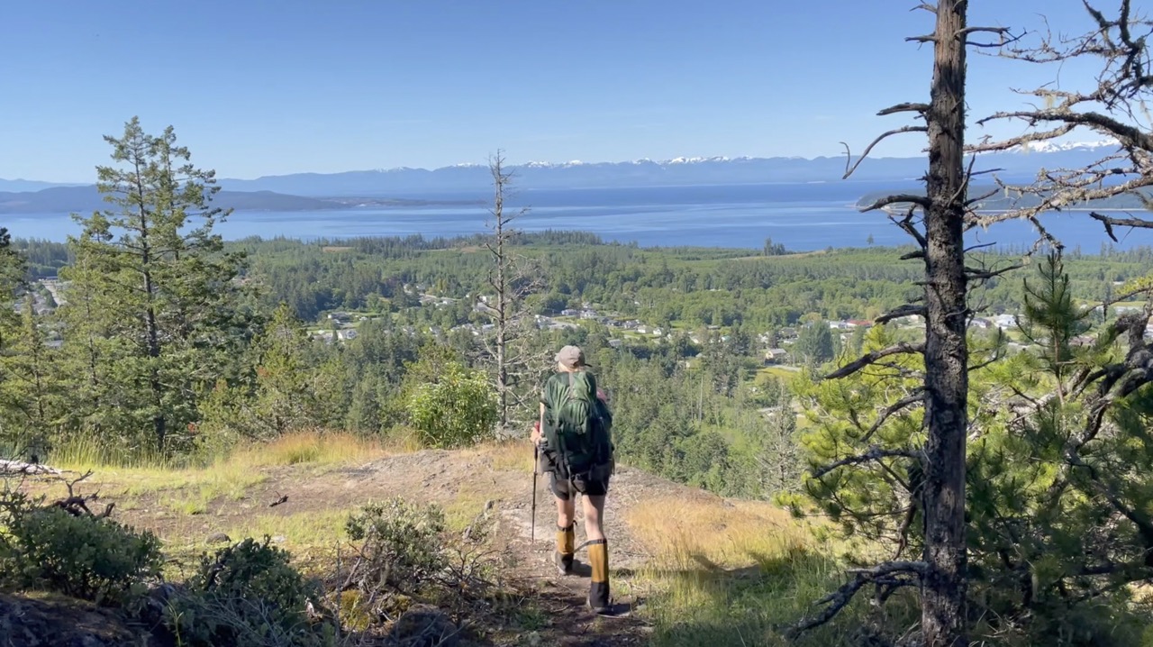
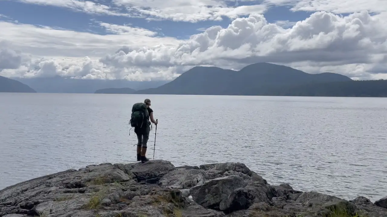
Scout Mountain (KM 57.5)
There isn’t any camping up on Scout Mountain but the views are exceptional so it’s worth talking about. Make sure you veer off the SCT to the left to check out the summit, it’s well worth the additional effort and is the ideal spot to cook lunch or nibble on breakfast. It exhibits fabulous views of the Malaspina Strait and once you link back up with the SCT you will begin to get an amazing view of Haywire bay in Powell Lake where the Shinglemill pub is located.
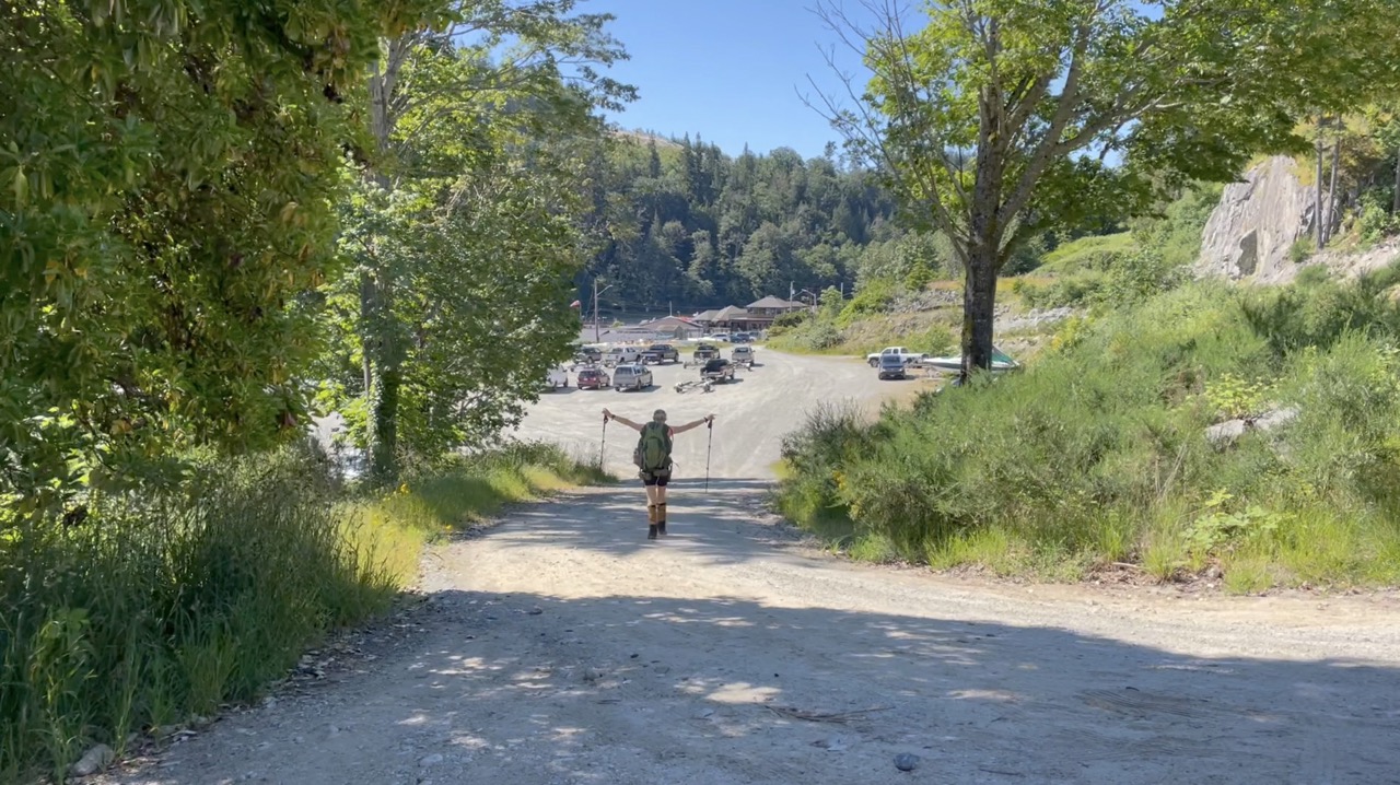
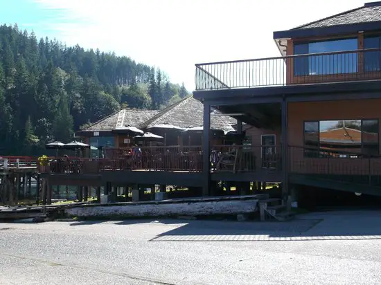
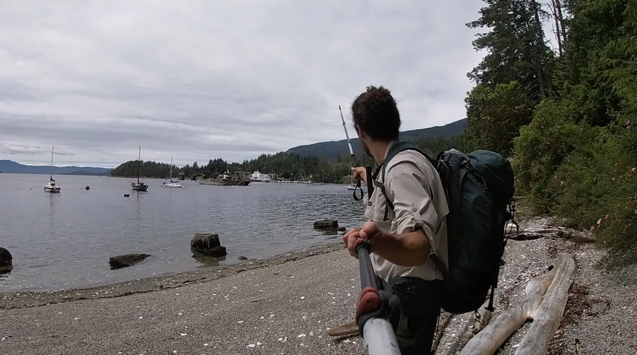
Shinglemill Pub (KM 50)
The Shinglemill Pub is not a spot you will lay your head, but, this is where you will want to restock the food that you left there and fill your belly with a burger and some brews. Don’t get too buzzed because you still have to hike about 5km to the nearest campsite!
Powell River to Lois Lake (3-5 nights/87KM)
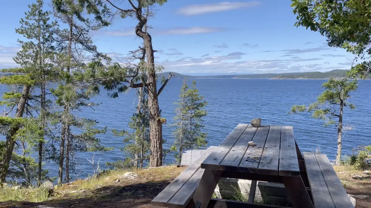
Tony’s Point (KM 55)
I’m not sure who Tony was, but shout out to him, he knows how to pick a great camping spot. There is a picnic bench looking over the water and plenty of room to pitch a few tents. If you’re hiking the SCT as a thru-hike and need a good sleep after your long walk from Riveley Pond or little Sliammon lake, this is the zone!
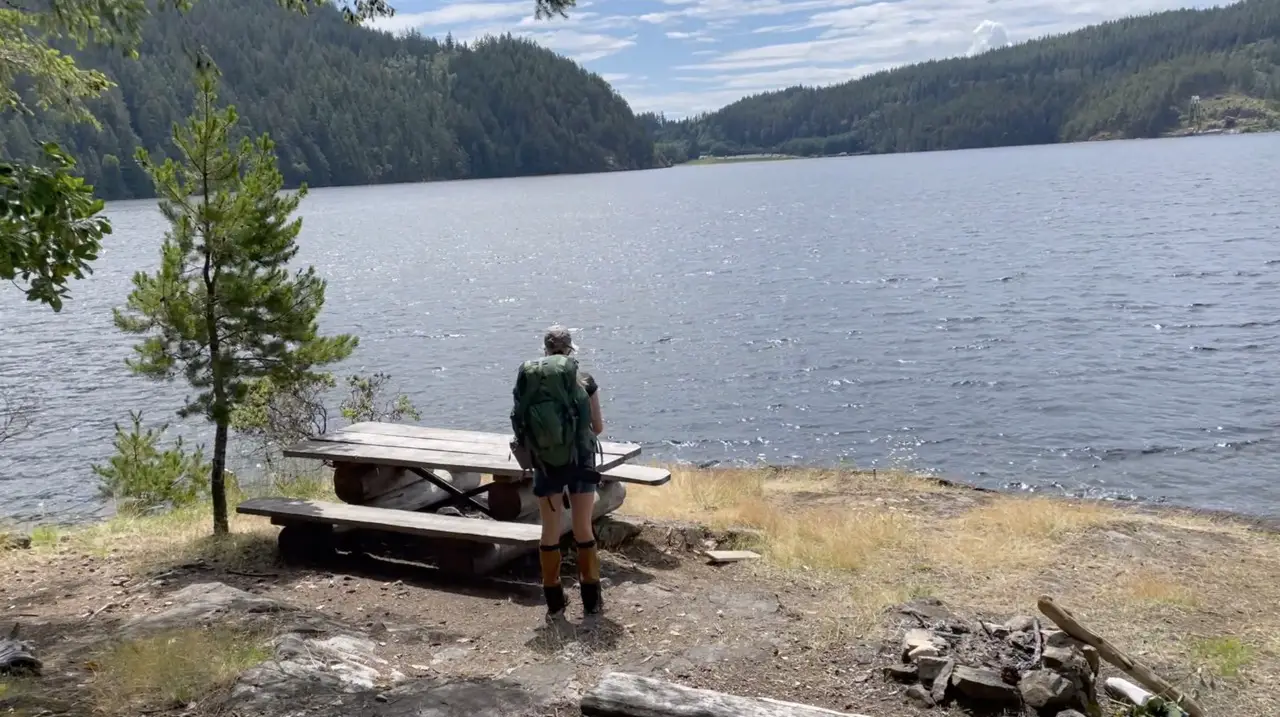
Inland Lake (KM 60)
Inland Lake is a total beauty to walk around and thanks to the wide trail and boardwalks it makes for some easy kilometers to cover. I’d recommend taking the shorter route (to the right if you’re heading south) around the lake. There is a great public beach area and dock for swimming if you’re feeling toasty when you pass by.
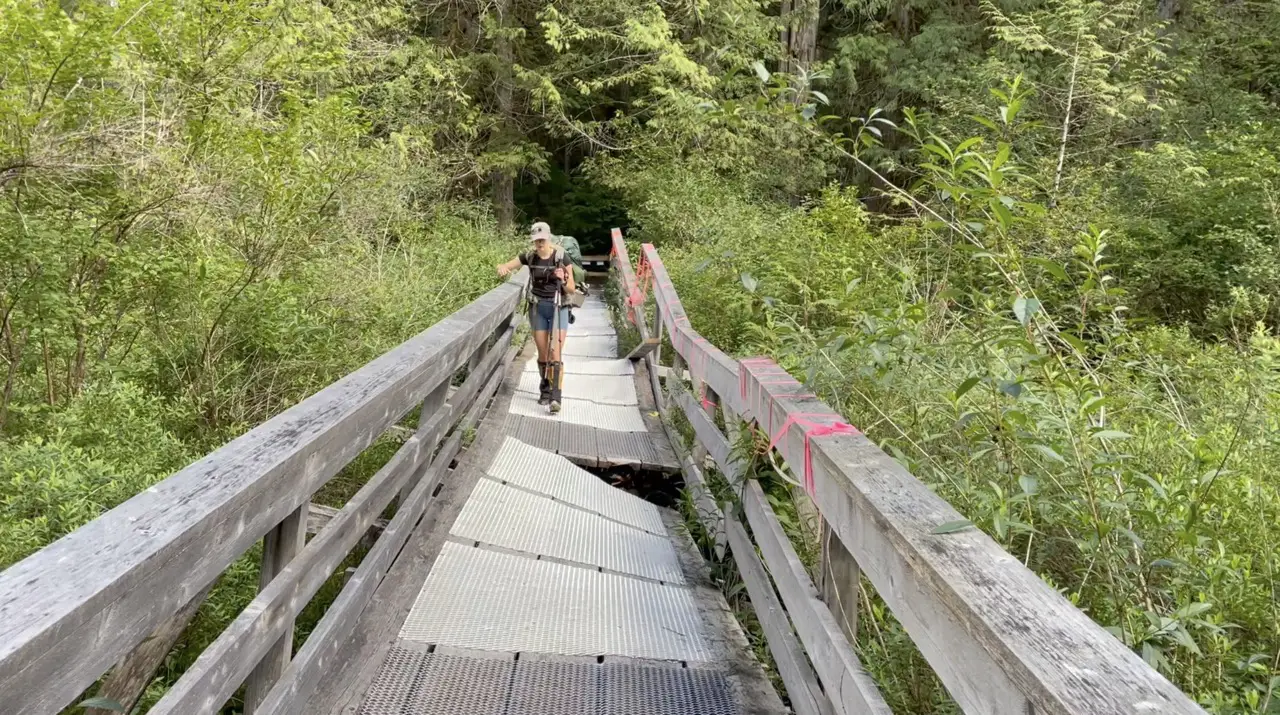
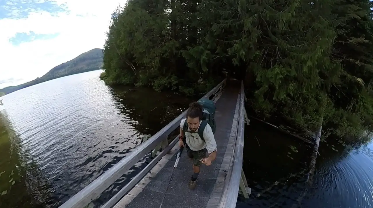
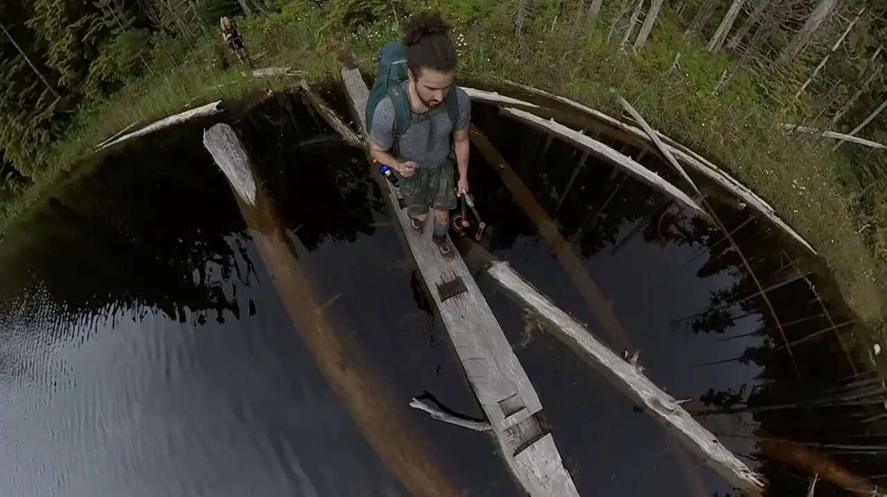
Anthony Island Hut (KM 68)
If you like character, this hut has got it! The Anthony Island Hut is located across a bridge off the main Inland Lake Trail. Yes, it’s actually on an island. The hut itself is very small and rugged. There are two wooden platforms to sleep on, but, the hut is not fully enclosed. You’ll be protected from the rain and weather but the bugs will still be welcomed to come and go. I’d recommend pitching a tent somewhere on the island if you are planning to spend the night. There are some great shoreline options if you take a quick walk around the island.
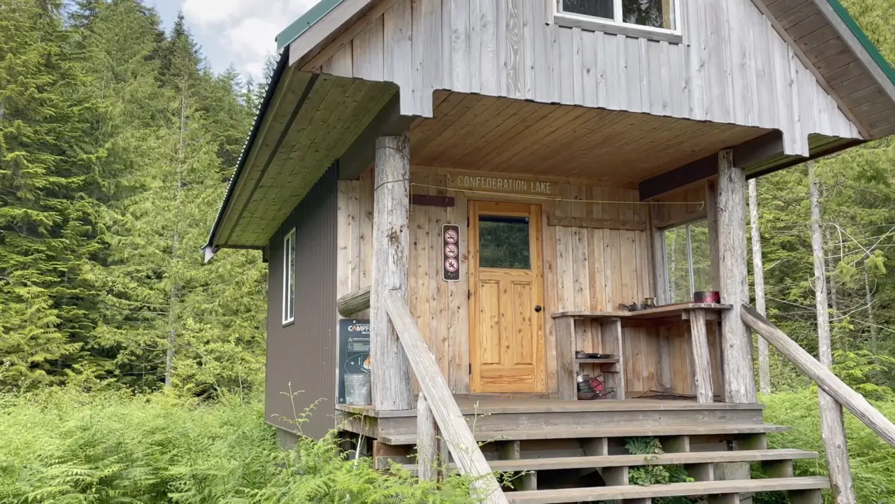
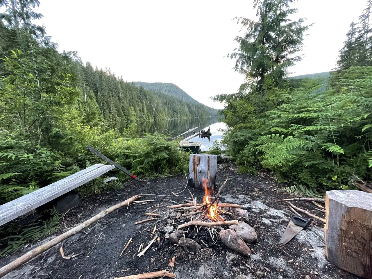
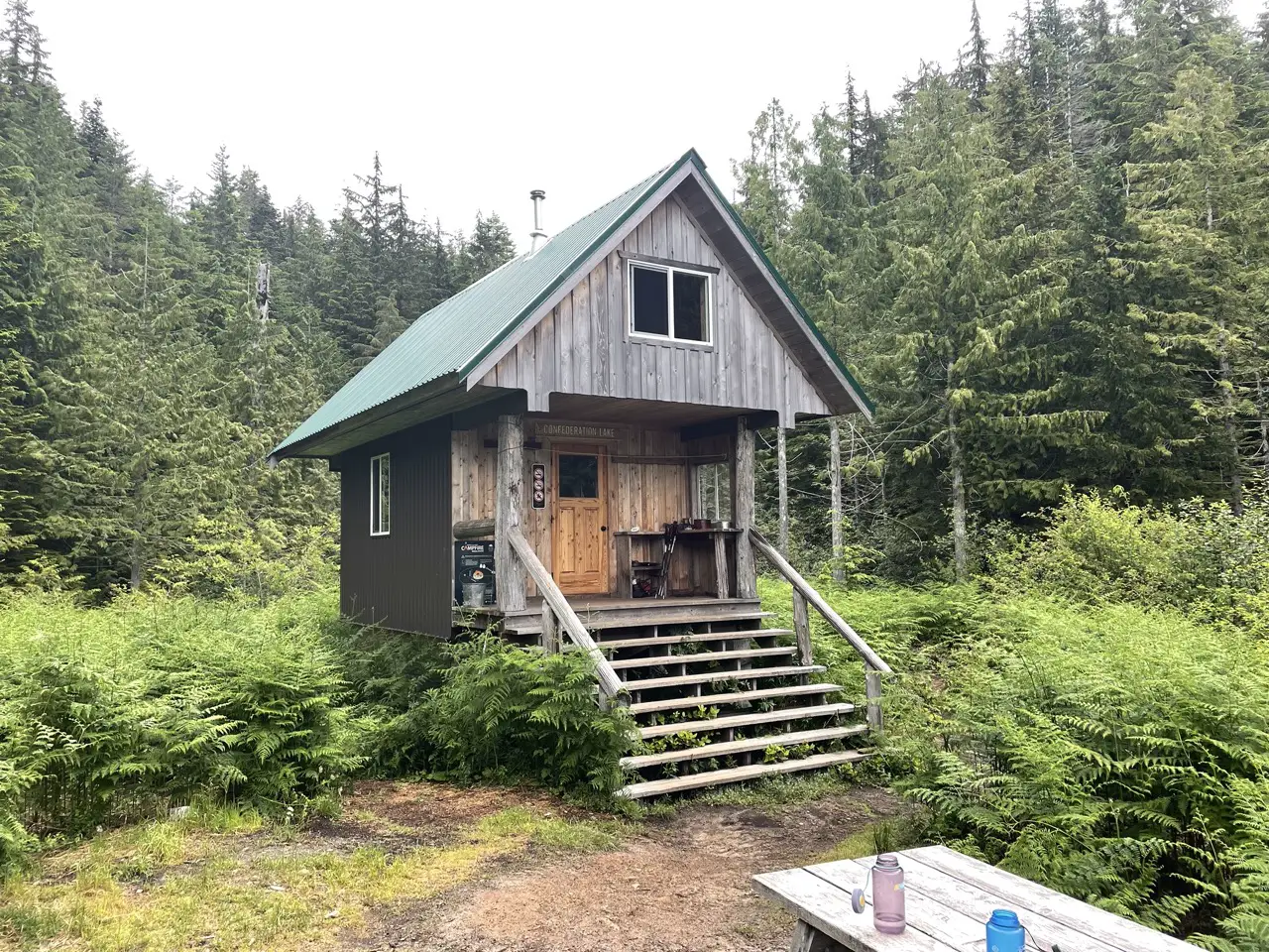
Confederation Lake (KM 74)
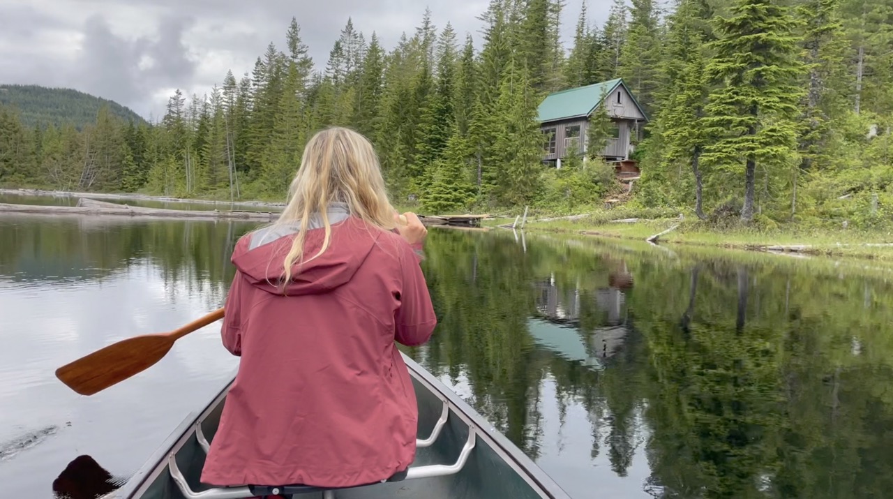
The section of the trail between Inland and Confederation lake is steep. You’ll have to climb well over 400m switch backing through the ancient fir forests until you reach the lake. For most, this uphill stint will come at the end of a hiking day so it makes the arrival at Confederation that much sweeter. The Confederation Lake hut is located on the edge of a picturesque fish bearing lake (yes you can catch trout here). But, I wouldn’t recommend carrying around a rod the whole time for this reason. It is a fully winterized hut and there is an awesome picnic bench on the water and a rowboat that you can take out and explore the lake with. Laura and I lucked out and had the hut all to ourselves for the evening.
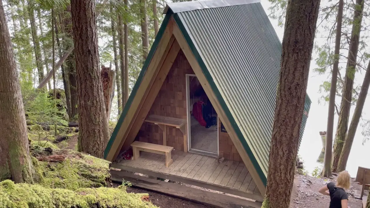
Fiddlehead Landing (KM 81)
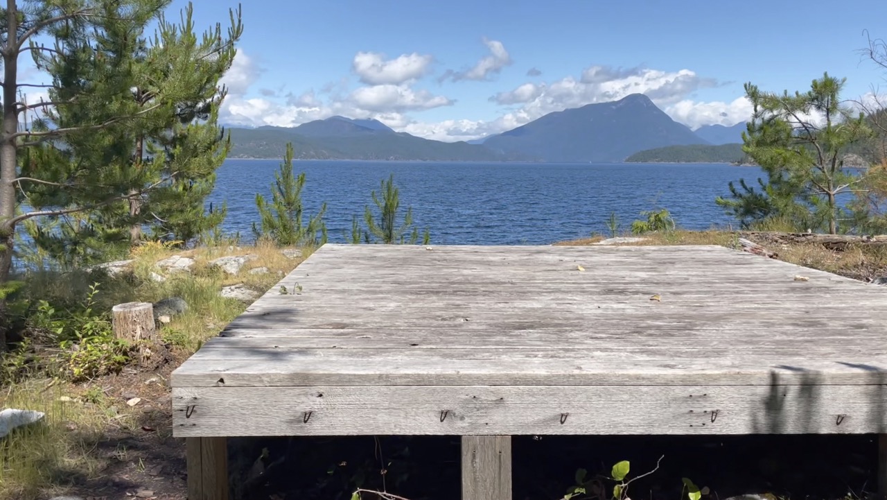
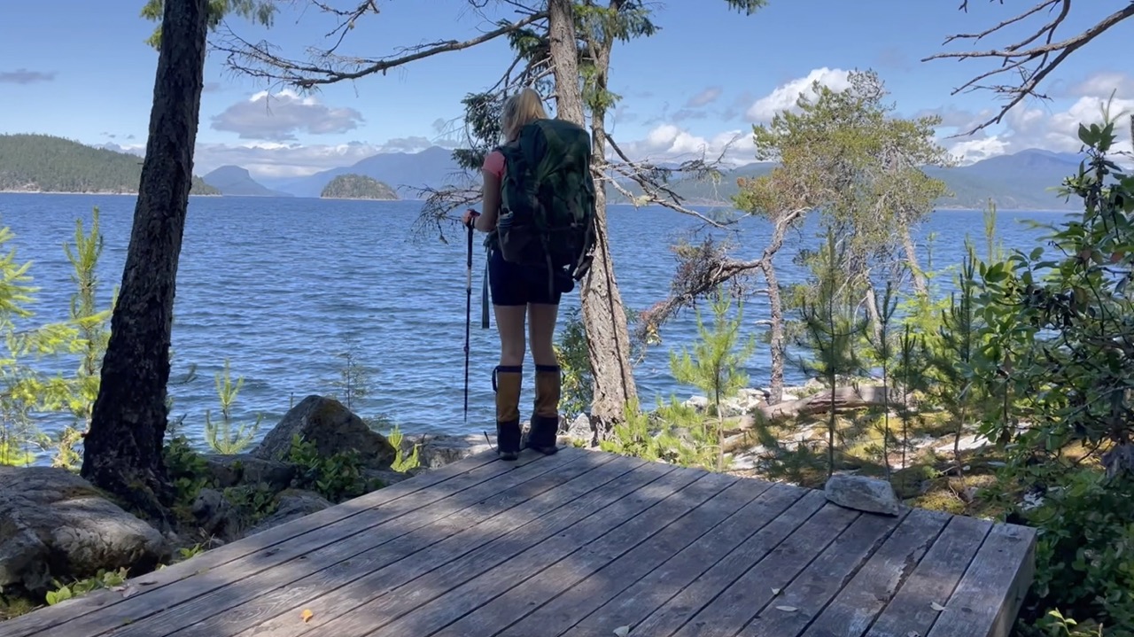
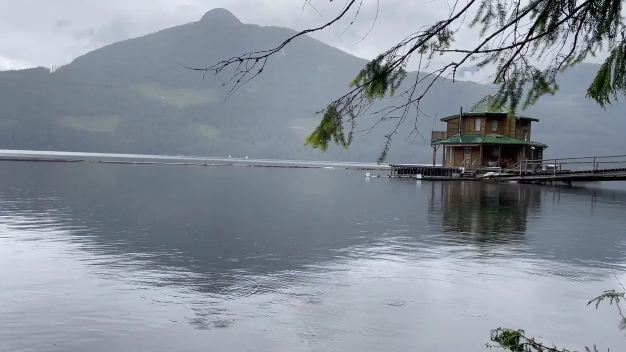
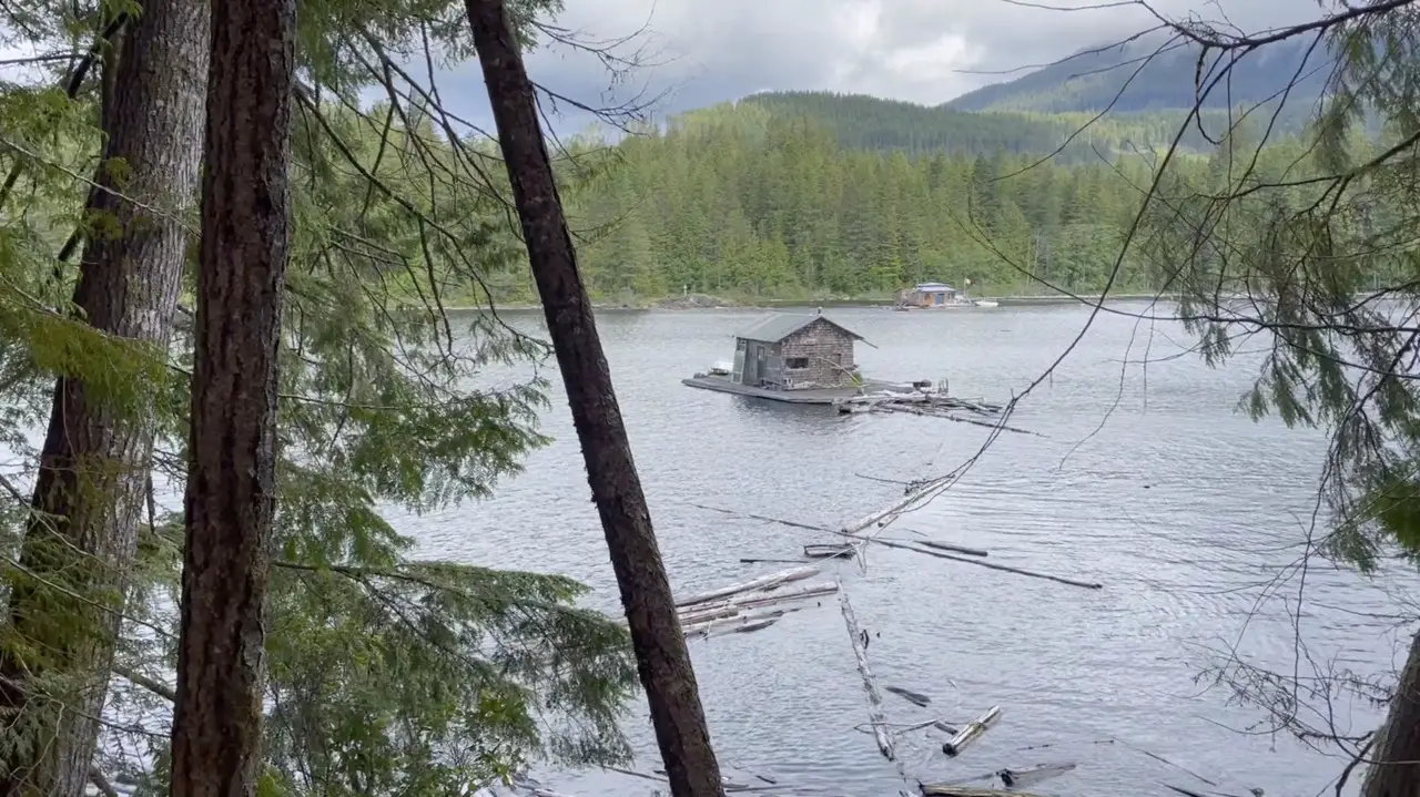
Fiddlehead landing is not a full sized hut, but what it lacks in size, it makes up for in character. It rests on a beautiful location on the shoreline of Powell lake overlooking Goat island and sugar tit mountain. It’s classic A-frame design make it an ideal spot for two hikers to spend the night although 4 would fit fairly comfortably. The A-frame is enclosed and on stilts so you can stay dry and hang out on the picnic tables underneath. If you go for a swim or peek you head out at the lake you’ll get to see some of the floating houses unique to Powell River along the shoreline.
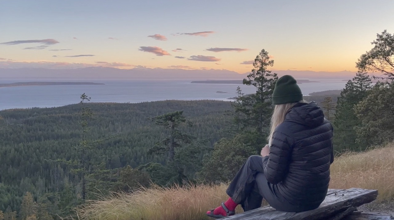
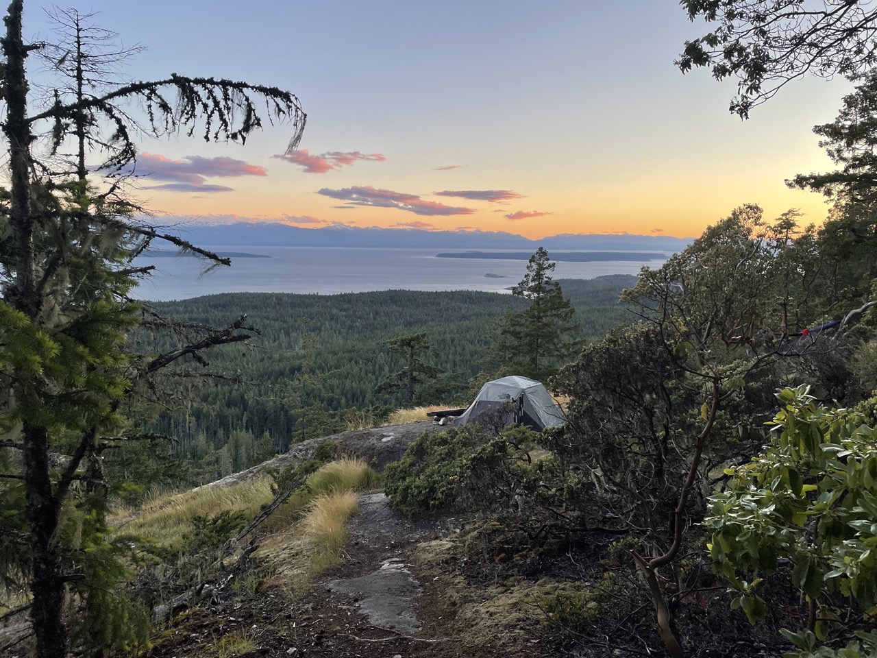
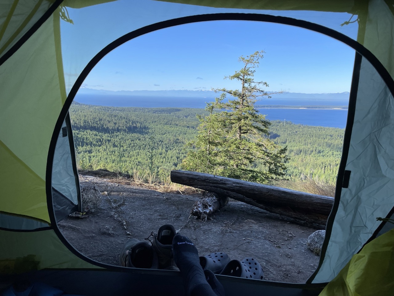
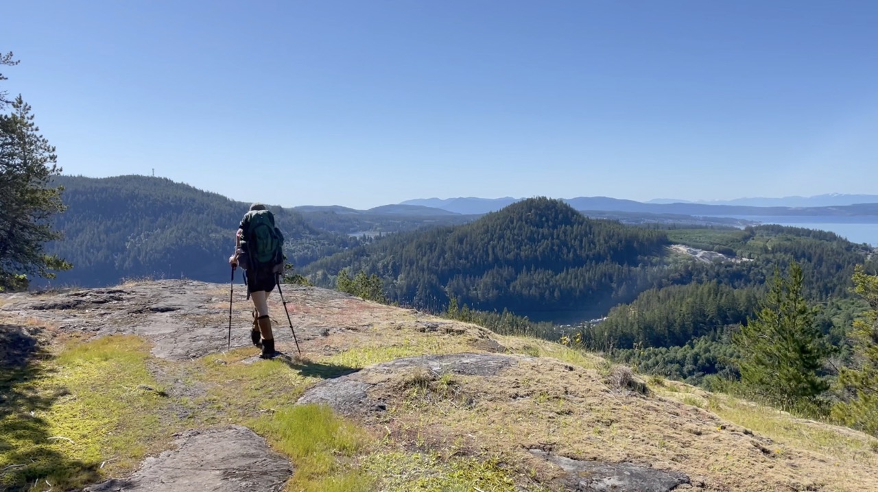
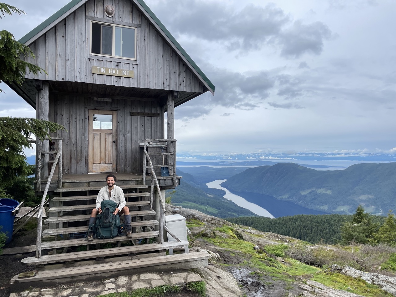
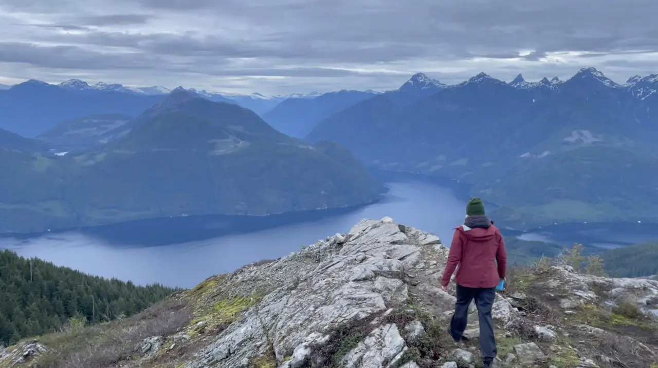
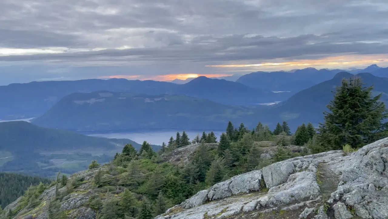
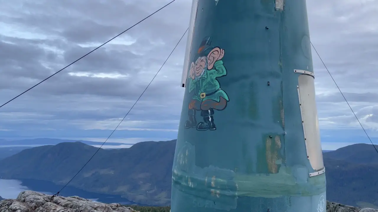
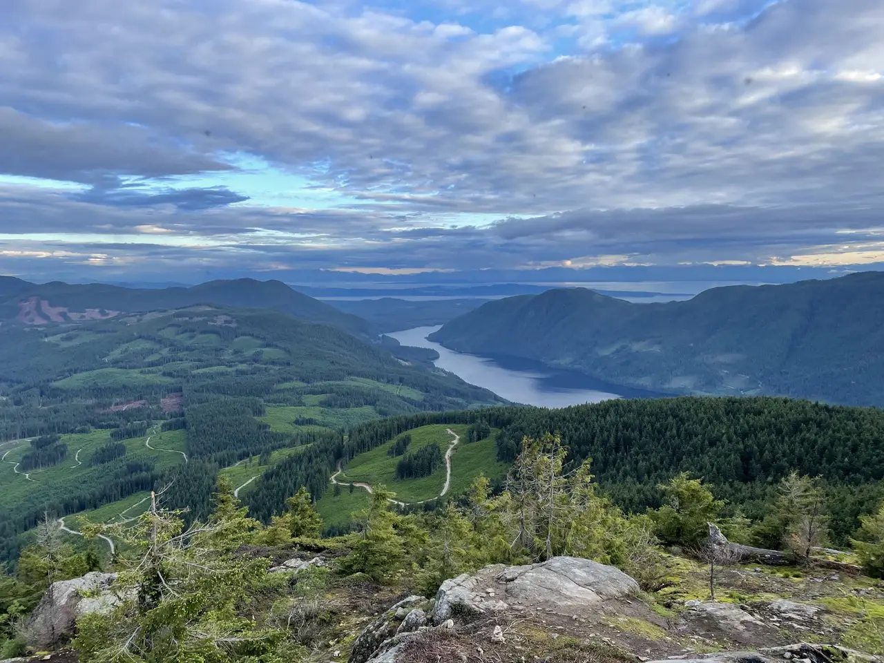
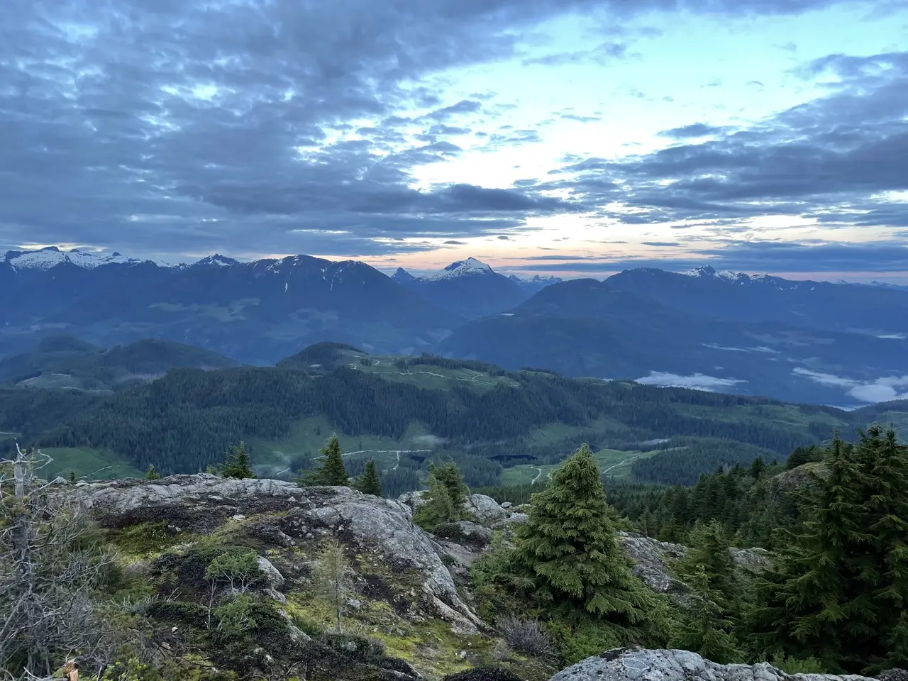
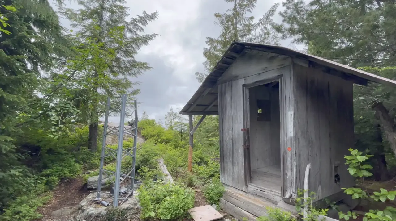
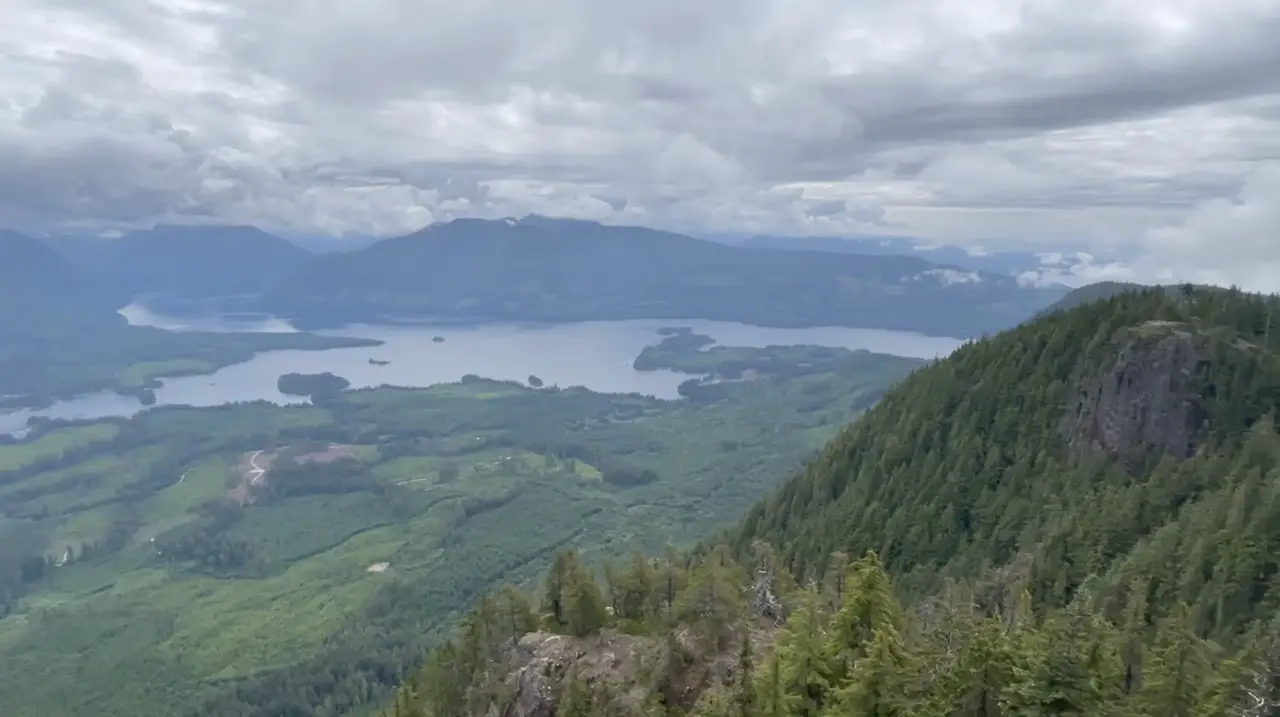
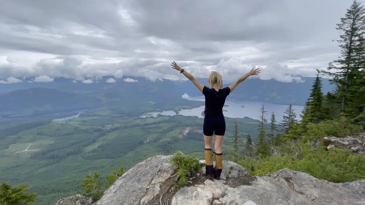
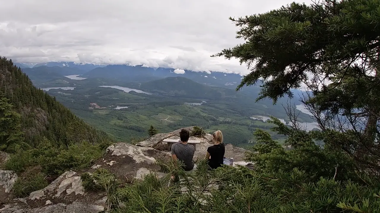
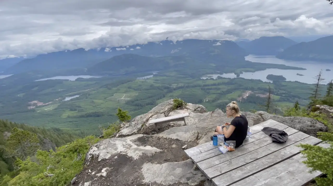
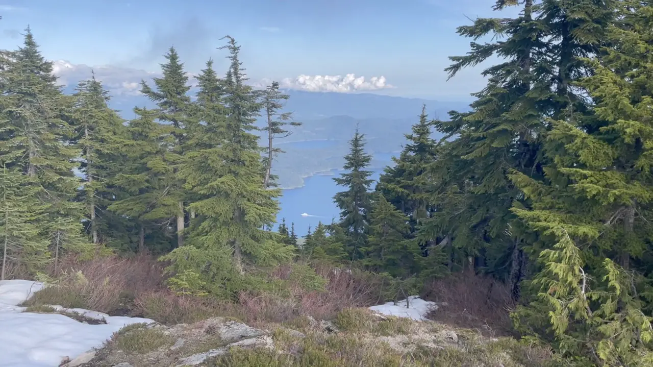
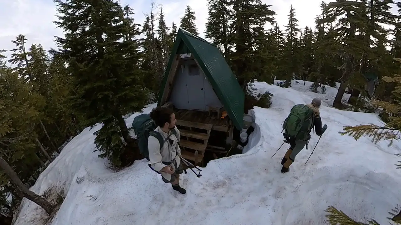
Tin Hat Mountain (KM 89)
Tin Hat Hut is one of the key highlights and the quintessential SCT viewpoint. The 360 degree panoramic views are a sight to behold and provide perfect views of the mountains, valleys and lakes that make the Powell River back country so unique. You need to plan for a night at Tin Hat, and cross your fingers for clear skies! The section of trail from Fiddlehead Landing to the Tin Hat Hut is one of the most strenuous on the entire trail. It’s a steady climb of over 900m and the loose rocks at the final portion on the trail can slow you down.
The Tin Hat Hut is typically one of the busiest on the entire trail because day hikers flock to its summit. Miraculously, Laura and I had the hut to ourselves and enjoyed a cloudy sunset on the summit. If the hut has a few people take a walk around the areas near the hut or up to the summit to scope out a tenting area. There are so many perfect spots with ridiculously good views to pitch a tent, just make sure the ground is dry!
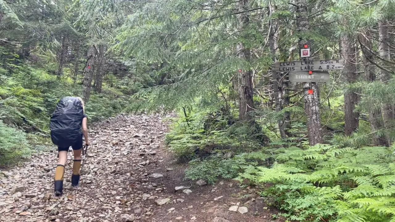
When continuing along the trail from Tin Hat South I would recommend back tracking and taking the shortcut. The Lewis lake portion of the trail is rather unexciting and (feels) or is quite a bit longer than the map makes it out to be. I’ve hiked this section before and did not feel guilty skipping it the second time around.
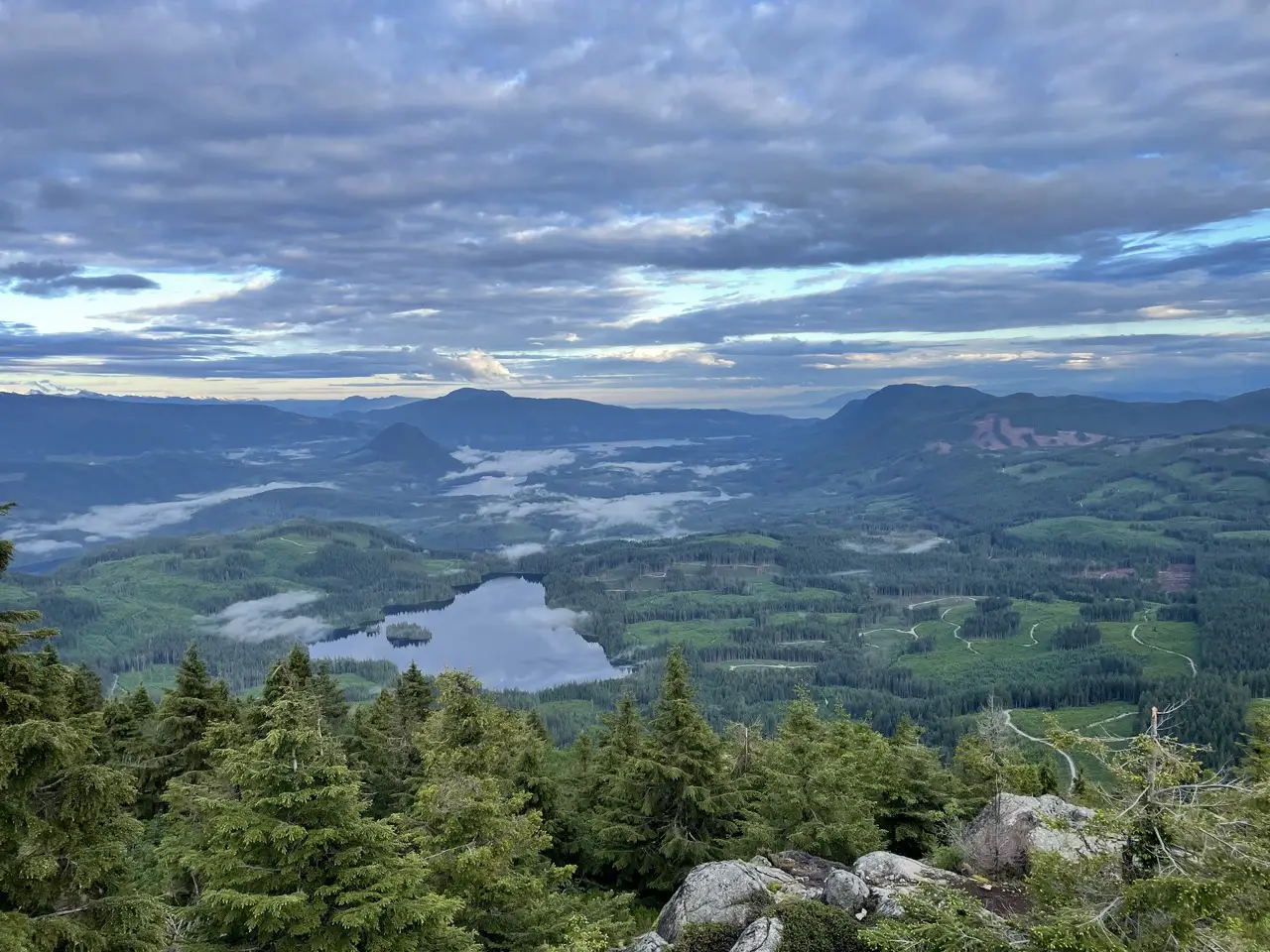
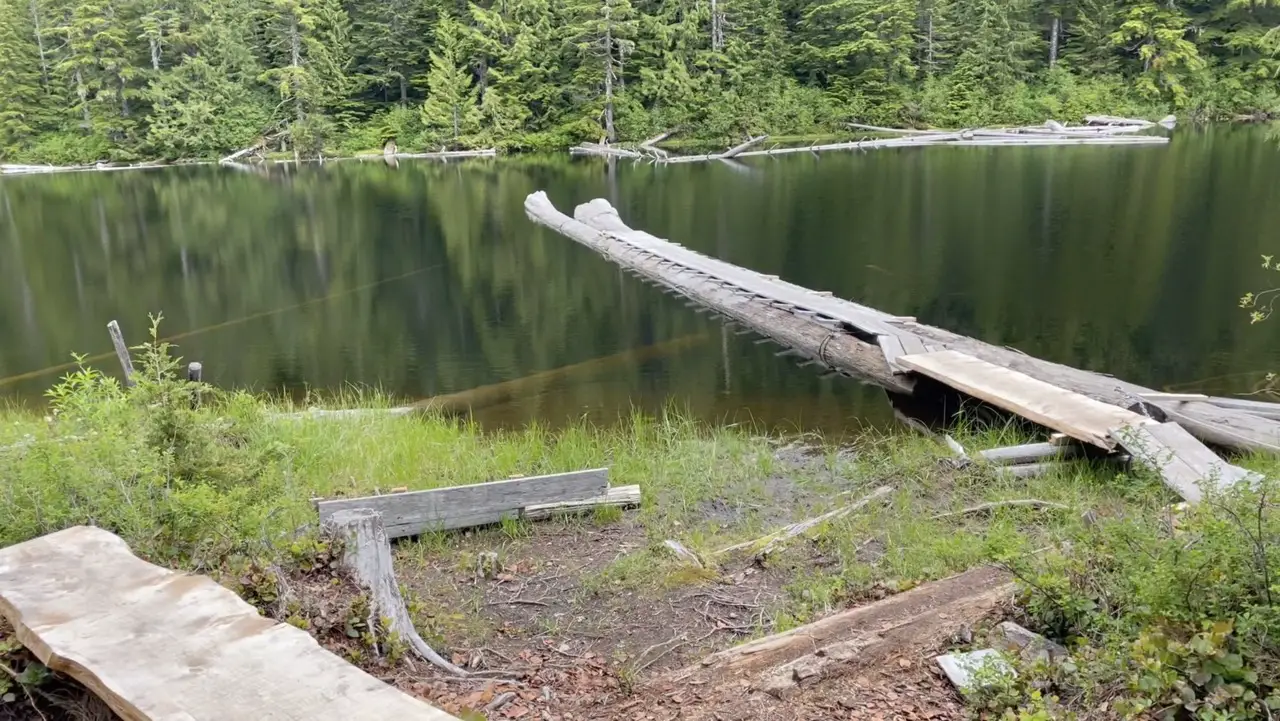
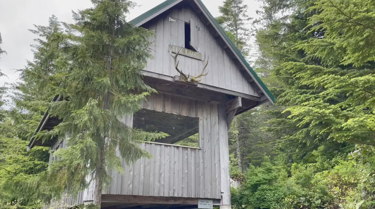
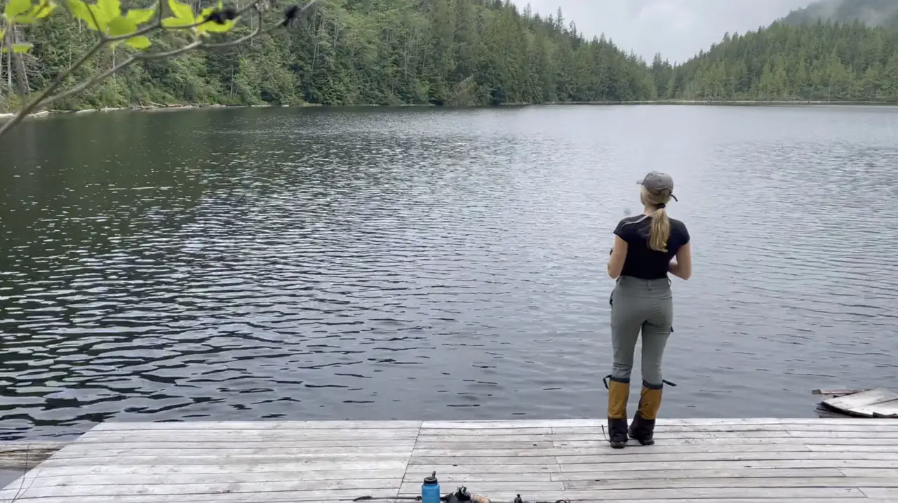
Elk Lake (KM 110)
The trail descends from Tin Hat down to about 400m and then switchbacks once again, through some familiar fir trees to Elk Lake at 950m. The Elk Lake hut location is wonderful and it sits on the edge of this oddly long mountain lake. The hut itself is open concept in the sleeping quarters meaning that bugs can sleep with you at night. We met a hiker there who set his tent up inside the hut which was quite genius.
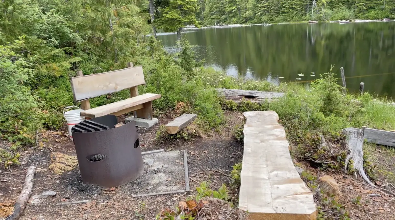
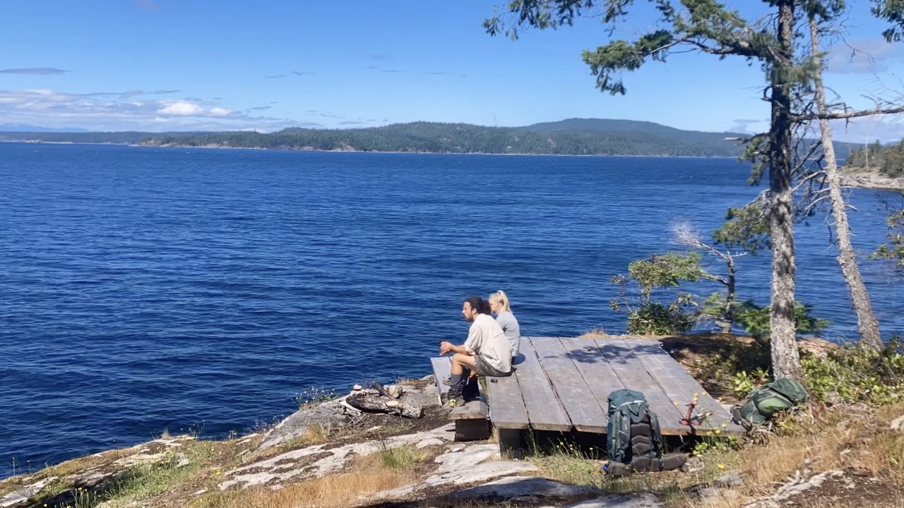
There are also a bunch of newly built tent pads on the lakeside which, quite honestly, are better than sleeping inside the hut itself. The true highlight however, is the massive dock designed with floating logs and the beautiful fire ring beside it. We went for a marvelous swim when we arrived, made dinner on the dock and had a huge fire with another camper. Oh ya, don’t let me forget. There is also a canoe that everyone is welcome to use to explore the lake!
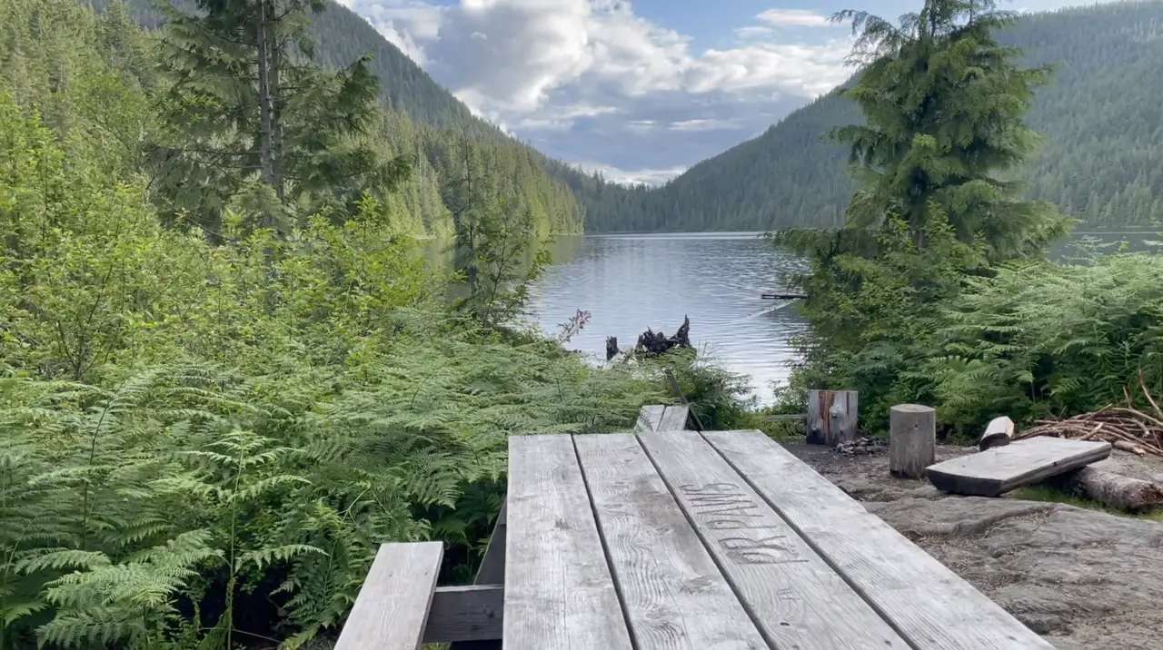
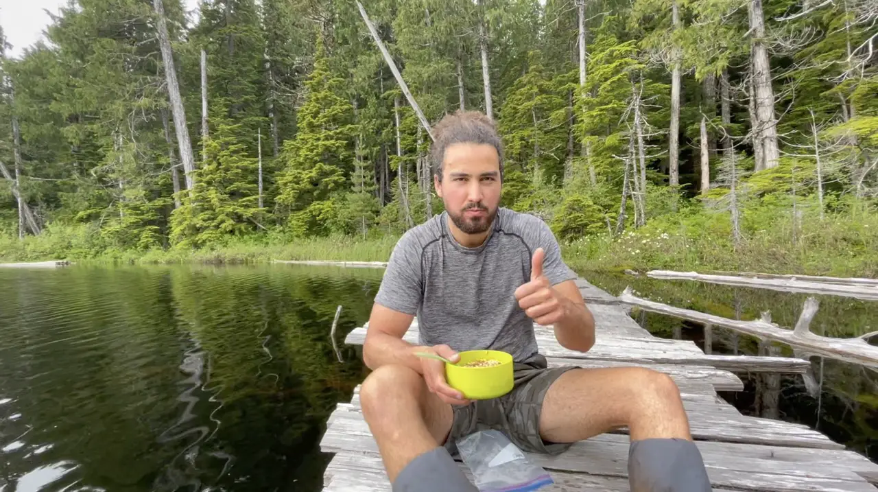
Coyote Lake (KM 116)
If you weren’t quite ready to rest your head at Elk Lake, or you wanted a bit more serenity, you can keep chugging along to Coyote Lake. This is a little gem of a campsite with two tenting areas and an awesome little dock. We ate some cereal here while passing by but this would be an ideal spot to spend the evening, especially for those who like to camp by themselves.
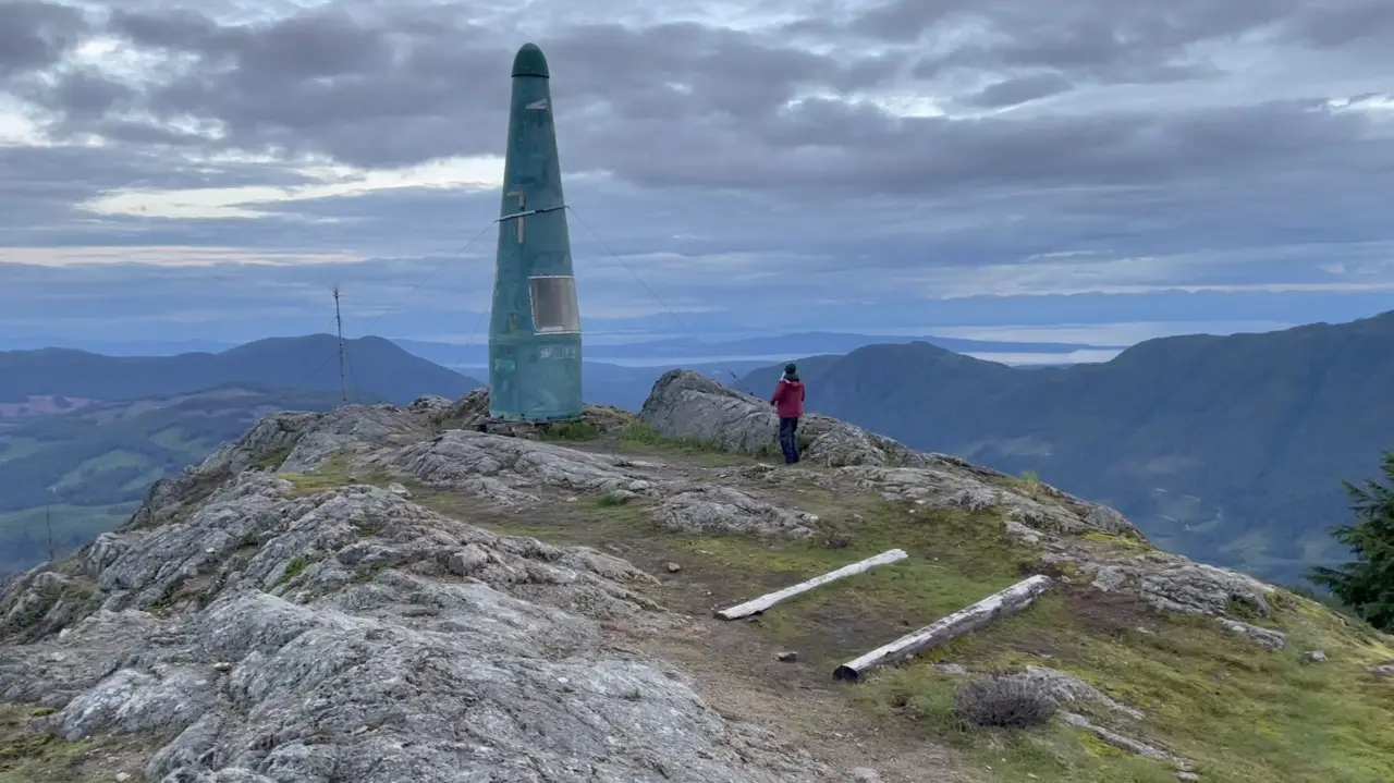
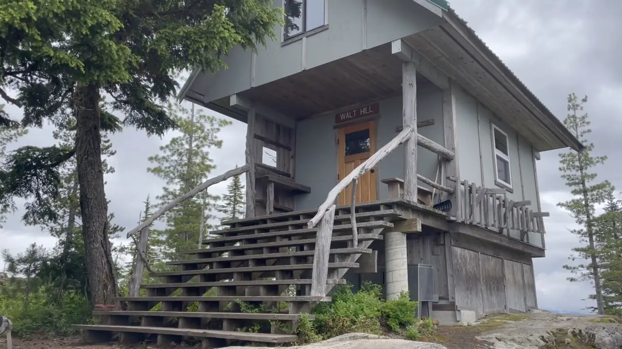
Walt Hill (KM 123)
You’ll begin to climb gradually up through the forest and will start getting peek-a-boo views of the lakes once again. There is an old weather station, now shack on-route to the summit that I initially mistaked for the summit. There are some great views from this little shack making it a great spot for a water break. While walking up we noticed thousands of tiny frogs, so keep your eyes on the ground so you don’t step on any of these beautiful bouncy critters.
The last few hundred meters and high point before the hut is a super cool vantage point of Lois lake and the hut resting on top of a massive cliff. Wander your way around the ridge slightly descending until you arrive at the hut.
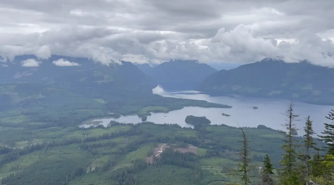
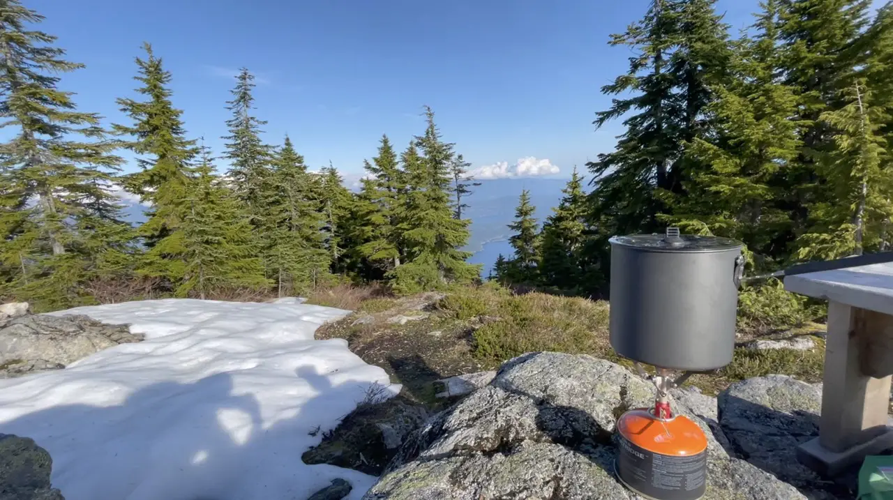
This one is another fully winterized hut, fully enclosed and equipped with a pellet stove. The top of the cliff just outside the hut offer some fabulous views of Lois Lake, Horseshoe Lake, Dodd Lake and Nanton Lake. There are a also few epic tenting options on top of the cliff if you can stomach it. The top of the cliff is the best spot to relax, cook a meal and sip on some tea, staring off into the views before calling it a night.
Lang Bay to Saltery Bay (1-2 Nights/45km)
Lang Bay (KM 135)
Before you walk the shoreline of Lois Lake and continue the journey to Saltery Bay you will have the opportunity to drop by the Lang Bay Store. The Lang Bay store is located on highway 101 at the end of Dixon Road. The Lang Bay Store is a great place to restock before you finish the final section of the trail and sells lots of hiking goodies and most importantly, Alcohol! Don’t eat or drink too much while you’re visiting because the 3km walk to connect once again with the SCT can feel extremely long.
Lois Lake (KM 140)
Once you are refueled and reconnect with the trail and cross the Lois River you will be walking along the shoreline of Lois Lake. This part of the trail can get confusing but if you walk up the logging roads and cut back down to the shoreline you will find the trail once again. Enjoy the peekaboo lake views through the forest and admire the float houses that rest near the shoreline. There are two campsites on the lake which are solid spots to spend the night but be aware, they both see a fair bit of traffic from car campers and canoe recreationalists. The first of the two campsites is my personal favourite (although the busiest) as it offers a few really solid lakeside camping options and easy access for swimming.
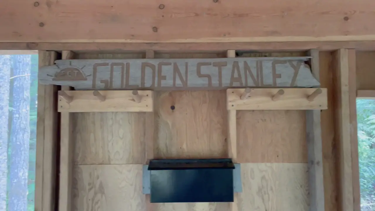
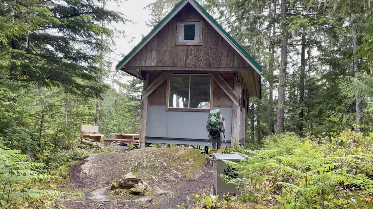
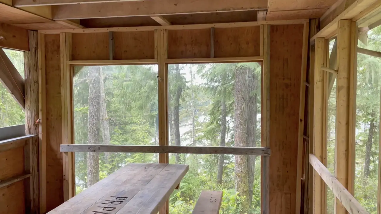
The Golden Stanley Hut (KM 145)
This hut was designed to bridge the gap between Walt Hill & Mt Troubridge. It’s one of the newest on the trail and is situated above the Stanley creek among the fir trees. Since the hut doesn’t have any views it tends to be less popular among hikers. However, the hut itself is gorgeous, there is an awesome fire ring, a fully enclosed sleeping area, covered open air eating area and you really can’t beat the relaxing sounds of a creek crashing all night long.
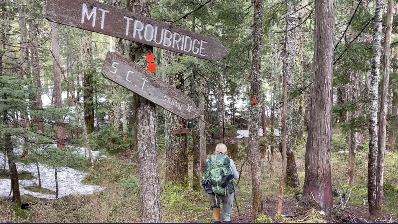
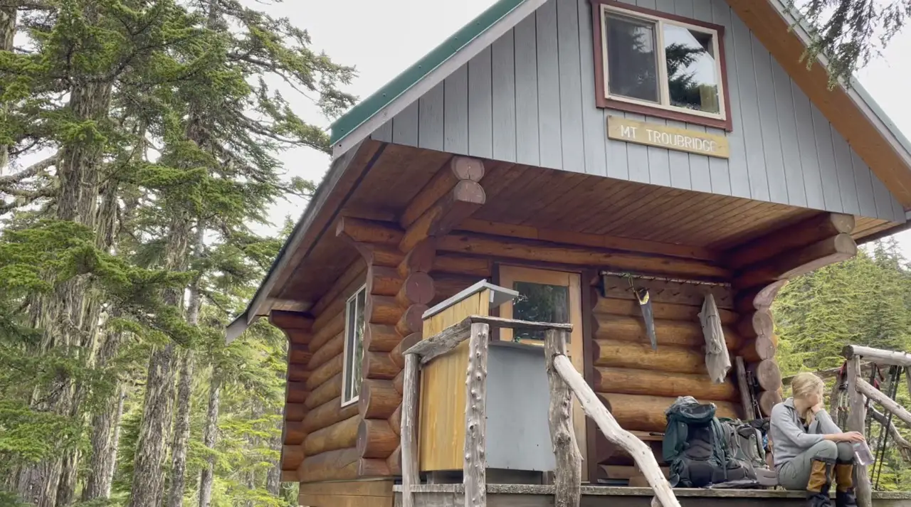
Mt Troubridge Hut (KM 158)
The Mount Troubridge hut is located at the Jocelyn pond a few hundred meters below the true summit. It’s fully winterized, cozy and is equipped with a pellet stove. The hut offers views of the Malaspina Strait, Nelson Island and beyond. This is the highest full sized hut on the trail and there is often snow until July.
Mt Troubridge Summit & Shelter (KM 159)
The 1km hike from the Troubridge Hut to the summit is quite steep but the the journey is wonderful. The Troubridge massif (group of mountains) is home to the greatest concentration of old growth trees along the trail. The summit is wonderful, and although you’re not getting tin hit 360 degree views, you can still enjoy sights of the Jervis inlet, lower Sunshine Coast, Salish Sea and the Inland Mountains through the tree tops.
We made dinner on the summit, watched the sunset, and slept in the emergency shelter. It’s a small a-frame hut and has enough room to sleep 2-4 people. If the snow has melted, and the ground isn’t too wet there are some solid spots to pitch a tent smack dab on the summit.
Rainy Day Lake (KM 169)
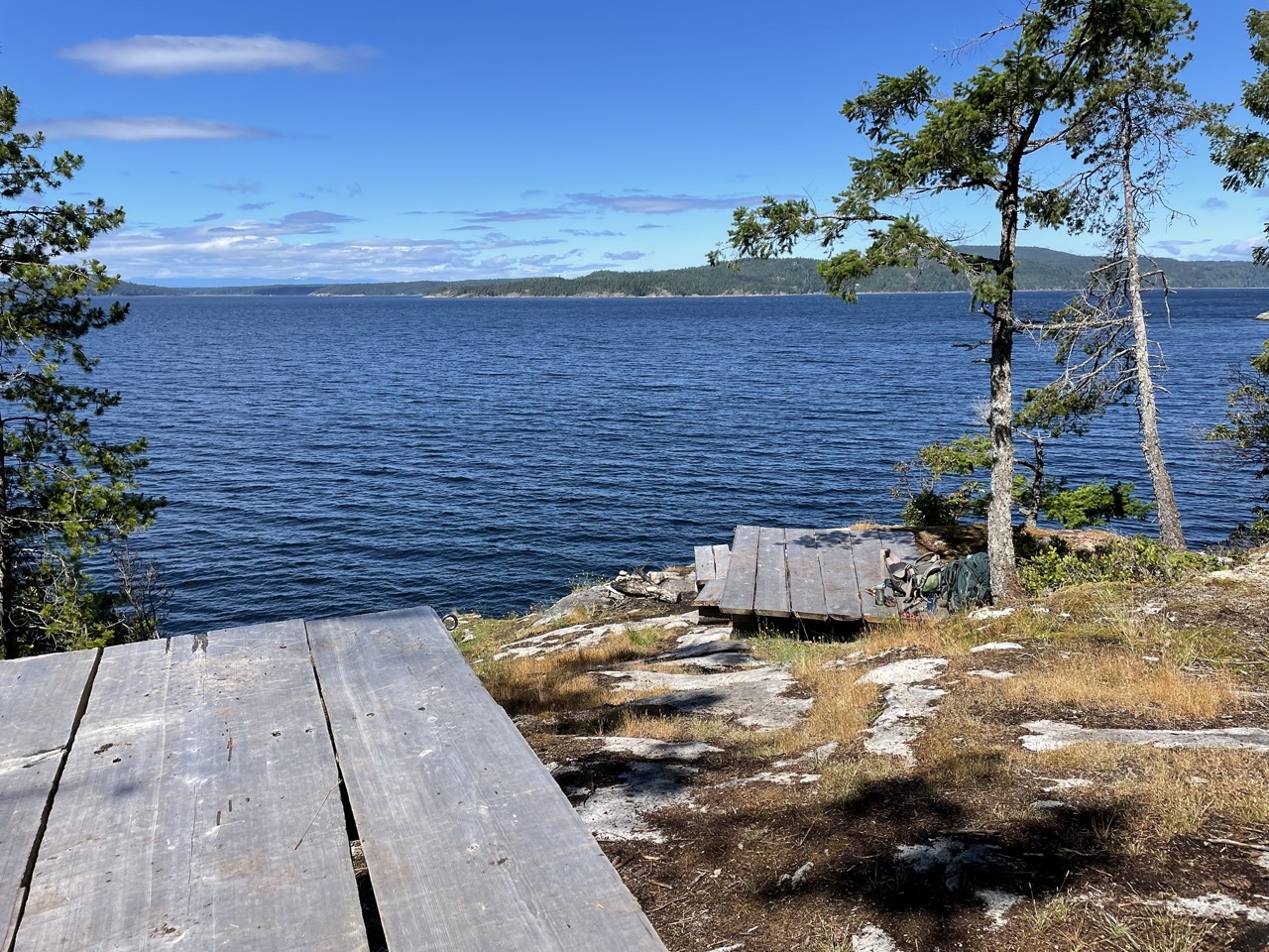
The forested descent from Mt Troubridge is quite beautiful. It’s truly a joy to see the change in the forest from the first day at Sarah Point to the end of the hike. The Rainy Day Lake hut is located on top of hailstone bluff and is simply awesome. There is an open air sheltered eating area below and an enclosed sleeping quarters up top all with views of the lake.
If you don’t fancy sleeping in the hut there are loads of spots to pitch a tent and plenty of fire rings and great picnic benches to enjoy a meal. The highlight of this hut for me was the awesome dock on the lake, which is the ideal spot to plunge into the lake and cool off.
Fairview Bay – (KM 171)
Fairview bay is located near the finish line at Saltery Bay. It’s a phenomenal spot to spend the night and offers some of the most exceptional ocean views and access on the trail. The hut is enclosed with plexiglass on the walls so you can hang out and look out to the ocean in all weather conditions.
Access to Fairview bay is only a few hours walk in from Saltery Bay so don’t be surprised to spend the night with a few people. There is loads of room to accommodate people with many tenting spots in the forest, benches looking out to the ocean and a few great fire rings.
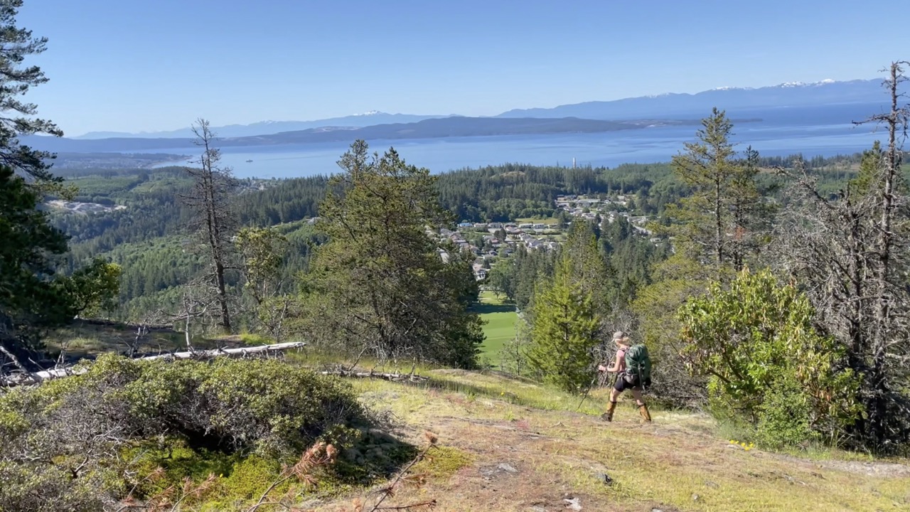
Saltery Bay (KM 178)
The final 9 kilometres of the Sunshine Coast Trail will fly by. If you’ve been hiking for 10 days, you’ll be on a full sprint to the ferry. Don’t rush to quick though because the next 4km following the Fairview bay hut are stunning. Enjoy those final steps along the bluffs above the water, even though you probably won’t want to hear the word bluffs for a while.
FAQ
Should I Bring A Tent For The Sunshine Coast Trail?
- Yes I would 100% recommend bringing a tent especially if you are planning to do it as a thru hike. Sometimes the huts don’t line up well with the distance you want to travel on any given day and sometimes the huts could be full, be too hot, or a tent pad might just be a more fun option. Of course you could manage/survive the trail without a tent, but, I would recommend you bring one along
Where can I find a map for the Sunshine Coast Trail?
- There are PDF maps of the Sunshine coast trail on the sunshine coast trail website or you can pick one up for free from the visitor centre in Powell River
Is the Sunshine Coast Trail Free?
– The sunshine coast trail is 100% free thanks to the hardwork of all of the PAWS volunteers. Everyone is welcome to sleep in the huts and travel the trail completely free. If you want to show your appreciation for the trail you can always donate to the PAWS here.
How Long is the Sunshine Coast Trail?
– The sunshine coast trail is 180km and takes anywhere between 8-12 days to complete depending on your pace and hiking style.
What is the best section of the Sunshine Coast Trail?
– In my opinion the best section of the SCT is from Sarah Point to Powell River because you get an amazing mix of ocean and old growth forest. Powell River to Lois lake is a close second and has some amazing mountainous terrain and lakes to swim in.
What is the worst section of the Sunshine Coast Trail?
– I loved absolutely everything, but the final push between Lois Lake to Rainy Day lake was fairly mundane, and the views from Mt Troubridge were nothing like Tin Hat
Are there many access points along the trail?
– There are plenty of access points to start the trail, meet friends, organize a pickup or receive a food drop off, Use the sunshine coast trail map to locate all parking locations.
Do I have to reserve camping on the Sunshine Coast Trail?
– You never have to reserve huts or campsites on the SCT, it is completely free and there is always lots of space to pitch a tent. If it’s busy, make sure to be welcoming to everyone, were all on the same team!
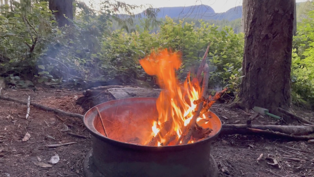
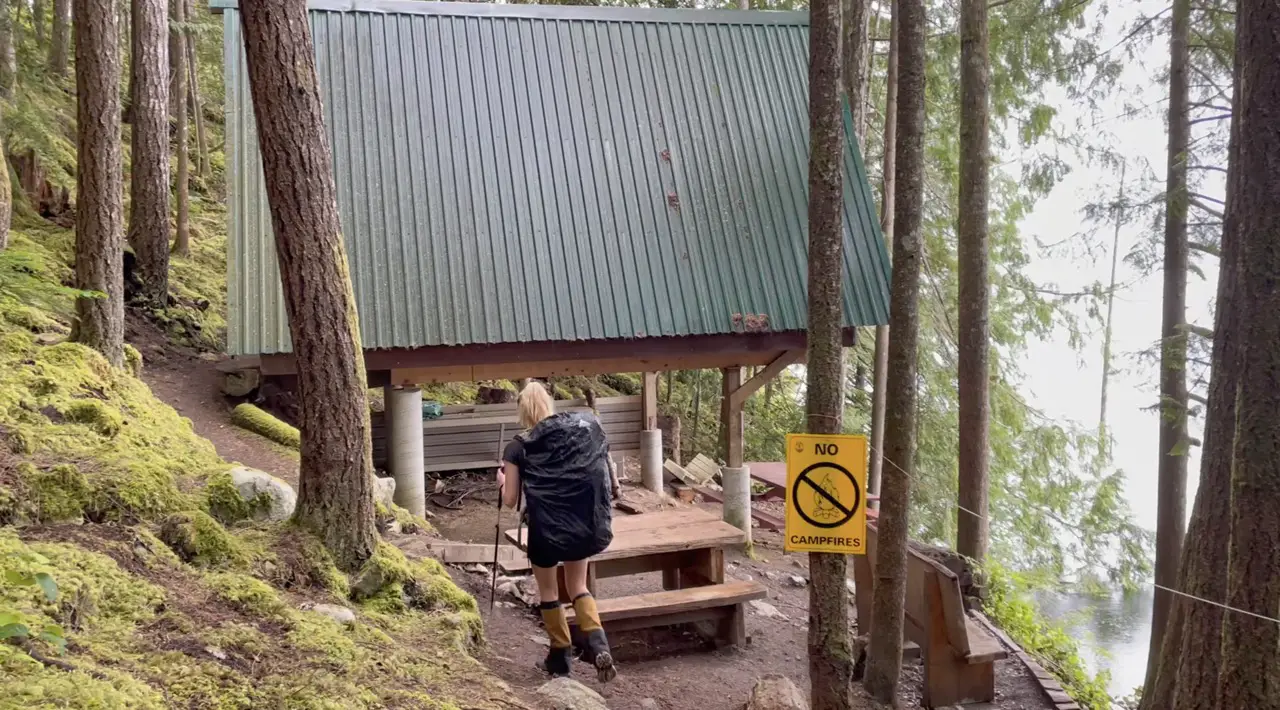
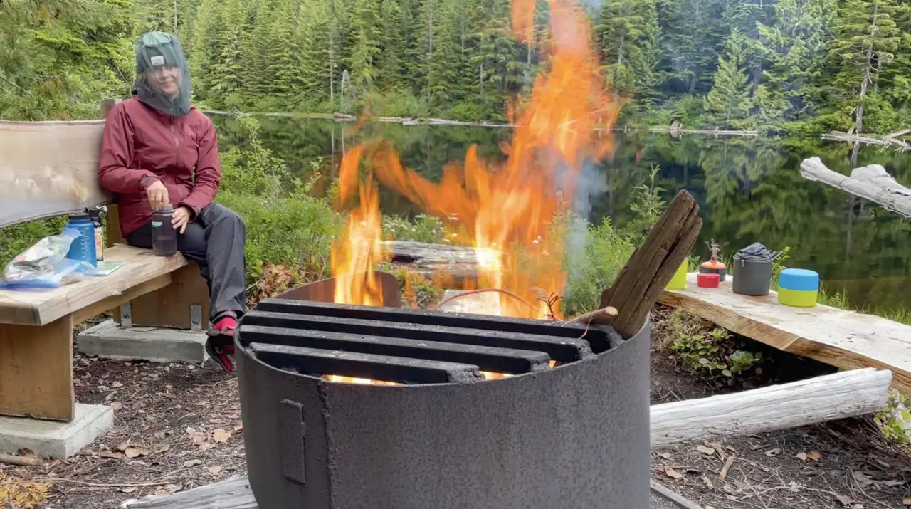
Can I have a fire on the Sunshine Coast Trail?
– Fires are allowed in existing fire rings (if there is no ban) there are usually barrels with rain water to put out your fires
Is there cell reception on the Sunshine Coast Trail?
– You don’t want to rely on your cell phone, but you will occasionally pop into areas with cell service.
What are the campsites like on the sunshine coast Trail?
– it’s a mixed bag. The great thing about the SCT is that you can pitch your tent wherever you like! Some sites or more rugged and not marked on the trail map and others, especially near the huts are decked out with fire rings, outhouses and tent pads.
Is the Sunshine Coast Trail Hard?
– I would personally rate this trail intermediate and think it is one of the easier thru-hikes that you can conquer in BC. In my opinion it is harder than the west coast trail and about the same as the Juan De Fuca. There is minimal elevation gain and less mud than coastal hiking trails. The sheer length of the trail, planning, coordination and weather is what makes it more difficult. However, do not underestimate the trail, your feet are going to be tired every single night.
What Clothes Should I Bring for the Sunshine Coast Trail?
– Here are the go to layers I bring for every summer backpacking trip
Where can I find water along the Sunshine Coast Trail?
– There are many creeks, lakes, rivers and ponds which are great places to filter water along the trail. Every hut and campsite has access to a water source with the exception of The Manzanita Hut, Tin Hat Hut and the summit of Mt Troubridge. These were the only spots where there is not water access. There are signs on the trail that warn you of the last place to fill before you get to these locations.
Safety Considerations on the Sunshine Coast Trail?
-Always carry a first aid kit, bear spray and make sure to hang your food if there are no bear caches at the campsite.
Are there bears and cougars on the Sunshine Coast Trail?
bears, cougars, wolves, dee, elk, coyotes, raccoons and many birds, eagles are some of the animals you may potentially run into along the way
That’s it, That’s All!
It’s going to be an amazing adventure.
As always, let me know if you have any Q’s in the comments.
Happy Hiking!