The Icefields Parkway is the king of scenic drives in the Rockies and is very deserving of its crown. National geographic even referred to the route as “the most beautiful journey on the planet.” It is about 3 ½ hours of nonstop driving, but we took the better part of 10 hours, filling our day with unimaginably beautiful stops. Most travelers, including us, drove the parkway in one single day. However, there are weeks’ worth of adventures, hikes, and experiences along this legendary stretch of highway. Our journey on the parkway began in Lake Louise and concluded in Jasper. I’ve listed in order the most notable stops and sights that everyone should have on their radar. If you’re travelling from Jasper to Banff, no problem, just follow the stops from last to first. The Icefields parkway was the most memorable drive I have had the pleasure of doing in my 24 odd years on earth. If you can knock all the spots off in one day, heck ya! If you can’t no worries, just revisit that section of highway for another day. Driving this scenic stretch of road is truly no chore. Remember to take your time and take it all in!
Table of Contents
Remember the Backcountry Basics
- Carry your Survival Kit & Essentials
- Let someone know where you’re going with a Trip Plan
- Know how to avoid negative wildlife encounters
- Practice Leave No Trace to keep the wilderness pristine
The Stops
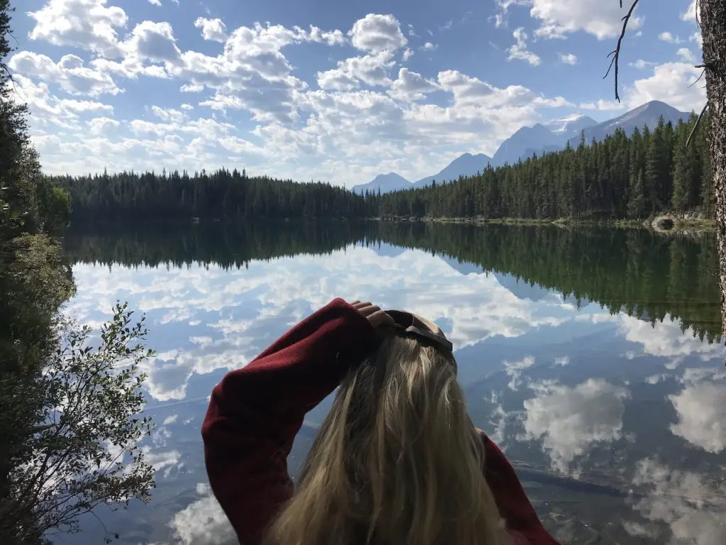
1. Herbert Lake
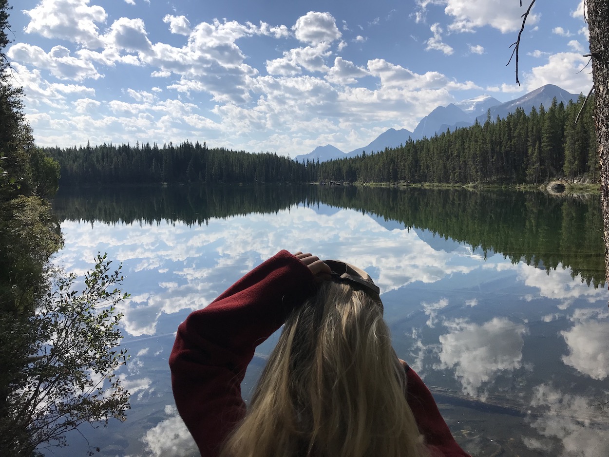
After only a quick 5.7km drive from lake Louise you will arrive at the must-stop location, Herbert Lake. The lake is a true spectacle. It is particularly special at daybreak and sunset as the towering Mt.Temple reflects beautifully off the glass like water. Herbert lake is an amazing spot for a quick paddle and a solid zone for a swim since the water is a much warmer than most glacial lakes. If you take a stroll around the lake, you’ll be rewarded with a man-made diving board built on the rocks that you can play around on.
Distance from Lake Louise (LL): 5.7km – GPS Coordinates: 51.46192, -116.2243
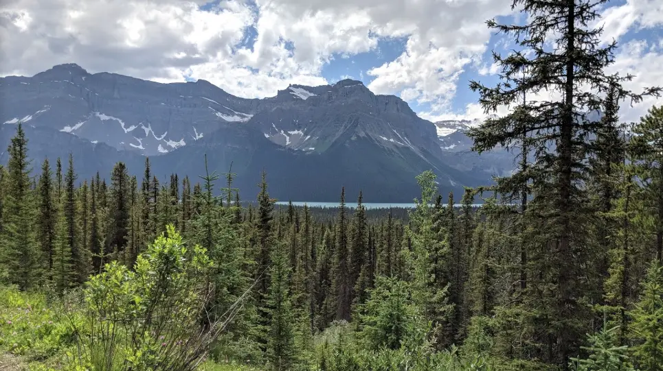
2. Hector Lake
Hector lake is one of the largest glacial lakes in Banff National park and is encircled by the Waputik mountain range. The picturesque turquoise lake is perfectly tucked beneath the trees and below the mountains. There are two ways you can experience Hector Lake.
Hector Lake Viewpoint
The most popular option is simply viewing Hector lake, and snapping quick photo from the highway pull off. It’s a little hard to spot while driving so make sure to get out of your vehicle to best experience it.
Hike to Hector Lake
The second, and my personal favorite way of seeing Hector lake is to hike down to it. The hike itself is a 5km round trip and experiences very minimal traffic. There is only about a 70m elevation drop down to the lake bringing the total elevation change to about 140m. If you decide to embark on the hike, give yourself at least 2-3 hours and ensure you are carrying your bear spray and survival gear as it is much more remote than other trails in the region. The Hector lake trail was extremely muddy which slowed us down significantly. We passed a father son duo who had previously visited and were equipped with rubber boots, it clearly was our first rodeo. This trail involves a large river crossing. Rivers are inherently dangerous, always respect the power of the water. We visited in late August, so the Bow river was very low. Be very careful when crossing the river in the slack seasons when it is running high. My rule of them when fishing is “if it’s it is above your knees, head back into the trees.” Also be mindful of the weather. If the water is already somewhat high and there is rain in the forecast, rivers can rise in a matter of minutes leaving you stranded, so be extra weary. There are rarely too many hikers on this trail as it is quite rugged and tucked away on the side of the highway with little signage. The vast majority of people hiking to Hector lake are staying overnight at the campsites and there is actually a pit toilet and picnic tables at the campground. If you’re lucky you may be able to take one of the Parks Canada canoes out for a spin before hiking back to your vehicle. One of the campers mentioned to me that the fishing is solid in Herbert lake so if you want to catch a rainbow for lunch, remember to carry your rod down with you. In terms of fly patterns, bait or lures… Alpine fish bite everything, so pick something shiny or colorful and you’ll get a tug or two.
Distance from Lake Louise (LL): 22.9km – GPS Coordinates: 51.57764, -116.3087
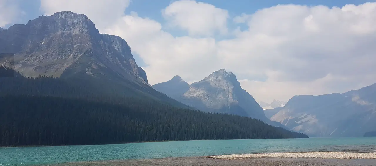
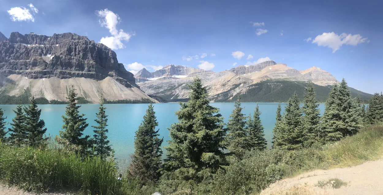
3. Bow Lake
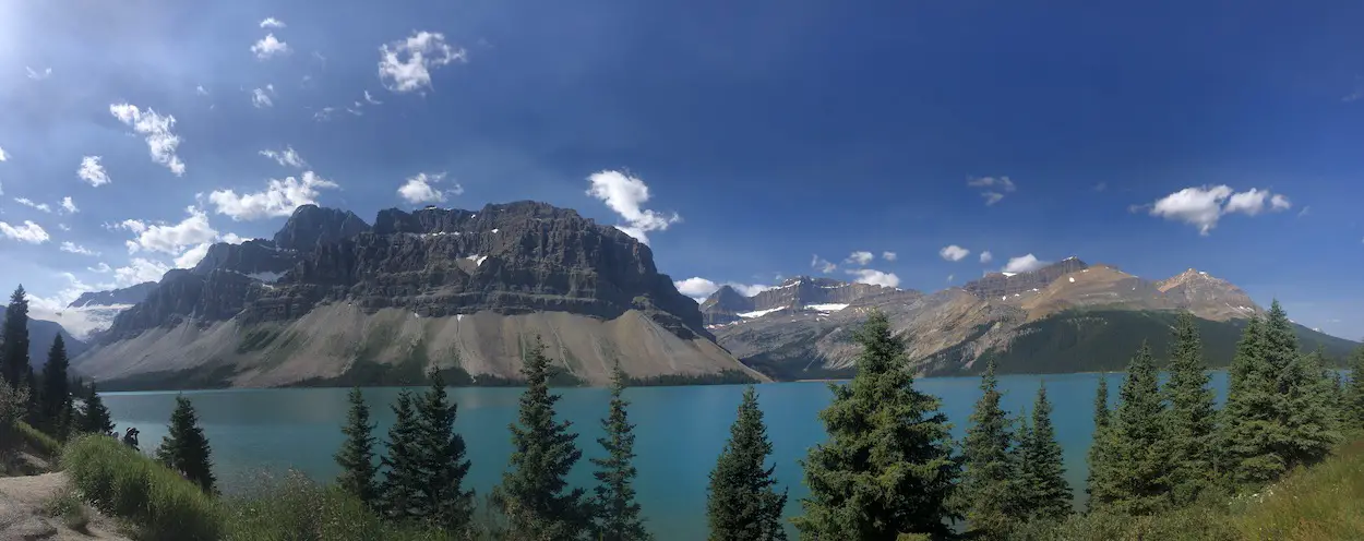
Bow lake is a marvel. It exhibits views of the Wapta Icefield, Bow glacier, Bow Peak, Mount Thompson and the Crowfoot Glacier. While stopping at Bow Lake I would recommend exiting your vehicle at three different locations, The Crowfoot glacier, Bow Lake Viewpoint and the Num-Ti-Jah Lodge. The Crowfoot Glacier viewpoint was my personal favorite and was where we stopped for a tailgate lunch. A couple hundred meters down the road is the Bow Lake Viewpoint, it’s not to different from the first viewpoint but why not take the beauty in from all angles. Lastly check out the historic hotel on the shores of Bow lake called the Simpson’s Num-Ti-Jah lodge. It was designed by a legendary wilderness guide Jimmy Simpson. You can read about the lodge and his family’s amazing backstory here.
Distance from Lake Louise (LL): 38.7km – GPS Coordinates: 51.66297, -116.43852
4. Peyto Lake
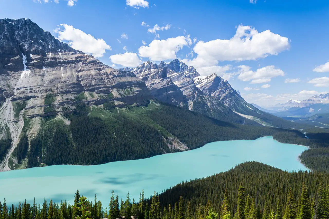
Peyto lake is considered by many to be one of the best views in our country. You’ve undoubtedly seen it before on postcards, in watercolor paintings, or somewhere on the internet. It’s tucked into the Waputik range nestled between Caldron Peak, Peyto Peak and Mount Jimmy Simpson. Peyto’s turquoise-emerald color water in the summer rivals that of Lake Louise and Moraine. It is the kind of view people would hike days over to witness. Fortunately, you’re barely required to walk more than 100m from the Bow Summit car park to gain access to the wooden viewing platform, enabling you to lay your eyes on Peyto in its entirety, one of the most spectacular glacial lake views you will ever witness. If you want an even better view, opt to take 3km Peyto Lake overlook hike. Depending on the time of day the hike might be very busy, but I assure you, you will not regret it.
Distance from Lake Louise (LL): 45.5km – GPS Coordinates: 51.71396, -116.50952
5. Silverhorn Peak
This one does not have to be a stop, but the sharp horn shaped rocks at Silverhorn’s peak make it very unique. Make sure you take a good long look out the window as you cruise by.
Distance from Lake Louise (LL): 48.8km – GPS Coordinates: 51.75927, -116.49654
6.Waterfowl Lakes
After passing by Mistaya lake which will be out of focus to your left you will reach the Waterfowl lakes. I would recommend pulling off at the first of the two lakes. There is an abandoned campground, and you can walk right down to the shoreline in a matter of minutes and dip your toes in the sea green water. If you don’t feel like leaving your vehicle you can get a fantastic view of the second lake by pulling over a little further down at the waterfowl lakes viewpoint. I much preferred the first lake view to the second so if you have the time, check out both!
Distance from Lake Louise (LL): 59.9km – GPS Coordinates: 51.83256, -116.60901
7. Catch a brown trout in the North Saskatchewan river
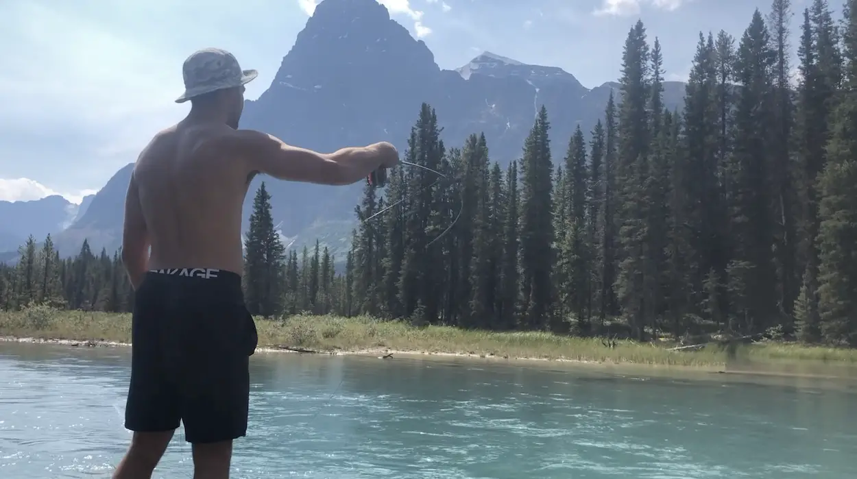
This one does not have to be added to everyone’s itinerary, but for me, catching a brown on the North Saskatchewan river was one of the biggest highlights of the whole drive. I cannot pinpoint exactly where I stopped, but somewhere after the Waterfowl lakes I saw a fly fisherman casting through the trees on the riverbank. I immediately slammed the truck brakes, swerved across the highway, and got out into the water with my rod. I spoke with the fisherman and he had no luck thus far. I tied on an ugly looking wooly bugger and within 20 casts I had hooked up to a beautiful brown trout that I battled in the emerald green waters, mesmerized by the mountains in the backdrop.
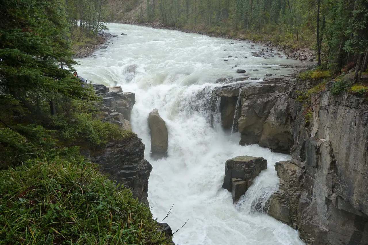
8. Mistaya Canyon
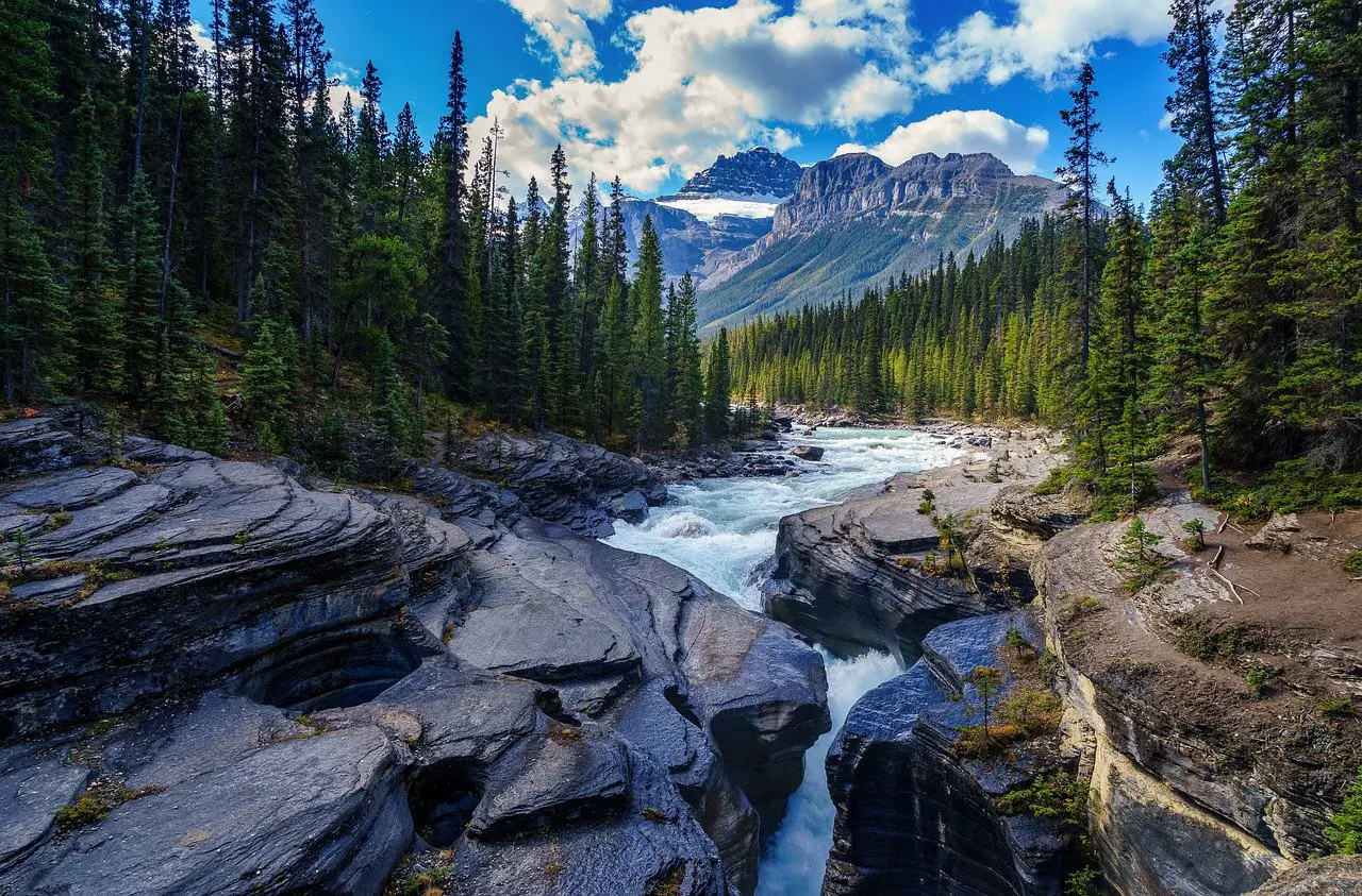
Zig Zagging and weaving through its rocky sidewalls is the Mistaya Canyon. It was formed over centuries due to the pressure of the Mistaya river whitewater gushing though. You can venture out on the rocks to get up close and personal with the rushing water, just be careful and watch your footing!
Distance from Lake Louise (LL): 75.1km – GPS Coordinates: 51.9422, -116.72043
⛽️🍕⛽🍕⛽️🍕⛽🍕⛽️🍕⛽🍕⛽️🍕⛽🍕⛽️🍕⛽🍕⛽️🍕⛽🍕⛽️🍕⛽🍕⛽️🍕⛽🍕⛽️🍕⛽🍕⛽️🍕⛽🍕⛽️🍕⛽🍕⛽️🍕
After the Mistaya canyon is “The Saskatchewan River Crossing”. This is the only spot for gas and grub on the way so make sure your tank and tummy are full before adventuring onwards.
⛽️🍕⛽🍕⛽️🍕⛽🍕⛽️🍕⛽🍕⛽️🍕⛽🍕⛽️🍕⛽🍕⛽️🍕⛽🍕⛽️🍕⛽🍕⛽️🍕⛽🍕⛽️🍕⛽🍕⛽️🍕⛽🍕⛽️🍕⛽🍕⛽️🍕
9. Weeping Wall
Roughly a 30 minute drive from Mistaya Canyon stands the Weeping Wall in the Cirrus mountains. It is a mammoth set of cliffs that is around 100 feet high and has coined the term “weeping” because of the waterfalls that drip down its face. The weeping wall is an even cooler stop in the winter when you can witness ice climbers scale its frozen waterfalls, including the main waterfall named “teardrop”.
Distance from Lake Louise (LL): 107km – GPS Coordinates: 52.14208, -116.99439
10.The Big Bend
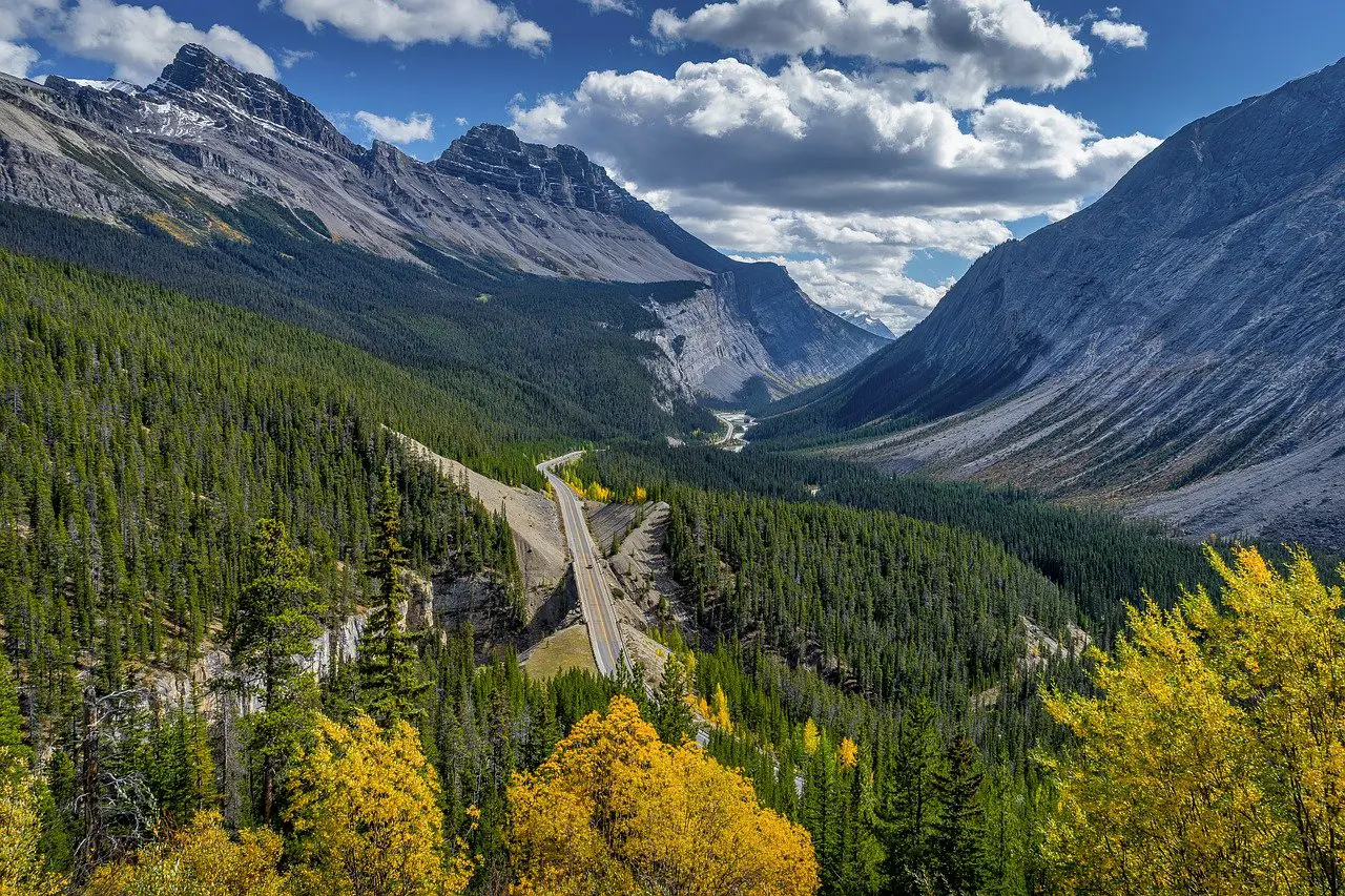
This was one of the most spectacular driving portions of the journey. The big bend refers to the only hairpin turn on the entire highway. Around the corner It will open an expansive viewpoint of the valley, mountains, and highway to your right. There will be a pullout after the bend on the passenger side of the road. Pull your vehicle over, give your tired engine a break and soak in the scenery of the valley.
Distance from Lake Louise (LL): 116km – GPS Coordinates: 52.1703, -117.0729
11. Bridal Veil and Panther Falls
From the parking lot the Bridal Veil falls is a 0.4km walk and the Panther falls is a 0.5km walk. Both waterfalls are unique. The bridal veil falls is a lengthy, multi-tiered waterfall that is said to be taller than 365 meters, however, due to the concentration of the trees, you are unable to see the entire length of the falls. The panther falls is distinctive in the manner it explodes out of a very small hole in the cliffside.
Distance from Lake Louise (LL): 116.3km – GPS Coordinates: 52.18166, -117.05319
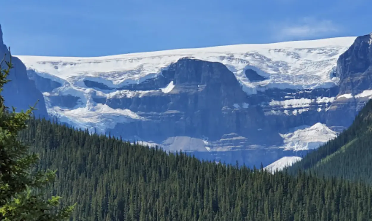
12. Athabasca Glacier
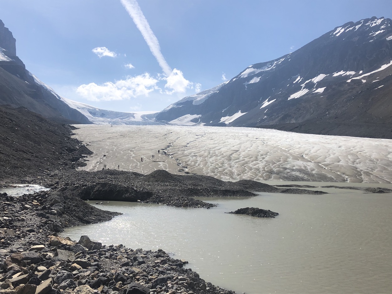
The Columbia Icefield is the most expansive icefield in the Canadian Rockies, covering over 230 square kilometers to a depth of 365 meters and 28km long. Dressed over the BC border at a high alpine elevation the vast sums of winter snow fail to melt by summertime. The progression of unmelted snow becoming ice or ‘toes’ develop into what are known as glaciers. The most famous of these ‘toes’ is the Athabasca glacier, which is one of 6 principal toes of the Columbia icefield. It is extremely easy to access via a quick walk from the parking lot. Travel on the physical glacier is not recommended for environmental and safety reasons. Glaciers have many hidden crevasses and travel on them should not be practiced without the appropriate gear. There are some paid tours you can opt to try if you want to get deeper and see more of the icefield.
Distance from Lake Louise (LL): 132km – GPS Coordinates: 52.20206, -117.23117
13. Tangle Creek Falls
Tangle Creek falls is a super cool multi-level waterfall that is very easily accessed by pulling over and crossing the highway. It looks like the falling water is made up of miniscule curly braids. I would recommend taking 15 minutes to stretch your legs and hike up to the top so you can get the full picture of the falls. When I initially drove past It looked very small and unimpressive, but upon stopping, the falls revealed more of itself and locked my focus to its looping and lashing water tangles.
Distance from Lake Louise (LL): 137km – GPS Coordinates: 52.26702, -117.2859
14. Stutfield Glacier
Twenty minutes’ drive down the road from Athabasca, you will catch your first glimpse of the Stutfield Glacier. Take a minute and pull off at the Stutfield Glacier viewpoint so you can appreciate another majestic ‘toe’ of the Columbia icefield. This is a very sedate and magnificent glacier that flows nearly symmetrically along an enormous rock face. The best part, about this glacier is that you can see without binoculars, the top of the ice field that looks like a lake shelved in the sky.
Distance from Lake Louise (LL): 139km – GPS Coordinates: 52.2735, -117.30835
15. Quartzite Boulder Field
This one is for all those rock and mineral lovers! The quartzite boulder field is an area with large pink Quartzite rocks that border the side of the road. They are covered in lichen and moss and sit just prior to the Endless Chain Mountain Range
Distance from Lake Louise (LL): 158km – GPS Coordinates: 52.42269, -117.3953
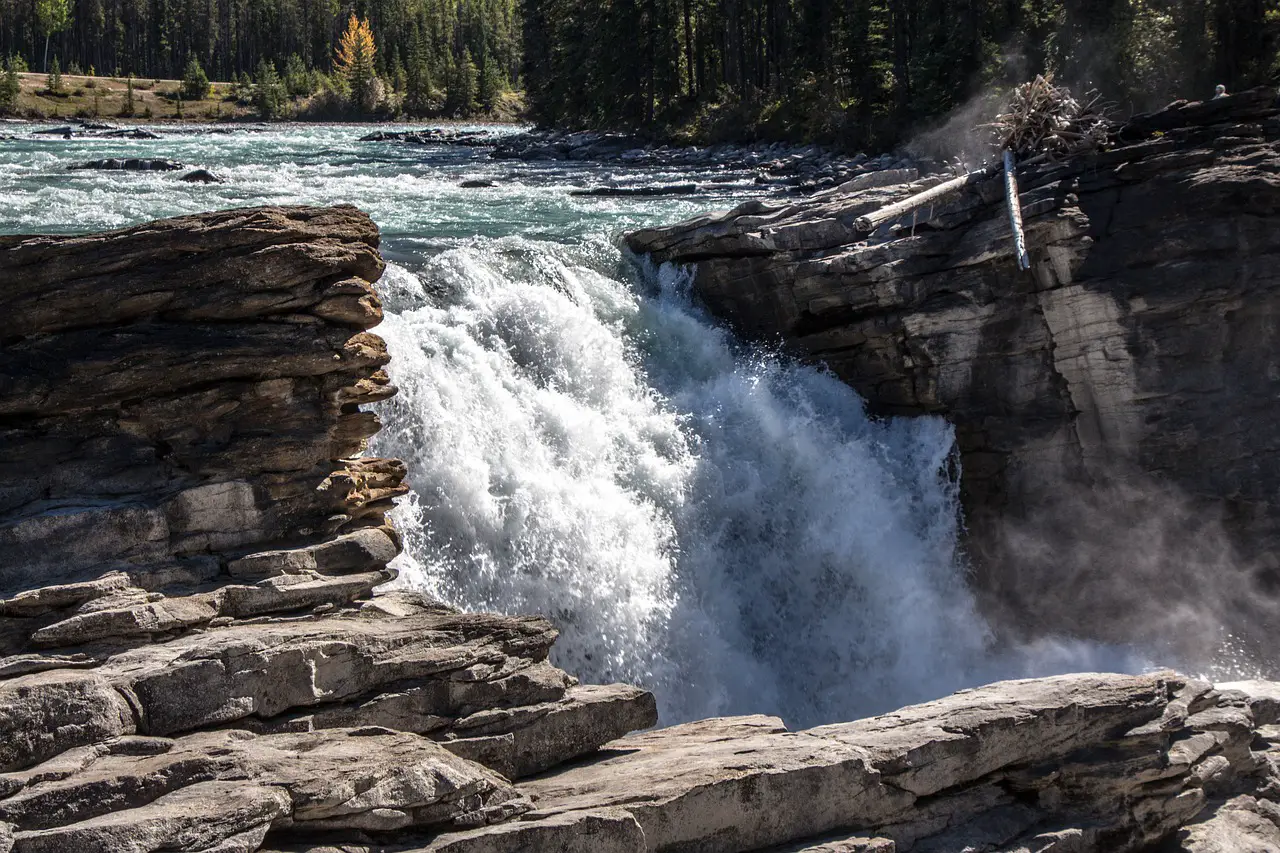
16. Sunwapta Falls
Yet another beautiful waterfall. The Sunwapta falls are accessed via a 600m walk from the highway pull-off. The turbulent water travels from the Athabasca glacier and drops down an 18.5-meter plunge at the upper falls. You won’t need to much time here, but by this point in the day it will start to feel good knowing you’ve almost seen it all.
Distance from Lake Louise (LL): 179km – GPS Coordinates: 52.53413, -117.64049
17. Kerkeslin Goat Lick (Goats & Glaciers)
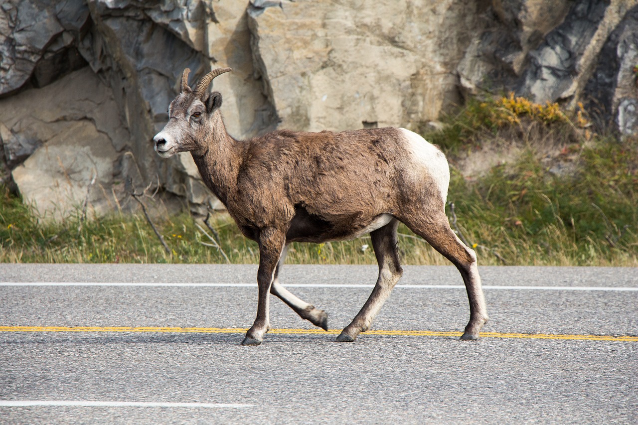
The “Goat Lick” is one of the best spots to view wildlife in the park. Remember to keep your distance from all mountain goat because they can be very dangerous if you are charged. Usually, goats live on dangerous cliffs dodging predators but they can be found very close to the road. The “Mineral Lick” is a pale colored mineral rich silt deposit that attracts them. The goats congregate to lick the silt for calcium and sulphate, consuming such an amount their droppings turn the color white.
Distance from Lake Louise (LL): 198km – GPS Coordinates: 52.63059, -117.85929
18. Athabasca Falls
There are several viewing and walking trails around the falls. Athabasca falls has a 24metre drop, but it is most eminent for the extreme volumes of water that thrashes over and into the gorge. Keep your eyes peeled for a grey bird called the Canyon sprite that glides and shoots in and out of the canyon.
Distance from Lake Louise (LL): 202km – GPS Coordinates: 52.66561, -117.88315
19. Horseshoe Lake
If you enjoy cliff jumping, horseshoe lake is your paradise. Please ensure that you are jumping safely, there have been many injuries and even deaths at Horseshoe Lake. Be smart, and use a pair of goggles to make sure the landing is clear and deep enough, and don’t do anything you do not have the experience for. It’s a very quick walk from the car park and there are a number of small bridges, high cliffs and clear water surrounding the lake. If you have been driving all day in the hot sun this is the perfect time for a swim. Be safe and go wild!
Distance from Lake Louise (LL): 205km – GPS Coordinates: 52.69826, -117.86623
20. Valley of the Five Lakes
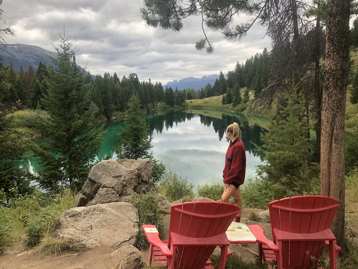
The valley of the Five lakes was one of my favorite stops on the parkway. The hike/walk is a 5km loop with an elevation change of about 172 meters. It blew my expectations right out of the water. Each lake was deeper, more breathtaking, and bluer than the one prior. Provided the small size of these lakes, I could not wrap my head around the eerie depth. We took our time and stopped at some of the lawn chairs along the way to take it all in. We did not fit this hike in on the same day as we drove the parkway, instead we visited the following afternoon during our stay in Jasper.
Distance from Lake Louise (LL): 224km – GPS Coordinates: 52.80832, -118.02314
Things To Know Before You Go
🍁 A Parks Pass is required 🍁
If you are going with a party larger than yourself the best option will be to purchase a family or group pass that you will hang from your dashboard mirror. You can find the current discovery price passing here.
⛽ Fill Your Gas Tank ⛽
Fill your gas tank in Lake Louise. The only place to fill petrol is at the Saskatchewan crossing which marks the half way point of the drive.
🚀 Watch Your Speed 🚀
Be mindful of your speed and follow speed limits. They are there to protect tourists pulling over on the shoulder and the wildlife that may decide to cross the road. Also, if you drive to fast you are going to miss out on the many sights you can enjoy when you slow down.
🥤 Bring Food and Water 🥤
You will likely be quite hungry and thirsty over the course of the day. The food/drink at Saskatchewan crossing is minimal and they’ll gauge you with the high prices.
📵 No Cell Service 📵
There is no cell service so make sure you let someone know where you going or prepare a “trip plan” if you are expecting to adventure on a more remote hike.

I promise this hit-list will help you have the most epic day possible on the “most beautiful journey on the planet.” It’s easy to drive by stops by accident and there is no cell service on the Icefields Parkway so make sure you screen shot this post and save the map so you can ensure you don’t miss a thing.
Did I Miss Any Must-See Stops?
Let me know in the comments!