Hiking is an amazing activity because it is accessible to people of all fitness abilities and skill levels, any time of the year. Everyone can hike! It isn’t an activity reserved solely for those who want to spend long grueling days scaling mountains. Hiking is simply defined as the act of walking through terrains with rough surfaces.
Walking or running on rough surfaces, gravel, soil and roots is proven to improve balance, strengthen ligaments, and be low impact compared to walking on pavement. However, the most important benefit about hiking is being outside in nature. Simply being in the forest, mountains or by the water will rapidly improve your mood and health.
Squamish is a fantastic place for adventurers and is loaded with amazing hiking trails. Listed below are 5 of the best easy hikes & walks that you can try in Squamish, BC.
Table of Contents
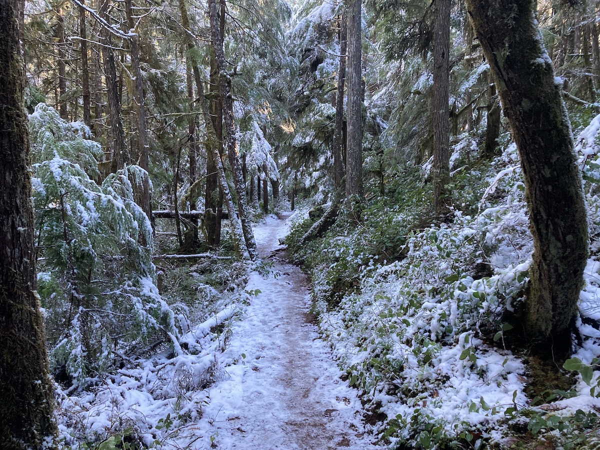
Brohm Lake Loop & Tantalus Viewpoint
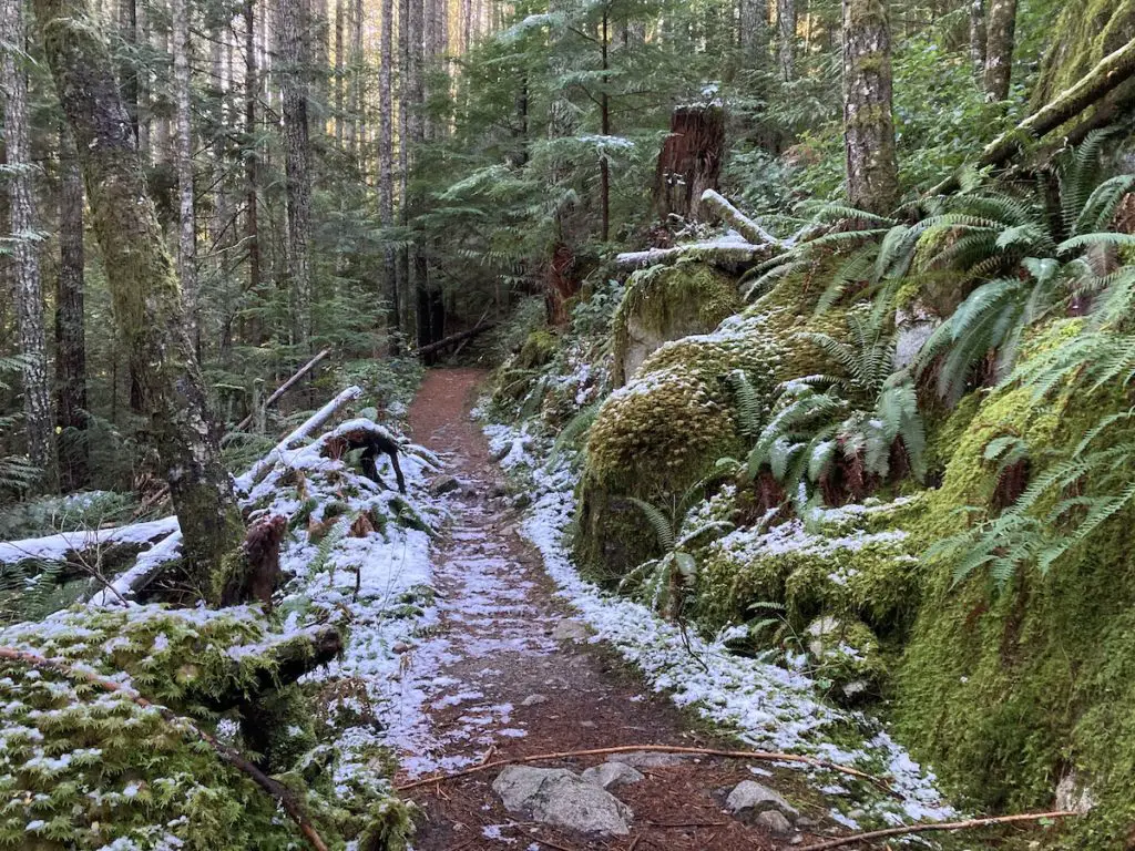
Brohm Lake is well known as one of Squamish’s favourite summer cool down spots. Locals love to lounge, float, swim, rope swing and cliff jump into the refreshing lake. The lake is only a quick walk from the parking lot making it a super easy spot to pop down for a swim when returning or embarking on adventure somewhere else along the highway.
The park is also very well known for its fantastic network of moderate hiking trails. There are many different distances and loops to choose from when exploring the park. This is a great area for hikers of all skill levels and will stimulate trail users with beautiful forests, glassy lakes and fantastic mountain views at the Tantalus viewpoint. It won’t take up your whole day and is the perfect option to get fresh air and exercise in the morning or afternoon.
Quick Stats
| Distance (Round Trip) | 5.5km |
| Elevation Gain | 175m |
| Time (Round Trip) | 1-3 hours |
| Dogs | Yes |
| Camping | No |
| Season | Year Round |
| Difficulty | Easy |
| Remoteness | Moderate |
| Highest Point | 404m |
Directions
Brohm Lake is located a 15 minute drive North on the Sea to Sky highway (BC-99 N) from downtown Squamish.
Trail Map
Click HERE for the Full Brohm Lake Tantalus Viewpoint Loop Hiking Guide
4 Lakes Loop Trail
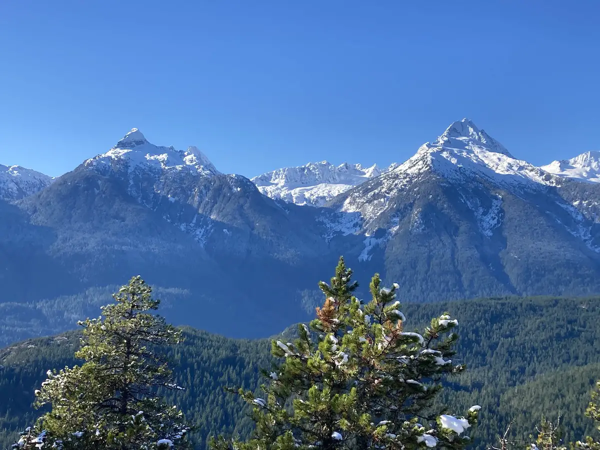
Alice Lake Provincial park is an amazing recreation hot-spot year round. It’s tucked beautifully into the dense forest and in-between the snow-capped mountains. On hot summers days the lake gets lots of sunshine and swimmers, paddlers and fisherman flock to its shores for some fun on the water.
Off the water there are a few great hiking, walking and mountain biking options. The Four lakes trail is the best hiking option in the park for those looking for an easy/moderate adventure. The hiking loop directs you through 6km of trail past four beautiful lakes. The elevation gain is very minimal and the trail is exceptionally maintained with very easy footing. This is a great hiking option for those looking for something quick and don’t want to commit to a lengthy day hike in the sea to sky area.
Quick Stats
| Distance (Round Trip) | 6km |
| Elevation Gain | 142m |
| Time (Round Trip) | 2-3 hours |
| Dogs | Yes |
| Camping | Yes (Alice Lake Provincial Campground) |
| Season | Year Round |
| Difficulty | Easy |
| Remoteness | Well Trafficked |
| Highest Point | 313m |
Directions
Alice Lake is located a 12 minute drive North on the Sea to Sky highway (BC-99 N) from downtown Squamish. There is great signage before the turnoff on the right to Alice Lake Road. Follow signs towards the Parks Office and park on the side of Alice Lake Road to the left by the Stump Lake Trailhead.
Trail Map
Click HERE for The Full 4 Lakes Loop Trail Description
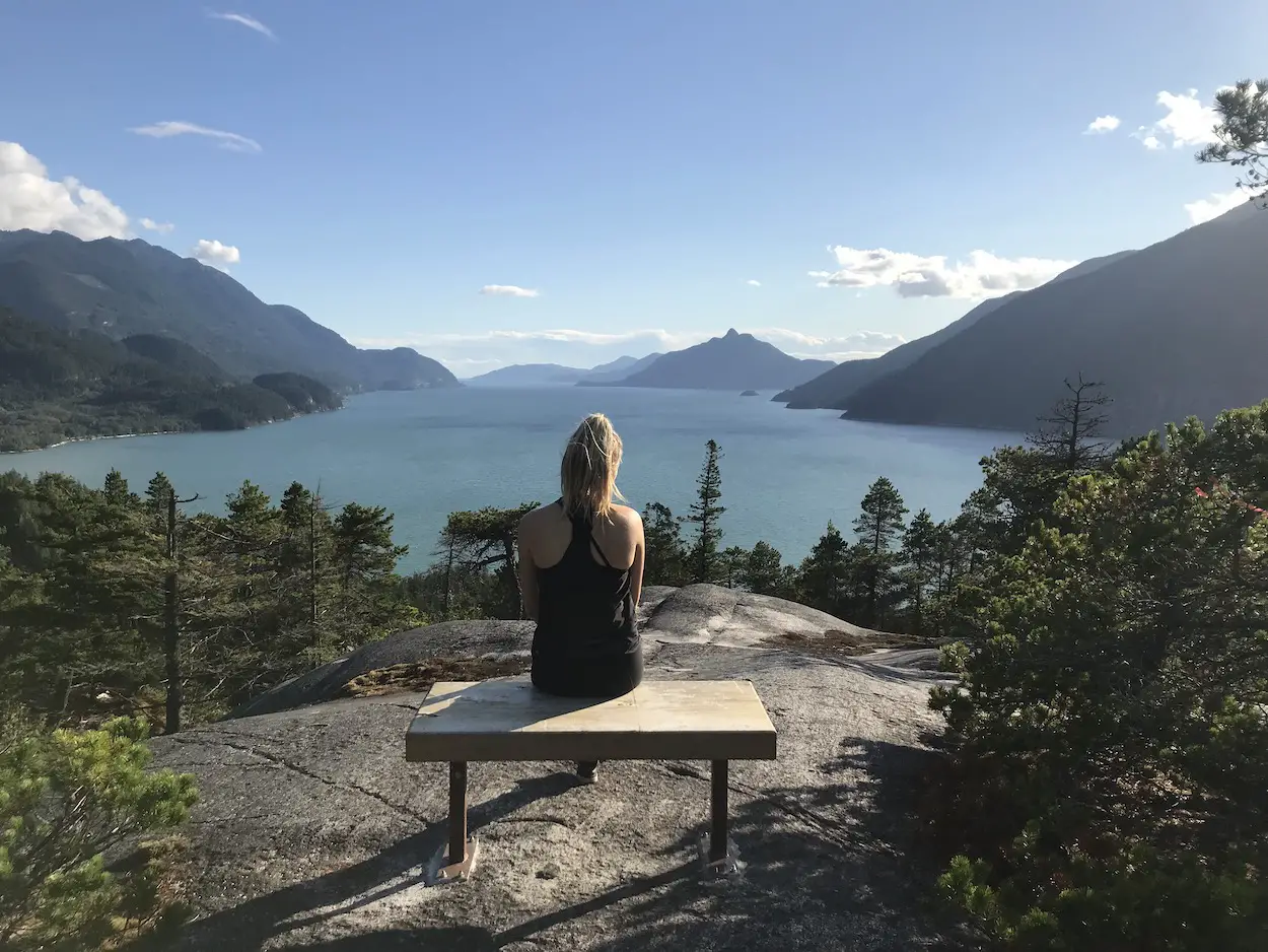
The Jurassic Ridge & Murrin Loop Trail
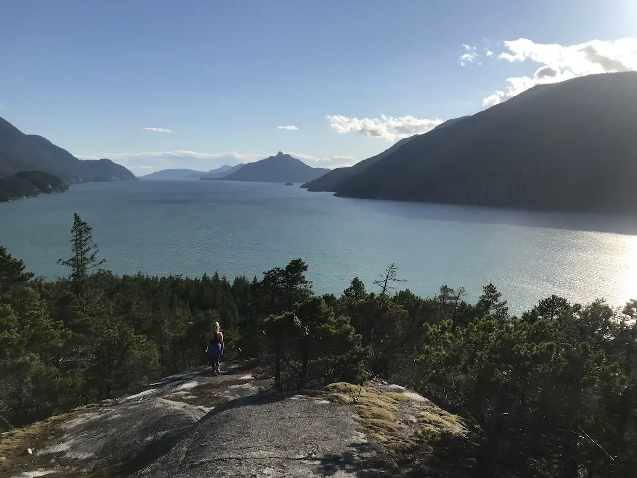
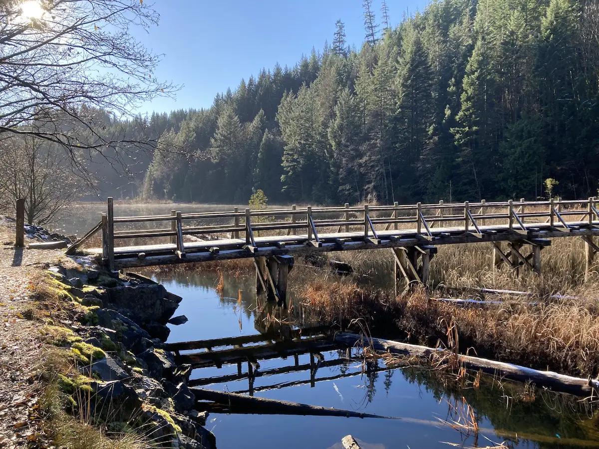
If you’re a Vancouver local who plays in the Sea to Sky area Murrin Provincial Park is likely on your radar, but, probably for all the wrong reasons. You may know Murrin park as that random little lake on Hwy 99 that seems so weirdly busy and where traffic always seems to stack up. However, the park is not only good for picnicking, swimming and fishing at Browning Lake. It is loaded with cool rock climbing routes and more importantly is home to a fantastic hiking loop.
The Jurassic Ridge and Murrin Park Loop trail is short and sweet. It rewards hikers with numerous unbeatable viewpoints of Howe sound. Hiking is probably the least popular activity in Murrin Park so you will likely have the ridge portion of the trail all to yourself. The trail itself is short, but there are some steep rock portions up/down the ridge including a few rope sections. It’s nothing overly challenging but the terrain makes this hike intermediate in difficulty. As always I would recommend you wear a pair of hiking boots. For those who want something easier you can bypass the ridge and continue on the Murrin Loop which has a fabulous view at Brian’s Lookout.
The Jurassic Ridge and Murrin Park Loop trail leads to multiple viewpoints, and in my opinion, some of the best benches, picnic areas and spots to take a photo in the Sea to Sky Corridor.
Quick Stats
| Distance (Round Trip) | 2.4km |
| Elevation Gain | 160m |
| Time (Round Trip) | 1-3 hours |
| Dogs | Yes - On Leash (Not allowed in Lake or on Beaches) |
| Camping | No |
| Season | Year Round |
| Difficulty | Moderate |
Directions
Murrin Park is located 9.5km south of Squamish along the Sea to Sky Highway (Hwy 99).
Trail Map
Click HERE for the Full Jurassic Ridge & Murrin Loop Hiking Guide
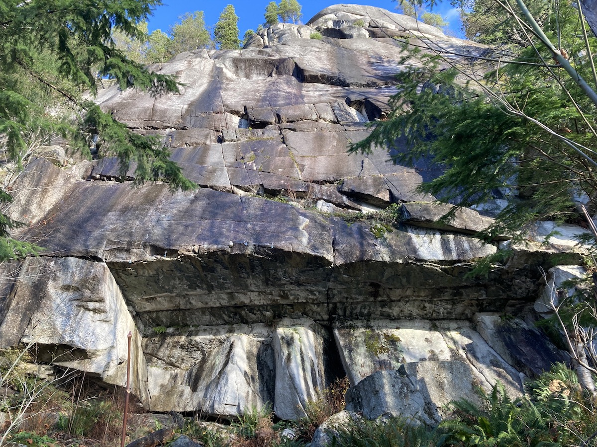
Smoke Bluffs
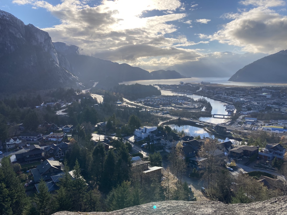
The Smoke Bluffs Park and trail network is an awesome spot to explore in the heart of Squamish, BC. The Viewpoint trail rewards hikers with an unbelievable birds-eye view of Squamish, Howe Sound and the Stawamus Chief. It requires minimal effort and depending how you decide to conquer it, a very small time commitment. The park is most popular among rock climbers who enjoy the plethora of varied climbing routes up the monstrous granite walls scattered throughout the park. Other than the great view, my favourite part of the hike was looking at all of the insane climbing routes and all of the people scrambling their way up the rock walls.
Quick Stats
| Distance (Round Trip) | 2km |
| Elevation Gain | 158m |
| Time (Round Trip) | 1-2 hours |
| Dogs | Yes |
| Camping | No |
| Season | Year Round |
| Difficulty | Easy |
| Remoteness | Well Trafficked |
| Highest Point | 157m |
Directions
Heading north on Hwy 99 take a right turn onto Loggers Lane. Follow Loggers Lane past the Squamish Adventure centre and take a right at the sign for Smoke Bluffs Park.
Trail Map
Click HERE for the Full Smoke Bluffs Viewpoint Trail Hiking Guide
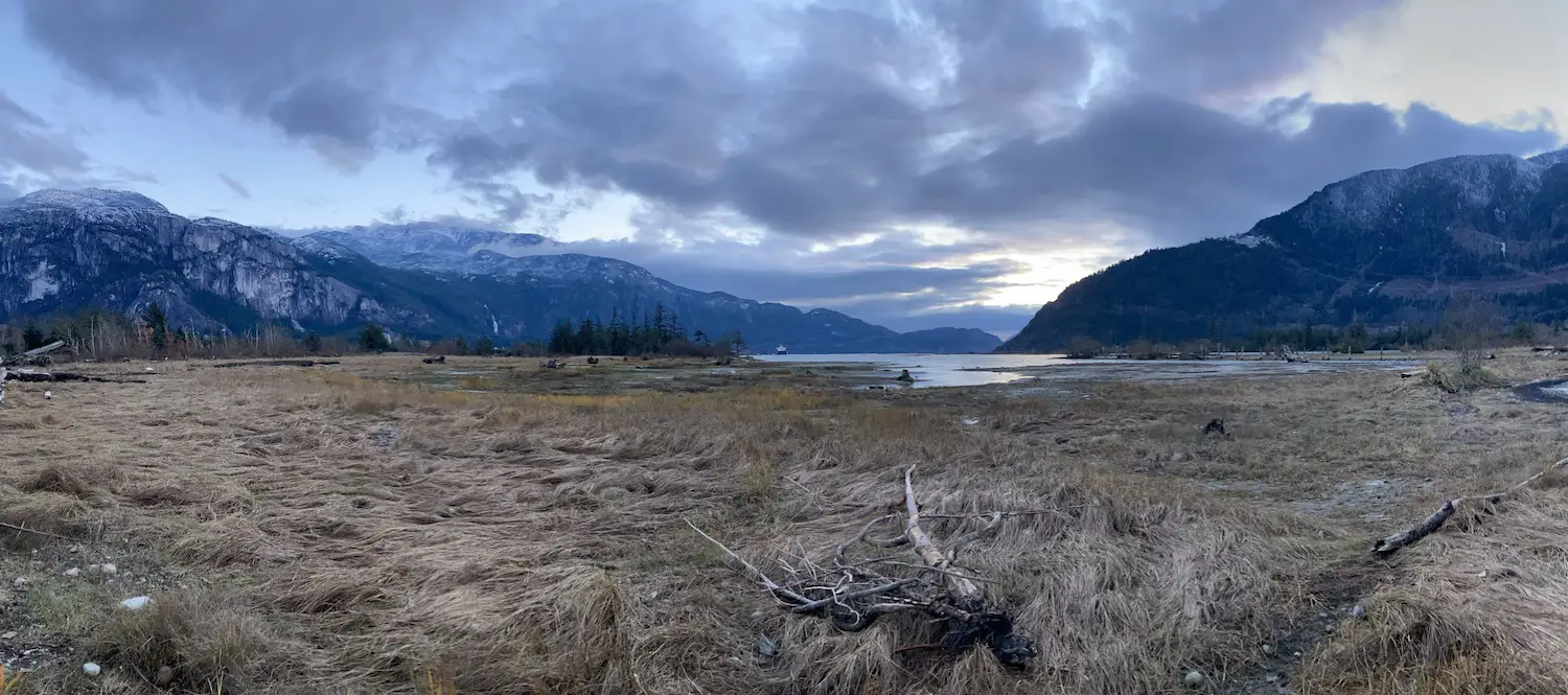
The Estuary Trail
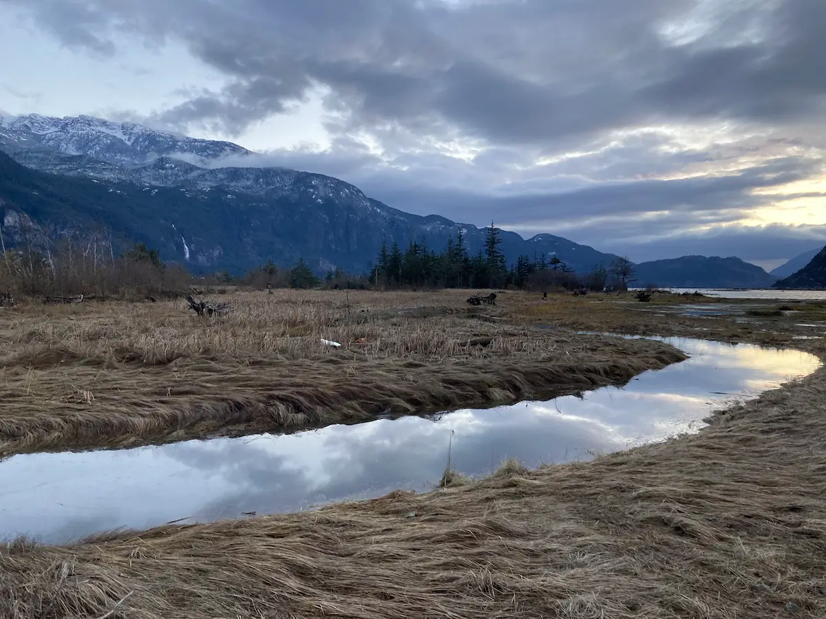
The Estuary Trail is an awesome 3km flat walking trail located right in the heart of Squamish BC. This one is more of a walk than a hike. It is super popular among local dog walkers, joggers, bird watchers and cyclists. Although Squamish itself is pretty much a nature preserve, this trail is an amazing walk that follows along the estuary in Howe Sound which connects to the Squamish River. It is home to more than 200 different species of birds. The walk exhibits fantastic views of the Stawamus Chief, Howe Sound, and Shannon Falls.
Quick Stats
| Distance (One Way) | 3km |
| Elevation Gain | 6m |
| Time (Round Trip) | 1 hour |
| Dogs | Yes |
| Camping | No |
| Season | Year Round |
| Difficulty | Easy |
| Remoteness | Urban |
| Highest Point | 10m |
Directions
Located in downtown Squamish BC. Park your vehicle on Second Avenue, Cleveland Avenue or Vancouver street and begin the walk on Cleveland Avenue just past Vancouver Street.
Trail Map
Happy Hiking!