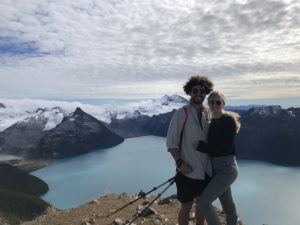
Nothing beats a day ski touring on the Duffey. Vantage Peak is absolutely breathtaking and provides access to world class pow skiing lines. On a sunny day, the Keiths Hut area is one of my absolute favourites to play in. This zone is like a portal to Alaska and is just a few hours from Vancouver. The Cerise creek area is best known for Keiths Hut, an awesome spot to hunker down for a night or two providing seamless early morning access to the Anniversary Glacier, Mount Matier, Joffre Peak and the surrounding areas. There once was a more defined trail but the area was absolutely gutted during a gigantic slide off Joffre peak in 2019. Honestly, it just adds to the adventure with its surface of the moon vibes. Please keep in mind that the route to the summit is complex involving route finding and constant travel through avalanche terrain. Only those with avalanche training and the proper gear should recreate in this area.
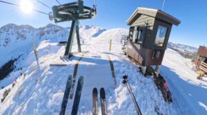
If you would like to watch the video version of this adventure you can find it HERE.
The Backcountry Basics
- Carry your Survival Kit & Essentials
- Let someone know where you’re going with a Trip Plan
- Know how to avoid negative wildlife encounters
- Practice Leave No Trace to keep the wilderness pristine
- Carry a Satellite Communicator like SPOT X
Table of Contents
The Breakdown
| Distance (Round Trip) | 18km |
| Elevation Gain | 1200m |
| Time Needed | 5-7 hours |
| Pets Allowed | Yes |
| Terrain Type | Alpine |
| Highest Point | 2235m |
| ATES | Complex |
| Remoteness | Moderately Trafficked |
Driving Directions
Vantage Peak is located in the one and only Duffy Lake Area. If you love ski touring and don’t know the Duffy, YOU SHOULD! It’s a magical zone Northeast of Pemberton and is home to world class powder stashes and ball busting big mountain lines.
Parking for the Cerise Creek drainage is located 66km or 1 hour North of Whistler on the BC-99 N. Continue 4km past the Salt Shed parking area until you see a safe pull-off on the right side of the road. There should be a reasonably walked trail close to the road with a log crossing over the creek.
BC’s highways can get pretty gnarly in winter. In my opinion, the gnarlier the better, that means the powder is falling! However, you’re going to want to travel in a vehicle that is reliable and equipped with top of the line winter tires and safety gear. If you don’t own a vehicle or are visiting from out of town FarOut Wilderness offers some of the best 4×4 vehicle rentals in BC that are equipped to drive absolutely anywhere. They’ve got winter tires, chains, GPS communicators and ski/board racks. Check out their website and use code RISE5 to get 5% off your 4×4 vehicle booking.
Additional Safety Considerations For Ski Touring/Splitboarding
If you’re planning on doing some backcountry skiing or hiking, please make sure you leave prepared. You must carry avalanche gear, have the proper training and constantly be assessing snow. Always carry a compass and a GPS device like a Spot X and know how to use it. I personally always like carrying a hardcopy map. The two best maps for the area are “The Duffey Lake 1:50 000 by Joh Baldwin” or the “Exploring the Coast Mountains on Skis: A Guide to Ski Mountaineering” by John Baldwin. Johnny B is always clutching up for boys in the backcountry. Ninety nine percent of the time I use my cell phone as my navigation tool, but you don’t ever want to rely on an iPhone or Android that is notorious for shutting off in the cold. Remember to always check the weather forecast and Avalanche Canada’s South Coast Inland area before embarking.
The Route
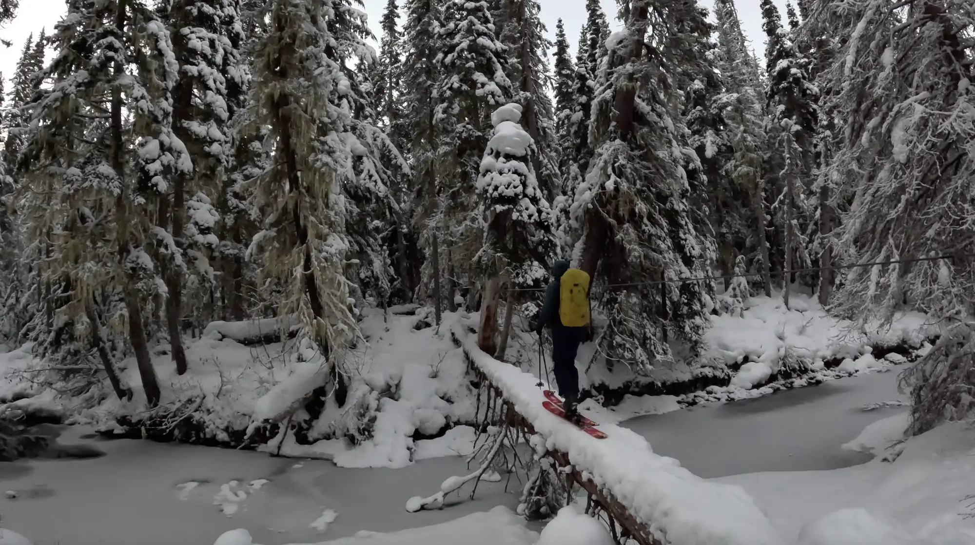
The adventure begins steps away from your vehicle with a legendary ‘ski circus’ balance beam. This log crossing is pretty darn sketchy especially earlier in the season. One false move and you’ll end up in the coldest bath of your life.
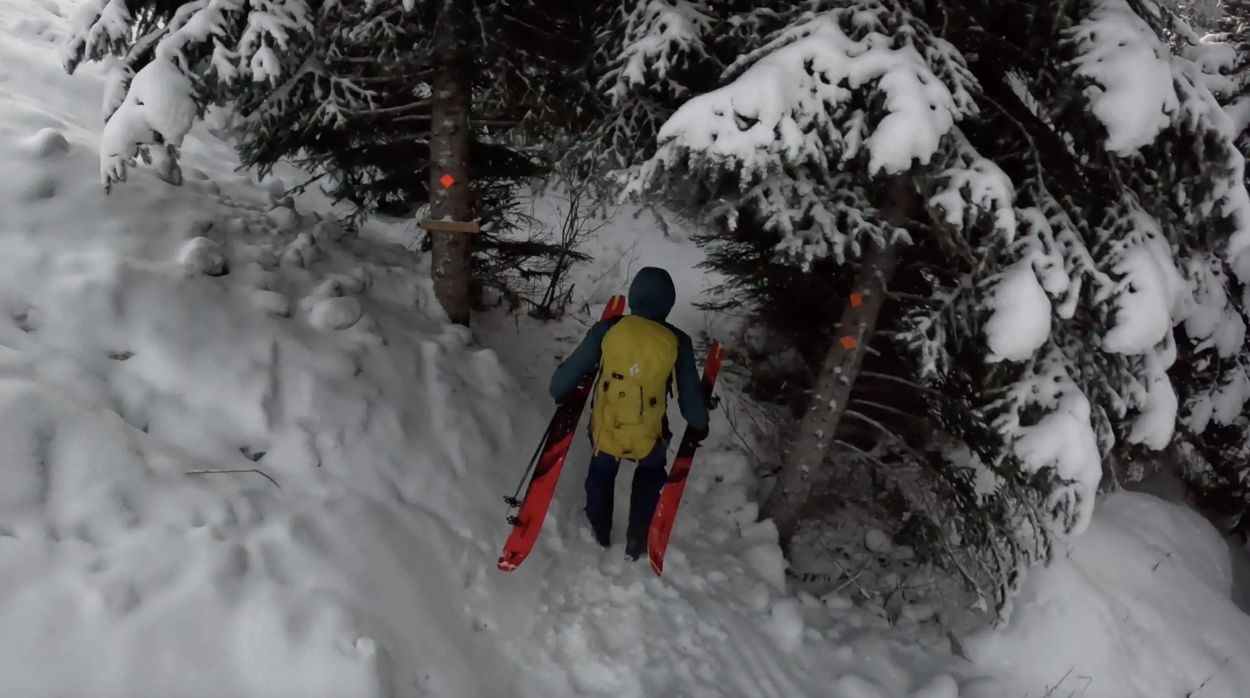
I found it best to cross with my skis horizontal across the log using small side steps and holding the steel wire for stabilization.
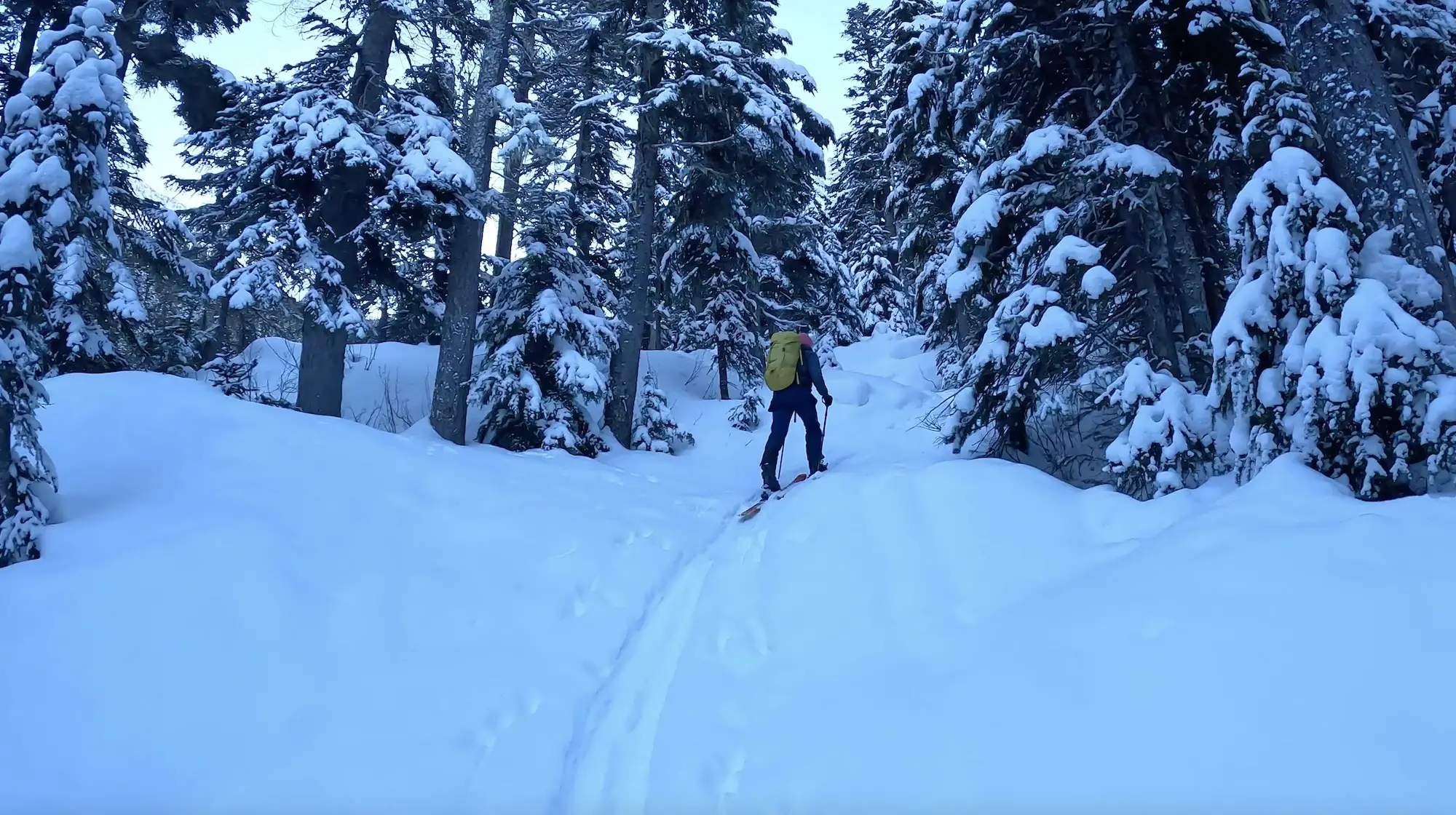
Once you cross the river you are going to connect with the summer trail through the forest. Follow along the trail heading uphill to the right to avoid skinning along the creek which can be difficult depending on the snow pack. You’ll connect with a an old logging road and you will follow it until you reach the slide debris.
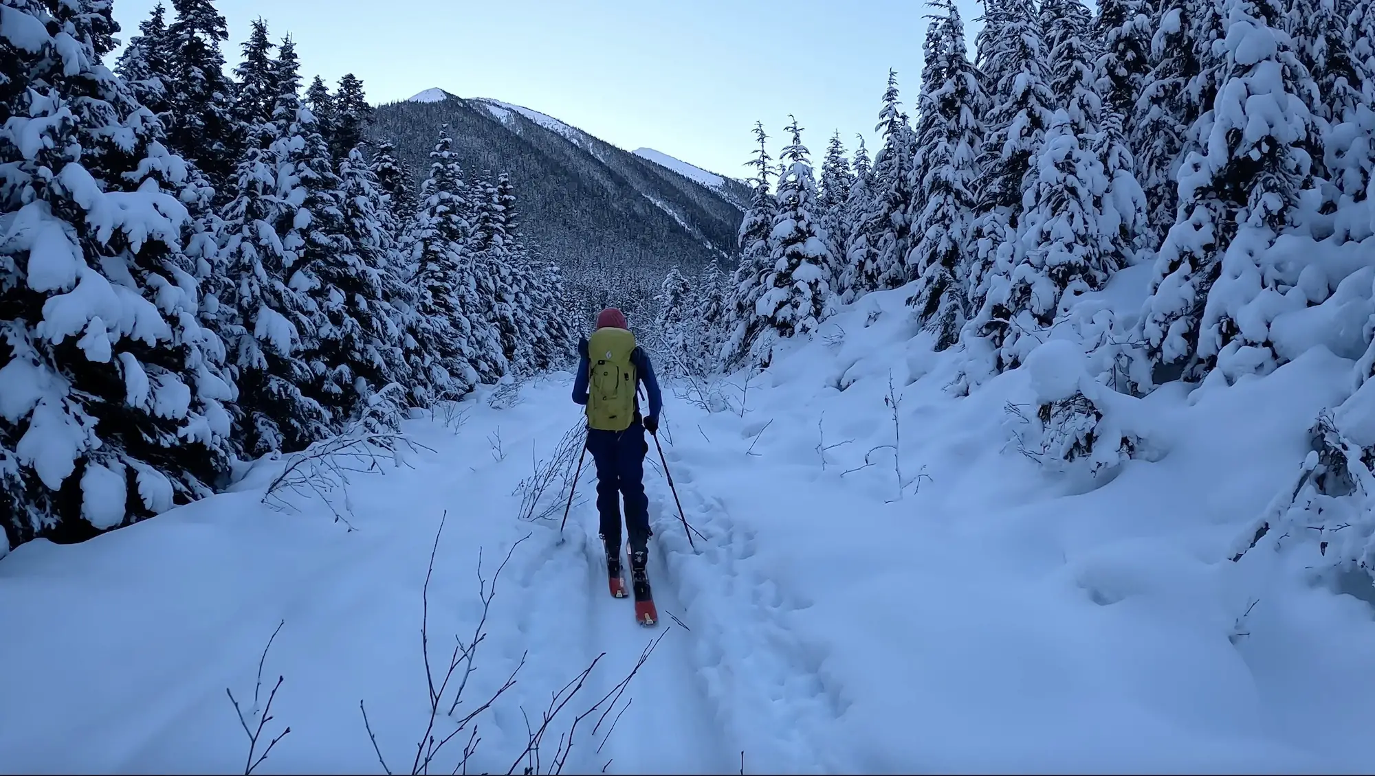
It’s mind boggling how powerful the 2019 slide was. It honestly looks like the entire valley was clear cut. There is no rhyme nor reason to walking through the slide debris. We followed a decently travelled skin track which ended up being super efficient.
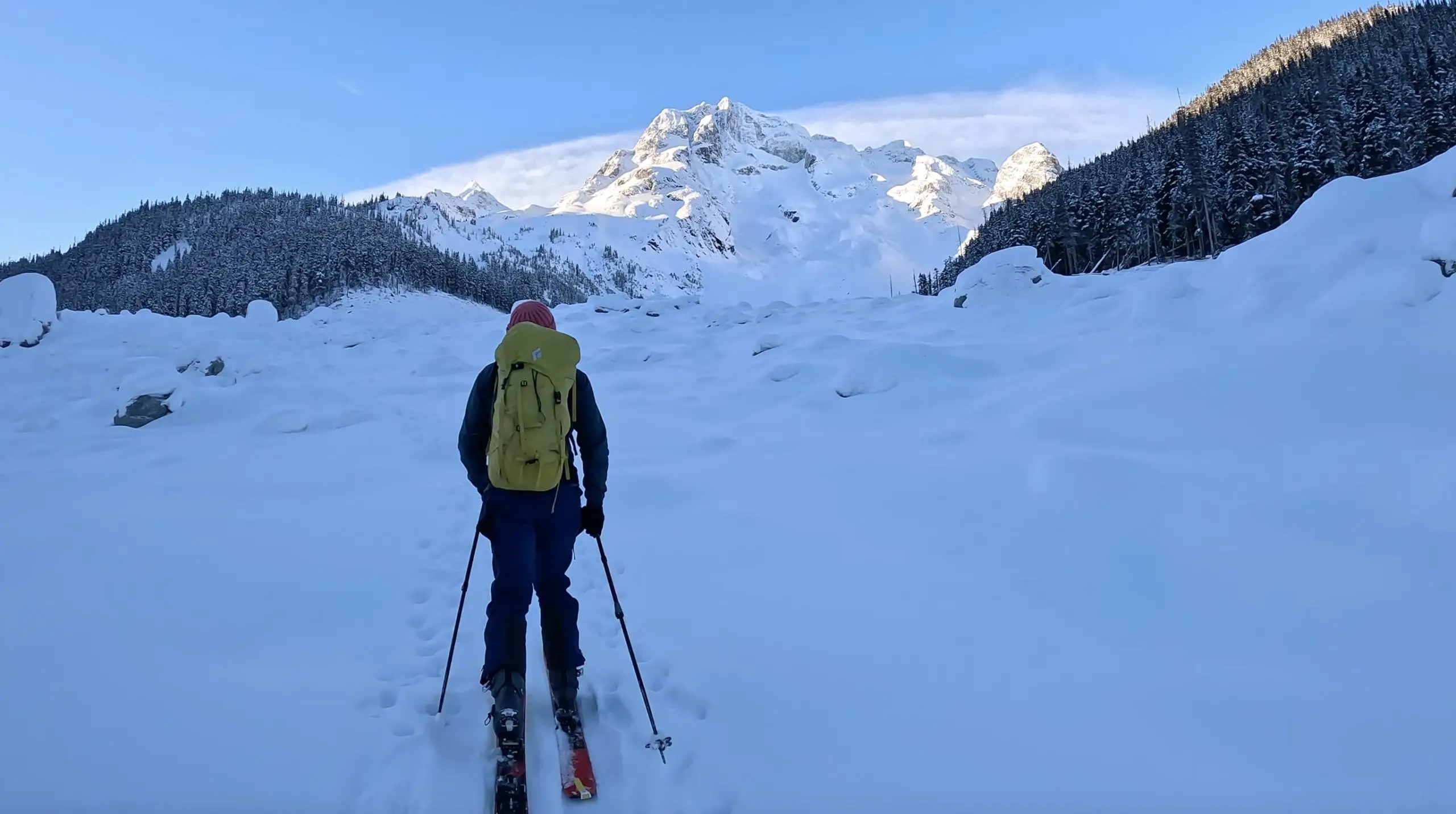
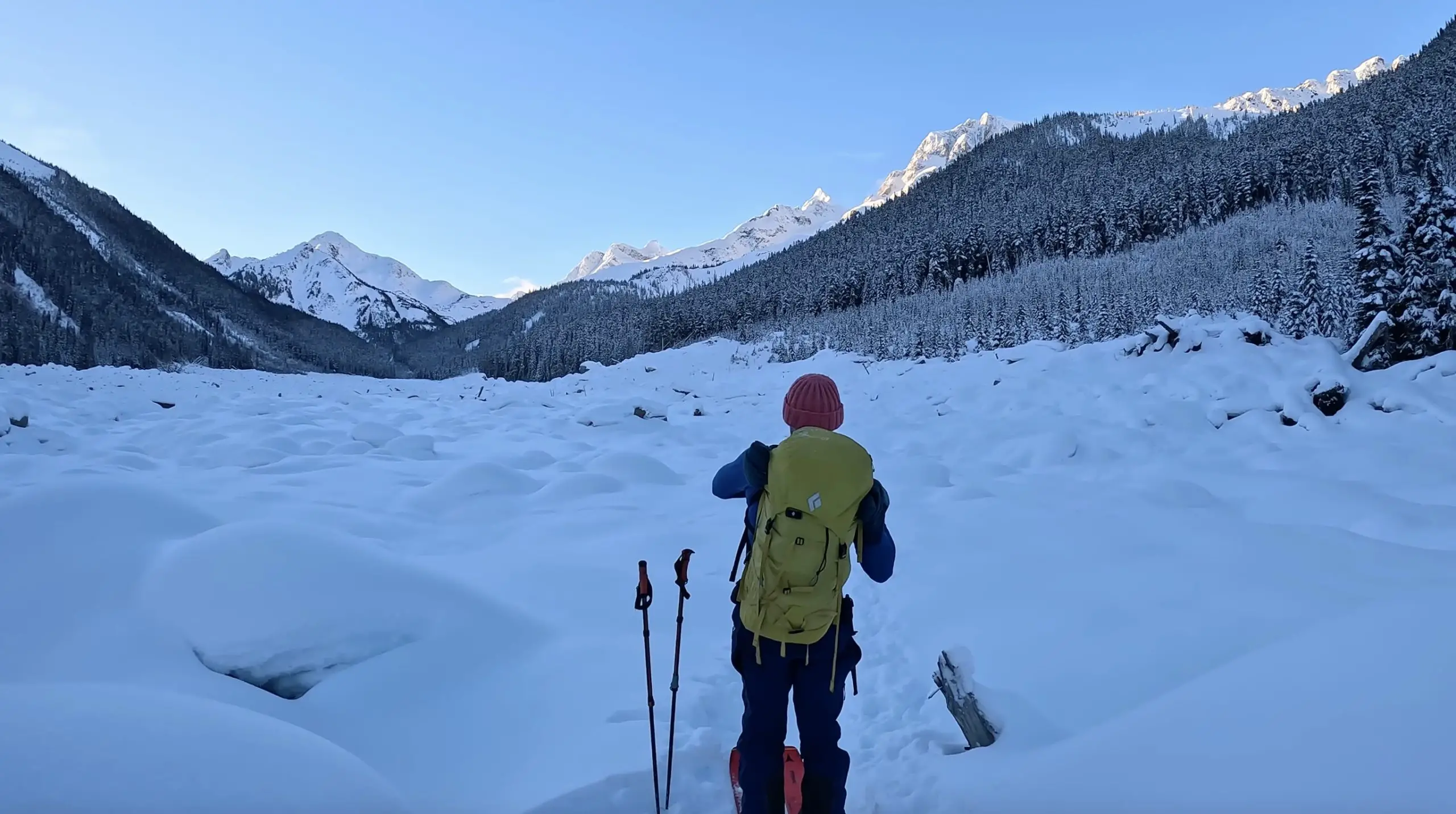
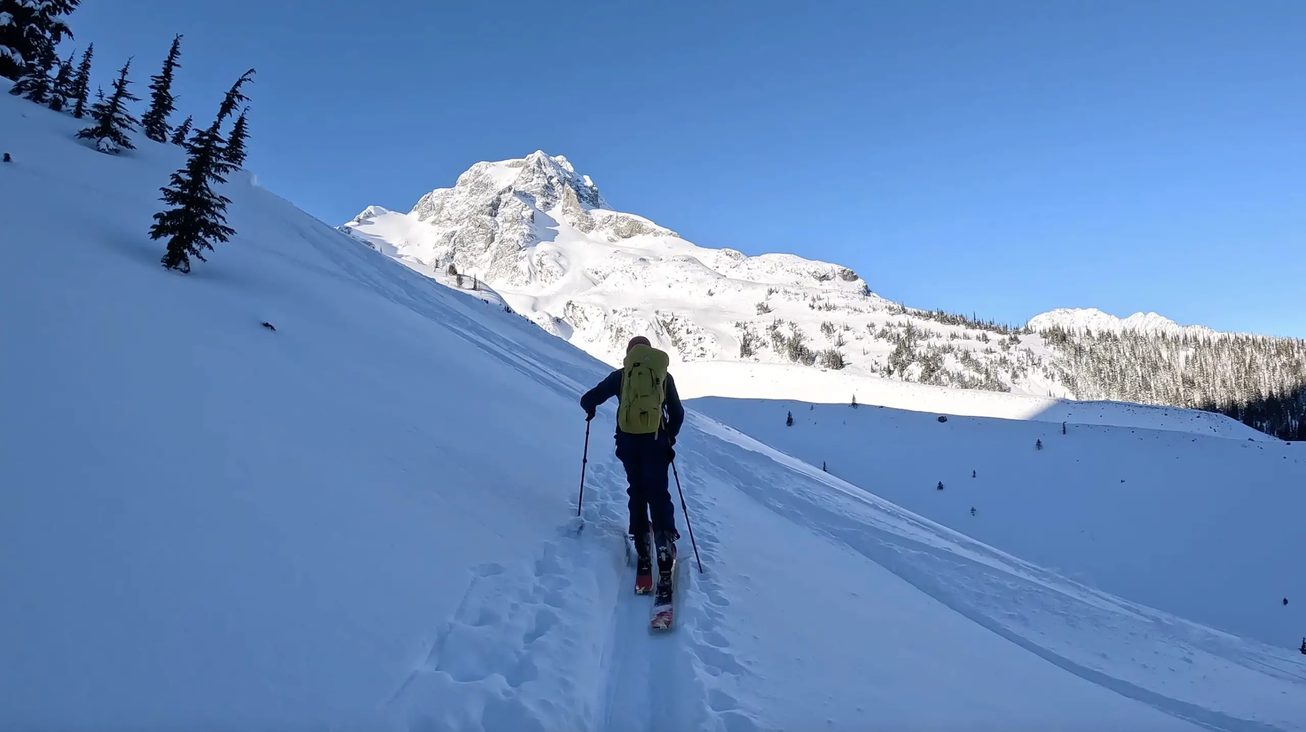
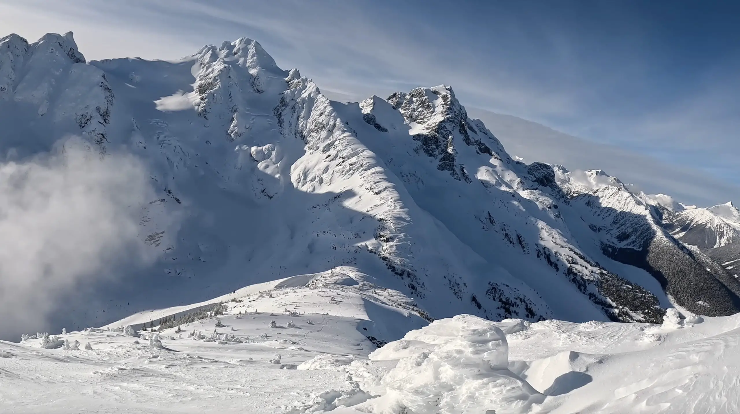
Once you cross the slide path you’ll encounter a hill and trees. Get ready to begin gaining some elevation. You can follow the summer trail markers here or choose your own skin track. Once you reach the moraine the trail splits off. Right will take you up towards the hut and left (south) takes you towards Vantage Peak.
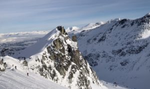
As you exit the foliage you’l have wonderful views of Joffre Peak to your right and will be able to see the ridge and summit of Vantage to the south. Typically skiers and climbers will continue to traverse the moraine until you arrive at the col of the ridge. Given the conditions for the day, Rob and I decided to approach the ridge differently and skinned across the valley, sticking to the trees to avoid the traverse across the large open face before the col.
Remember to always use your own judgement and training, assess snow as you move and decide as a group unit the best ways to proceed.
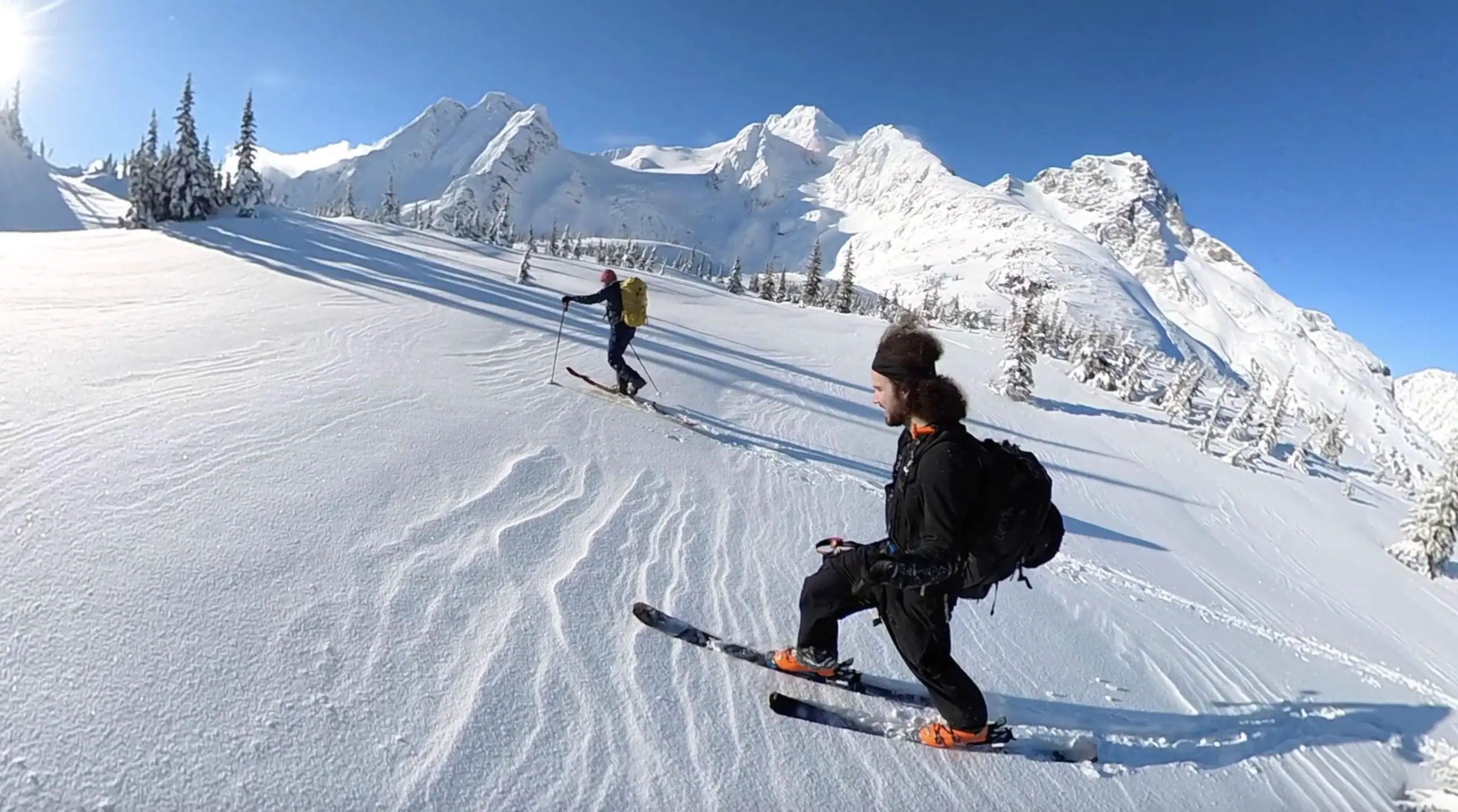
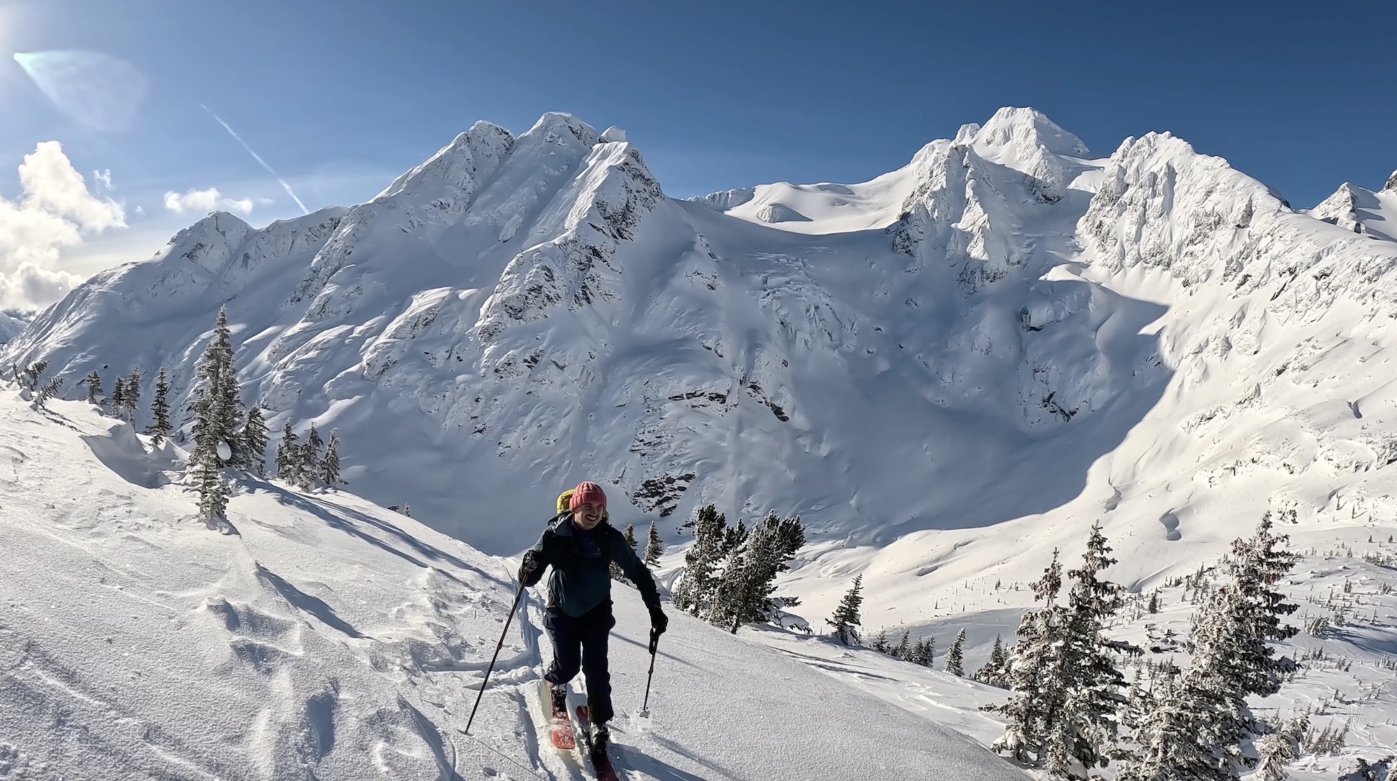
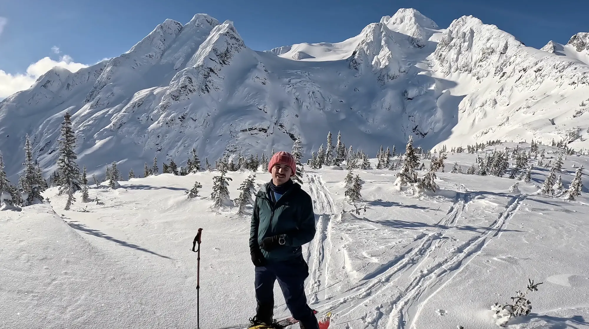
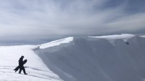
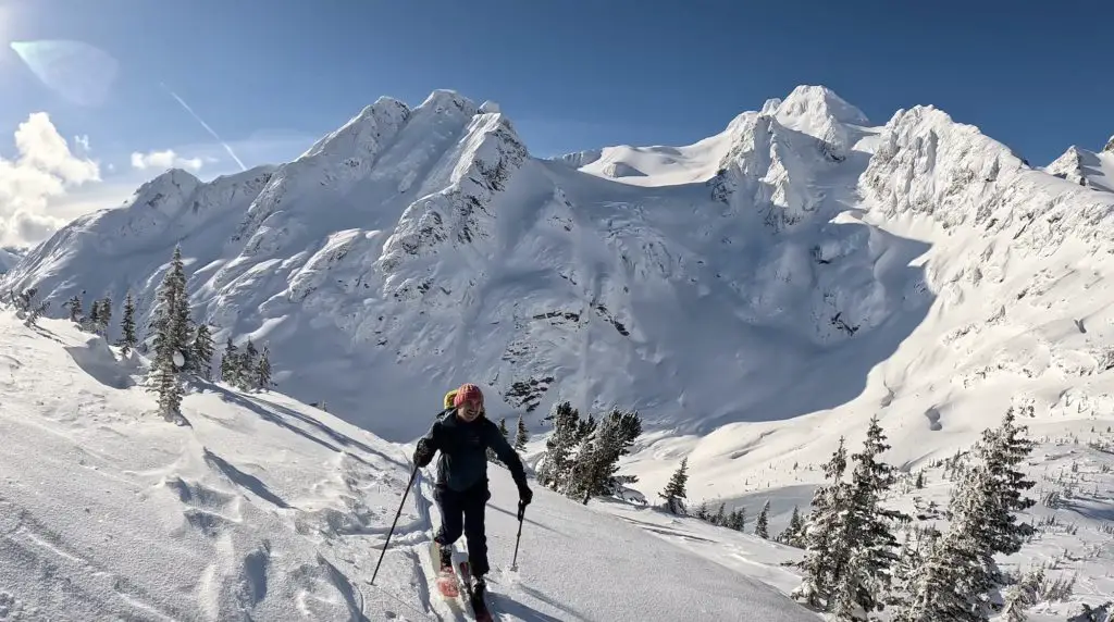
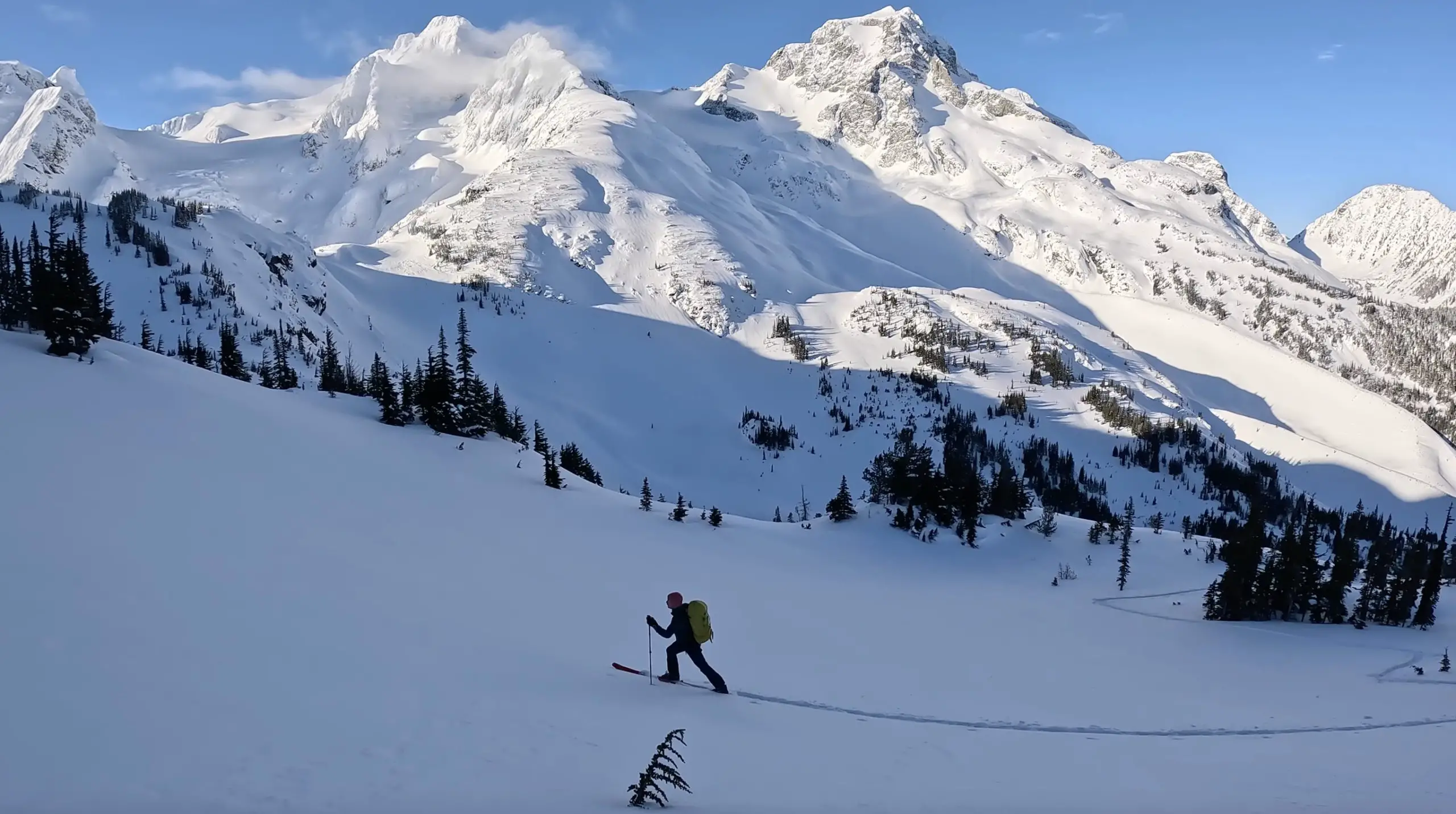
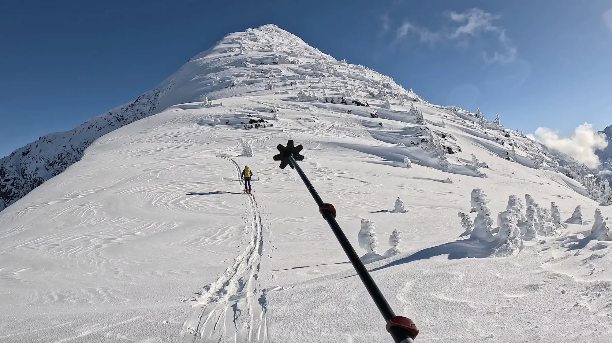
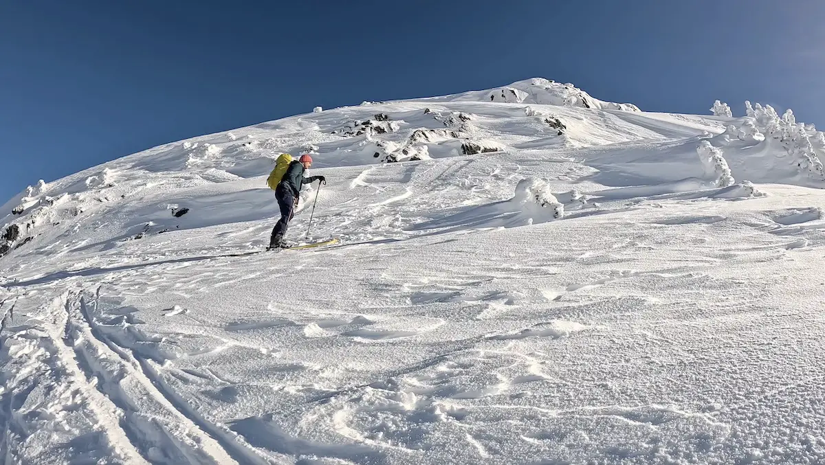
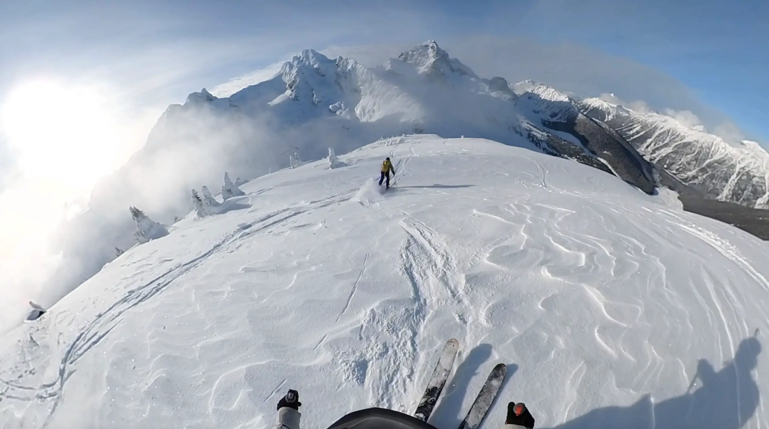
Once you’re on the ridge the skinning will become increasingly trickier. Make sure to stop for a water break so you can enjoy views behind. Although a tad technical, most skiers can comfortably skin up the majority of the ridge. Always keep a wide berth from the cornices on either side.
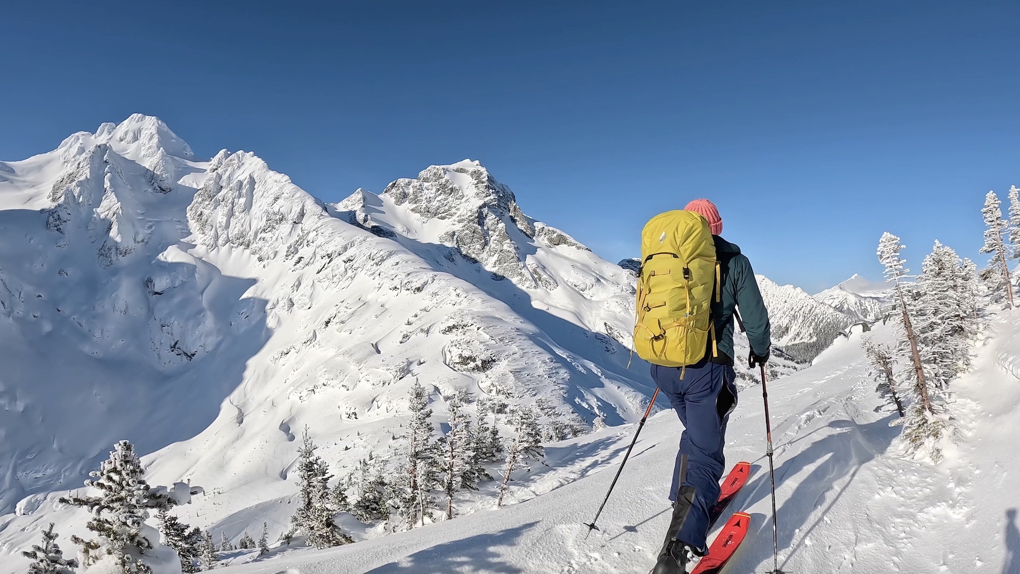
About 3/4 of the way up you’ll have to ditch your skis and begin to boot-pack. The cornices are huge on either side of the summits ridge and I couldn’t stomach walking along the top. I decided to call it quits just before the summit and have a snack before skiing down. Call me a wimp, but I’m more focused on the skiing than peak bagging. (Rob went back the following weekend and bagged the summit).
There are a number of options for the ski down. Make sure to scope out which route looks best for your group on the way up. We decided to ski the face about halfway down the ridge, because this was the only visible way to get around the cornice from our vantage point (no pun intended).
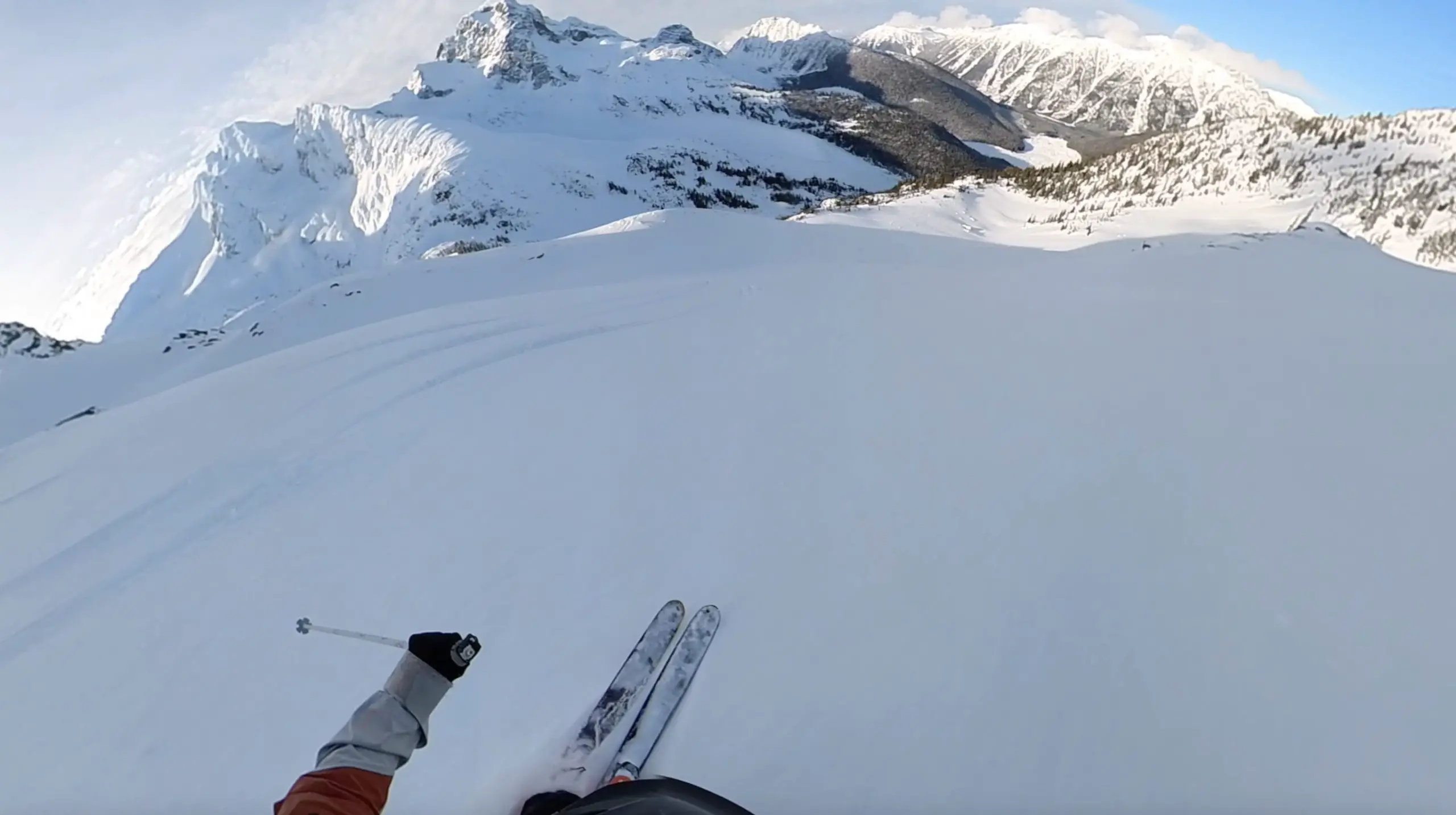
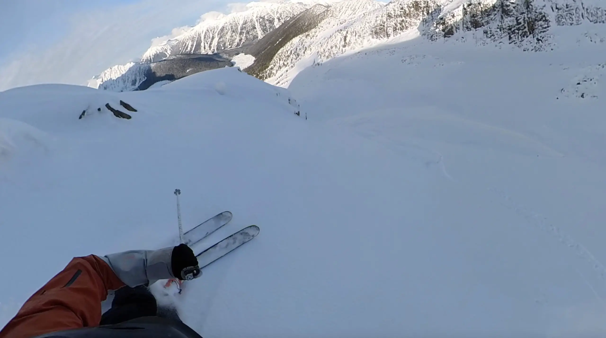
The turns down were something out of a story book and we linked up an awesome tree lines stacking face shots all the way to the valley’s bottom.
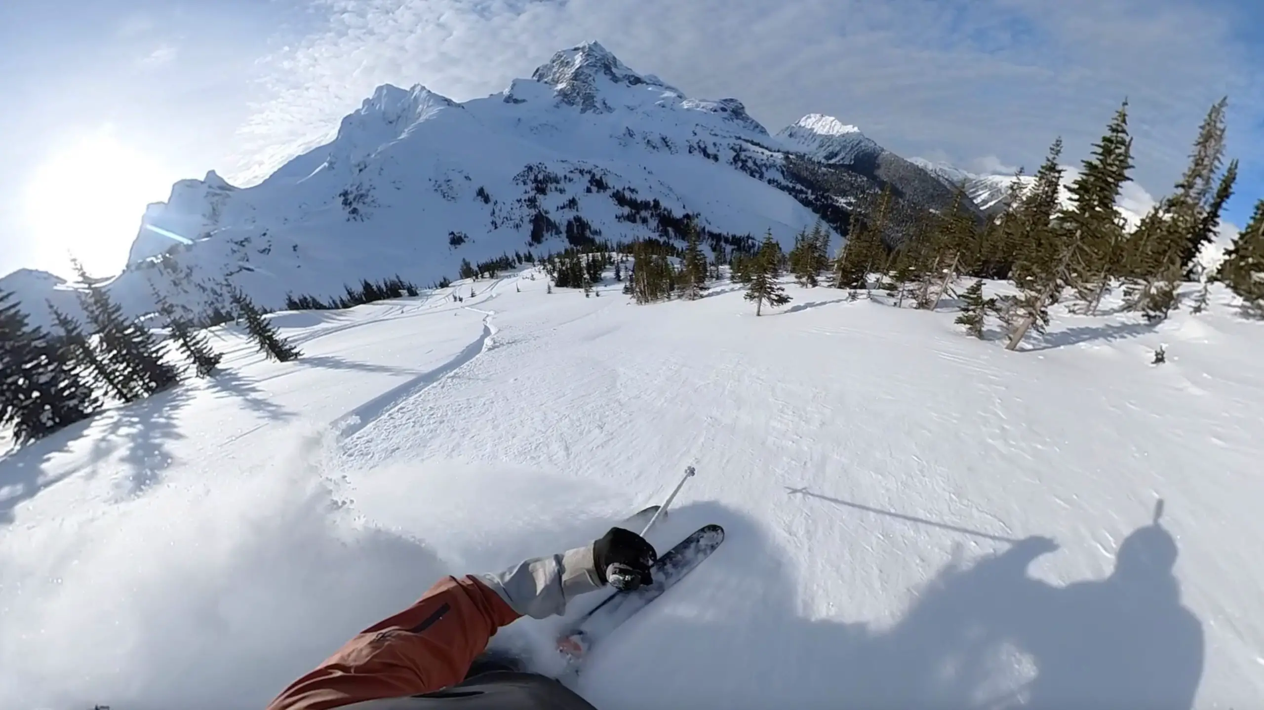
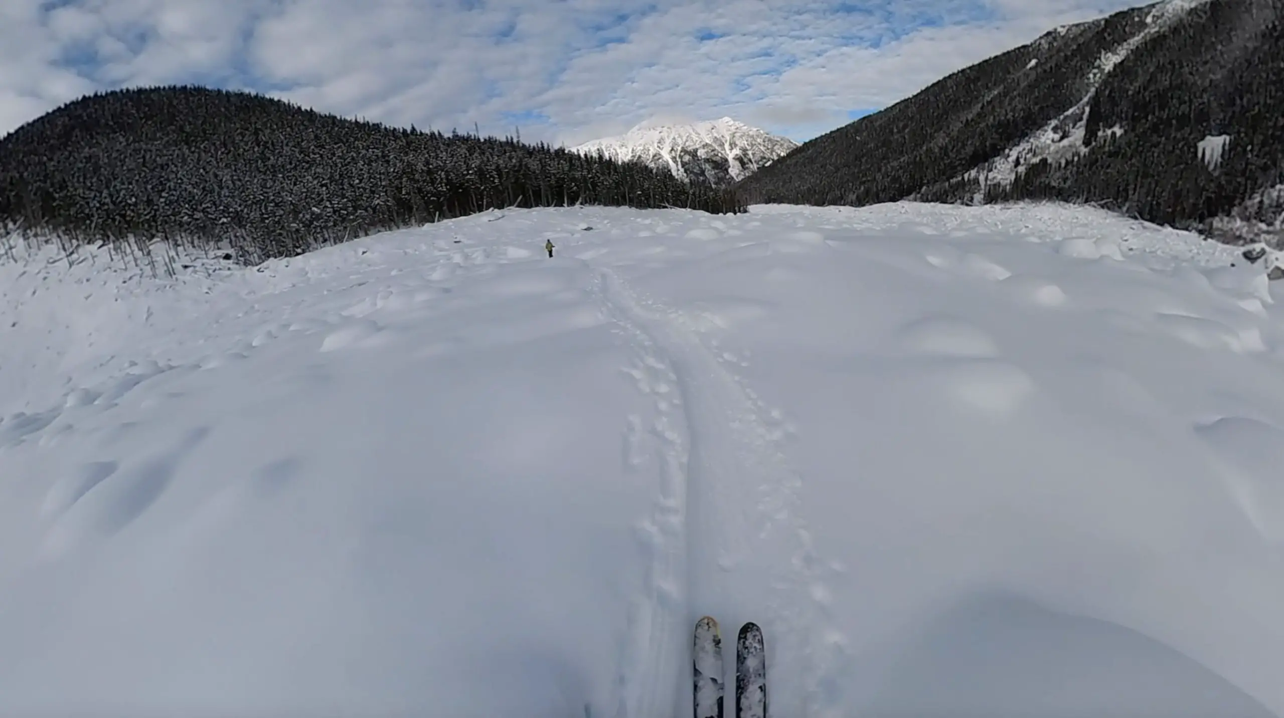
On the way out we didn’t put skins on but did our fair share of scooching and skating through the valley. The lower portion of the trial was a skating rink littered with roots and rocks leaving our thighs begging for mercy.
Try and save a little bit of energy for the final log crossing to your vehicle.

Let me know if you have any questions in the comments.
Have fun, be safe and keep on shredding’
If you would like to watch the video version of this adventure you can find it HERE.