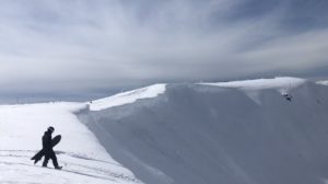

Anyone who resides or has visited the lower mainland has likely ascended or heard talk of North Vancouver’s natural stair climber, ‘The Grouse Grind’. The Grind is a fantastic spot to bang out an amazing workout and be rewarded with a wonderful view. But the overall journey isn’t much of an adventure, it is rather dull and grueling.
Hiding in the dense forest, a close hike nearby the base of the grouse mountain ski hill lies the crash site and remains of a US air force F-85 Sabre Jet, the old grouse mountain ‘Village’, countless abandoned cabins, artifacts, and what is left of the old ‘Skyline Chairlift’. Hiking the Skyline trail and the surrounding network offer an amazing, more remote feeling adventure acting like a time machine taking you back into the early days of Grouse mountain and ski culture in North Vancouver.
Remember the Backcountry Basics
- Carry your Survival Kit & Essentials
- Let someone know where you’re going with a Trip Plan
- Know how to avoid negative wildlife encounters
- Practice Leave No Trace to keep the wilderness pristine
Table of Contents
The Breakdown
| Distance (Out and Back) | 6km |
| Elevation Gain (To Grouse Chalet) | 800m |
| Time (Round Trip) | 3 Hours |
| Dogs | Allowed on Trail Forbidden on Grouse Mountain Property |
| Camping | No |
| Season | Year Round (Spikes in Winter) |
| Difficulty | Moderate |
The Route
There are many trail options leading to the peak of Grouse. Some well-known named options include the BCMC, OBCMC, Larson, LGMH, Mackay Creek, Old Mountain Road. and of course, the Skyline trail.
People hike the Skyline trail in many different fashions. You can hike it as an out and back trail or use it as part of your ascent or descent from Grouse mountain enabling you to create hiking loops with the variety of nearby terrain.
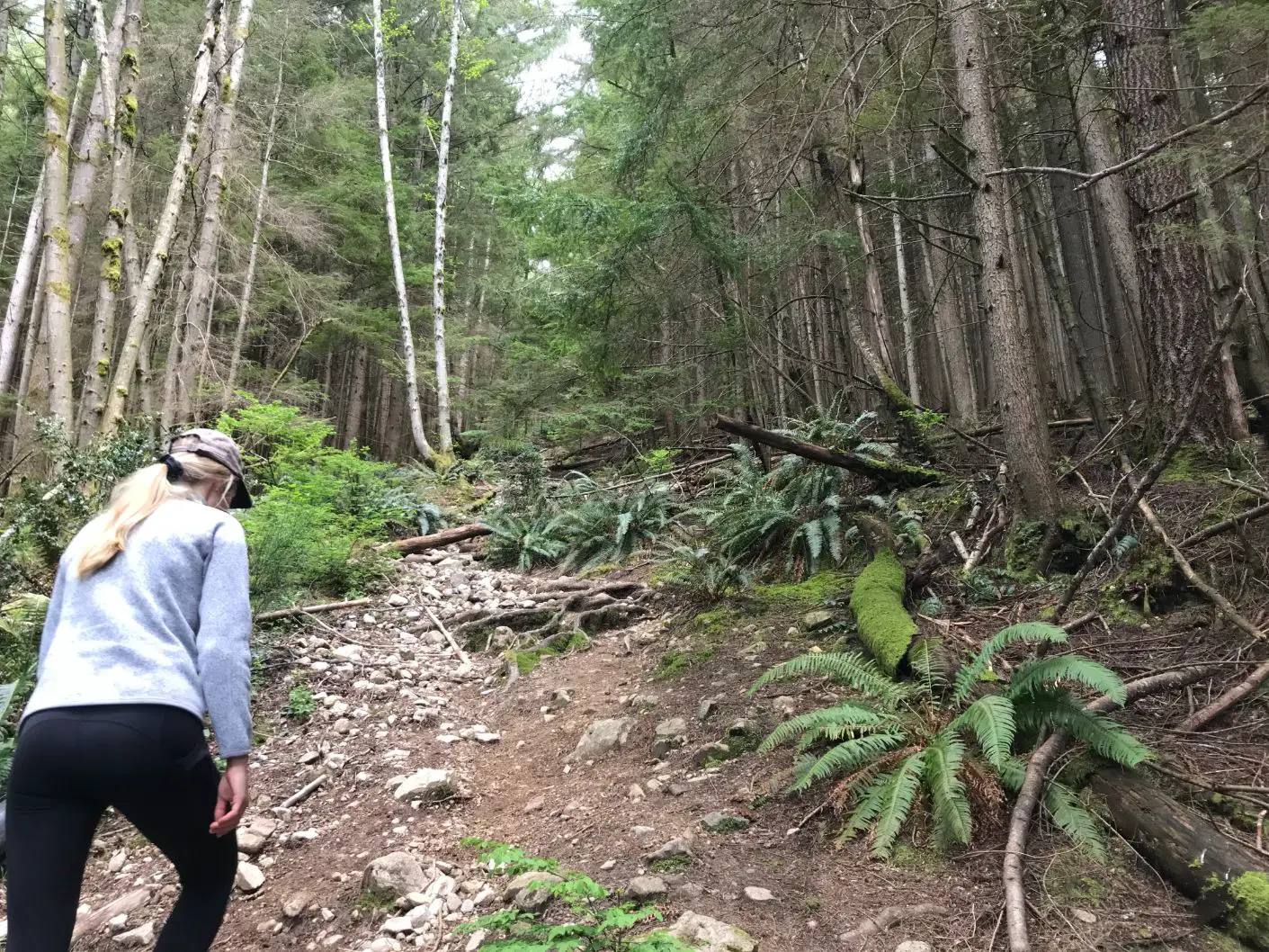
The Skyline trail is accessed from the top of Skyline Drive in North Vancouver. Parking is available below the gates at the top of the road. To begin walk past the red gates and continue up the cement roadway. Take the cement walkway to your right and continue uphill. You will see a little storage hut and the driveway to someone’s residence at the top. You will come across a fork, continue straight up the unnamed trail in front of you, the Baden Powell will be to your right. You will reach a gravel road and the old parking lot to your left, continue upwards until you come across the skyline trailhead marker.

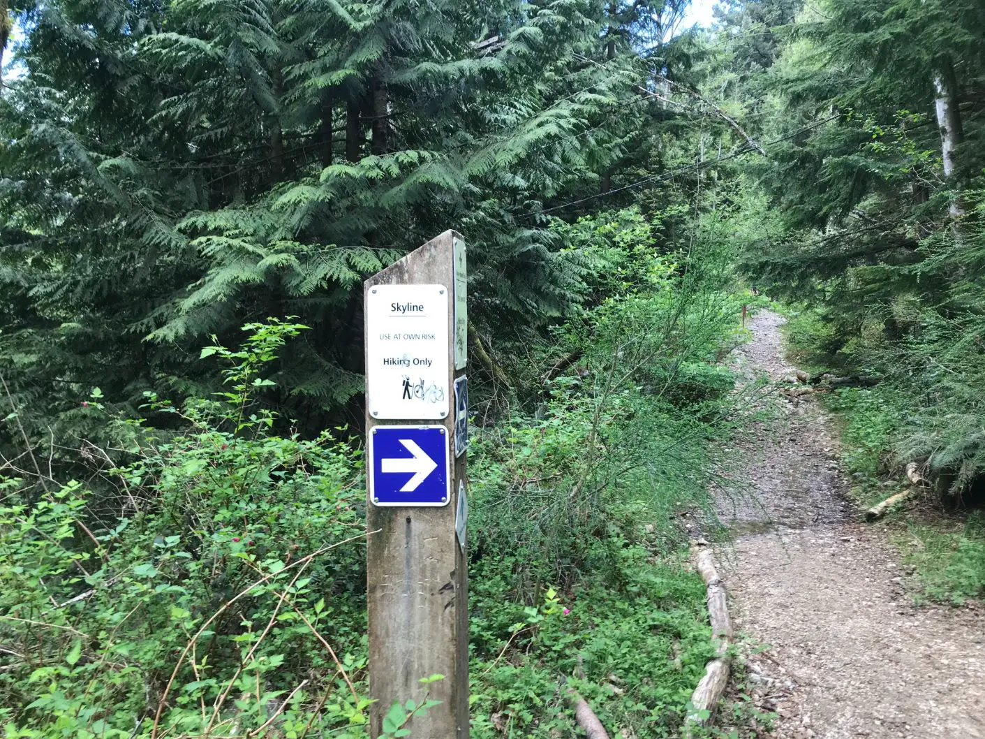
The Skyline trail is not too different than the grouse ground, it is relentless and climbs straight up from Skyline drive to the base of the Cut ski trail. The trail feels like you are climbing up an old stream bed filled with many loose rocks. Be sure to wear hikers and take strong steps.
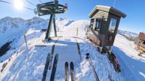
The Village Chair
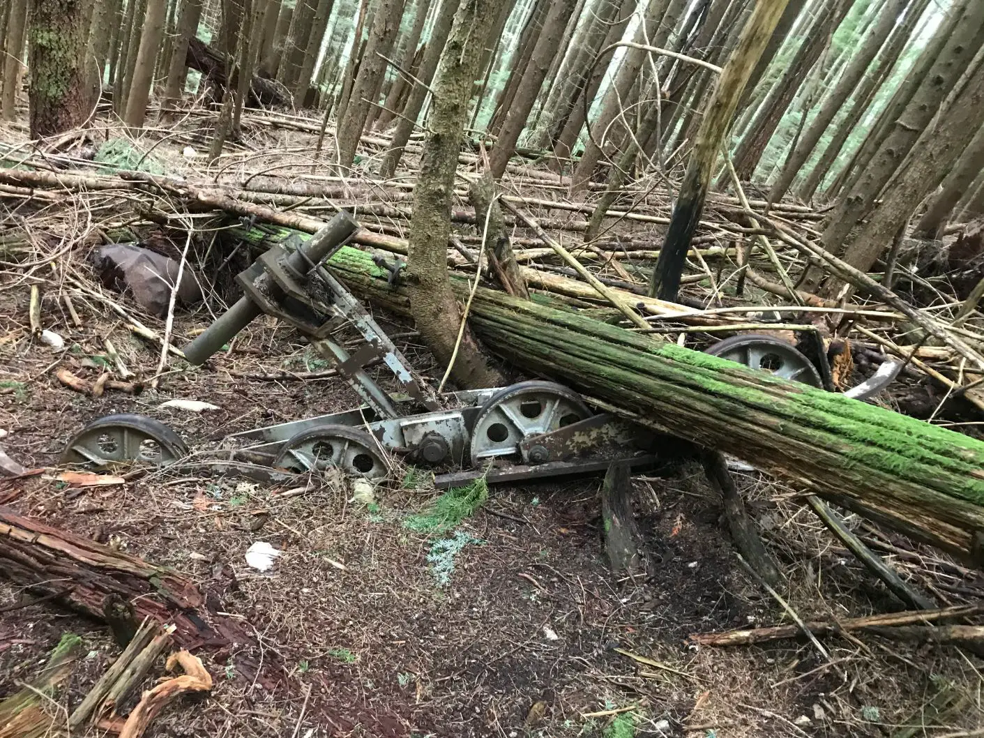
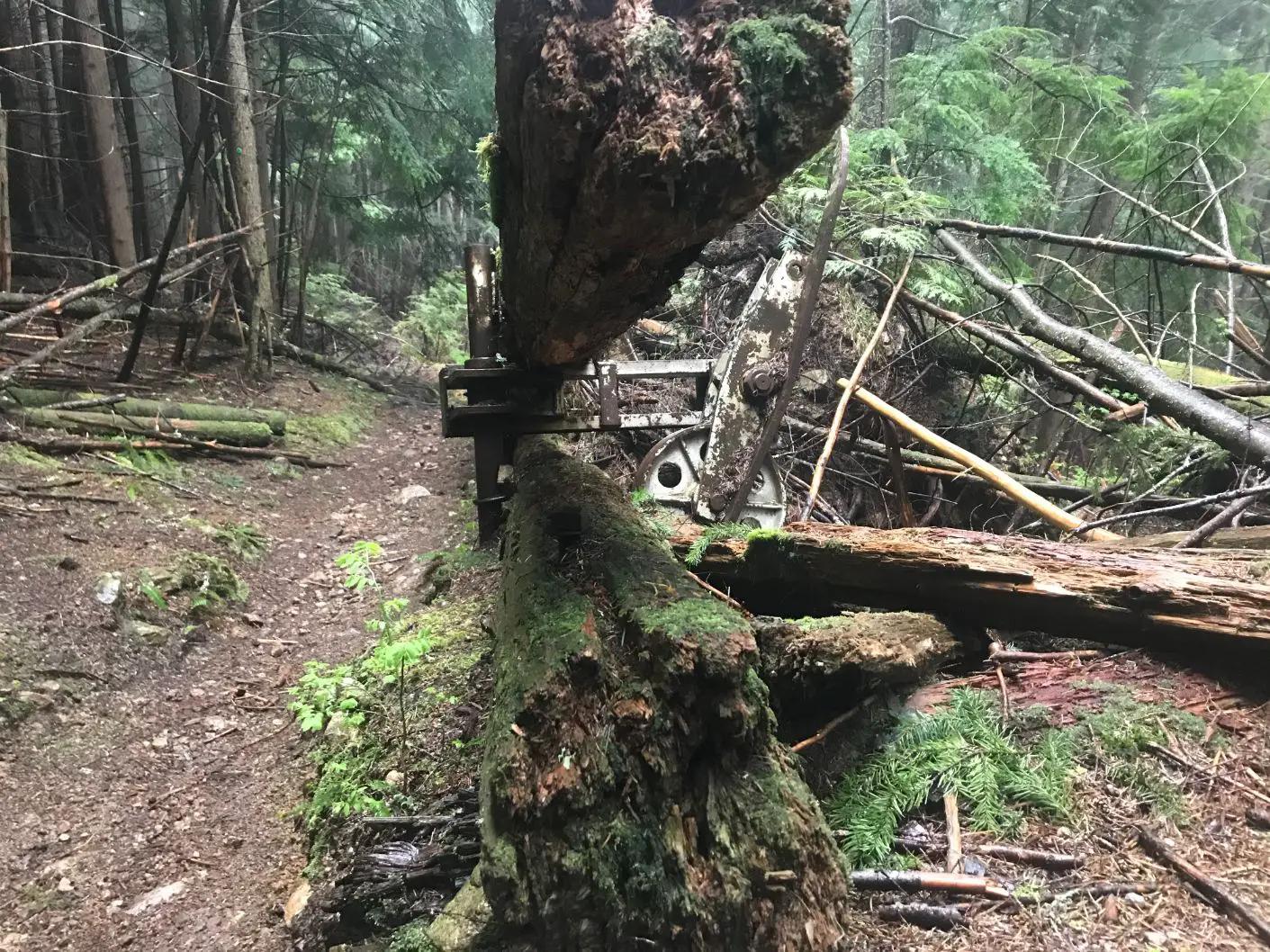
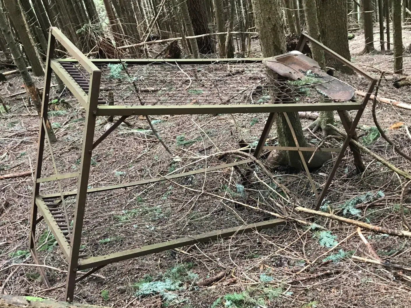
The trail follows the path of the old double chairlift (The village chair) that used to carry skiers and sightseers from Skyline drive to the bottom of the “Cut Ski run” or what was known then as ‘The Village’. Grouse claimed this was the first double chairlift in the world and attracted tourists from every continent opening to the public on December 1, 1949. However, double chairlifts had already been erected at Hollyburn Mountain and Red Mountain resort in BC prior. As you are hiking up the skyline trail you will see components of the fallen chairlift structure and wheels scattered along and beside the path. The double chairlift was supported by large wooden beams that looked like telephone poles, and apparently for some time the chairs had a metal roof to protect riders from snow and rain on the way up. I did not see any of the old chairs in the area, people likely collected them over time once the lift was decommissioned.
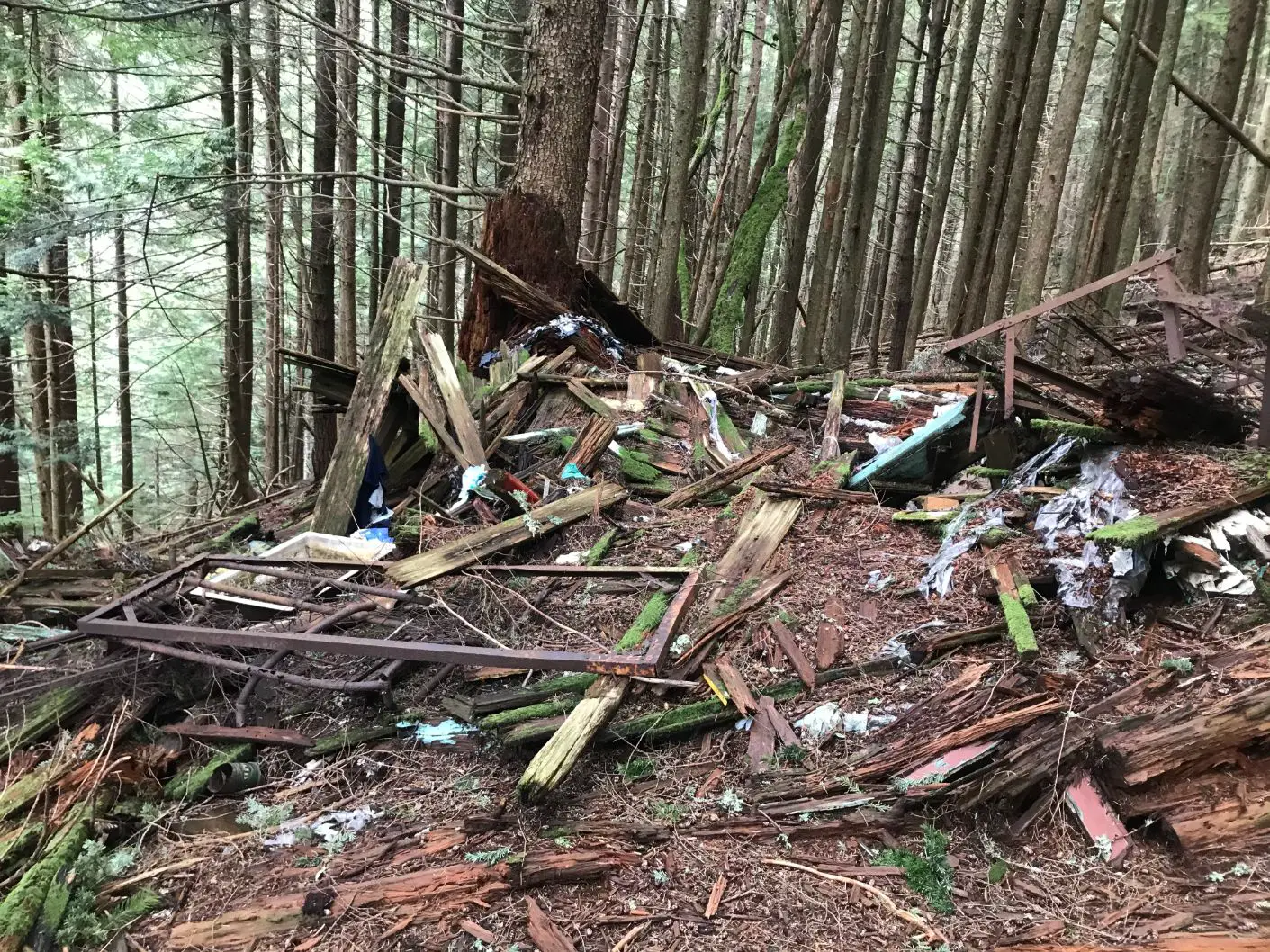
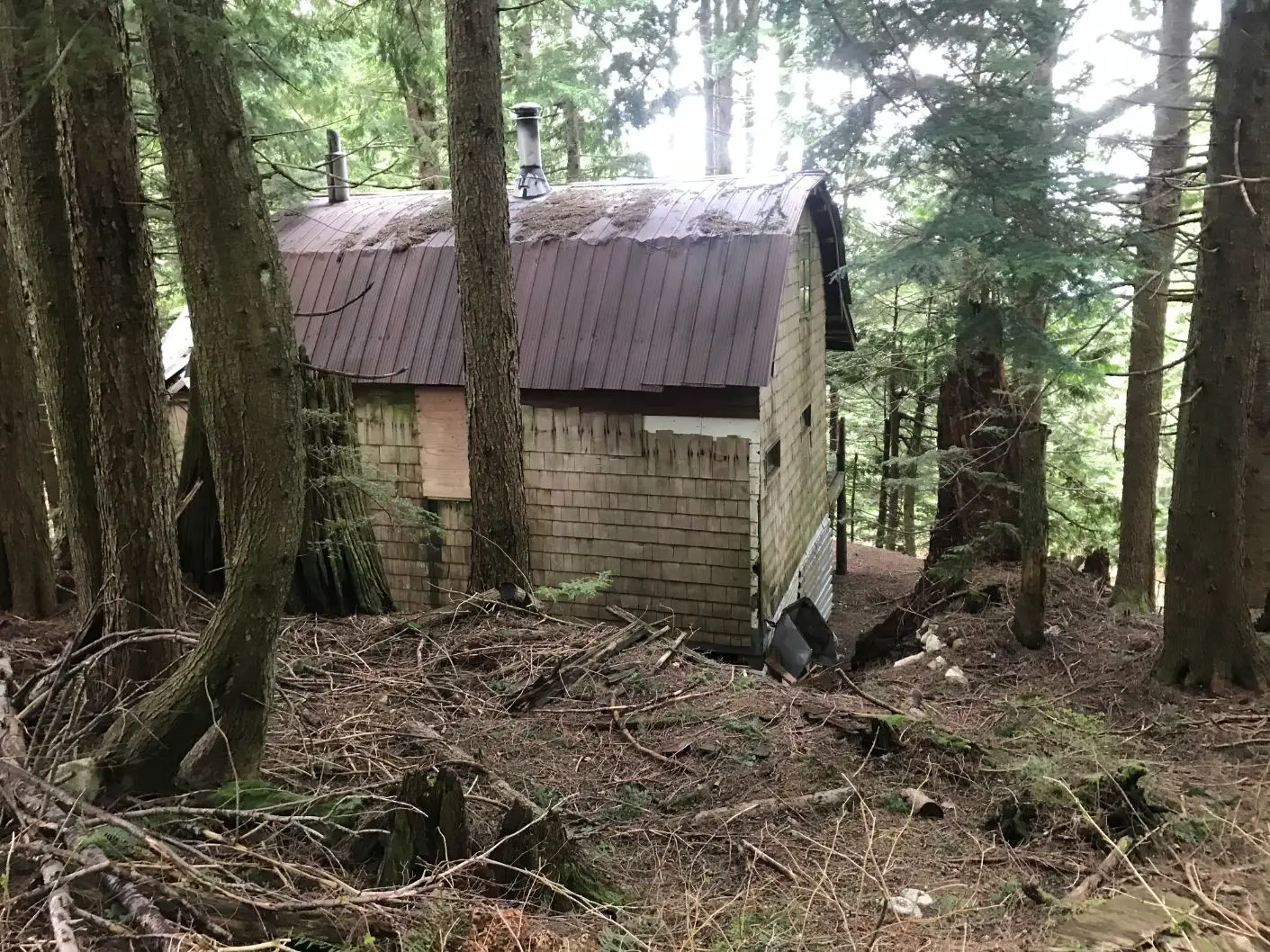
Abandoned Cabin Remains “The Doghouse”
Three quarters of the way up to the Cut you will see the ruins of an old shack to the uphill looking hikers right (the east). This cabin was located where tower 17 of the Village Chairlift used to stand and was named the “DogHouse”, home to Ray Nunn a ski patroller from grouse mountain. In the ruins of the shack, you can make out old bunkbeds, a sink, toilet and other household amenities that were left years ago.
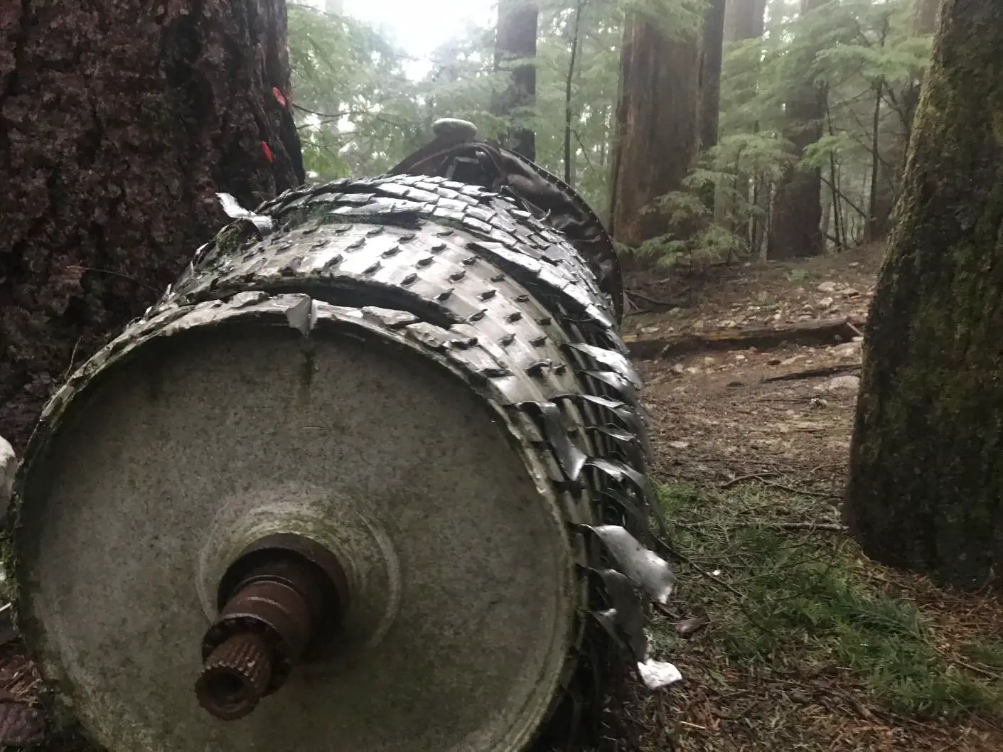
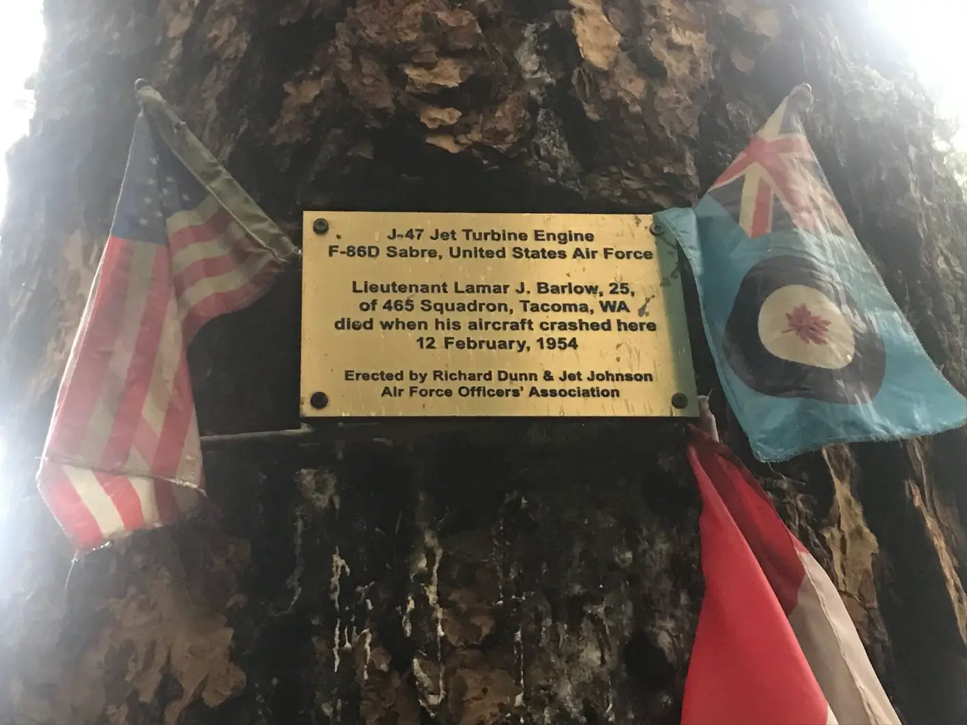
Finding the F-86 Sabre Jet Crash Site
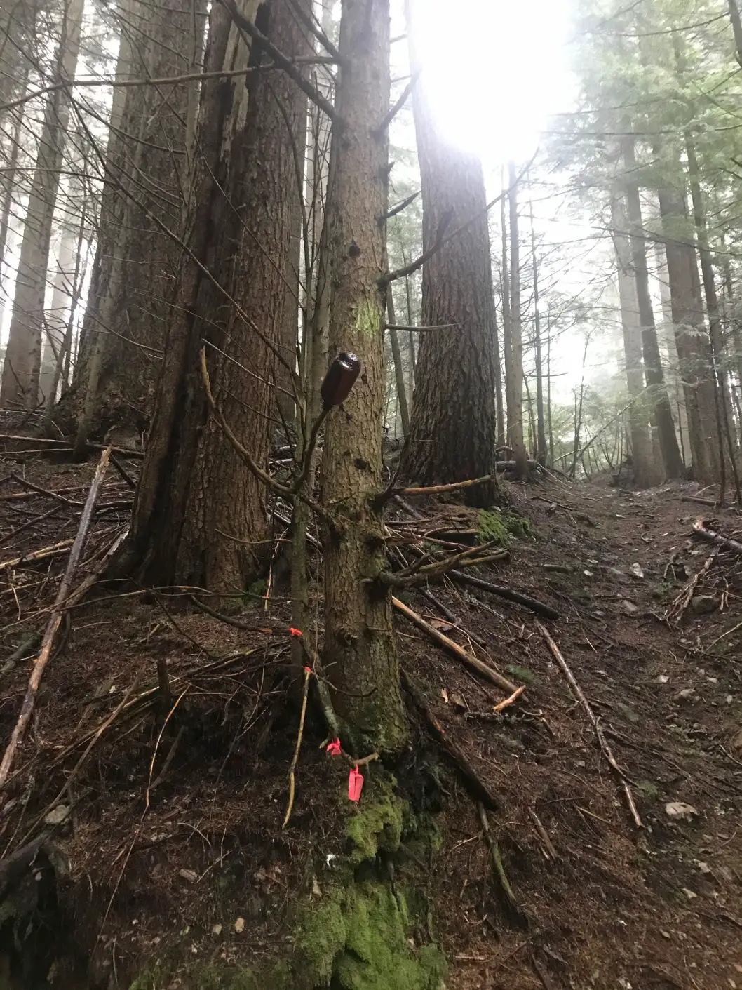
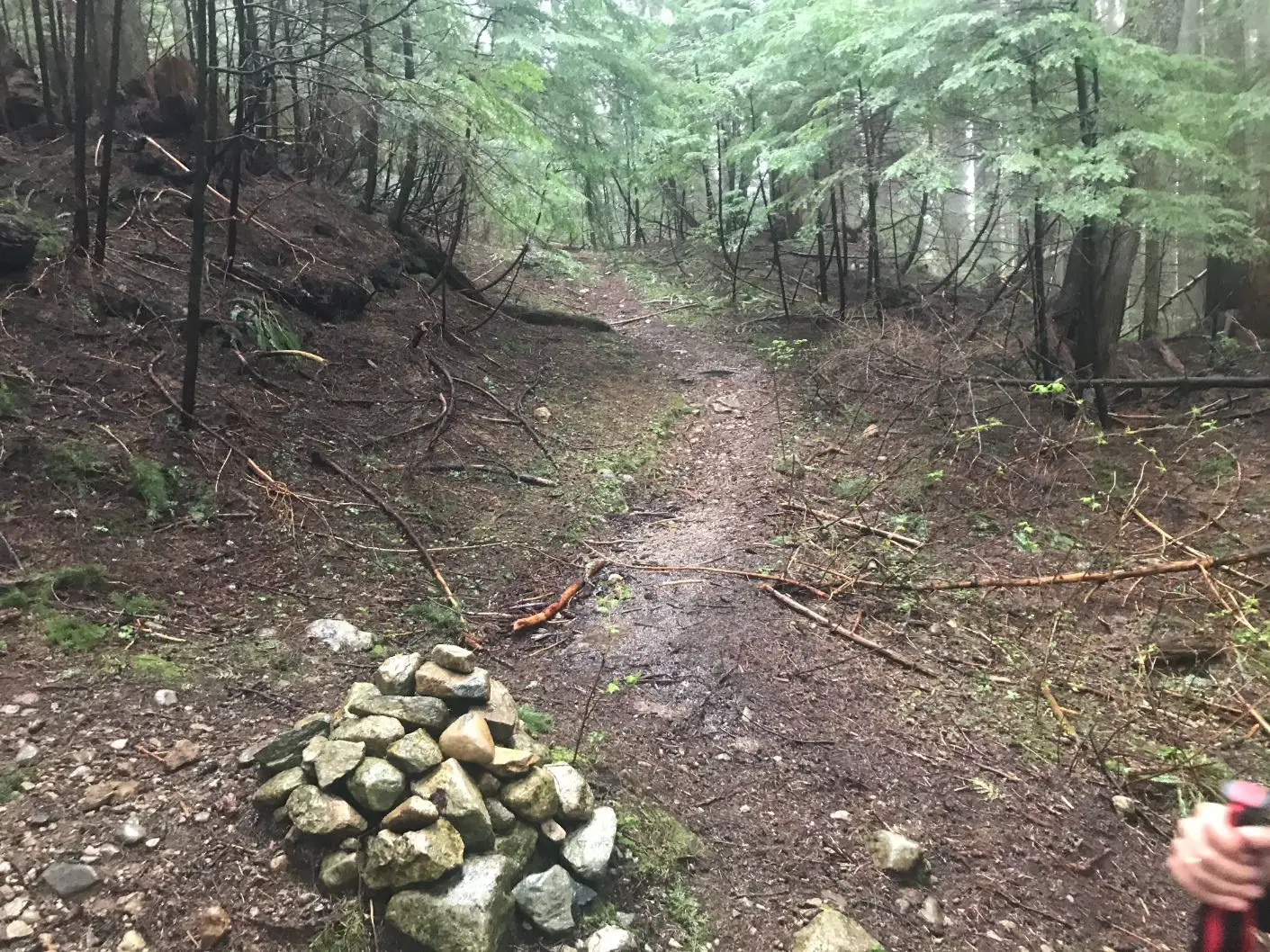
The easiest way to find the jet engine is to continue hiking the skyline trail past the cabin, about 50 meters or so until you come across a tree to your right that has some green spray paint on it. Take a right at this tree and continue up the trail. You will arrive at a trial confluence, and there will be some rocks stacked up, turn right and head downhill. If you accidentally go straight, you instead will be following the LMGH trail which will take you to the base of Skyline Drive. (this is a great option for the downhill portion of the hike). Shortly after you turn right at the confluence and head downhill you will see the memorial and the jet engine sitting beneath the trees.
The Remains & History
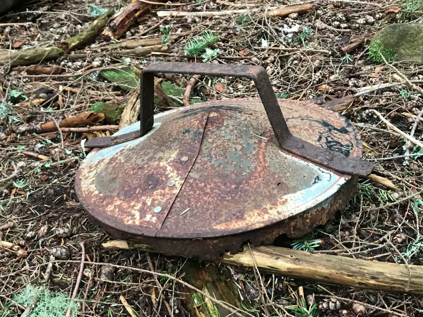
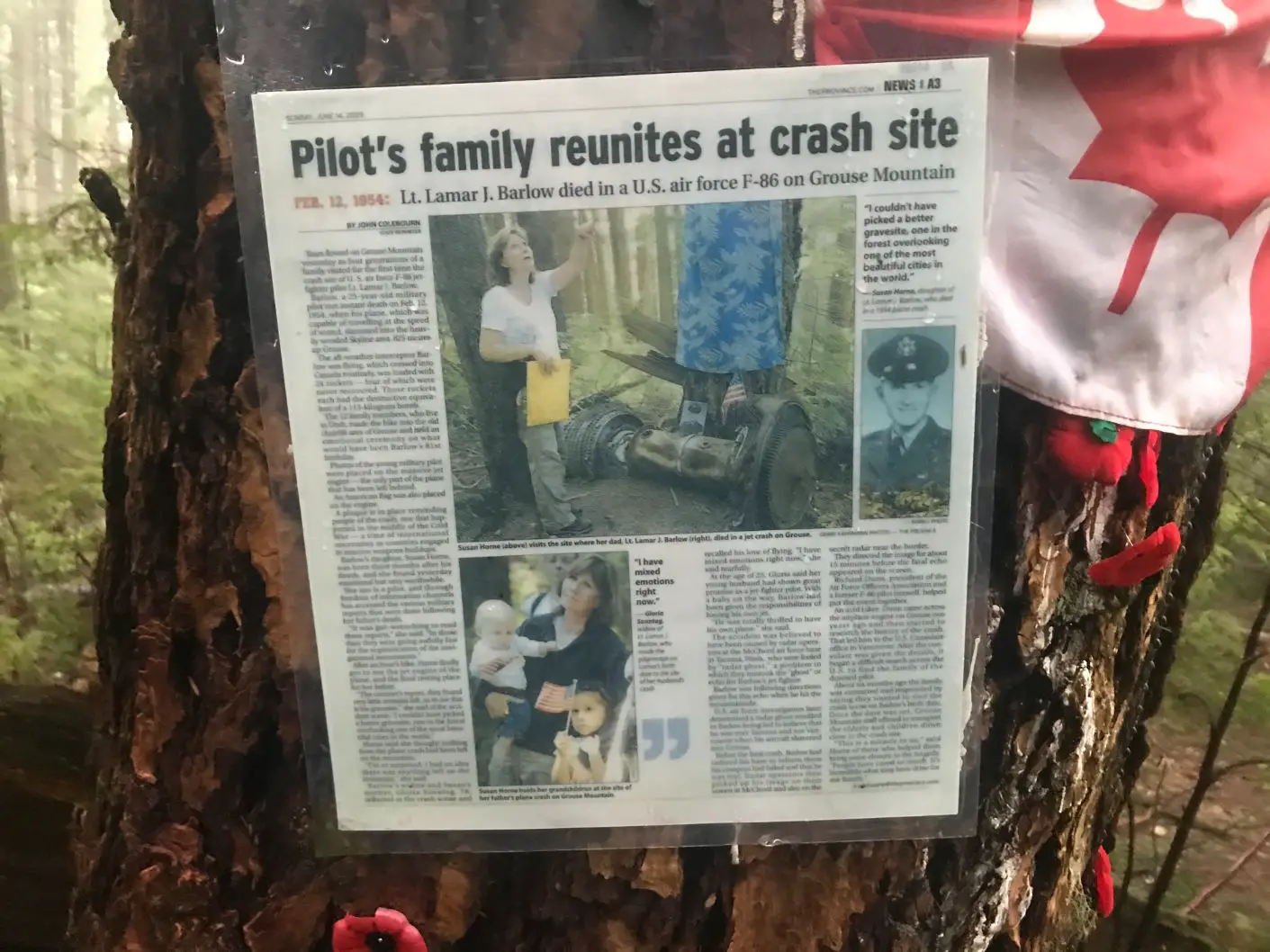
On February 12, 1954, a United States Airforce pilot flying an F86 Sabre Jet met instant death as he tragically smashed into Grouse Mountain at 2700 feet, travelling at the speed of sound. The Pilot, Second Lt. Lamar K. Barlow departed from the McChord Air Force Base in Tacoma to embark on a routine training flight. The accident was believed to have been caused by radar operators at the McChord air force base in Tacoma, who were fooled by a “radar ghost,” which they misread as the echo for Barlow’s jet fighter. It is believed that Barlow was likely following the directions given for this echo which would have made him think he was over Tacoma and not Vancouver. The last contact with Barlow was a Maday call, attempting to land at the Sea Island terminal. The F86 Sabre Jet was loaded with 24 rockets, which weighed over 113 kilograms each. There has been some speculation among the community and conspirators that believe, due to the amount of weaponry on board, and the fact that he was travelling so fast when trying to make an emergency landing that some information was kept secret. Maybe he was on a mission to intercept something, maybe a UFO?
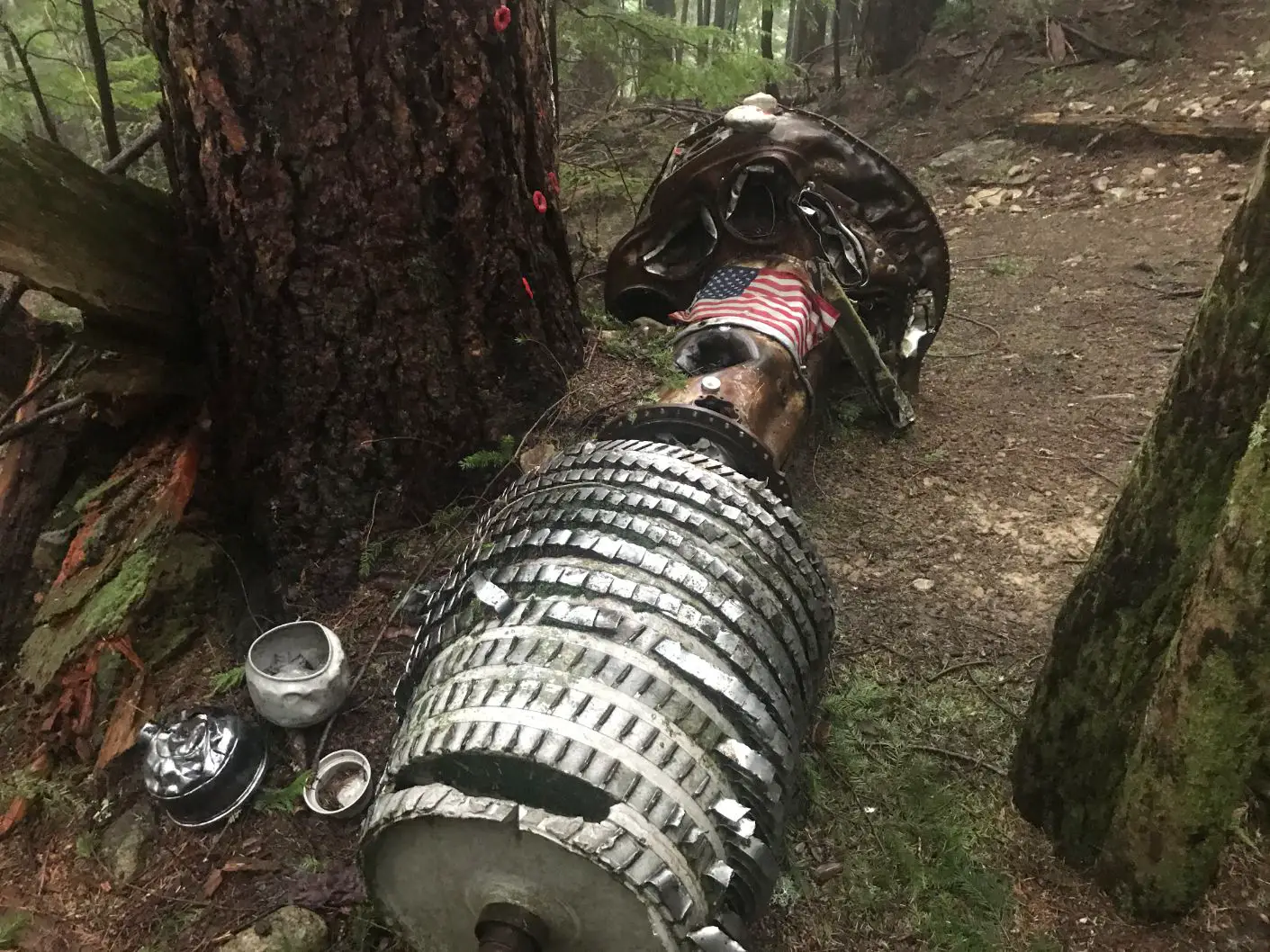
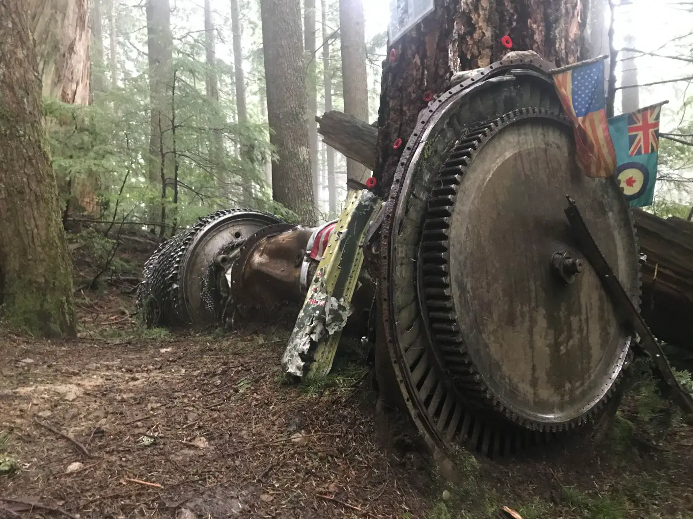
The F-85 Sabre Jet Memorial site is located directly behind the old cabin and according to news articles, the only eyewitness to the crash was a 6 year old girl named Robin McPherson who was heading home for lunch in North Vancouver. Robin claimed to have seen it zoom out of the clouds and into the mountainside without emitting a noise.
The Crash site was first discovered by Ray Nunn as he approached his cabin for the ski weekend. Debris had smashed through his cabin window and he could smell the gasoline. After his discovery, with the aid of a few mates living close by in the “Al Ron” Cabin, they began to search for the pilot’s body. They could not find it, and around 9pm told some hiking skiers to notify RCMP and search and rescue. An 11-man search party hunted through the night and found the remains of the pilot near the wreckage at around 2am. Investigators determined Barlow was still strapped in and made no effort to abandon ship as it smashed into the hillside.
The site of the crash was roped off and guarded until the air force could come to inspect the site. Grouse Mountain was closed for a period to seal off skiers from tampering with the wreckage and to protect them from the twenty-four rockets. The USAF brought Barlow’s remains back to the McChord airfield, and removed and crated as much of the wreckage as possible to bring back to the air base for study. Four of the twenty-four rockets were not recovered and are still somewhere lodged into the mountainside (I guess you must really watch your steps)
In 2009 thanks to efforts of Richard Dunn the president of the Air Force officers association, 12 of Barlow’s family members were finally able to visit the crash site and have a proper memorial for LT. Barlow on the day that would have marked his 81st birthday. Photos of the young pilot and other items have been placed on the massive jet engine from those paying their respects. A plaque and news article has been attached to the tree where the engine lies.
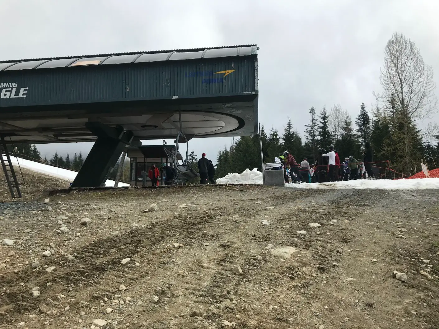
Continuing to the Cut and Grouse Mountain
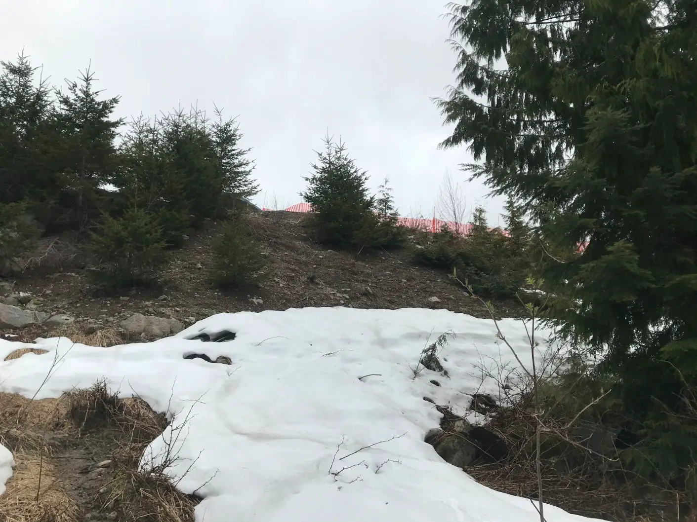
Once you have visited the jet crash memorial site you can continue your journey up to the Grouse Mountain Chalet. Retrace your steps back to the Skyline trail and continue upwards. The trail will begin to get smaller and rockier. You will arrive at the base of the “Cut” ski run on grouse mountain.
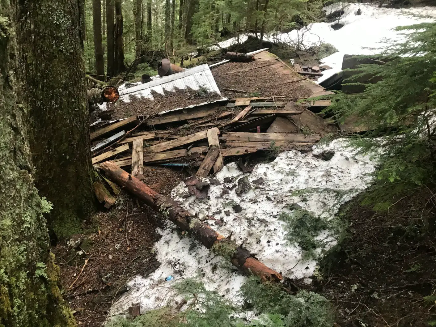
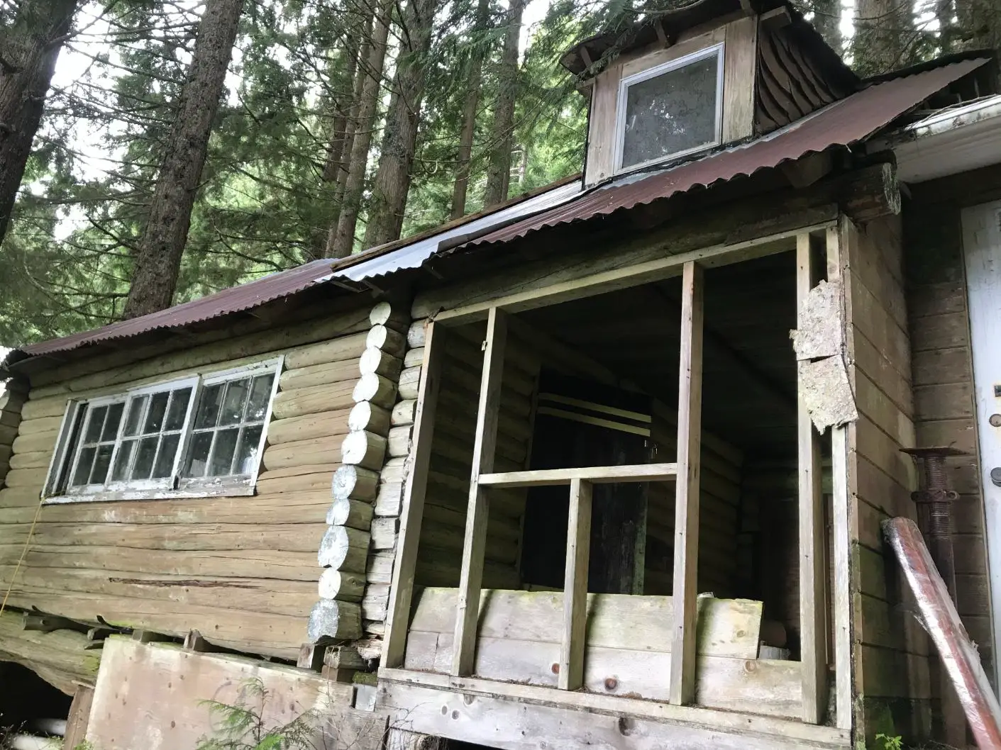
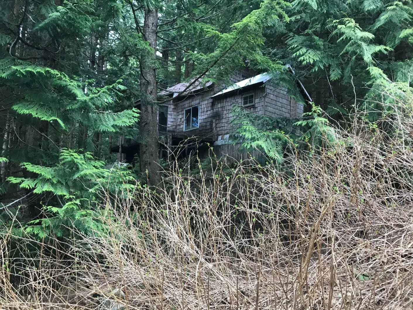
The Abandoned Village
Standing at the base of the cut you will see buildings to your left. This is where the old Grouse Mountain Village begins. At its peak, the village was made up of hundreds of shacks and was a skiers, hikers and socialite’s paradise. Many were weekend warriors and other full-timer’s calling it “the place to be, and a “way of life”. Building supplies were initially carried up by hand laying the foundation for what we now know as the Grouse Grind. As Grouse Mountain gained in popularity the Old Mountain Highway was created as part of many failing business ventures. One organization even had plans to build a funicular railway up to the ski hill. Upon the railway’s failure, the mountain Highway road was completed and for a time acted as a toll road up to the cabins.
I always love spending time bushwhacking the Eastern and Western sides of the Cut in the forest imagining the village back in an era when it was bustling harder than the Whistler village of today.
*Please be extra cautious when walking near the cabins and do not trespass as the foundations and rooftops of these things could easily come down. Also, if you find any cool old artifacts, take a picture, but let them be.*
To The Chalet
Once you have seen enough of the village remains you can head up to the Chalet. From the bottom of the Screaming Eagle Chairlift there is no marked trail unless you connect with the BCMC trail or arrive at the top of Grouse Mountain. If it’s summertime, it’s no problem to walk up the ski runs or pave your own trail through the forest. If you are attacking the trail in wintertime, there may be some tracks heading west from the cut that will lead you back to the BCMC trail. Be extra cautious when paving your own trail. There are tons of cabins and old artifacts/garbage in this area so keep your eyes peeled as you make your way to the summit.
I’ve been skiing my whole life and had no idea as to the amount of Vancouver history that was tucked into Grouse Mountains forests. The Skyline trail is an amazing window into the past and is right on North Vancouver’s doorstep.
Did you know the about the Grouse mountain ‘Village’?
Let me know in the comments