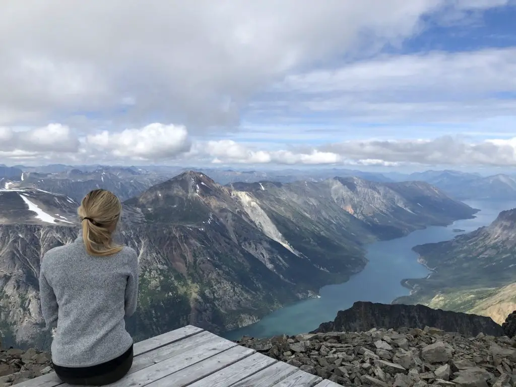
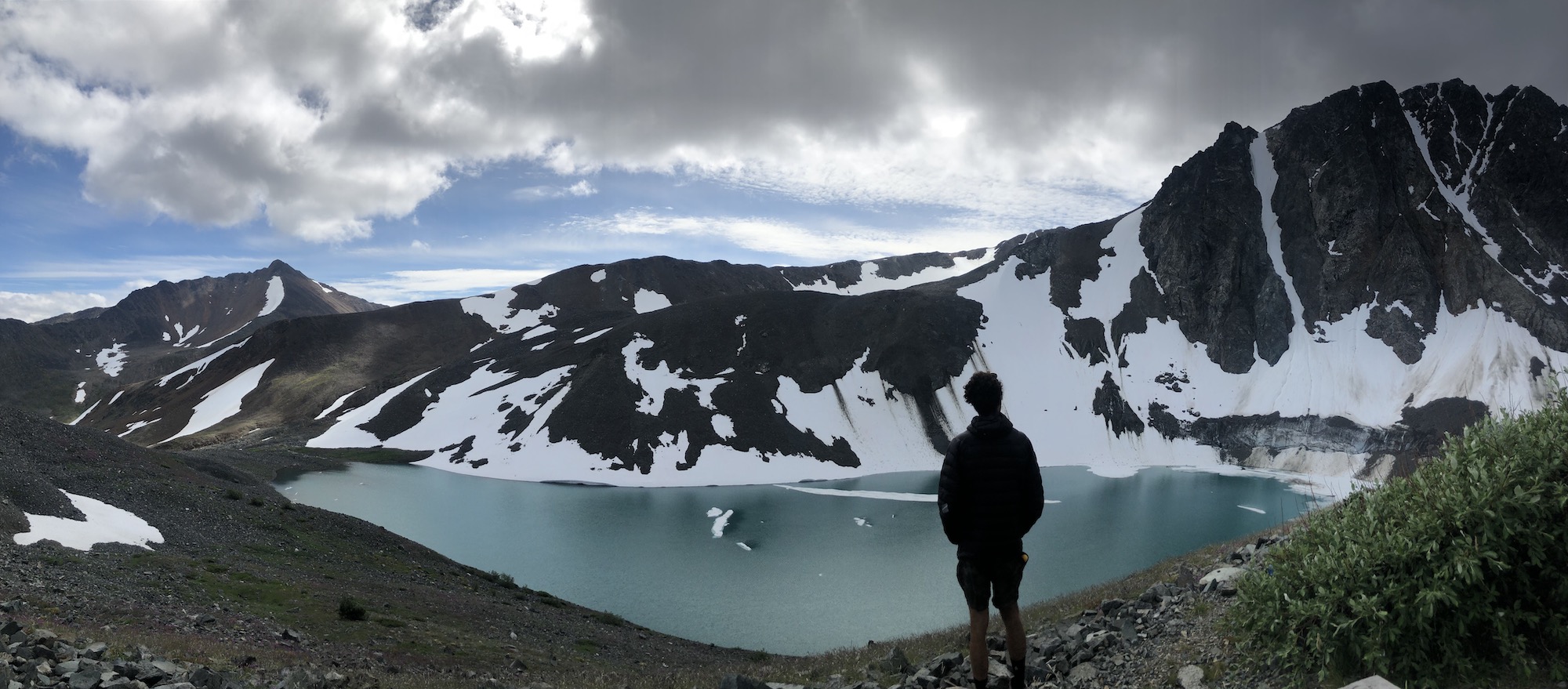
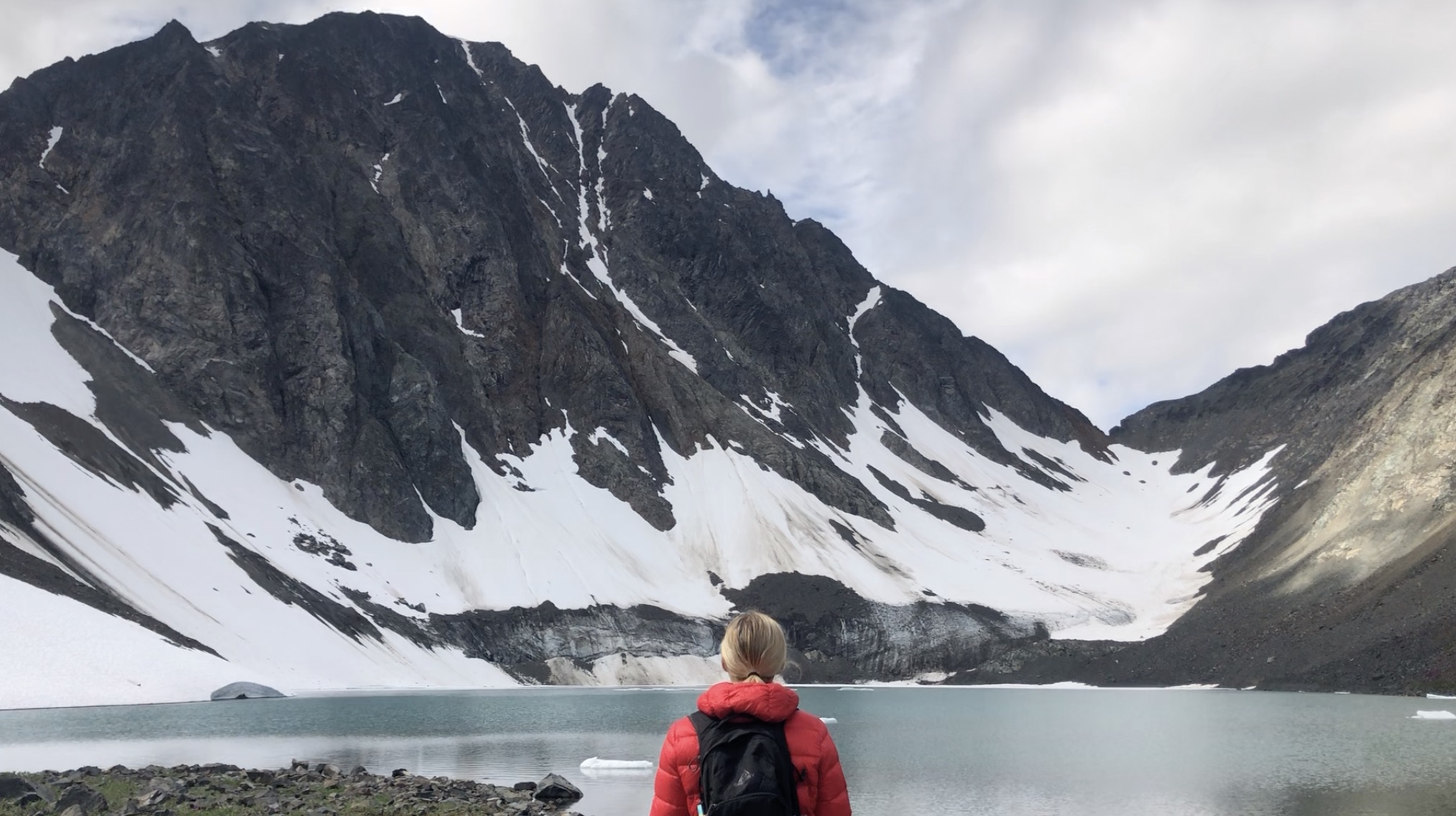
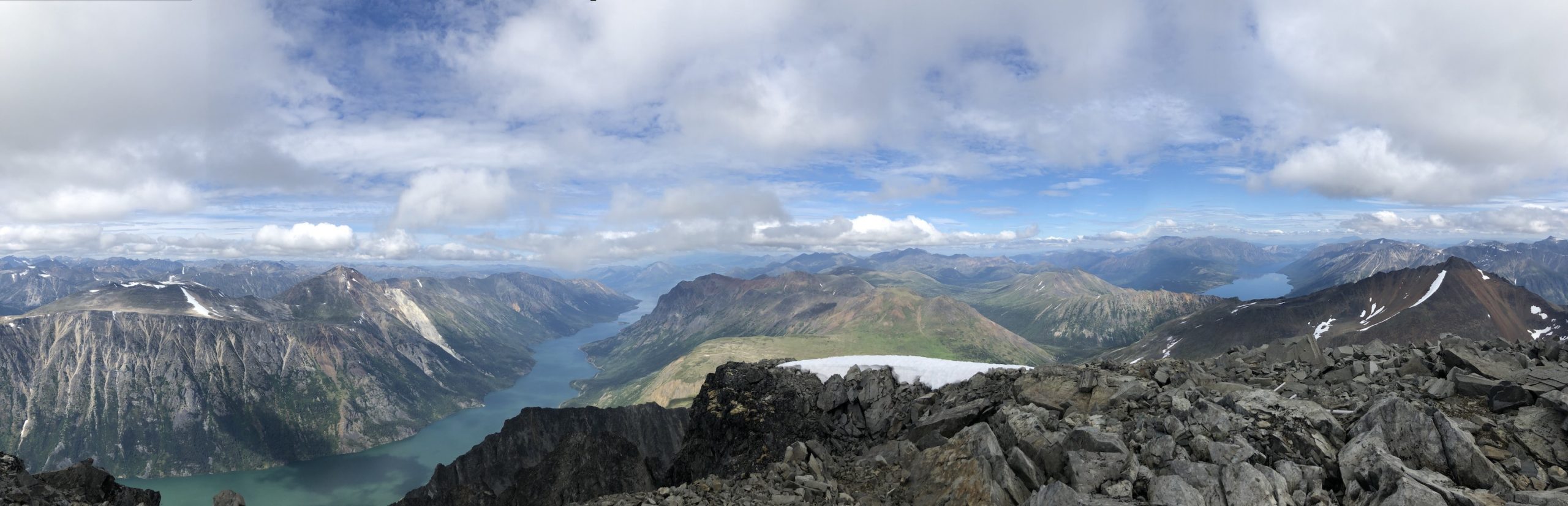
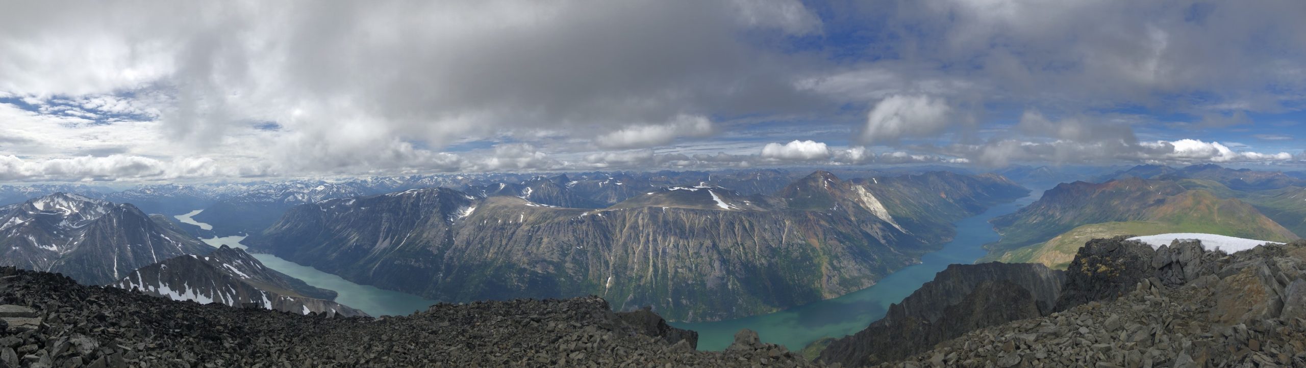
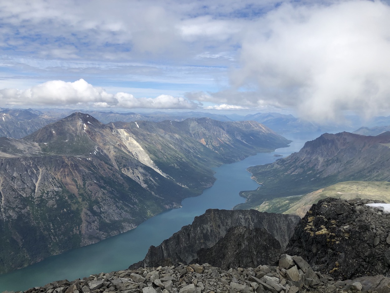
Paddy Peak is an unbelievable adventure sandwiched between the Yukon/BC border and Skagway, Alaska. The summit towers over the surrounding mountains at 2206m and showcases the most exceptional 360° panoramic views in the province. There is a lake situated at the mountains base and it’s gorgeous. You can sit for hours listening to the cracking glacier and watching the ice fall. The lake can be accessed via a very rough 4×4 road (good news for off-road enthusiasts) but, most hikers choose to attack on foot. You will absolutely not regret the effort you shell into this one.
Check out our Paddy Peak hiking video HERE
Remember the Backcountry Basics
- Carry your Survival Kit & Essentials
- Let someone know where you’re going with a Trip Plan
- Know how to avoid negative wildlife encounters
- Practice Leave No Trace to keep the wilderness pristine
- Carry a Satellite Communicator like SPOT X
Table of Contents
The Breakdown
| Distance (Round Trip) | 21km |
| Elevation Gain | 1747m |
| Time (Round Trip) | 8-11 hours |
| Dogs | Yes |
| Camping | Yes - Backcountry (no reservation) |
| Season | July-Sep |
| Difficulty | Difficult |
| Remoteness | Very Remote |
| Highest Point | 2206m |
Driving Directions:
Driving from Carcross, YT continue on the South Klondike highway towards Skagway Alasksa. Once you hit the Carcross bridge (there’s only one bridge in town), continue for 38km or about 25 minutes. You will see a narrow 4×4 gravel road on the right. If you pass a creek and gravel pit you have gone too far. If you have a high clearance off-road rig, head on up the road, if you have something a little more tame, go ahead and park in the gravel area beside the highway.
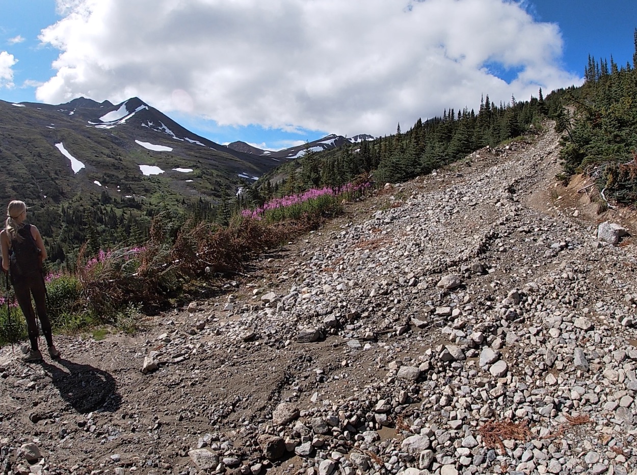
Here is where the fun begins. Drivers have the option of driving the 7km logging road right up to the Alpine at the base of Paddy Peak and the glacial lake beneath. It sounds simple, right? Well…. it’s a little to good to be true, the road is very challenging. Laura and I initially decided to drive the logging road in my trusty Ford-F150 as we are comfortable on 4×4 roads and the hikeYukon website said that most trucks with high clearance should not have trouble with this road. I started bottoming out a fair bit and we weren’t driving much faster than walking so at around the 2 km mark, due to the length of my truck we decided to turn around and park when we had the chance.
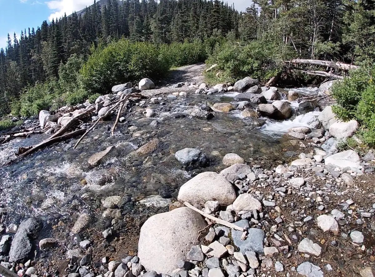
The road is doable in a high clearance vehicle with solid tires and this will also be necessary for the river crossing at 3.5km. If you’re an experienced off-road driver this road is no problem and it may turn out to be some of the most insane views you ever get from your vehicle. The road has some washouts, narrow portions, becomes extremely steep with thick gravel, mud and has a large creek that you have to cross. Just make sure you’re prepared and have the tools to get yourself out if you get stuck.
The Route
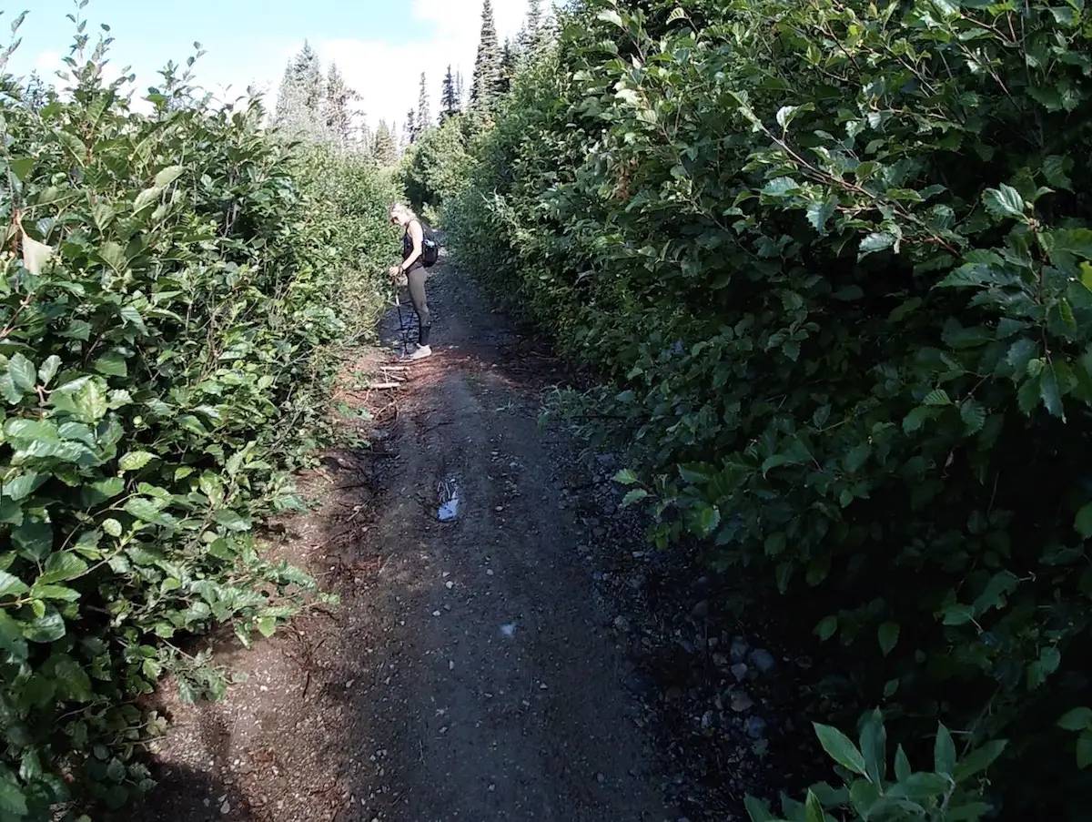
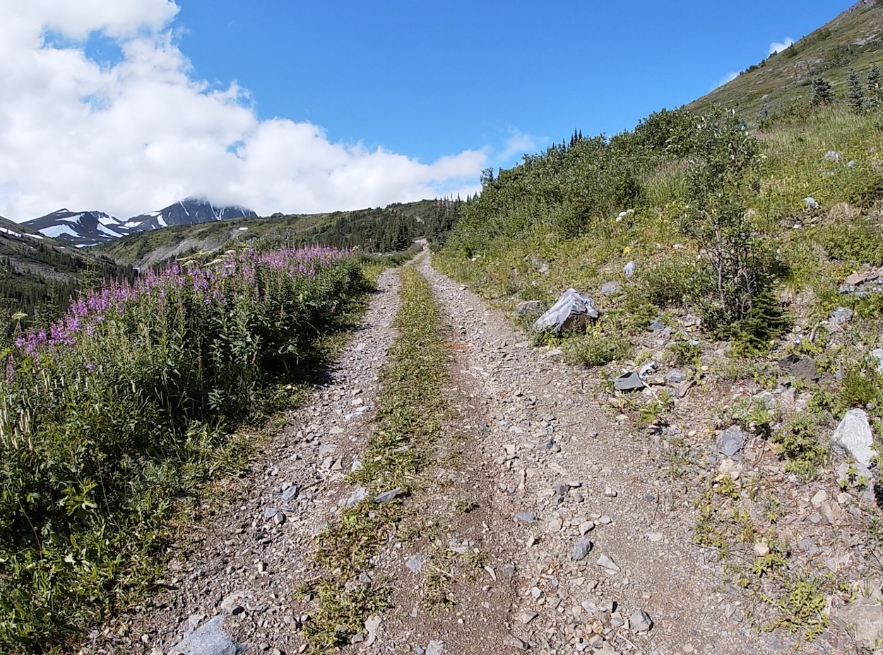
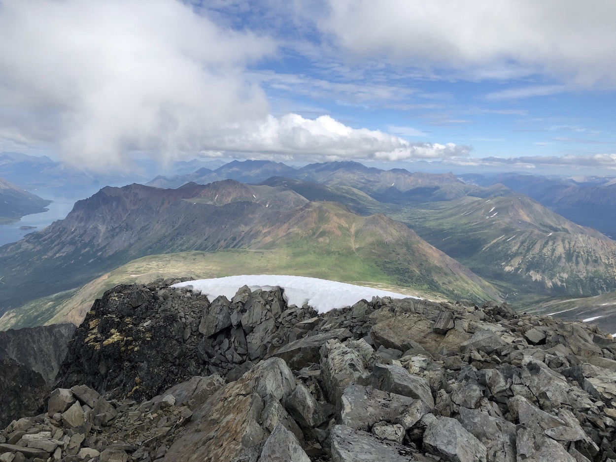
For the vast majority of us the hike is going to begin with a 7km uphill slog up the 4×4 road. It’s not as boring as it sounds, by the time you hit the 4km mark you’ve escaped the trees and are walking through an insanely gorgeous alpine meadow. You should be able to look up and spot the gargantuan Paddy Peak staring back at you in the horizon. I absolutely loved this logging road, I couldn’t get over how gorgeous it was and had a lot of fun checking out all of the old mining equipment and artifacts scattered along the side of the road.
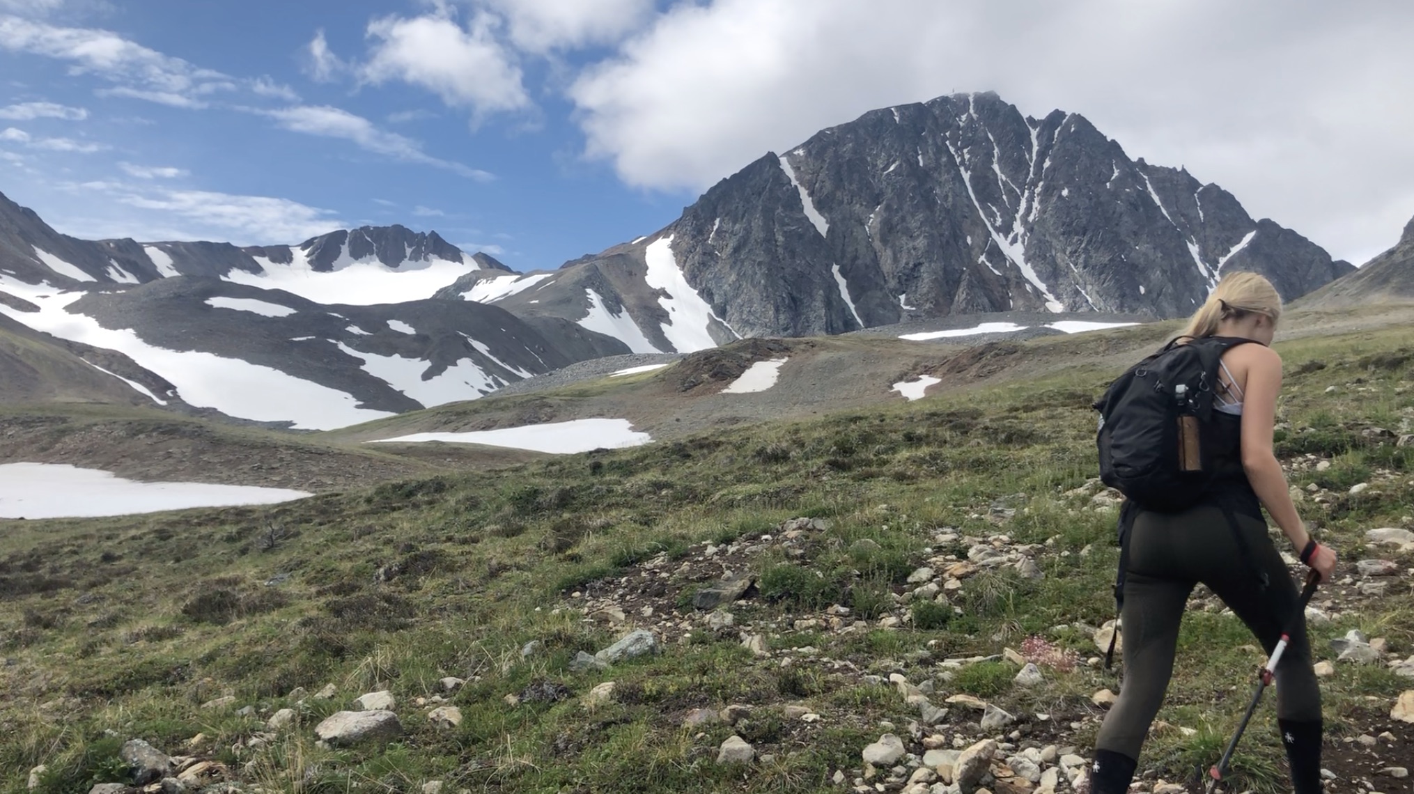
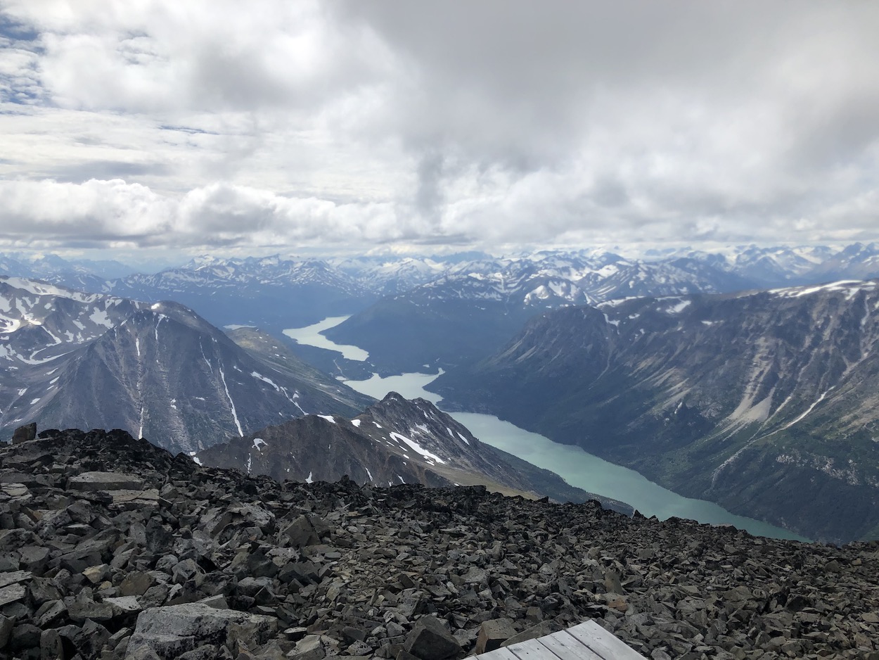
At around the 6.5km mark the original road starts to become a little less clear and there are many different 4×4 roads and old prospecting trails veering off in different directions. At this point you will be getting very close to the lake. If it’s a clear day navigation really won’t be an issue as Paddy Peak sticks out clearly. You have the option to hike up to the bench overlooking the lake (this includes a slight bit more elevation gain/loss) or to just make your way directly to the left side of Paddy Peak. The map I drew above shows a rough version of our route involving the quick diversion to the bench overlooking the lake. The bench is the ideal spot to rest your legs for a bit, hydrate and have a snack. Every few minutes while we were sitting we would hear a massive crack, boom and watch ice fall from the glacier into the unnamed lake below. We arrived at the lake in just under 2 hours and enjoyed the views for quite some time.
From the viewpoint above the lake you will be able to scope out your next move. Head down and to the left around the lake. There is runoff at the end of the lake, the side furthest from the glacier, that you will have to cross. Depending on the time of year, water level should be no problem. Worst case, just take your shoes off to cross.
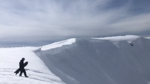
This is where the more technical ascent begins. When we hiked in August there were still some significant patches of snow so our route involved walking up and around as much snow as we could in an effort to keep our feet dry. There is no perfect way up to the top so choose a route that works for you and keep on heading up. I did find that the area a little further to the left had smaller rocks, was slightly less steep and was easier to manage especially on the way down.
About halfway up to the ascent to the summit is where things got a little challenging. The rocks are an awkward size and were continuously sliding under my feet. There were a couple times where I felt like I was going to start a rockslide. Take your time and be alert/vocal with your hiking partners so no one gets whacked with a rogue rock.
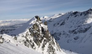
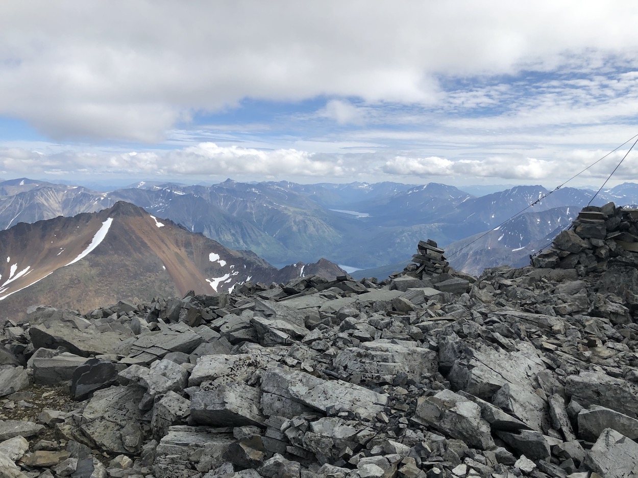
There is a weather tower that marks the summit and works as a great guide for keeping you in the best possible trajectory. We hiked pretty close to the cliffside to the right and I couldn’t help but safely peer over the edges because it was so insanely beautiful.
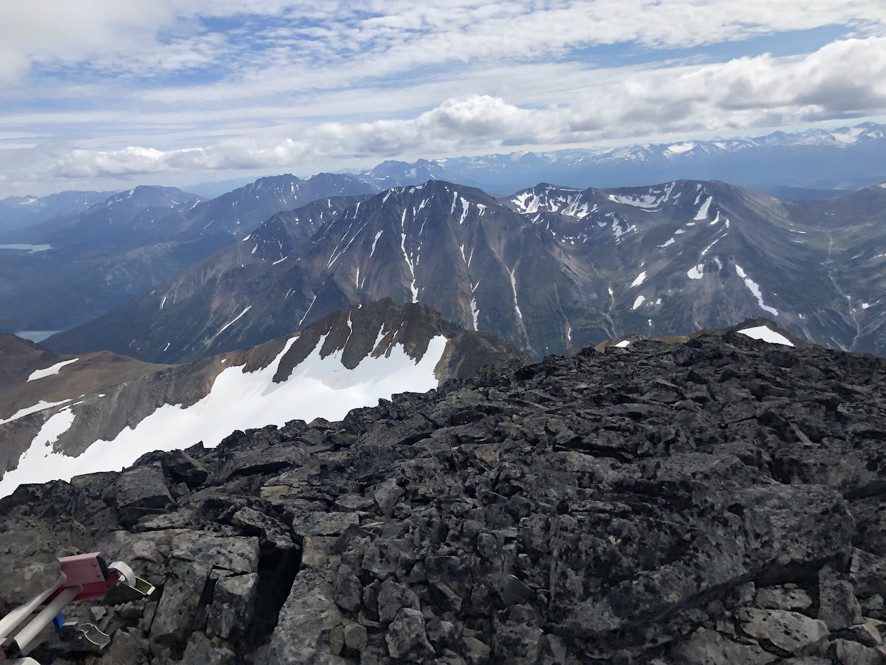
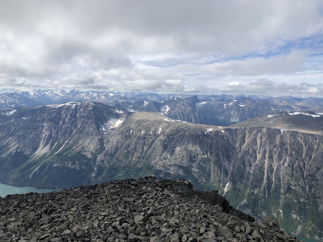
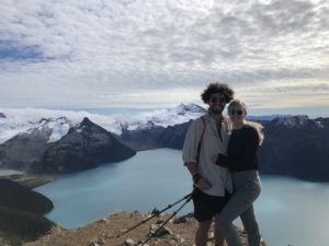
When we reached the summit my eyes practically popped out of my head and I felt like I was in a movie. The 360° panoramic mountain views were baffling. I felt like I could reach out and touch the Alaskan mountains and jump right into the many lakes below. Laura and I enjoyed lunch on the Heli-Pad at the summit and prepared for the descent as the weather began to change.
In an effort to reduce time and tension on the knees I ended up boot-skiing down some of the slushy snow on the rockface. In our newly soaked shoes we hiked the rest of the way down and arrived back at the truck after 7 hours and 10 minutes.
Paddy Peak was one of the best trails I have ever had the pleasure of hiking and I would go as far to say it is one of the best in Yukon & BC. When I visit again I will surely bring our overnight gear, so we can camp at the base of the lake and spend a few days climbing up a couple of the other unbelievable summits in the area. It’s one hell of an adventure and I know you are going to love it!
Let me know if you have any questions in the comments?
Happy Hiking!