Quick Summary
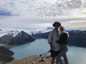
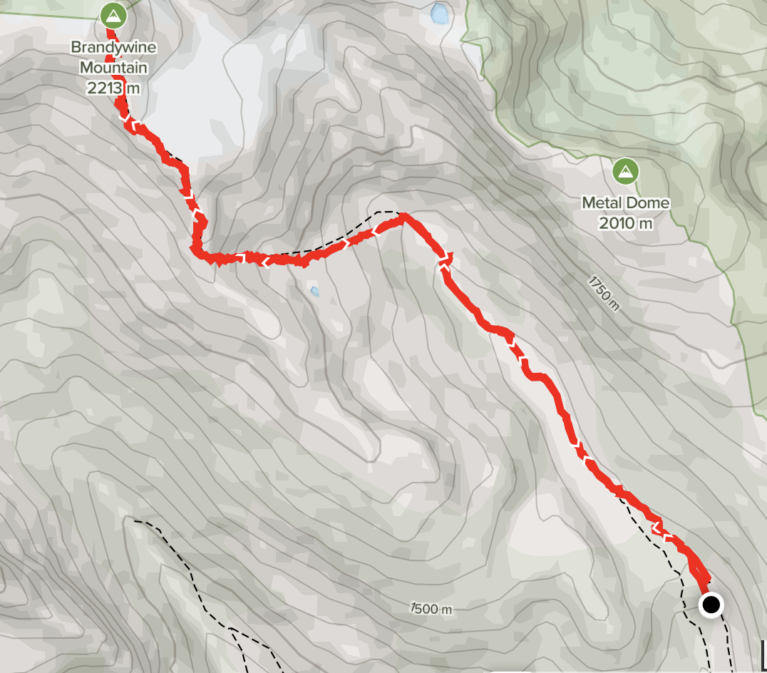
The upper trailhead to the Brandywine meadows and summit is one of my favourite adventures in the region. A great 4×4 drive, a picturesque green meadow with many clear river runoffs flowing through the grass ending with a steep climb to the ridge and summit opening up unparalleled views of the Callaghan valley and surrounding mountains.
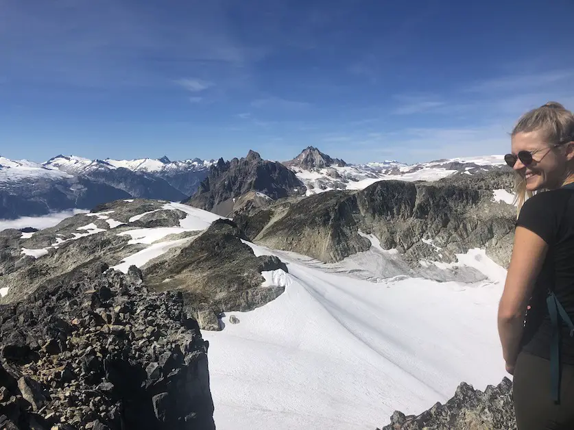
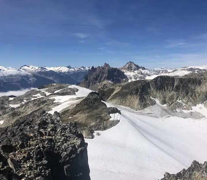
Table of Contents
Remember the Backcountry Basics
- Carry your Survival Kit & Essentials
- Let someone know where you’re going with a Trip Plan
- Know how to avoid negative wildlife encounters
- Practice Leave No Trace to keep the wilderness pristine
- Carry a Satellite Communicator like SPOT X
The Breakdown
| Distance (Round Trip) | 16km |
| Highest Point | 2,213m |
| Elevation Gain | 1470m |
| Time Needed (Scenic Pace) | 6-8 hours |
| Time Needed (Race Pace) | 4 hours |
| Camping | Yes - (no reservation required) |
| Season | July-October |
| Difficulty | Intermediate/Advanced |
| My Personal Rating | 4.5/5 |
I would rate this trail intermediate to advanced due to the mild scrambling at the top and route finding. From the upper lot to the summit is a 12km roundtrip and around 1000m in elevation gain. Starting at the lower lot expect an 18km roundtrip and around 1500m of elevation gain.
How We Stumbled Upon This Adventure
While trying to drive up to the Panorama Ridge trailhead during the middle of the Covid pandemic we were turned around by a parks Ranger. I was unable to make a reservation for that day and as a perpetual optimist I decided if we got there early the Ranger would make an exception if I asked nicely. Unfortunately, the ranger told us “no” laughed at me, and directed us into what in my opinion was a much better adventure, Brandywine Mountain!
How to Get There
Exit onto Callaghan road from highway 99. Take a left at the first road and continue along the road until it becomes gravel. You will pass a large gravel clearing… which is used for snowmobile unloading in the wintertime and on the far side will connect with the Brandywine FSR. The road became increasingly steep and you need to be extra cautious in low clearance 2wd vehicles. You will reach a junction with a sign to the left pointing 2km to the lower Brandywine meadows trail or 5km to the upper trail.
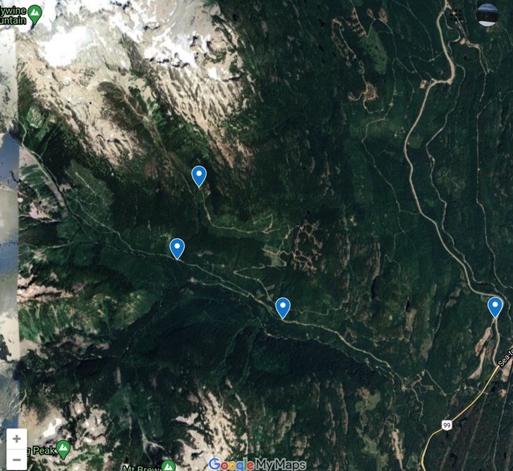
Which Trailhead To Choose?
The Lower Trailhead
If you have a low clearance 2wd vehicle, take the left and start at the junction and start from the lower trailhead unless you’re keen on ripping your oil pan off or are an experienced rally car driver.
The lower trailhead adds around 550m of elevation to the hike and makes it much more challenging as a day trip, many people who begin at the lower lot plan on doing this as an overnighter and camp in the Brandywine meadows the first night. I cannot speak to much as to the details of the lower trail as I have always started from the upper lot. All I know is that a BC Parks sign will be on the right which marks the start of the trail.
The Upper Trailhead (Right at the Junction)
The upper trailhead is my personal favourite. If you have a 4×4 vehicle with decent clearance and comfort with driving on rough terrain than go for the upper trailhead, your legs will thank you! The drive was much more treacherous than I expected The slope gets very steep, the trail becomes smaller and there are many rocks and boulders to maneuver around. When we first began the ascent in the truck I didn’t see another vehicle for some time and was convinced that I was headed to the middle of nowhere and should turn around. Finally, a Subaru SUV came cruising up behind me so I knew we weren’t driving into the abyss. There are two parking lots at the top one at the start of the trailhead and another which stops about ½ a kilometer before the true upper trailhead lot. There were some serious washouts and even tougher terrain in the last ½ kilometer of the drive so manypeople including my self opted to park before the first area. Make sure you turn yourself around and parallel park or back into wherever you park because when this trail gets busy it can become almost impossible to turn around and it wouldn’t be fun reversing down the hill. At the time I was relatively new to driving on 4×4 trails and the drive up was exciting and scenic making it one of my favorite parts of this adventure.
The Route
From where we parked you begin the hike following the 4×4 trail until it ends at the upper trailhead lot. The whole drive and especially this portion is extremely scenic, you will also have fun watching any vehicles that try and maneuver the final portion of the road. I was impressed to see a few SUV’s that made it all the way up.
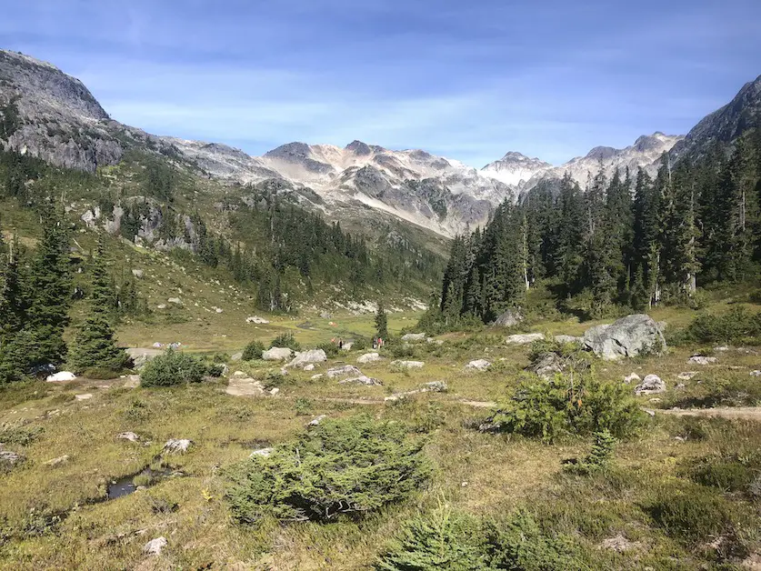
The first portion of this hike is to the meadows. It is super quick and does not take long from the start of the upper trailhead. It is absolutely stunning up there, it is open green and there is a huge water runoff and hundreds of little creeks running through the meadow. Almost all of the campers we saw were stationed in the meadows. This is the backcountry so you’re allowed to camp where ever you please. If you’re feeling more adventurous there are plenty of great spots to pitch a tent off the beaten path in the surrounding mountains.
Stay to the right along the river until the uphill begins – the trail will begin to break off to multiple spots on the left. Depending on how fast the runoff is flowing when you get there just choose a spot to cross.
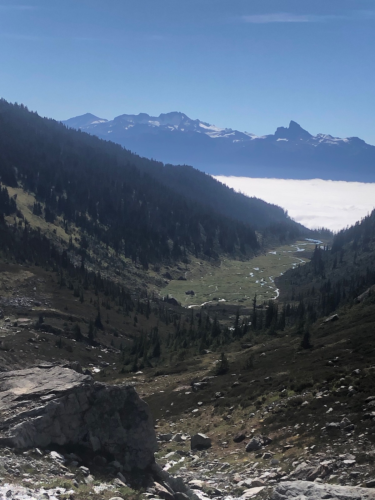
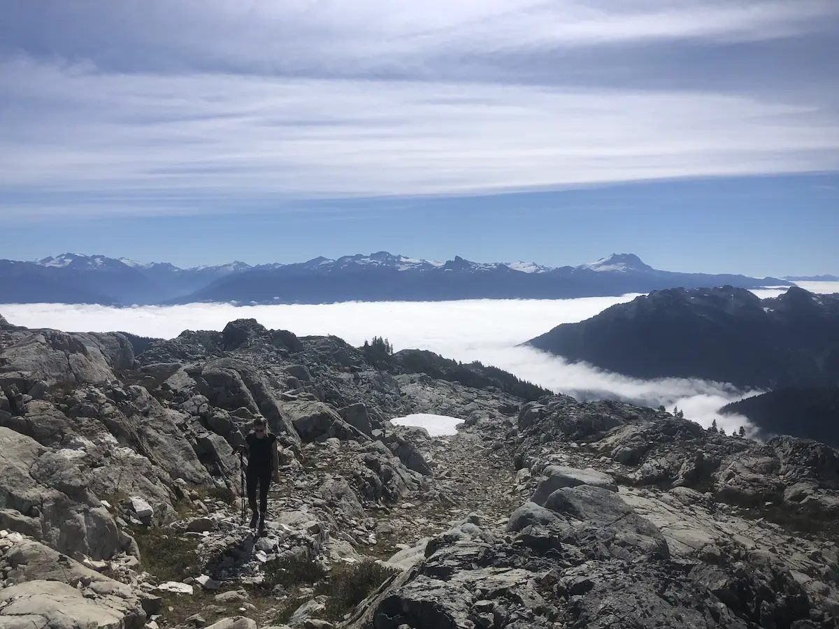
Next step was to head up the mountain – there really wasn’t any signage but you will cross the river and head up left on the scree/shale rock – the higher you climb the more beautiful the views of the meadow and surrounding mountains will get. This section is steep and be careful with you footing because the rocks can be slippery.
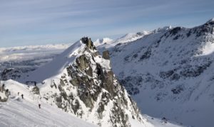
There was not really a well marked trail up this portion when I was there so I just kept hiking up until I got to the top of this ridge. When you reach the top you will be rewarded with a beautiful 360 degree view. Many people will stop here have lunch and make the descent.
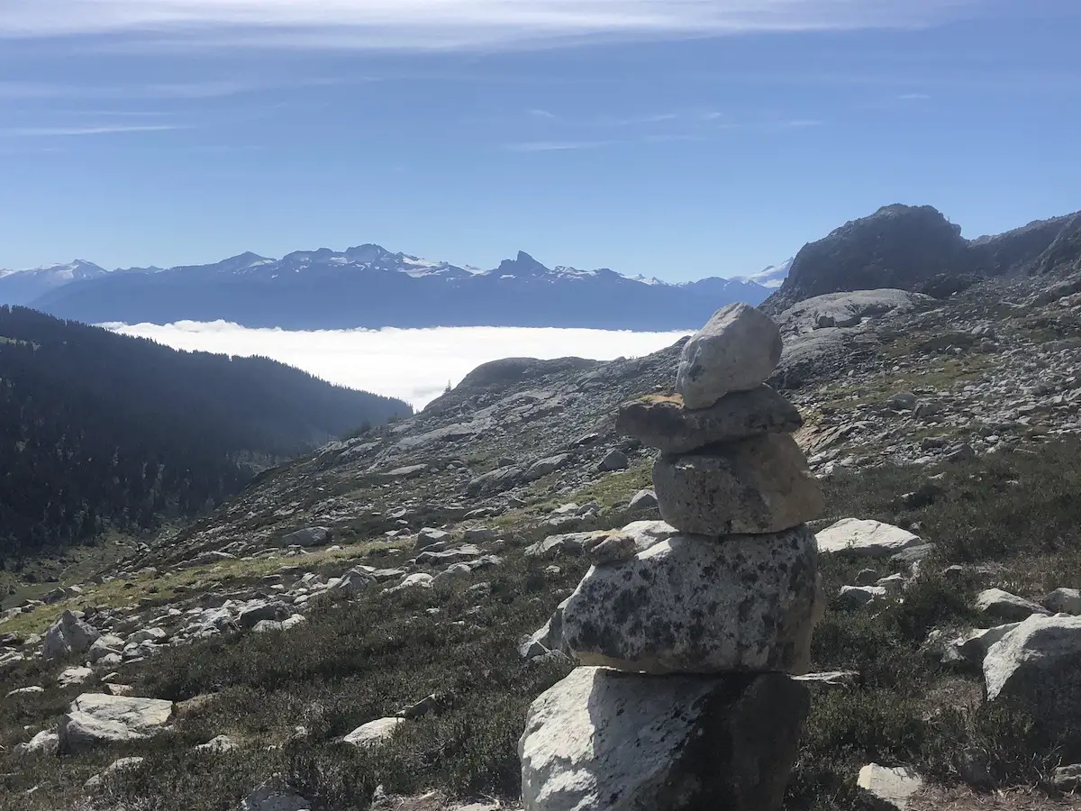
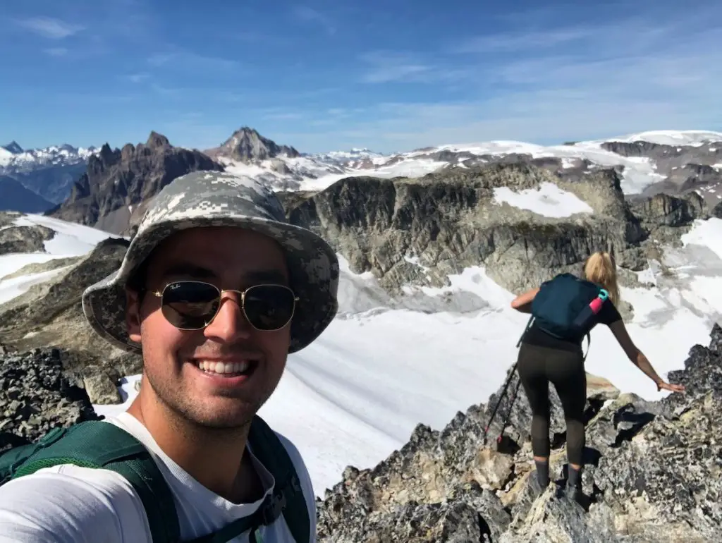
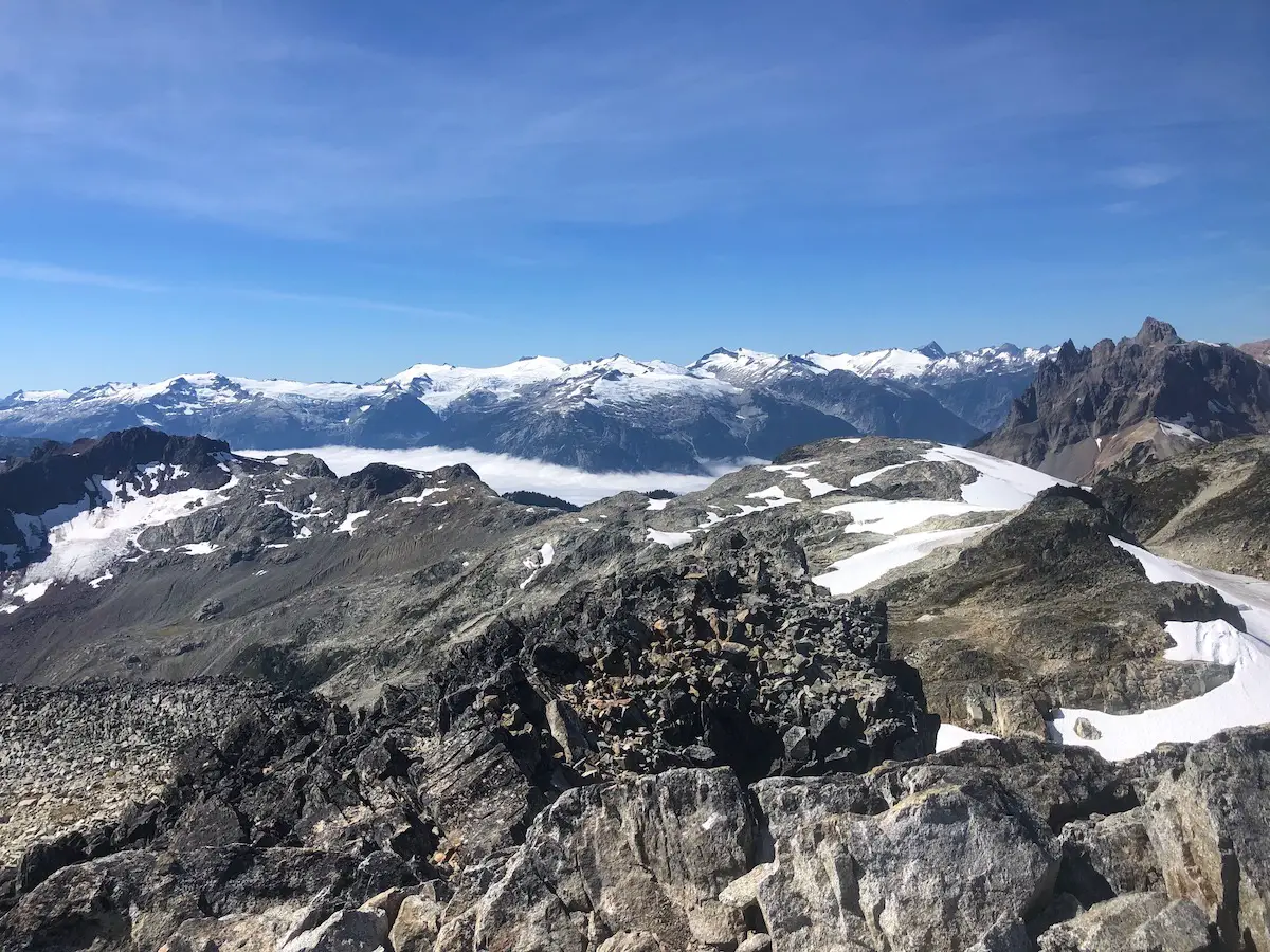
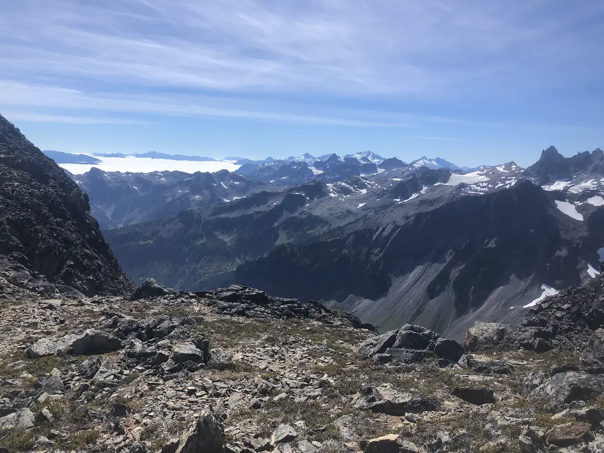
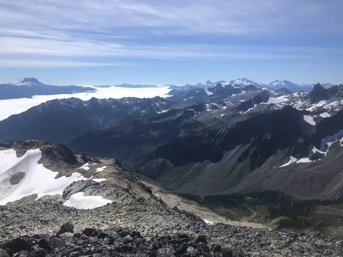
If you wan’t to get reach the summit which is well worth it turn to your right and continue walking up the ridge. You will be surrounding with beautiful glaciers and a large bowl of glacial snow to your right.
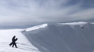
The summit is amazing – The further you go the more you see and this hike is just filled with surprises until you get to the peak. At the peak I had a quick peanut butter sandwich and we scrambled down. I hate the downhill potion of hiking but the views kept me pre-occupied and less focused on the aches in my knees.
Since we left early we were the first group of the day to get to the summit – on the way down I was very surprised by the number of people coming up. This isn’t really a well kept secret. But like any well known trail in BC, get up early and get out there because nothing beats the serenity of the trail on your own.
What Goes Up Must Come Down
On the way down crossing the river I slipped forward a little bit and sent my bear spray shooting down the runoff never to be seen again. This was the third canister I had bought this summer so I’ve decided I need to tie it to my pack or get a hip belt for it.
When we finally made it back to the truck the parking was packed and since I didn’t park too strategically in the morning I had to make a few 12 point turns before I could get straight down the 4×4 trail and back onto the main road.
I liked this trail so much I’m making a point to hike it every summer season.
What’s Your Favourite Hike in the Callaghan Valley?
Let me know in the comments