Table of Contents
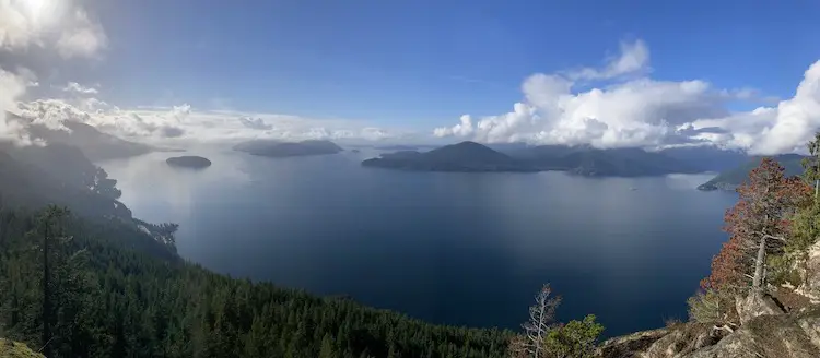
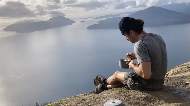
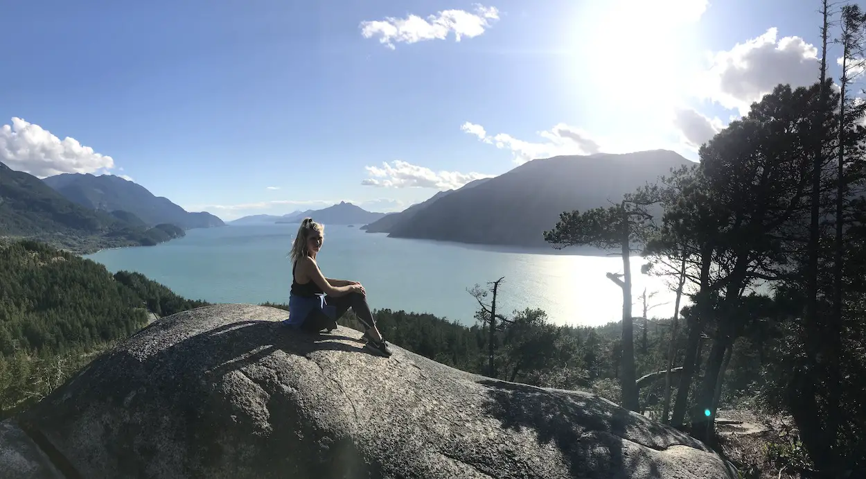
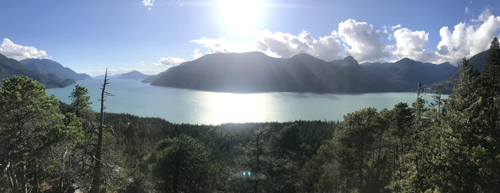
Tunnel Bluffs
The Tunnel Bluffs Trail is your ticket to spectacular panoramic views of Howe Sound, Bowen Island, Horseshoe Bay and Vancouver Island. The trail itself is moderate and can be tackled by hikers of all skill levels. This is the perfect hiking option in the fall and winter as it stays snow free for most of the year. The trail requires hikers to climb about 470m in elevation over 2km of switchbacks and the final 2-3km of the trail is flat. On the journey to the viewpoint there are some fun log bridges to cross and a few small runoff waterfalls. At a fast pace you can complete the trail in 2-3 hours but, on a clear day, you are going to want to spend a solid chunk of time soaking in the views.
Remember the Backcountry Basics
- Carry your Survival Kit & Essentials
- Let someone know where you’re going with a Trip Plan
- Know how to avoid negative wildlife encounters
- Practice Leave No Trace to keep the wilderness pristine
- Carry a Satellite Communicator like SPOT X
Quick Information
| Distance (Round Trip) | 5.5km |
| Elevation Gain | 833m |
| Time (Round Trip) | 2-4 hours |
| Dogs | Yes |
| Camping | No |
| Season | Year Round (Crampons/Microspikes in Winter) |
| Difficulty | Moderate (Some steep/difficult portions) |
| Remoteness | Moderate Traffic |
| Highest Point | 890m |
Directions To Tunnel Bluffs
The Tunnel Bluffs viewpoint trail is located in the village of Lions Bay. To get to Lions Bay Drive North on BC-99 towards Squamish/Whistler. Exit toward Lions Bay Avenue from the highway. Follow Bayview Rd and Mountain Drive to Sunset Drive. You can also just follow the signs towards the ‘school’ and then continue up the road from the school until you reach the Sunset Drive Trailhead parking area.
Trail Map
Click HERE to read the Complete Tunnel Bluffs Hiking Guide
Sea to Summit Trail
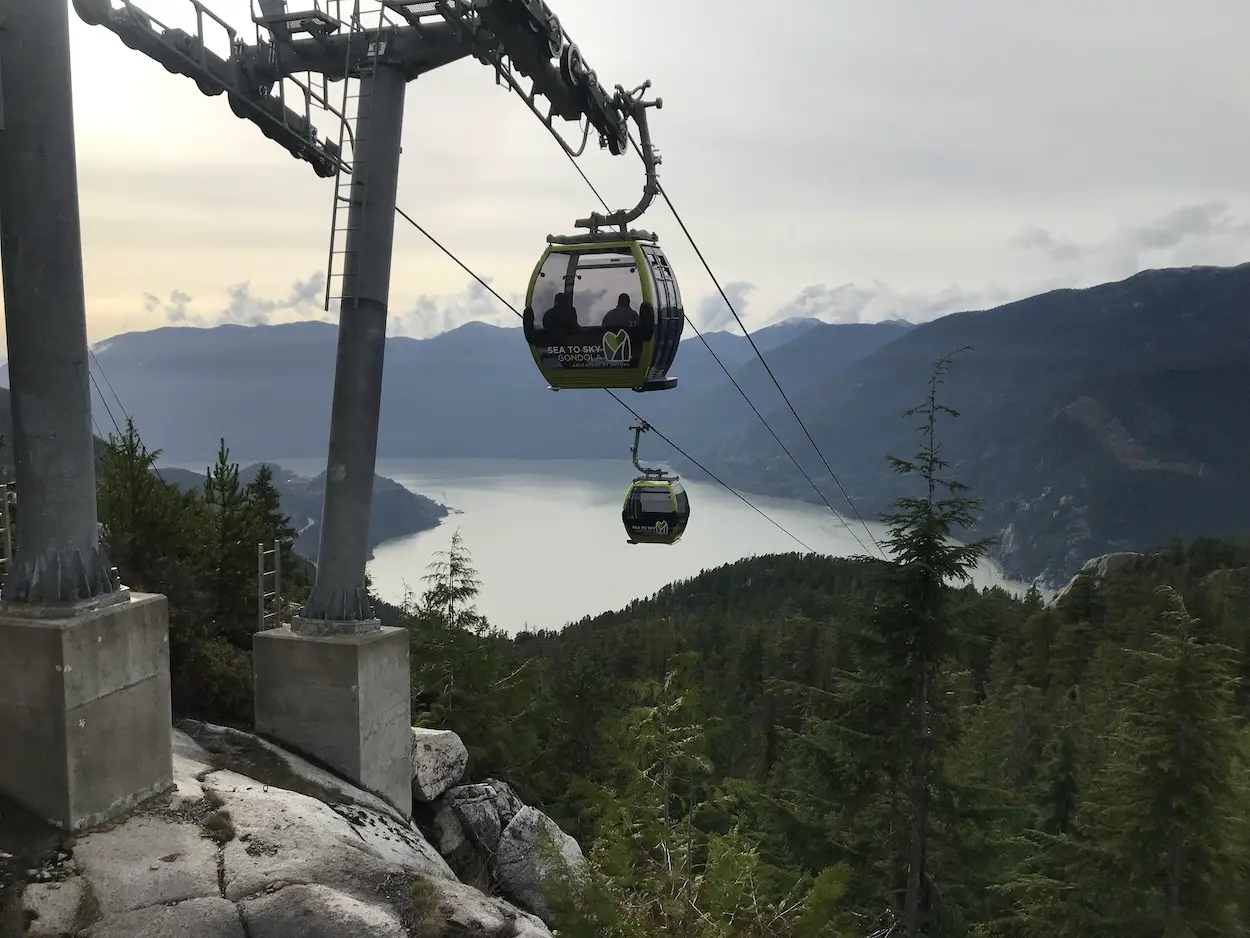
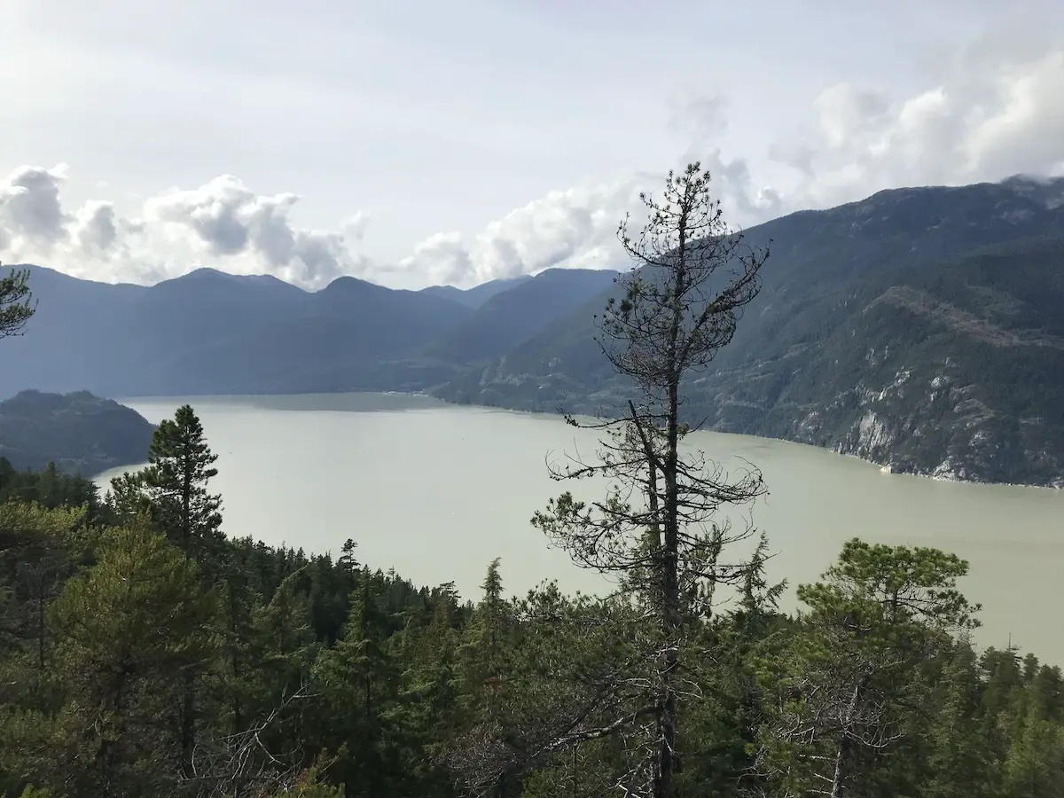
The Sea to Summit Trail is a less trafficked and equally as scenic alternative to the Stawamus Chief trail. It’s Squamish’s version of Vancouver’s Grouse Grind but with a way more epic view and a plethora of hiking accessibility at the top. It enables trail lovers to challenge themselves with a killer uphill workout and the best part, you don’t have to kill your knees hiking down. A gondola ride down is 15 bucks and if you don’t get the chance to ride a gondola often, it will be a fun experience.
Quick Information
| Distance (Round Trip) | 5.5km |
| Elevation Gain | 833m |
| Time (Round Trip) | 2-4 hours |
| Dogs | Yes |
| Camping | No |
| Season | Year Round (Crampons/Microspikes in Winter) |
| Difficulty | Moderate (Some steep/difficult portions) |
| Remoteness | Moderate Traffic |
| Highest Point | 890m |
Directions to Sea To Summit Trail
It’s under an hour’s drive from Vancouver to the trailhead. From Vancouver, follow the BC-99 towards Squamish, continue 50km North until you reach the exit to the parking areas on your right. You have the option to park at the Shannon Falls Parking Lot, the Sea to Summit Gondola lot, or the Stawamus Chief lot.
Trail Map
Click HERE to read the Complete Sea to Summit Trail Hiking Guide
Chadsey Lake & Sumas Mountain Eastern Lookout
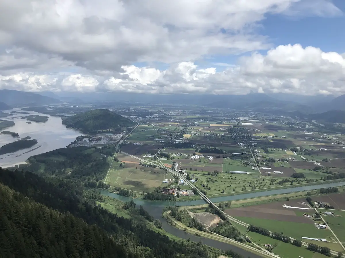
The Eastern Lookout from “Baker Rock” offers one of the most unbelievable views of the Fraser Valley landscape. The blue hues of the Vedder river coupled with green-brown farmland, and the snugly fitted mountains make you feel like you are inside a real-life watercolor painting. The viewpoint can be accessed from a variety of different ways including walking up the Sumas Mountain FSR, hiking from the Abby Grind and Taggert peak, or the Centennial Trail. In my opinion, the route beginning at the Sumas Mountain Viewpoint parking lot is the best adventure as it involves some bumpy driving, a lake, variety in terrain, minimal traffic and the amazing viewpoint at the summit. There is seldom snow up here in November but its worth it to bring along a pair of microspikes just in case.
Quick Information
| Distance (Loop) | 10km |
| Elevation Gain | 530m |
| Time (Round Trip) | 3-4 Hours |
| Dogs | Yes |
| Camping | No |
| Season | Year Round (Spikes in Winter) |
| Difficulty | Moderate |
Directions to Chadsey Lake & Sumas Mountain
The trailhead parking lot is in the Sumas Regional Park. Exit Highway 1 at Whatcom Road. Follow Sumas Mountain Rd, turning onto Batt Rd and then onto Taggert Road to begin heading up the dirt road. Taggert Rd/Sumas Mountain FSR is a well-maintained dirt road. There are some big potholes (nothing crazy), but an SUV or something with a bit of extra clearance will give you peace of mind. I did see some low clearance BMW’s doing okay on the way up, but cannot report on the health of their oil pans 😊. If you have a low clearance car you can park at the lower pull off, or earlier, and take the Centennial Trail up to Chadsey Lake.
Trail Map
Click HERE to read the Complete Chadsey Lake & Sumas Mountain Hiking Guide
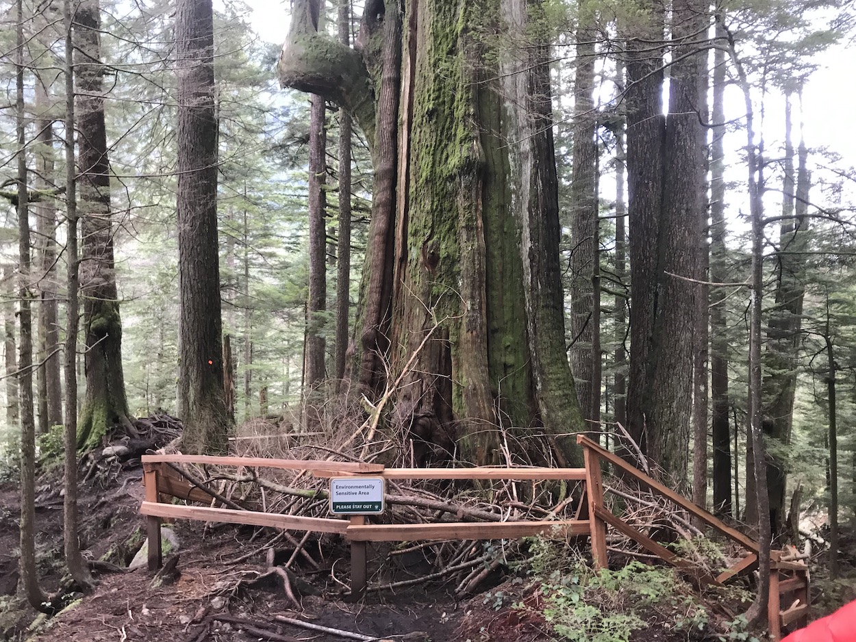
Kennedy Falls & Big Cedar Tree
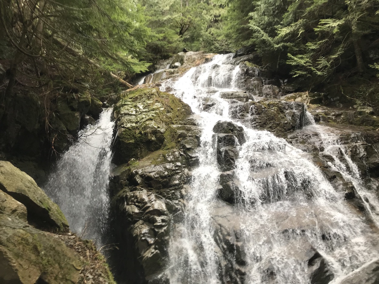
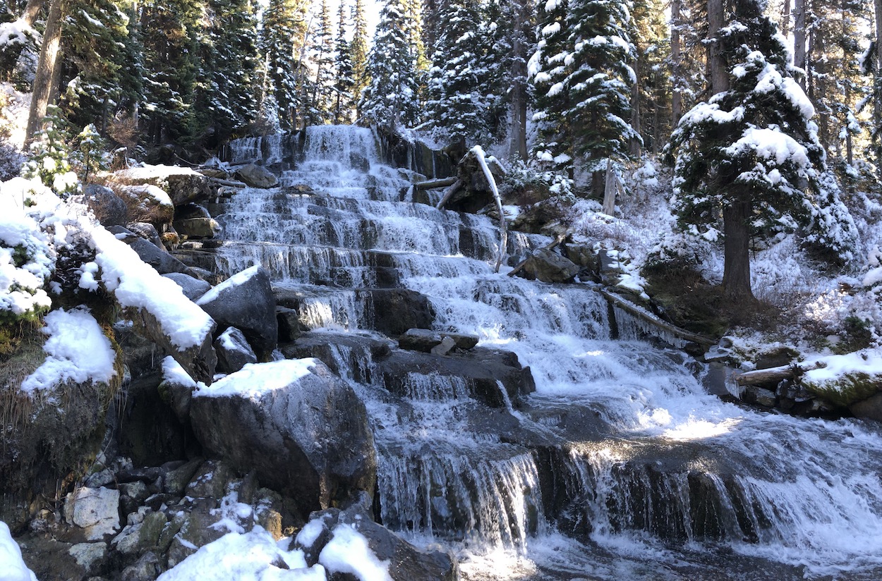
The Kennedy Falls and Big Cedar Tree trail rewards you with the opportunity to visit two lesser known, but equally iconic North Shore natural landmarks that adventurers have been visiting for decades. The Kennedy falls trail is not quite the hidden gem it used to be, but still offers a more remote moderate hiking experience just minutes out of the city bounds. What this hike lacks in elevation gain, it makes up for with it’s meandering rollercoaster like nature, slippery roots, and the muddy soil. It’s undoubtedly a more stimulating and rewarding hiking adventure than some of the other staple trails nearby. Fortunately, due to the trail’s low elevation, it can be accessed and hiked easily all year round. There won’t be snow up there unless there is snow in the city. Wintertime is my favorite time to hike or run this trail because there are reduced crowds, and the ground is a little more compact than in the Fall, Spring, and Summer. There are several different ways to hike this trail, you can attack it from Baden Powell trail via Lynn Headwaters park or from the Old Mountain Highway gate at Mcnair Drive via Baden Powell or Lower and Upper Griffen trails. This post will focus on the most direct and simplest of the routes beginning at the Mt. Fromme Parking lot in North Vancouver.
Quick Information
| Distance (Out and Back) | 10km |
| Highest Point | 505m |
| Elevation Change | 406m |
| Time (Round Trip) | 4-5 Hours |
| Dogs | Allowed |
| Camping | No |
| Season | Year Round |
| Difficulty | Moderate |
Directions to Kennedy Falls and Big Cedar Tree
Finding the Mt Fromme Parking lot is very simple. Plop yourself in North Vancouver and drive all the way to the top of Mountain Highway, the parking lot will be on your right.
Parking is the biggest challenge of this trail, even more so than the hiking itself. Mt Fromme is an extremely popular location for Mountain bikers which makes parking a bit of a nightmare outside of working hours. I’ve seen up to 12 cars lined up waiting for parking. Your best bet if you wound up there at peak hours, and the lot is full is to drive down mountain highway and find street parking (non-permit) below Dempsey road. Parking down the hill will increase the overall elevation of the hike, but hey, at least you will be nice and warmed up.
Trail Map
Click HERE to read the Kennedy Falls Hiking Guide
Murrin Park Jurassic Ridge Trail
If you’re a Vancouver local who plays in the Sea to Sky area Murrin Provincial Park is likely on your radar, but, probably for all the wrong reasons. You may know Murrin park as that random little lake on Hwy 99 that seems so weirdly busy and where traffic always seems to stack up. However, the park is not only good for picnicking, swimming and fishing at Browning Lake. It is loaded with cool rock climbing routes and more importantly is home to a fantastic hiking loop.
The Jurassic Ridge and Murrin Park Loop trail is short and sweet. It rewards hikers with numerous unbeatable viewpoints of Howe sound. Hiking is probably the least popular activity in Murrin Park so you will likely have the ridge portion of the trail all to yourself. The trail itself is short, but there are some steep rock portions up/down the ridge including a few rope sections. It’s nothing overly challenging but the terrain makes this hike intermediate in difficulty. As always I would recommend you wear a pair of hiking boots. For those who want something easier you can bypass the ridge and continue on the Murrin Loop which has a fabulous view at Brian’s Lookout.
The Jurassic Ridge and Murrin Park Loop trail leads to multiple viewpoints, and in my opinion, some of the best benches, picnic areas and spots to take a photo in the Sea to Sky Corridor.
Quick Information
| Distance (Round Trip) | 2.4km |
| Elevation Gain | 160m |
| Time (Round Trip) | 1-3 hours |
| Dogs | Yes - On Leash (Not allowed in Lake or on Beaches) |
| Camping | No |
| Season | Year Round |
| Difficulty | Moderate |
Directions to the Jurassic Ridge Trail
Murrin Park is located 9.5km south of Squamish along the Sea to Sky Highway (Hwy 99).
Trail Map
Click HERE to read the Complete Jurassic Ridge Trail Hiking Guide
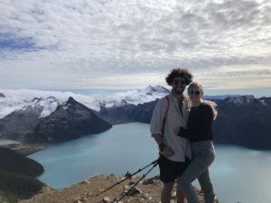
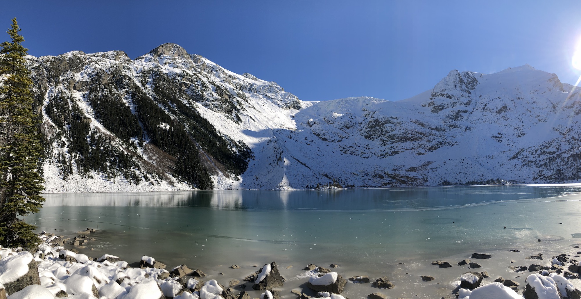
Joffre Lakes
Joffre Lakes is truly one of BC’s most incredible hikes, it’s also one of the easiest! These are the easiest glacial lakes to access in the province and if you’re new to the mountains the three lakes will undoubtedly hold the most breathtaking watercolors you’ve ever witnessed. Three stunning lakes, a waterfall, and the Matier Glacier, this one is truly a 10/10. October and November are the ideal months to hike the Joffre Lake trail. In October the Lakes will not yet be frozen and the mountains will have a dusting of snow. By Late October and November the Lakes will be froze, and there will be heaps of snow. I love snow and thought the trail was even more incredible in the early winter. The trail is typically compact snow and ice so Microspikes or Crampons are a must.
Directions to Joffre Lakes Provincial Park
Cruise highway #99 northbound through Pemberton. Continue through Pemberton along the highway towards Mt Currie. Take a right at the intersection towards Lillooet. Keep driving past Lillooet lake until you see the signs for Joffre Lakes. If you are there early enough head to the lower lake dirt parking lot as this is closest to the trailhead.
Quick Information
| Distance (Round Trip) | 10km |
| Highest Point | 1,600m |
| Elevation Gain | 370m |
| Time Needed (Scenic Pace) | 4 hours |
| Time Needed (Fast Pace) | 1.5 hours |
| Camping | Yes (Reservation Required) |
| Season | May-September |
| Difficulty | Intermediate |
| Remoteness | Heavily Trafficked |
Trail Map
Click HERE to read the Complete Joffre Lakes Hiking Guide
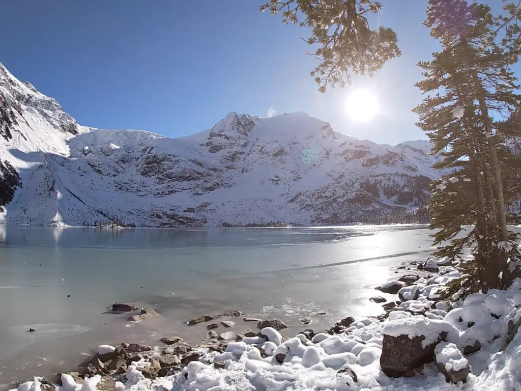
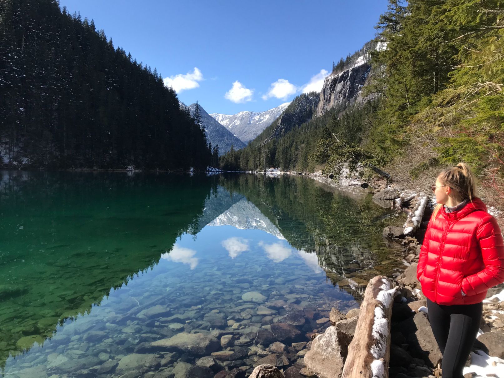
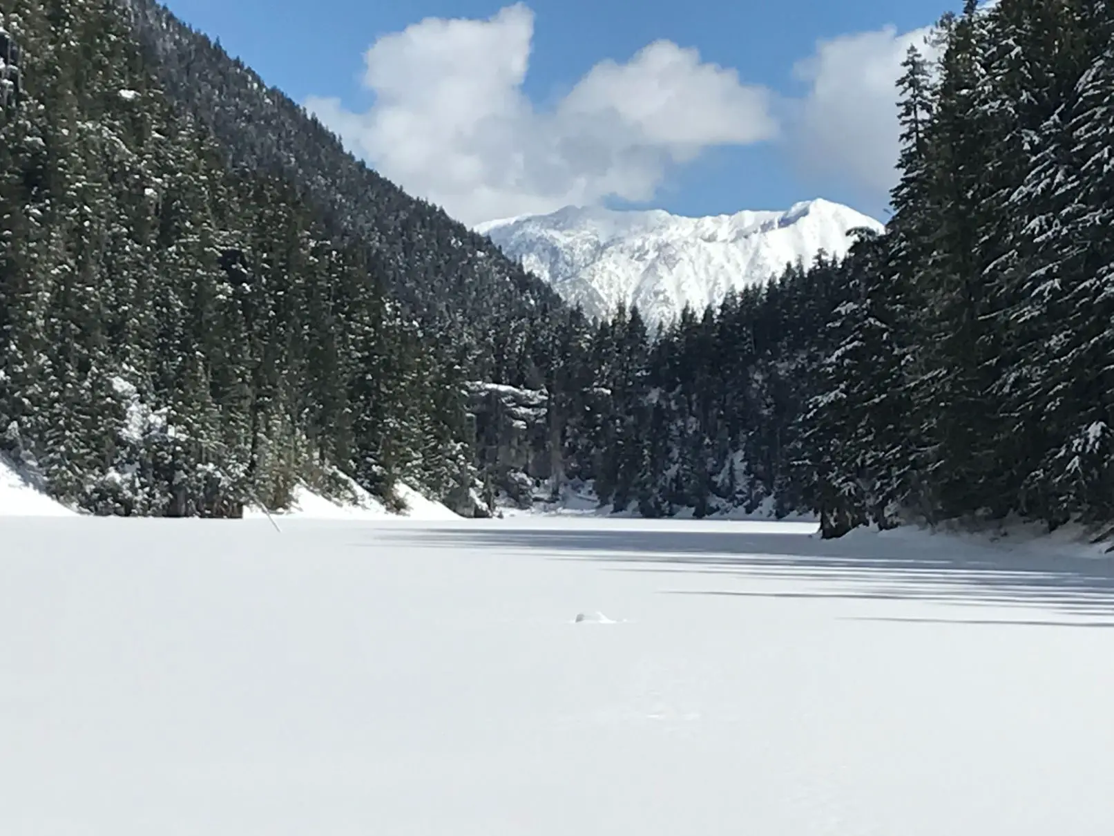
Lindeman & Greendrop Lake Hike – Chilliwack Provincial Park, BC
I’ve expended thousands of hours in my lifetime fishing along the Chilliwack river, but it was not until this year on an unbearably slow outing that I decided to pack the rods in, drive up a little bit further, and rip a hike. The Lindeman & Greendrop trail is a fantastic beginner/moderate trail that offers an amazing alpine lake and mountain view for a very modest elevation gain and overall effort. I’ve hiked the trail in both the summer and winter, but enjoyed it the most in the Springtime! Due to its 800m elevation, Lindeman lake ices off comparatively early while the ground, trees, and surrounding peaks hold their snow making everything beautifully picturesque. Also, the icy walk up deters many hikers from heading all the way to Greendrop, and as we all know, trails are much better when you have them to yourself.
Quick Info
| Distance (Out and Back) | 13km |
| Elevation Gain | 400m |
| Time (Round Trip) | 4-5 Hours |
| Dogs | Yes |
| Camping | Yes (First come first serve w/Backcountry permit) |
| Season | Year Round (Spikes in Winter) |
| Difficulty | Beginner/Moderate |
Directions To Lindeman Lake
Lindeman and Greendrop Lakes are located at the far reaches of Chilliwack Lake Road just before Chilliwack Lake Provincial Park. For those who have never driven Chilliwack Lake Road, the drive is awesome, you will weave along the river passing by many fisherman and campers as you head to the destination. About ¼ of the way up the road you will lose cell phone service. There is no cell phone service or gas stations after this point so make sure your tank is full.
A parking lot is available to the public at the trailhead where there are pit toilets. If the parking lot is closed, or it is full you can just park on the shoulder of the road near the gate to the parking lot. Make sure to keep all your valuables hidden and car locked as there are lots of characters prowling these out of service areas.
Trail Map
Click HERE to Read The Complete Lindeman and Greendrop Lake Hiking Guide